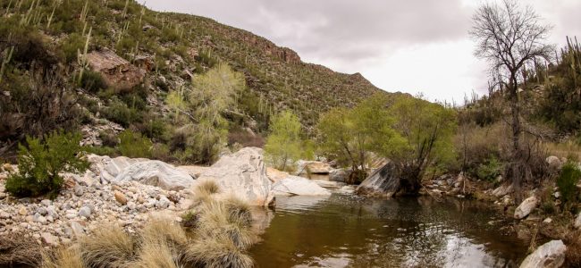
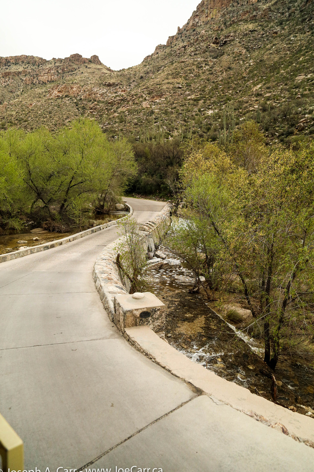
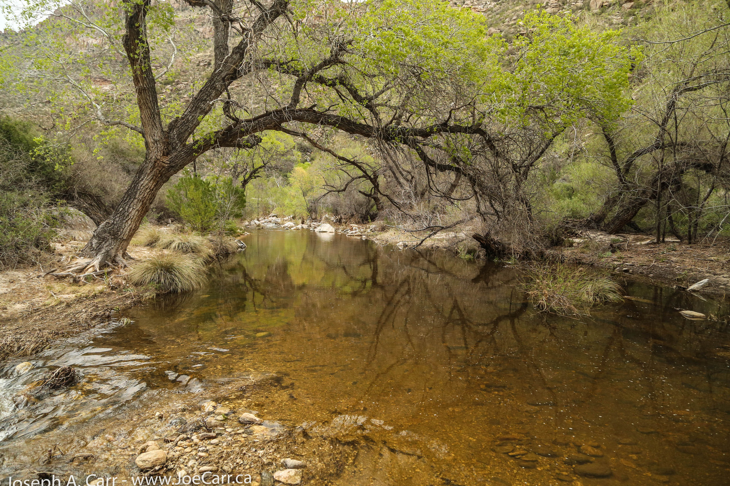
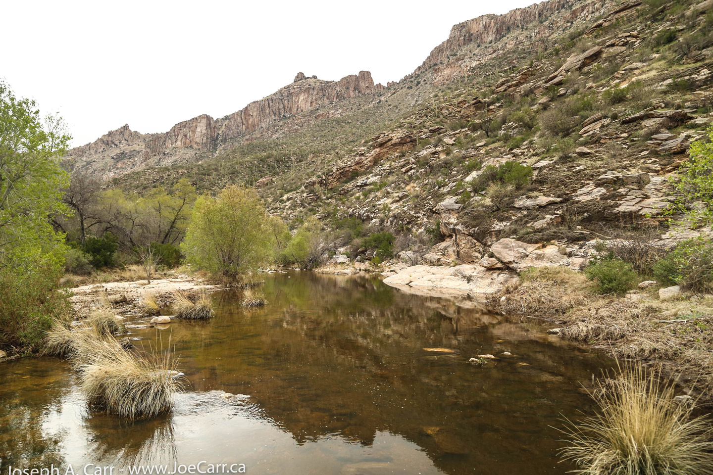
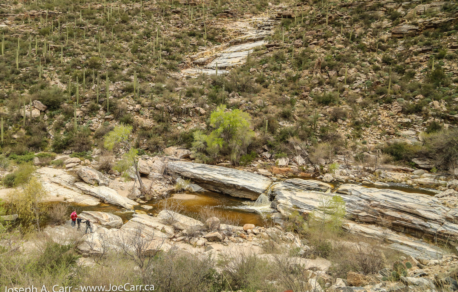
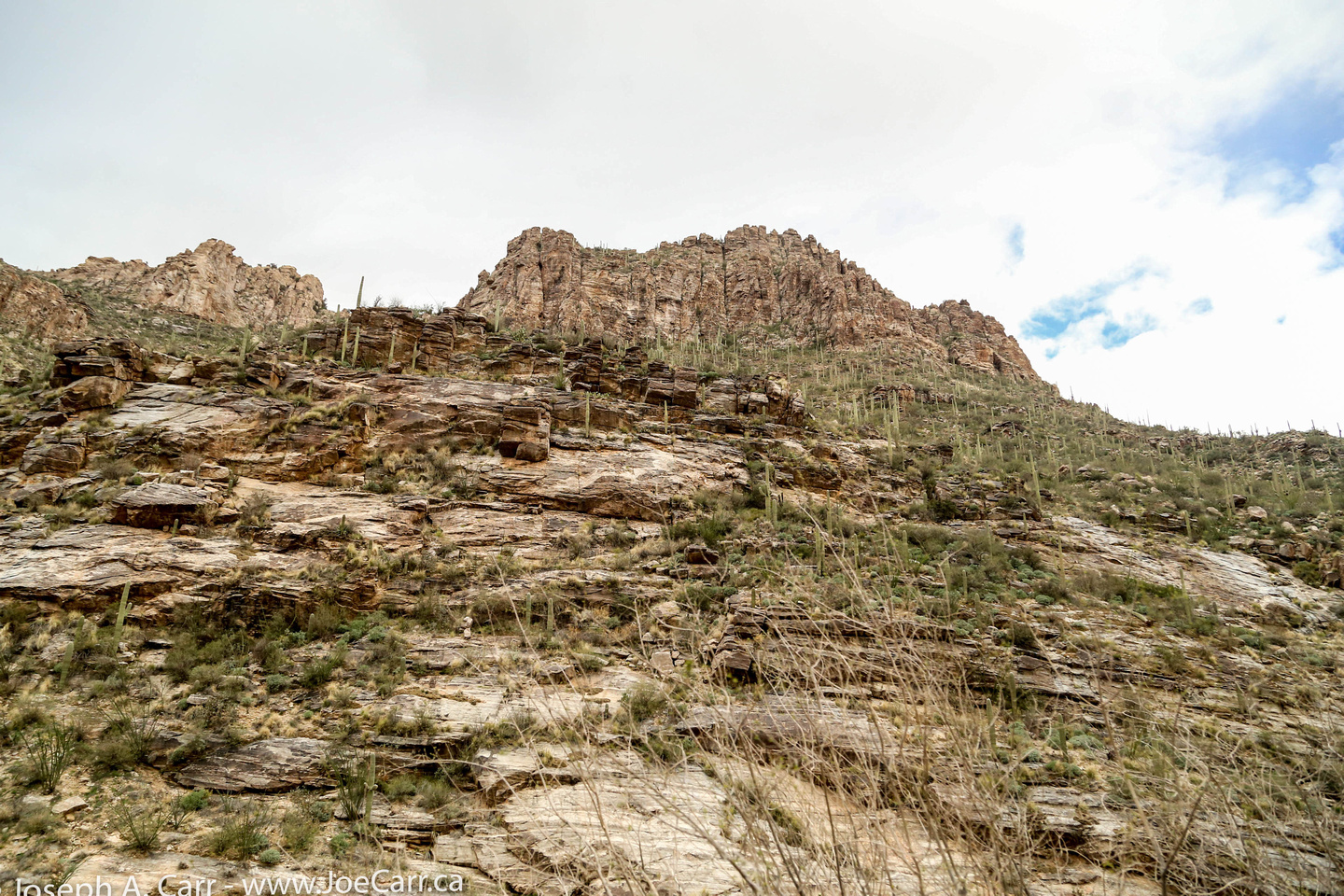
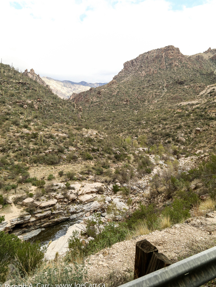
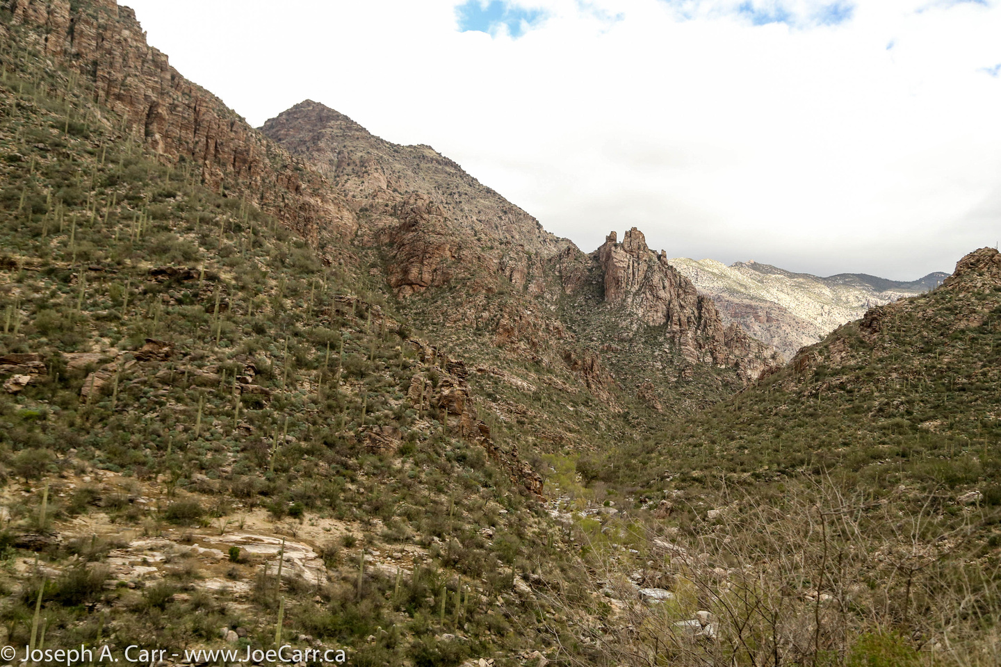
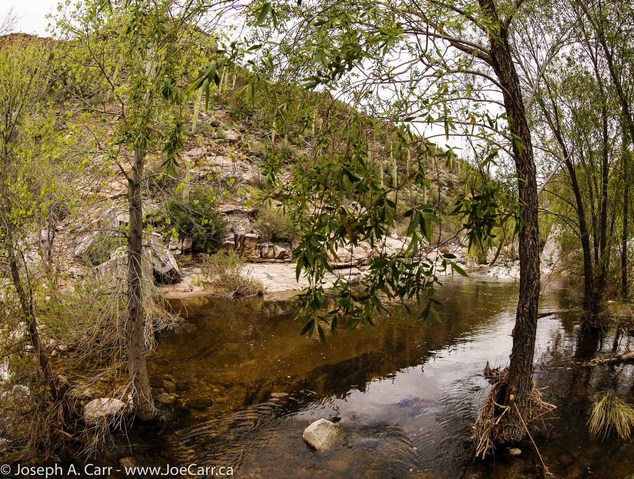
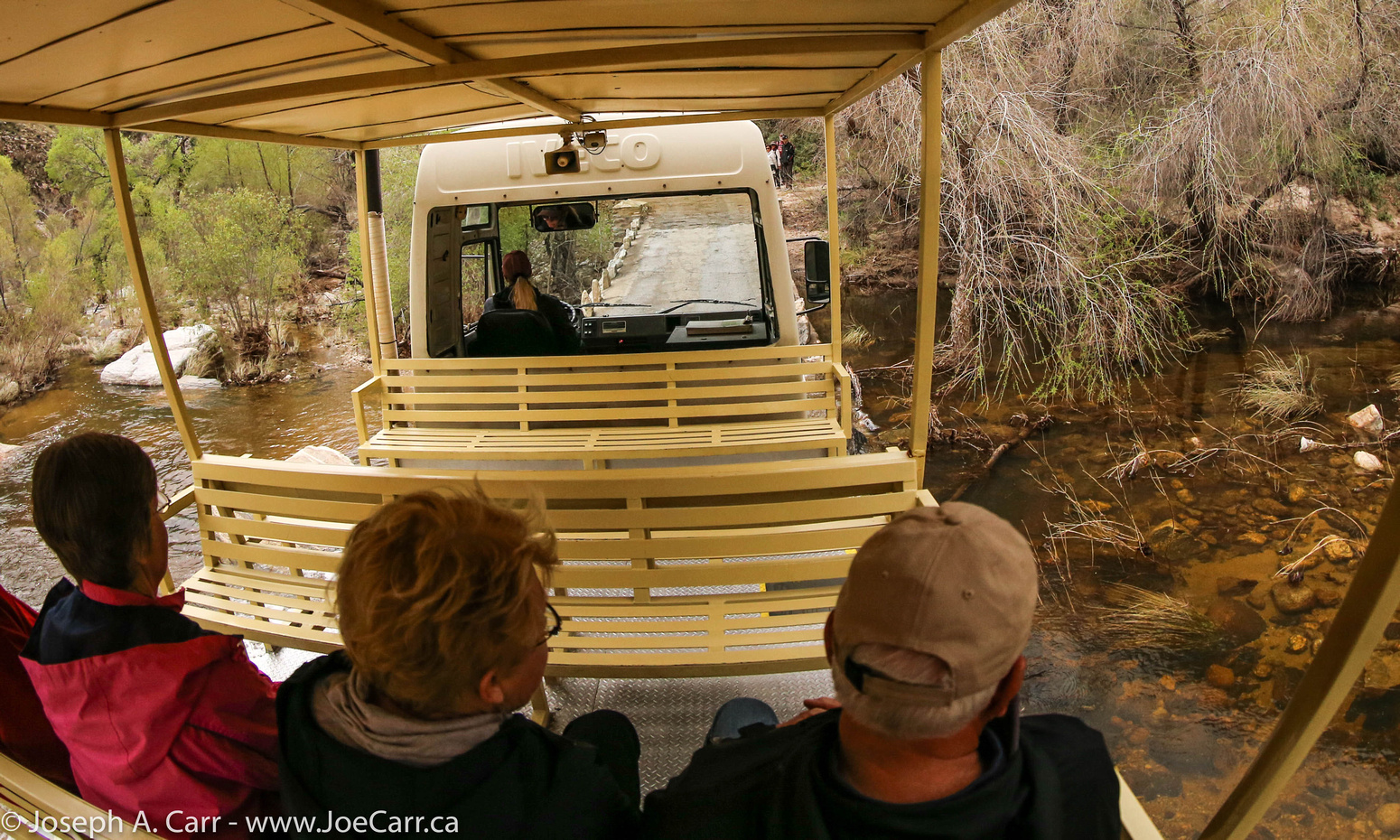
The Sabino Canyon Recreational Area is close to where I’m staying in the Oro Valley, so I drive over to have a look – $5 admission. There are some people walking, but it is a long uphill trek to the scenic canyon, and it is threatening to rain, so I pay another $10 to take the tram. There is narration on the way up, and there are nine stops along the way, so people are picked up or dropped off at many of the stops.
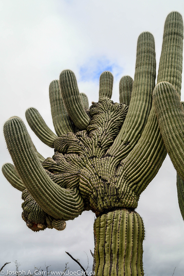
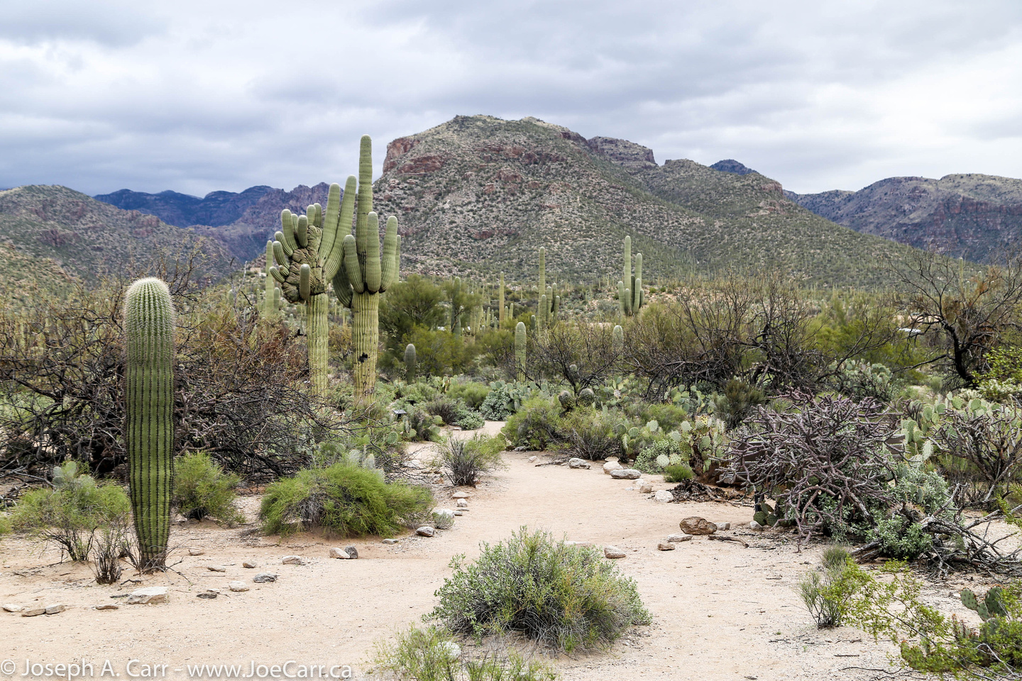
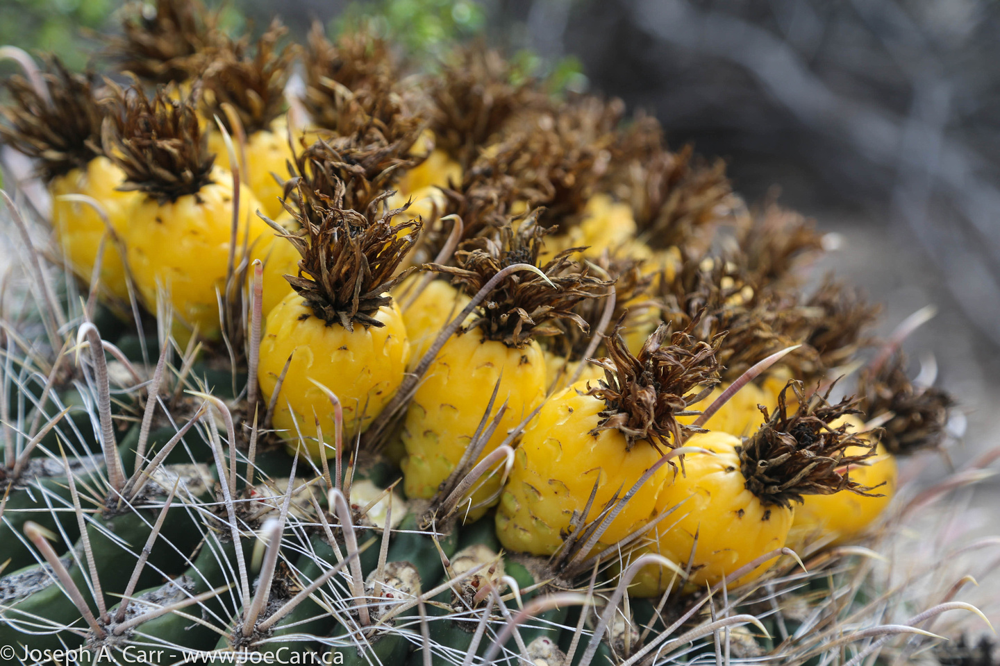
It gives me an interesting peek into the Catalina Mountains that are north of Tucson, and the Riparian areas in the canyon. The Bajada Loop is a very short walking trail right next to the Visitor Center, and it has a wonderful variety of cactus and bushes of the desert. The half hour drive there and back allows me to see how people live in the suburbs of Tucson. I’m back at the hotel by noon.
Omani man eating some dates – lunch stop, Al Hamra oasis
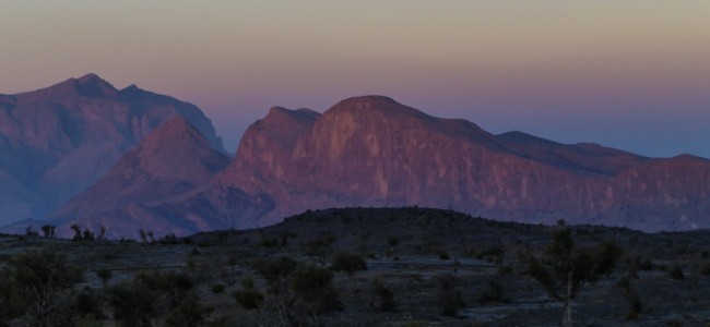
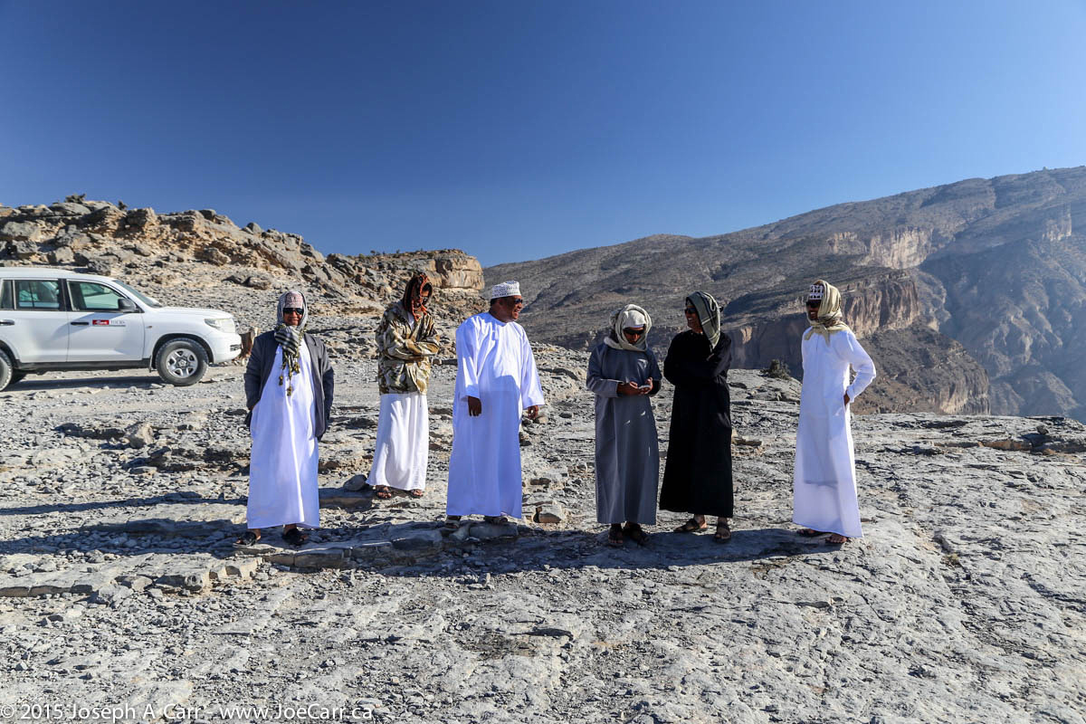
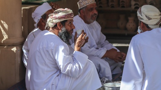
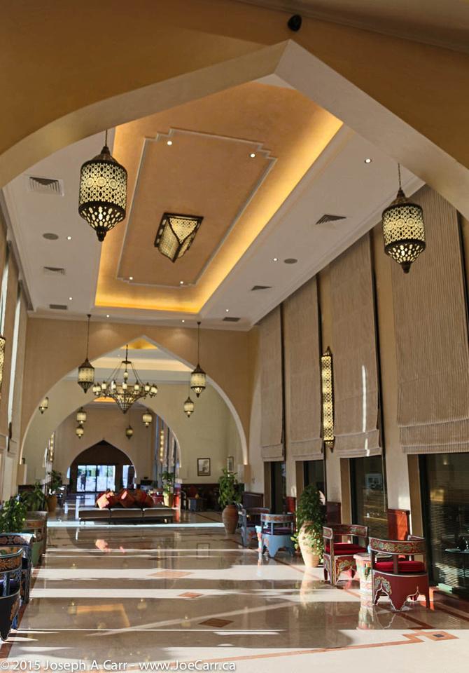
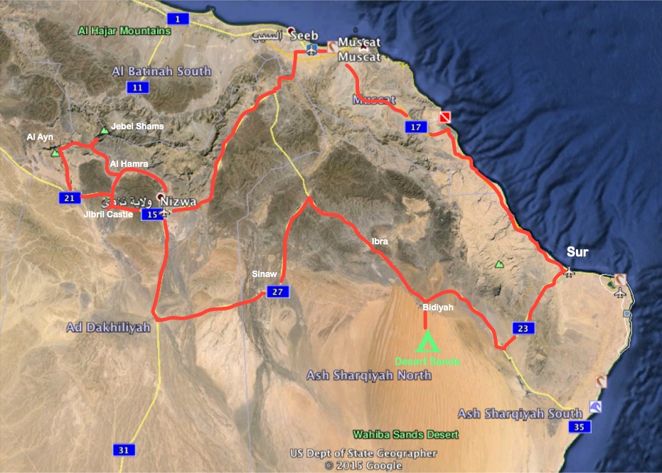
After leaving our palatial hotel in Nizwa, we stop for lunch in the Al Hamra oasis, and make a brief stop to see the abandoned Persian village of Ghul before climbing 2,000 metres up into the mountains. Our destination is Jebel Shams (Mountain of the Sun), Oman’s highest mountain at 3,028 metres (just over 10,000 feet). We stay at the Jebel Shams Resort, which is at the end of a long, winding and steep road. The resort is situated a few hundred metres from Wadi Ghul, the Grand Canyon of Arabia.
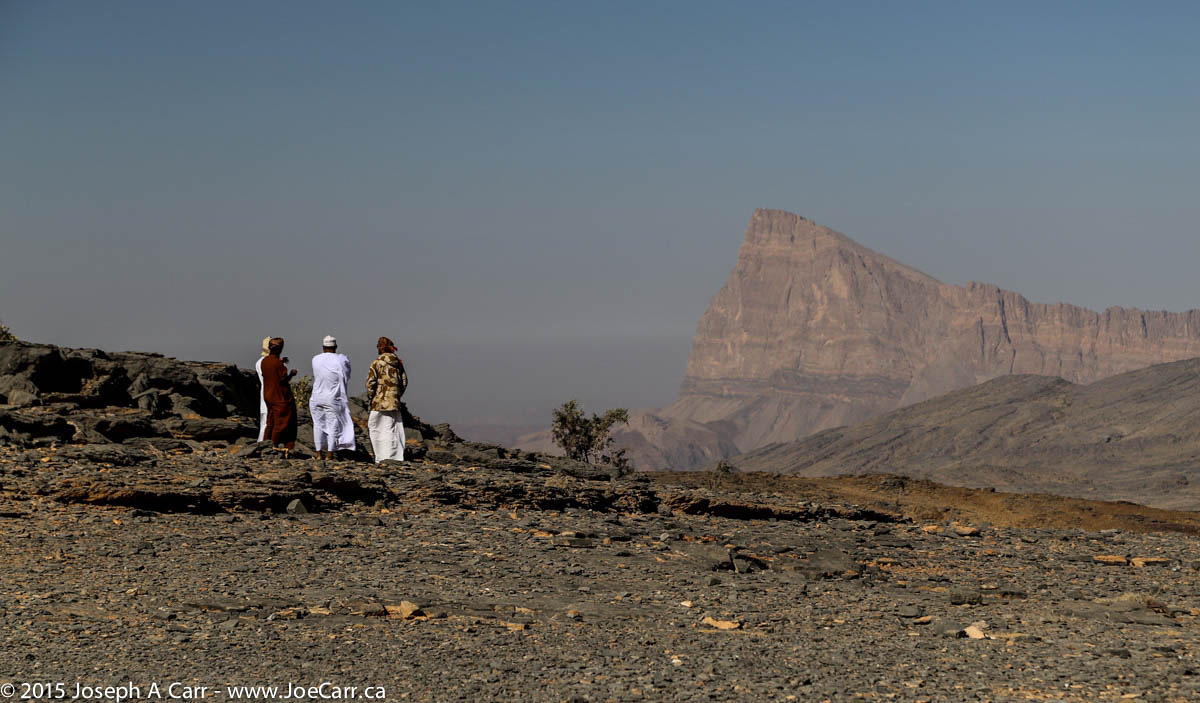
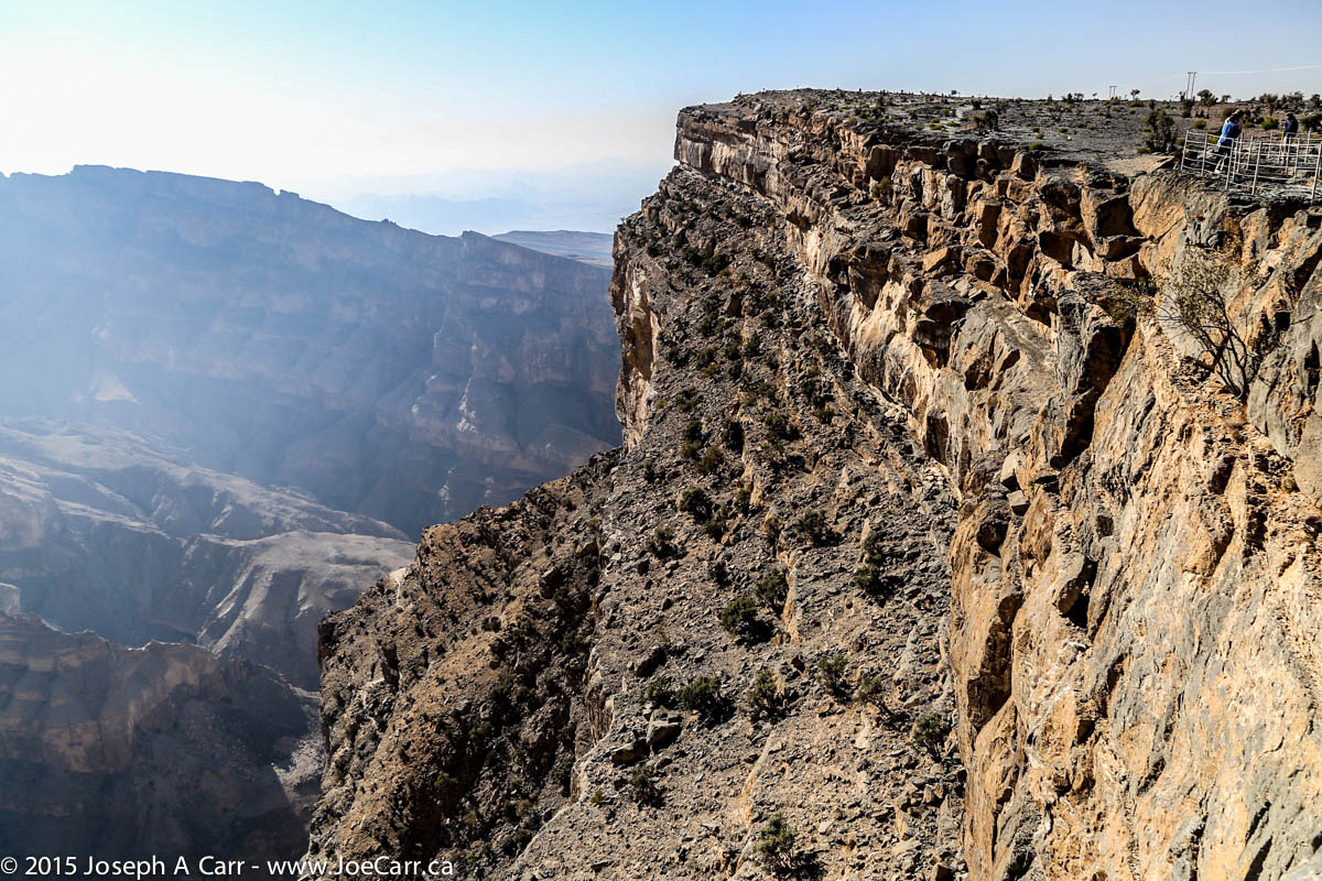
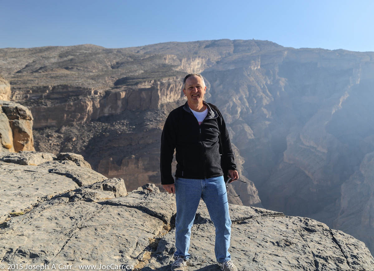
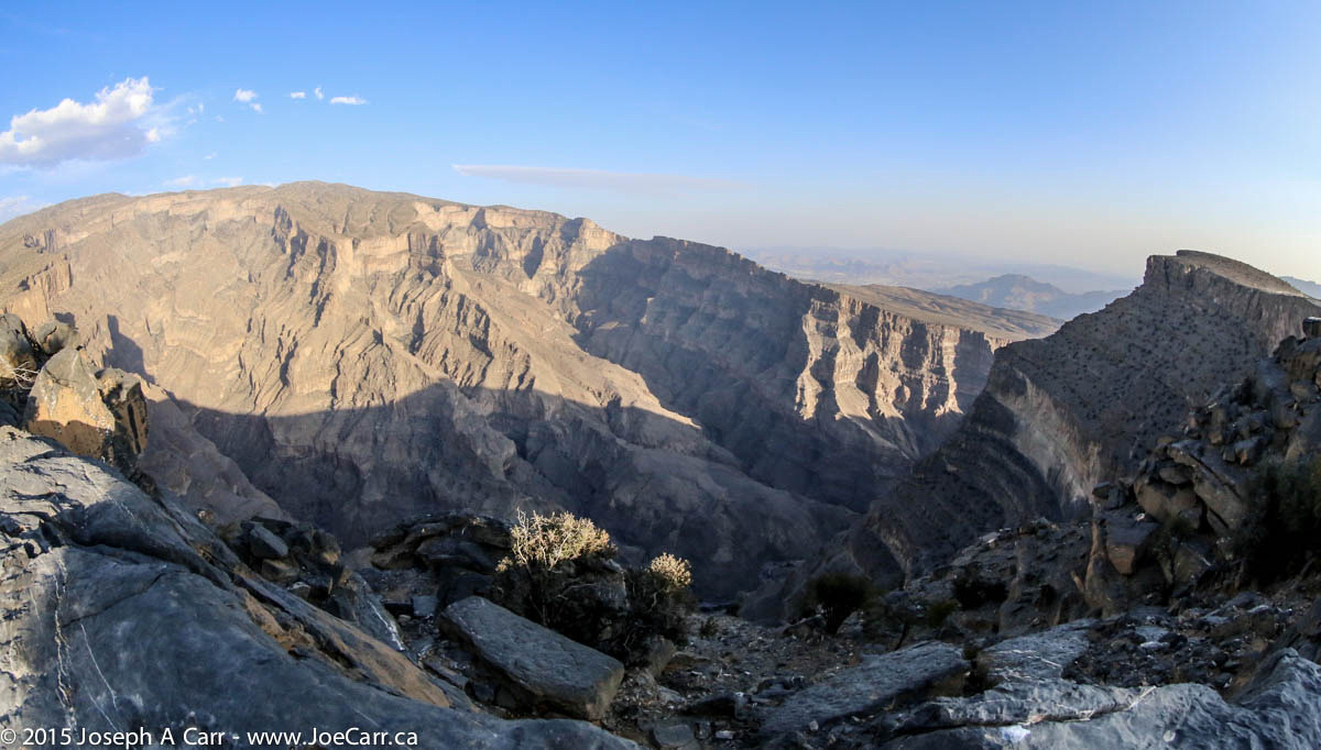
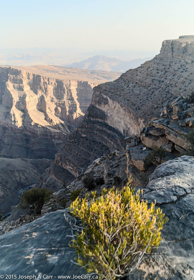
I walk over from the resort to the rim of the canyon before dinner, and find a spectacular sight that is much deeper than the Grand Canyon in Arizona. I peer over the edge of Wadi Ghul to a small abandoned village barely visible almost 1,000 metres below! The wind is terribly strong, but at least it is blowing up the canyon and over the rim, so it isn’t a safety hazard. I find taking photos of the canyon in the late afternoon very challenging, and resort to bracketed photos and HDR settings.
Jebel Shams Resort has pretty basic accommodation compared to the luxury we have had so far on the tour. I keep the electric heater going in my room, since at this elevation, it gets very cold at night. The Internet connection is down, so I use my time this evening to catch up on my journal and tag my photos with locations and titles.
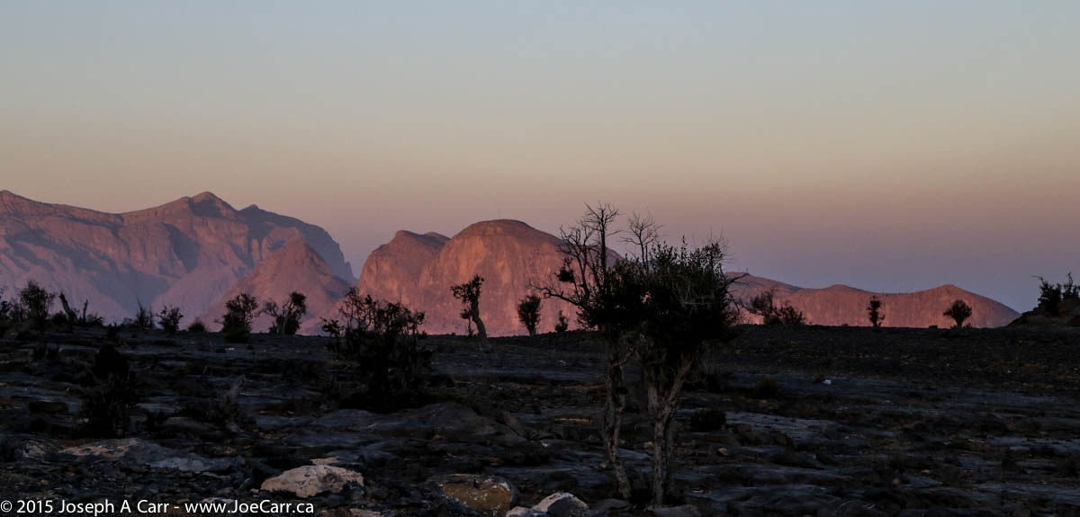
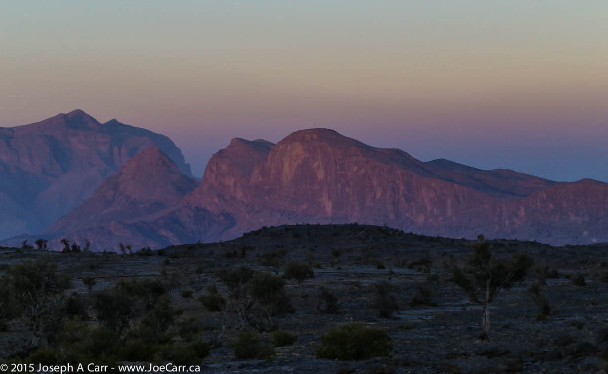
I get up before dawn this morning and take some photos of the mountains bathed in the pre-dawn light. The pre-dawn view of the mountains, the Earth’s shadow and the Belt of Venus is spectacular! After an early breakfast, we drive (as a group) the short distance from the resort to see and photograph Wadi Ghul after sunrise, and then drive down the mountain and onto the wadi and other sights before returning to Muscat and civilization.
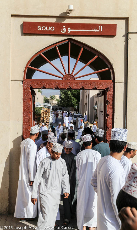
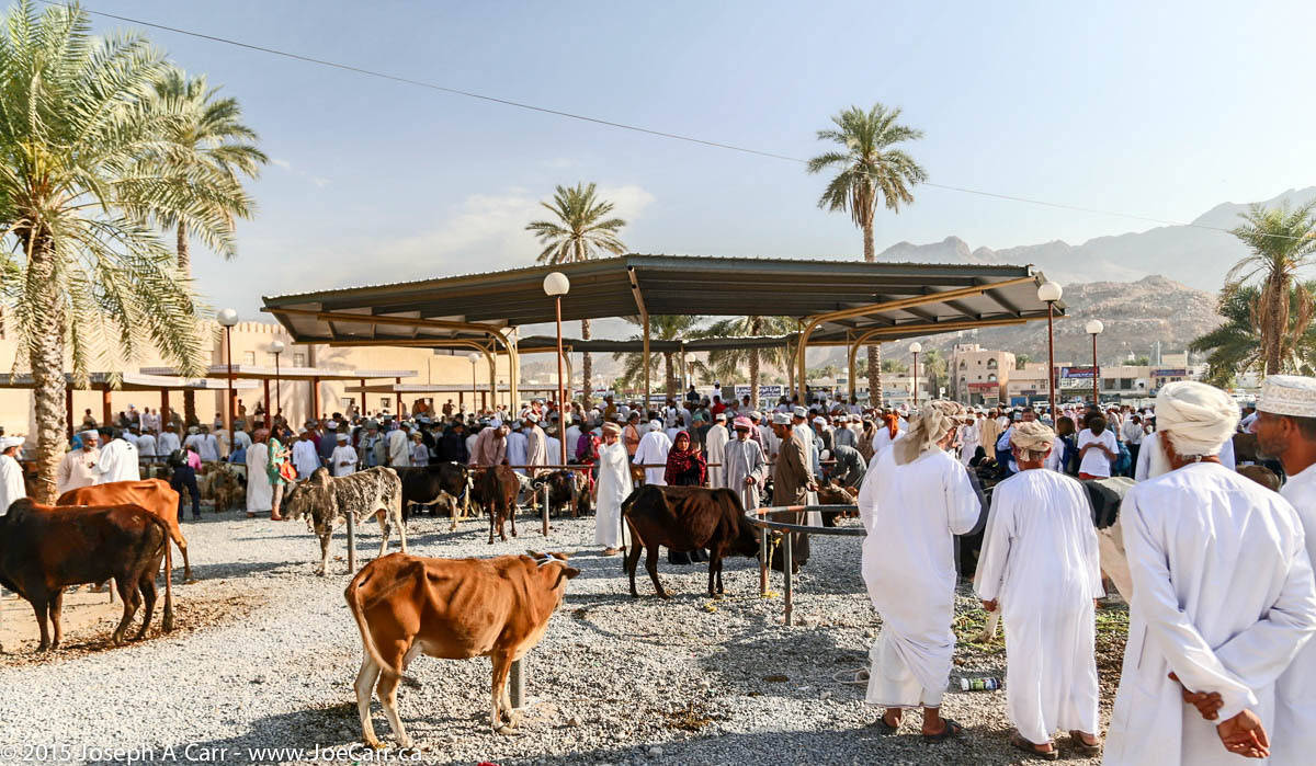
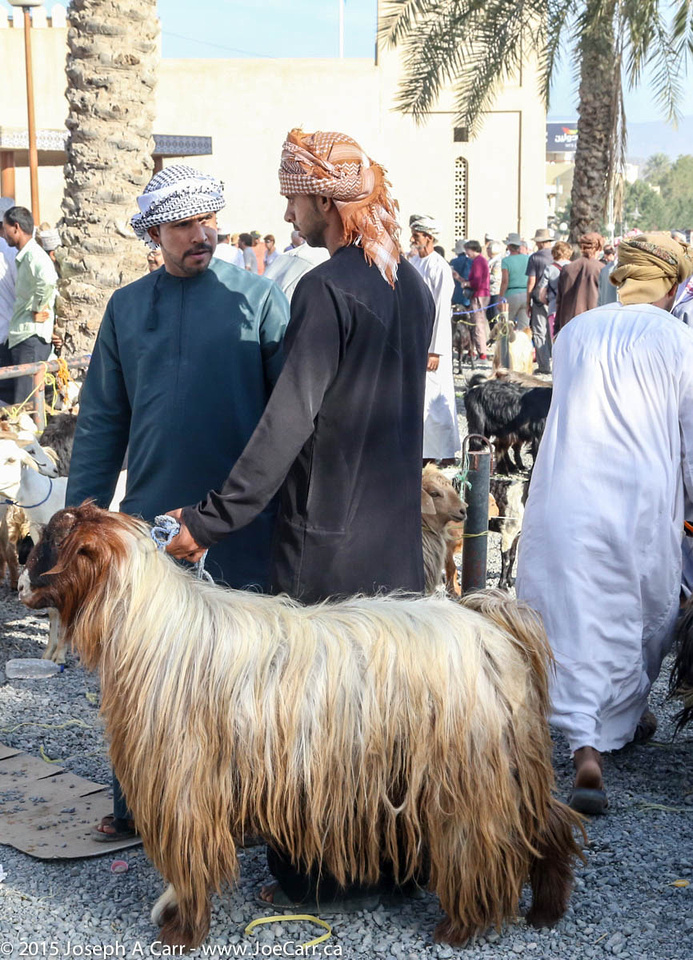
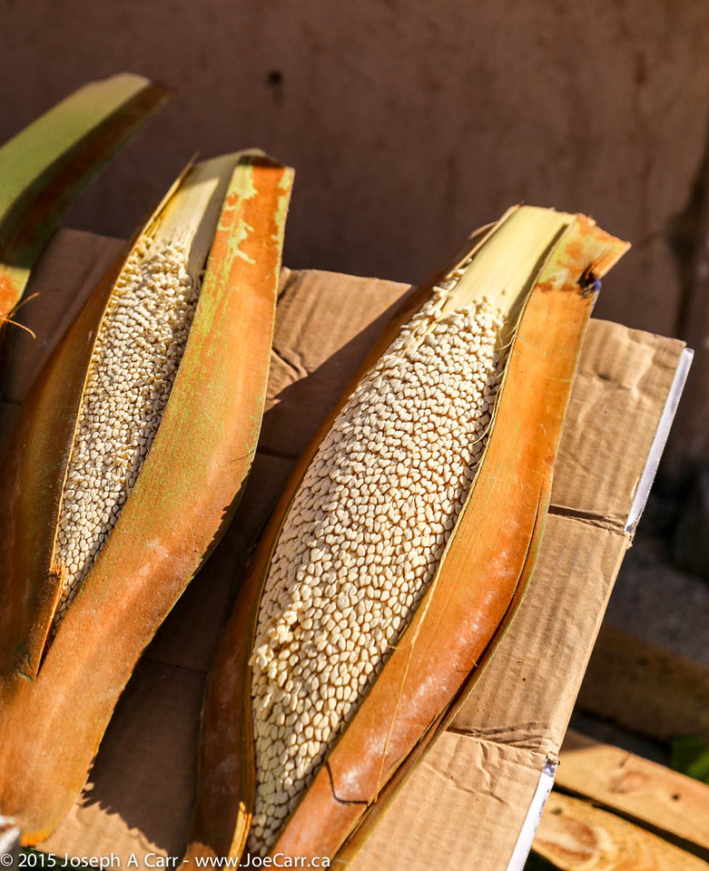
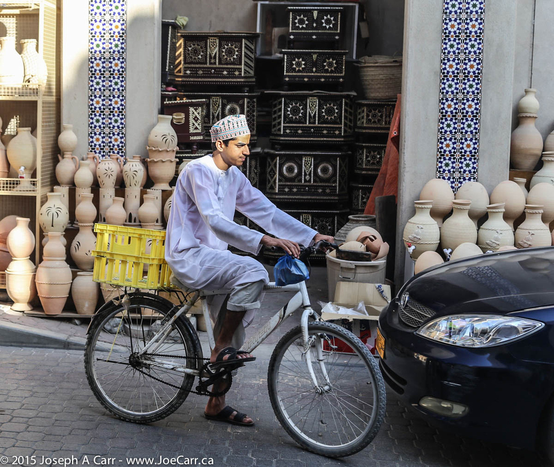
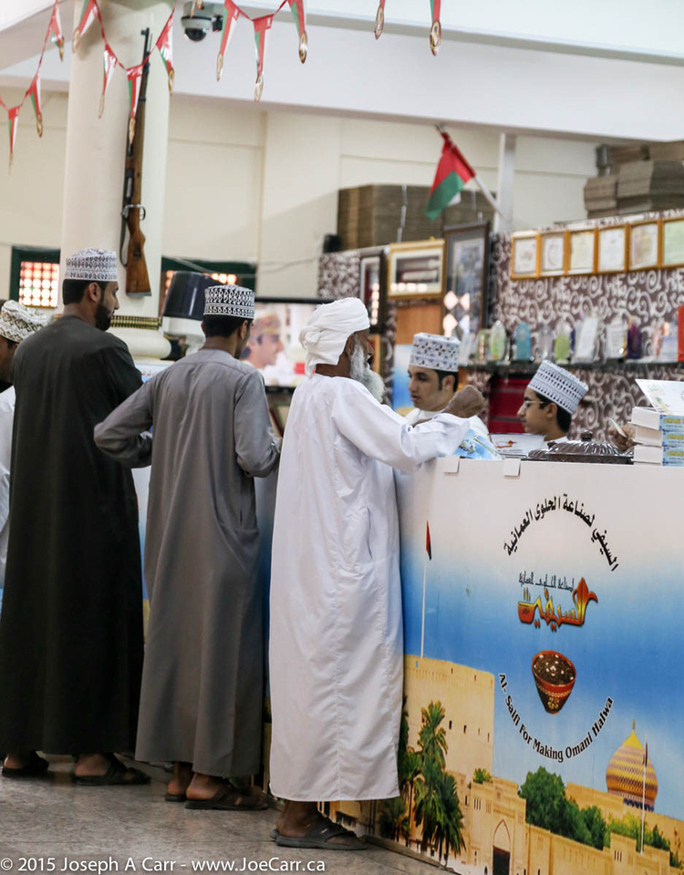
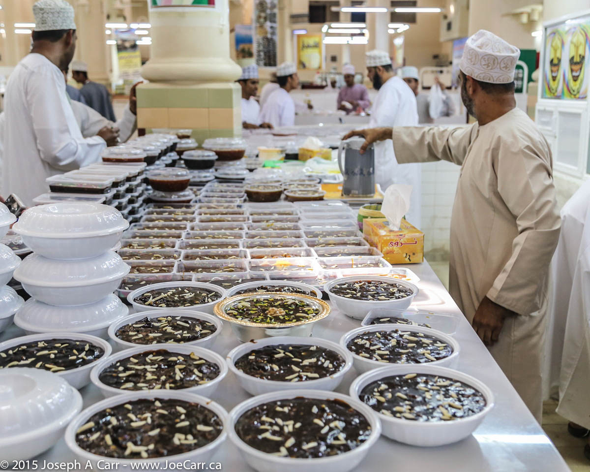
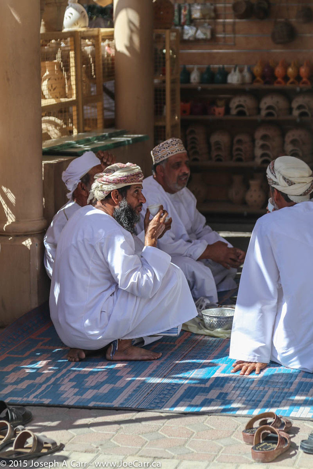
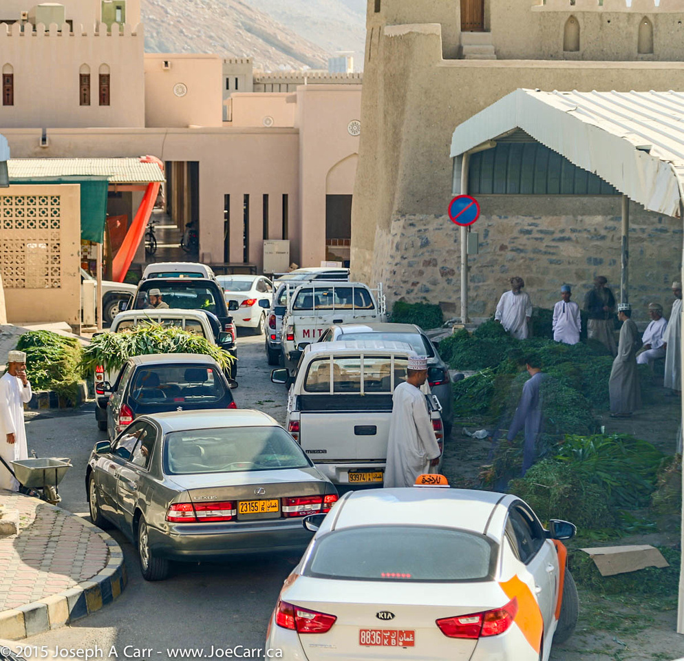
It is another full day today, beginning with a visit to yet another souq: the Nizwa Souq. This souq is perhaps the most interesting of them all, since it is huge, and offers an amazing variety: cattle and goat market, butchered meat, fruit and vegetables, silver jewelry (especially silver khanjars – traditional daggers of Oman) and crafts. The Halwa shop (Omani sweets) is undoubtedly the busiest place in the whole souq. However, there are no camels at this livestock sale. In addition to the large number of locals, there are lots of tourists at the souq…and everyone arrives early!
I have lots of time to people watch, and yet I see only one woman the whole time I’m there. Omani men (and their sons) are doing the shopping, at least at the souq. Nizwa’s fort is on the edge of the souq. It was built in the 17th century, and dominates the city with a 40 metre (125 foot) high huge round tower. I walk the back streets to see where the residents live. It is considerably quieter away from the souq, and the city appears to be very well developed, and offers its residents a good quality of life.
The oasis at Al Hamra
After leaving the souq, we visit the oasis village of Al Hamra, at the foot of the Hajar Mountains. This village is one of the oldest in Oman, and has a well-preserved row of two- and three-story mud-brick houses built in the old Yemeni style. We visit a traditional Omani house (Beit al-Safa) and have lunch in the oasis.
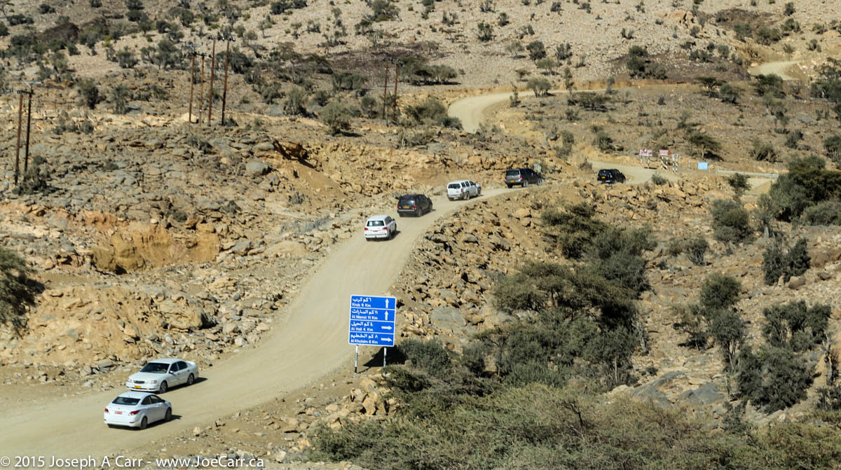
After leaving the oasis, we climb 2,000 metres up the tallest mountain in Oman, Jebel Shams. We are staying at Jebel Shams Resort, situated across the road from Wadi Ghul, the Grand Canyon of Arabia.
We board our coach after breakfast this morning, and end up waiting for a half hour while a couple pull their bags apart in the parking lot looking for something terribly important. Eventually we leave and learn our “Coach Captain” (driver) is called Phineus. He proves to be a very good driver: good-humored, and always on time. Our bus is quite new, very comfortable, air conditioned, and has a washroom and a fridge.
Freshly ploughed farm fields – red dirt
As we roll through Pretoria and onto South Africa’s national road system, we can see this is an excellent transportation system, with toll booths on certain sections. The M4 divided highway takes us past Cullinan (some famous diamonds mined here), Witbank (surface coal mining & refining), Middelburg and Belfast (forestry & farming) before we turn off and end up in Lydenburg. Most of us go to Wimpy’s for lunch – a fast food joint, South African style.
South Africa is home to the largest man-made forest in the world (140 sqkm). We learn that Pine trees are harvested after 10 years, with the trees growing to 12m high. Eucalyptus are also used in some areas, however they require more water, so they are falling out of favor. We see a steel mill just outside of Lydenburg.
Eroded rock formations on the Treur River at Bourke’s Luck Potholes
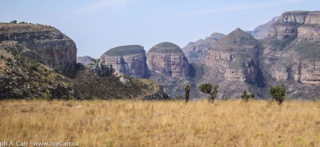
Panorama Route – Our first scenic stop is the viewpoint at the Blyde River Canyon, where we can fully appreciate the 800 metre drop to the canyon floor. Across the canyon are the “Three Rondavels”, huge round rocks that look like African huts. Our next stop is Bourke’s Luck Potholes, where the Treur River has eroded strange cylindrical potholes in the sandstone.
View of the Lowveld and escarpment from God’s Window
Our last stop in this area is God’s Window, a dramatic vantage point to view the Drakensberg Mountain escarpment with beautiful views of the lowveld, and even Kruger National Park is visible on a clear day. This is where the quirky movie The Gods Must Be Crazy (1980) was shot.
We arrive late in the afternoon in Hazyview after our first full day on the road. Hippo Hollow Country Estate is located on the tranquil Sabie River, where the resort’s namesake hippos regularly graze on the front lawn. My cottage is quite luxurious, having a king sized bed on the main floor and two single beds in a loft. My patio overlooks the Sabie River. There are very few mosquitoes, which seems strange with all the vegetation around and the slow flowing river only a few metres away…but I’m complaining!
The Chief
7pm – Shangaan River Club – This is a cultural experience that is staged right on the grounds of Hippo Hollow, consisting of tribal drumming, singing and dancing, followed by a traditional African feast. The chief of the local village is the master of ceremonies, and he introduces his troupe of orphans who sing and dance. He is very animated, talking to us for well over three quarters of an hour before the performance begins.
The chief explains how he is personally responsible for the care of the orphans, many of which are the result of AIDS killing both of their parents. They support themselves by this arrangement with the Hippo Hollow Country Estate, so I’m pleased that Thompsons has chosen to include this performance in the tour. I shoot some high definition video using “night mode” on my Canon HV-20, which works quite well until I run out of video tape! Despite this glitch, I have enough video to capture the event.
The feast of culture served buffet style after the performance is very good. There are lots of choices from the usual soups and salads, as well as a nice selection of African meat dishes that are served from traditional cast iron pots. Fruit, dessert, and drinks are also included. This is all served under a massive boma, or thatched building right next to the performance area. It wasn’t just our group who were taking in the feast, however the staff coped with the crowds quite efficiently. All of my group seemed to enjoy themselves, and everyone left the tables fully satiated.
If you are staying on the east coast of Kaua’i, the drive to the west coast make a nice day trip by car. The only working sugar mill is located at Port Allen, and they offer tours. Call ahead, since the tours are limited. Hanapepe and Waimea are agricultural centers for sugar cane, and both towns have boat harbors. Salt Pond Beach Park is just off the highway at Hanapepe – follow the signs. A nice beach for all ages, basic facilities, and limited camping.
The little town of Waimea is the gateway to the Waimea Canyon, which is a “must see” while you are on Kaua’i. There are two roads to Waimea Canyon, but I would recommend the Kokee Road, which is a right turn 3.6 miles past the town of Waimea. The sign is easy to spot from the highway. Just follow this very steep road with lots of curves, and stop at the lookouts along the way. Take your time, and enjoy the views along the way. After you leave the main highway, there are no gas stations or facilities other than a primitive bathroom at the main lookout, so take your own water and food, and fill the car with gas.
This side of Kaua’i is very dry, and if there was no irrigation, no productive crops would be possible. Irrigation ditches were established by the Robinson family when they originally acquired this land from the Hawaiians, and these ditches are still in use today. They can be seen from the air and you can catch glimpses of them from the Waimea Canyon roads.
Barking Sands is a missile testing range, and military airport. Restricted access is usually granted to civilians if you provide identification. Major’s Bay is worth visiting, but is inside Barking Sands, so you will need ID. Further along is the longest sand beach with the fewest people on it you will find anywhere in Hawaii! If you are adventurous, drive to the end of the Kaumuali’i Highway past Barking Sands base, and drive five miles further along the coast to Polihale State Park. This is as far as you can travel by car along the west side of the Na Pali Coast, and your car rental company may forbid you to go here.