post

Puerto Limon, Costa Rica

2011 Incan Empires Cruise

Sunday, November 27, 2011 – Day 7 – Puerto Limon, Costa Rica

Although this is my fourth time visiting Costa Rica, this is my first time in Limon. I came closest to Limon on my first trip to Costa Rica when I took a boat up to Tortuguero National Park to stay in the jungle for a couple of days.

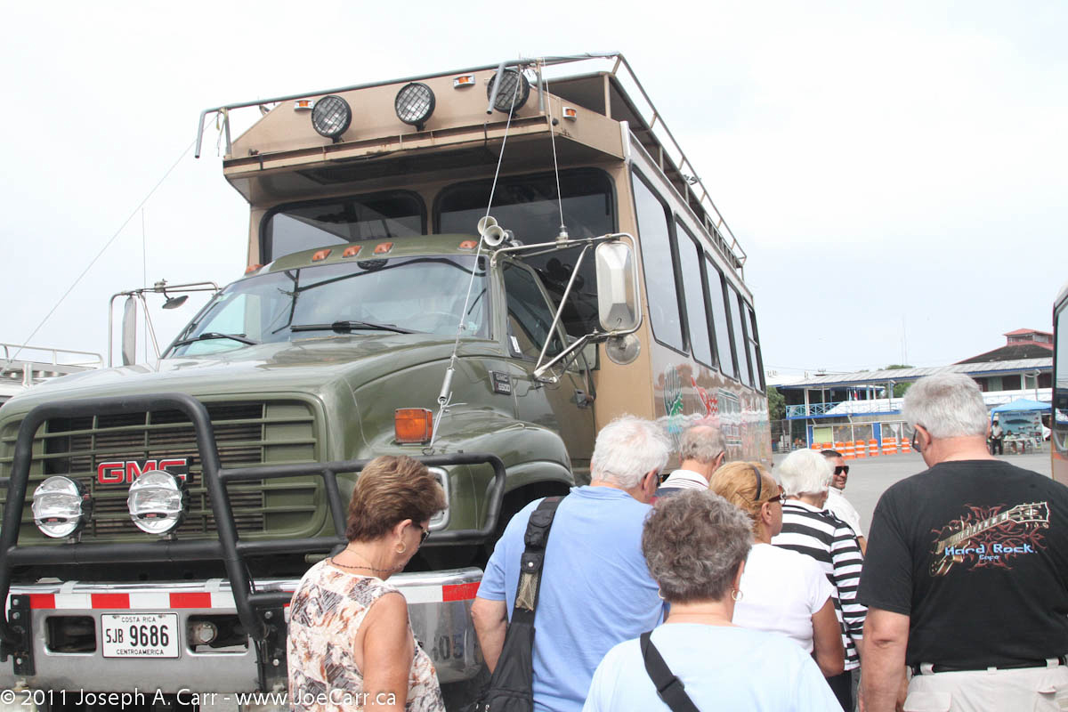
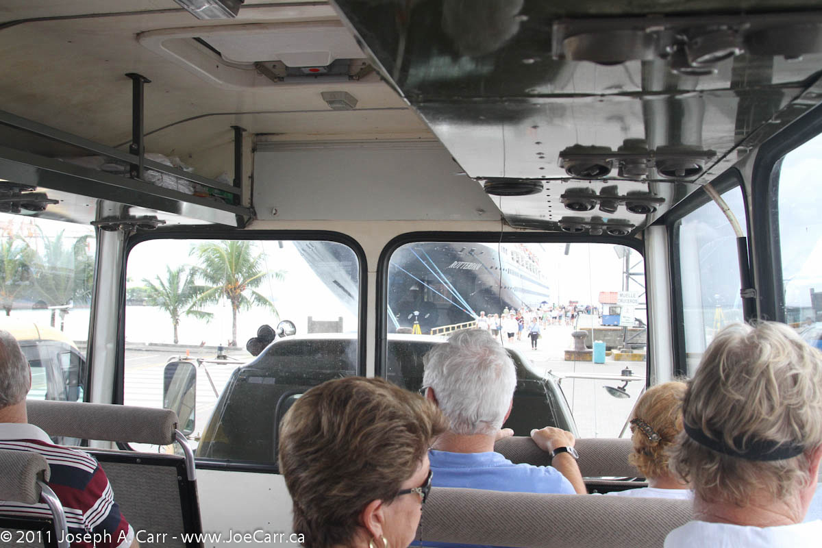
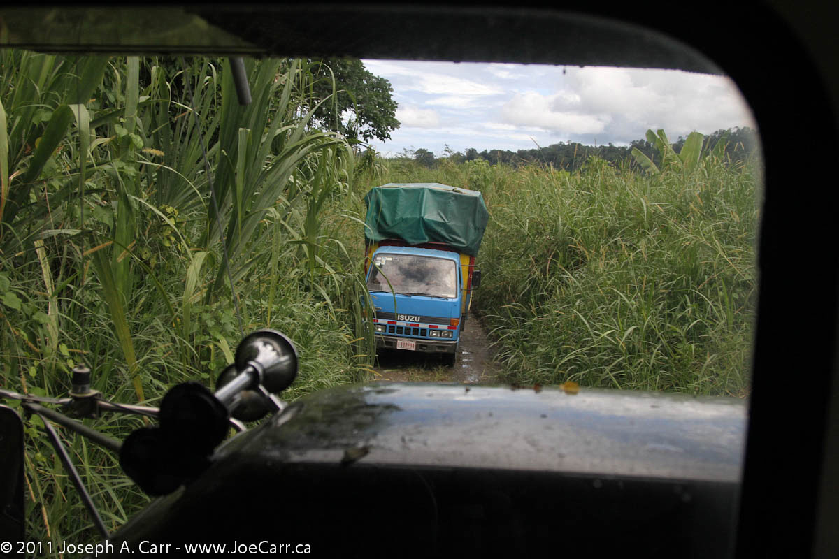
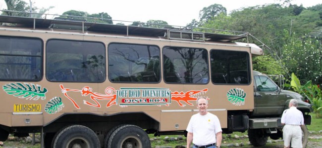
I signed up to take a shore excursion today, but I’m glad it doesn’t leave until 9AM because I am having a tough time getting motivated this morning. After having some breakfast and my cappuccino, I am finally ready to get out there. When our group leaves the ship to go on our excursion, we discover we will be transported in a big, honkin’ tandem wheeled bus that is so high off the ground, we have to climb a set of stairs that folds down out of the back of the bus. It is air-conditioned and the seats are quite comfortable. There are big windows, and I’m happy the bus is only about half full, so there is lots of room to spread out. Another bonus is the weather – no rain, but overcast so it’s not too hot. The locals tell us the last few days have seen pouring rain, so we are lucky, since the good weather holds for the whole day.

Female Golden Orb spider

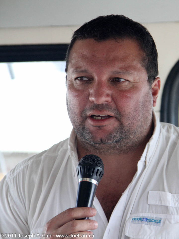
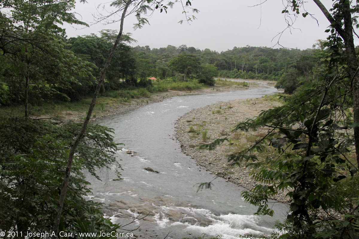
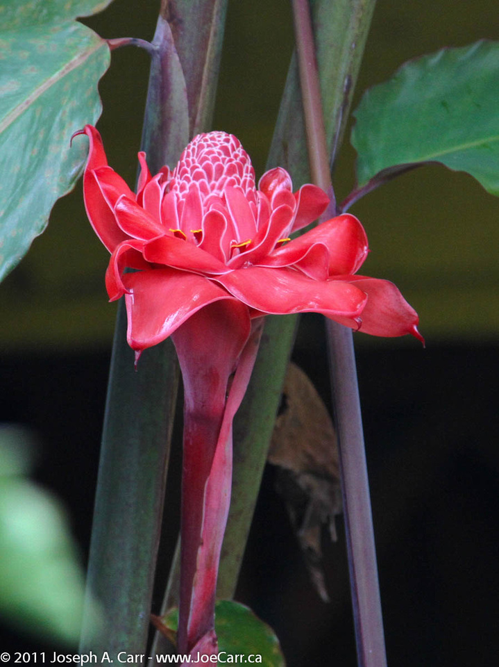
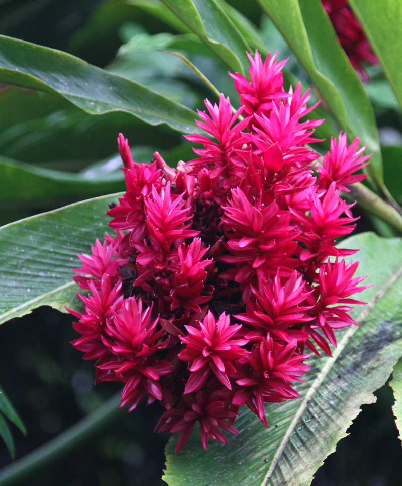
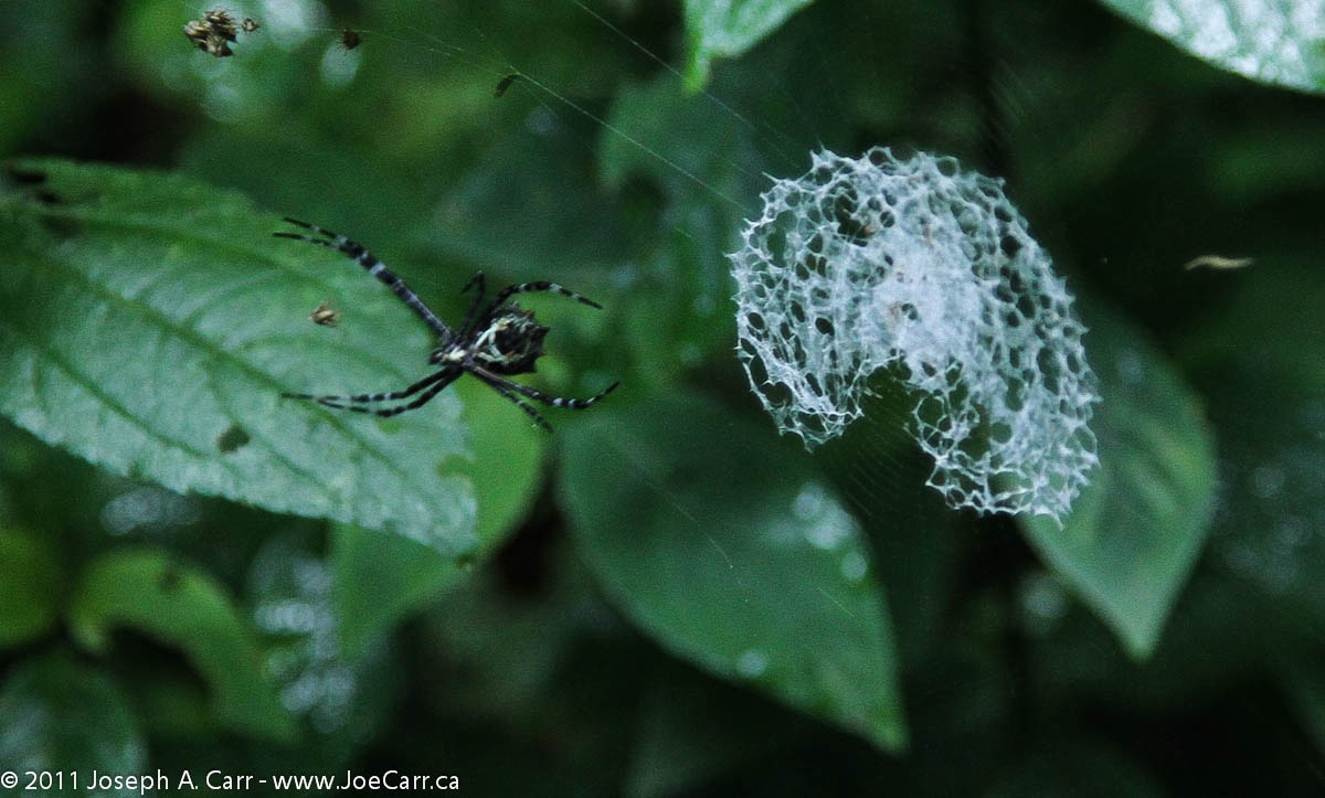
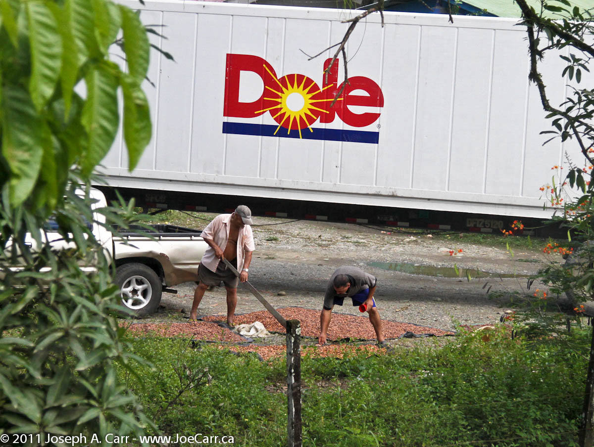
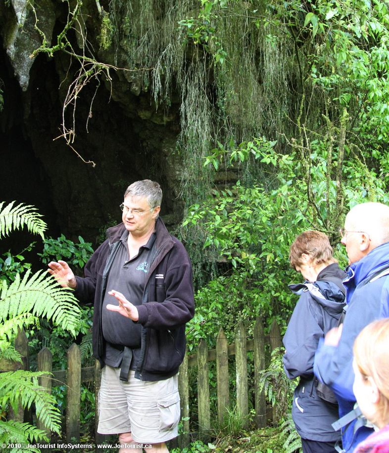
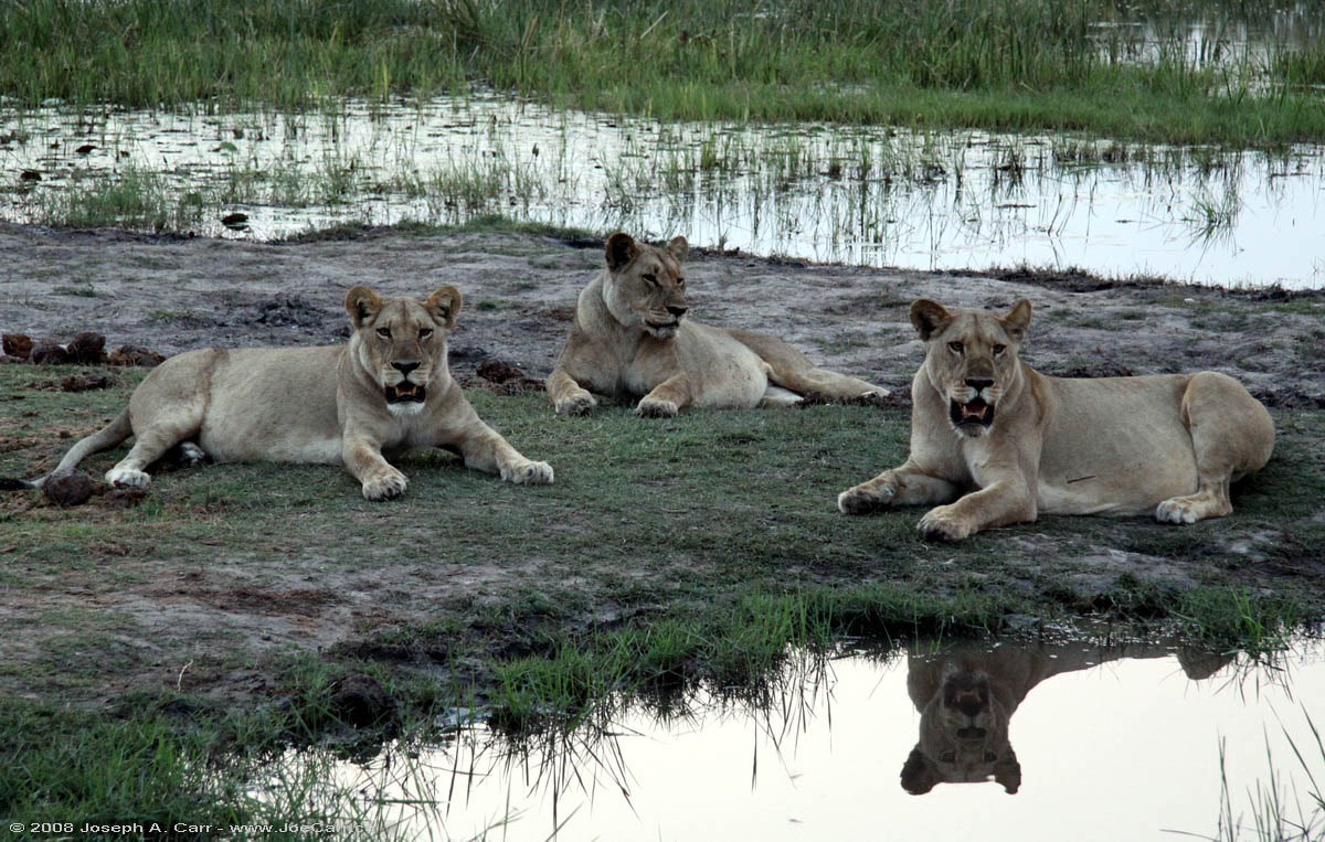
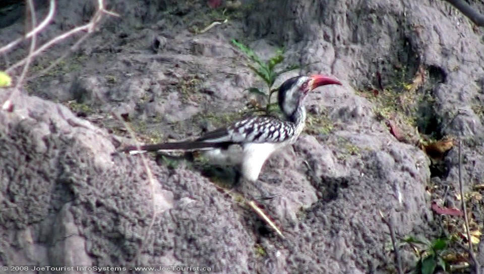
Eric is our guide and Jose is our driver. They are business partners, and built this vehicle from scratch on a GMC truck chassis. We head south along the coast and then turn inland, traveling along the Banano River past the little community of Bomba, which is where the pumping stations are located for Limon’s municipal water supply. We driver further along the Banano River and then stop for a walkabout. Eric points out all sorts of flora and fauna, include the Golden Orb spider, a Balsa tree, and a red Poison Dart frog.

JoeTourist: Puerto Limon &emdash; Ticos swimming in the freshwater near the Caribbean coastal beach

We carry on along the river and then turn off the road into a banana plantation, where we stop to have a snack and listen to Eric as he explains all about the banana business. Eric mixes a drink called a “Missile”, which is a local liquor called Guaro, a squeeze of local (sweet) lemon, and topped up with Fresca. I prefer to have a local Imperial beer, but those who try the Missile say it is very smooth and refreshing. The good weather is still holding as we return to the ship by 1:30PM. As we travel along the coast there are many Tico families swimming and playing along the shoreline since it is Sunday. Of course they all stop to wave when they see our bus – a bit of a contrast from my experience in Colombia, where the locals either ignored the tour bus or just stared at us.

It is a welcome relief to get back on board the ship, which is really starting to feel like a home away from home. We depart on time, with the First Officer piloting us this afternoon. We now head for the port of Colon to transit the Panama Canal tomorrow morning.

post

Te Kuiti & Waitomo Caves

Nov 4, 2010 – Thursday – Te Kuiti, New Zealand

The day starts badly at our B&B, since our host Margaret makes us instant coffee this morning. She also serves us a continental breakfast instead of the full English cooked breakfast we have had at all the other B&Bs so far. The fresh fruit and rhubarb compote for the cereal is nice, and the endless toast and homemade preserves are appreciated, however the instant coffee is dreadful.

Marokopa Falls
Marokopa Falls

At Margaret’s urging, we drive out to the coast on Highway 37 to Marokopa, where there is a black iron sand beach. The beach and estuary area is quite spectacular. On the way out on the highway, we also stop to see Marokopa Falls, which is 15-20 metres high…an amazing sight. On the return trip, we see Mangapohue Natural Bridge, a land bridge caused by a river eroding limestone to punch a gorge through the rock. These are both great sights, and they are no cost. On our way home, we checkout the Waitomo Caves, but don’t go in since Margaret has booked us into the competing outfit Spellbound, which she promises is a better glow worm cave experience. We check out the competition while we are here, and find the rates are significantly more expensive than Spellbound. After we return home, Margaret makes us tea, which is very much appreciated.

Pavlova at Kai Cafe
Pavlova at Kai Cafe

We go out to a nice restaurant tonight called Kai Cafe, which is run by a local young man and his French wife (who does the cooking). The meals are a blend of French cooking and local tastes. I have the Filet steak, which is a “Scotch” cut (unlike any filet I’ve had in Canada), however it is a very nice steak cooked to order, topped with a creamy mushroom sauce and accompanied by roasted potatoes, fresh steamed green beans, and a grilled tomato. My friends rave about their main course selections as well.

Pavlova is offered for dessert, which we all agree is better than the Cherries Jubilee we were served aboard ship in the Pinnacle Grill. I have a Cappuccino, which is nicely made. The young man who runs the place is thrilled that we are happy with our experience. Now called: Bosco Cafe on TripAdvisor – a quick bites place serving take-out, breakfast and lunch only. I add my favourable rating after returning home, but I can’t vouch for the place now that the format has changed.

Nov 5, 2010 – Friday – Waitomo Caves

JoeTourist: Glowworm Caves &emdash; Exit to cave

Today after breakfast, we leave for a 10am booking at Spellbound, the glow worm cave and dry cave tour located in Waitomo. It only takes us 10 minutes to drive from Te Kuiti, and the tour starts promptly at 10am – ending around 2pm. Our guide Norm gives us a terrific experience along the way. First he drives us about 20 minutes west of Waitomo to the entrance to a private cave which has a stream running through it. We don a hardhat with a light, get in a zodiac boat and slowly go into the cave to see the glow worms. We learn these are actually maggots, however they are tiny. They do indeed glow, and glow brightly enough to light the inside of the cave once we turn off our headlamps and become dark adapted. The glow reflects off the water, and I can see the other 12 people in the boat.

Norm hand propels the boat using an overhead cable, taking us within a few metres of a small waterfall before returning us to the landing. We then walk back to the entrance, leave our hardhats, and walk a few metres to the “coffee shop” where Norm makes us instant coffee, tea, or hot chocolate made from hot water stored in thermos. Biscuits to dunk complete the offerings. Toilets are also available nearby. There are wild Turkeys roaming in the pasture as we walk for five minutes to the dry cave, where Norm tells us he was one of the founders.

It is a superb cave with a walkway that goes for perhaps 300 metres or so. There is a large gallery, some air shafts, other entrances to see, and of course lots of stalagmites and stalactites. There are also some animal bones: some you would expect such as farm animals and possums; however there is also a skeleton of a Moa, an extinct bird which had a trachea, hip bones and big thigh bones. After exiting the dry cave, Norm takes us on a drive over some farmland along the ridgelines, and finally returns us to the starting point.

This evening we return to Kai (now called the Bosco Cafe) for our last dinner in New Zealand (and of the trip). I have the fish of the day (Snapper), which comes with oven roasted potatoes, green beans, and a very nice pesto topping, as well as some salad around the plate. When we return to the B&B I get serious about packing – tossing out heavy paper and other stuff that is now useless. We settle our accounts with Margaret for our stay, however she only accepts cash, so that makes it a bit inconvenient. All the other B&Bs accepted credit card payments.

Hilo, Hawai’i

October 20-24, 2009 – Hilo, the Big Island of Hawaii

Hilo is on the east coast of the Big Island of Hawaii. which is the wet side of the island. Although the temperatures are nice and warm, it rains in Hilo virtually every day, and the area has the tropical vegetation to prove it. Hilo is a contrast to Kailua-Kona on the other side of the Big Island, since it is less tourist-oriented, giving the visitor a glimpse of the Old Hawaii.

Kilauea Volcano is less than one hour’s drive south from Hilo, so I made several trips to see the sights in Volcanoes National Park and nearby areas in my rental car.

The North Coast of the Big Island is rugged, tropical, and mostly inaccessible, however the road along the coastline north from Hilo provides easy access to some of the gulches and valleys, rivers and streams, spectacular waterfalls, and of course the coastline itself before the road veers off to Waimea. Stopping along the way will provide you with a glimpse of how Hawaiians live day-to-day.

The Imiloa Astronomy Center is located in Hilo, and presents astronomy to visitors using interactive displays, a planetarium, special exhibits, and ties astronomy to Hawaiian customs and culture. Imiloa is run by the University of Hawaii on behalf of the big multi-national observatories located atop Mauna Kea. Worth a half day visit. Admission charged.

Hilo Bay & the shoreline along Kalanianaole Avenue presents fascinating vistas of the geography surrounding Hilo, so it is a good idea for visitors to familiarize themselves with the bay and the Pacific Ocean beyond. There are numerous civic parks along Kalanianaole Avenue, and all are only a few minutes drive from anywhere in Hilo. Tidal ponds provide safe and easy access for everyone to play in the ocean, while just a few metres away are rocks and surf to challenge even the most capable swimmers and surfers. Coconut Island, Banyan Drive and Liluokalani Gardens are all interesting destinations worth spending some time at…in fact, take a picnic lunch (“sack lunch” in Hawaiian), and plan to spend the day exploring Hilo Bay.

Rainbow Falls and Boiling Pots Pools are both located right in Hilo on the Wailuku River, which flows into Hilo Bay. Although not as spectacular as other falls and rivers you might find on the Big Island, they are easy to get to, and certainly worth a look.

Despite being an amateur astronomer, I didn’t manage to visit the Mauna Kea Visitor Center. It is a fairly easy drive from Hilo, and offers free nightly star gazing from this station located at the 9,500′ level on Mauna Kea. Please note, the big observatories are not located here – they are near the summit at the 14,500′ level! If you plan to go to the Visitor Centre, take a winter coat and check their website to ensure the weather will be clear. It may be raining in Hilo, but it could easily be clear on the mountain (or vice versa). I did visit the top of Mauna Kea and the observatories a few years later in 2014.


JoeTourist: Hilo &emdash; Breakfast at the B&BOctober 20-23, 2009 – I stayed at the Old Hawaiian Bed & Breakfast for four nights. The place is situated in a nice part of town near the Wailuku River, and is owned and operated by Lory & Stewart Hunter. Lory’s superb breakfasts are served on the lanai (patio), and include fresh fruit smoothies, fresh baked pastries, cooked eggs, tropical fruit cocktail, and of course, Kona coffee. There are three rooms to choose from, and all guests share access to the large lanai, telephone, fridge, microwave, and high speed wireless Internet. There are no televisions in the rooms, so bring a notebook computer if watching videos or the news is important to you. JoeTourist recommended.

post

Johannesburg to Hazyview

October 27, 2008 – Monday – Johannesburg to Hazyview

Southern Africa 2008

We board our coach after breakfast this morning, and end up waiting for a half hour while a couple pull their bags apart in the parking lot looking for something terribly important.  Eventually we leave and learn our “Coach Captain” (driver) is called Phineus.  He proves to be a very good driver: good-humored, and always on time.  Our bus is quite new, very comfortable, air conditioned, and has a washroom and a fridge.

JoeTourist: Johannesburg to Hazyview &emdash; Freshly ploughed farm fields - red dirt
Freshly ploughed farm fields – red dirt

As we roll through Pretoria and onto South Africa’s national road system, we can see this is an excellent transportation system, with toll booths on certain sections.  The M4 divided highway takes us past Cullinan (some famous diamonds mined here), Witbank (surface coal mining & refining), Middelburg and Belfast (forestry & farming) before we turn off and end up in Lydenburg.  Most of us go to Wimpy’s for lunch – a fast food joint, South African style.

South Africa is home to the largest man-made forest in the world (140 sqkm). We learn that Pine trees are harvested after 10 years, with the trees growing to 12m high. Eucalyptus are also used in some areas, however they require more water, so they are falling out of favor. We see a steel mill just outside of Lydenburg.

JoeTourist: Johannesburg to Hazyview &emdash; Eroded rock formations on the Treur River at Bourke's Luck Potholes
Eroded rock formations on the Treur River at Bourke’s Luck Potholes

Panorama Route – Our first scenic stop is the viewpoint at the Blyde River Canyon, where we can fully appreciate the 800 metre drop to the canyon floor. Across the canyon are the “Three Rondavels”, huge round rocks that look like African huts. Our next stop is Bourke’s Luck Potholes, where the Treur River has eroded strange cylindrical potholes in the sandstone.

JoeTourist: Johannesburg to Hazyview &emdash; View of the Lowveld and escarpment from God's Window
View of the Lowveld and escarpment from God’s Window

Our last stop in this area is God’s Window, a dramatic vantage point to view the Drakensberg Mountain escarpment with beautiful views of the lowveld, and even Kruger National Park is visible on a clear day. This is where the quirky movie The Gods Must Be Crazy (1980) was shot.

We arrive late in the afternoon in Hazyview after our first full day on the road. Hippo Hollow Country Estate is located on the tranquil Sabie River, where the resort’s namesake hippos regularly graze on the front lawn. My cottage is quite luxurious, having a king sized bed on the main floor and two single beds in a loft. My patio overlooks the Sabie River. There are very few mosquitoes, which seems strange with all the vegetation around and the slow flowing river only a few metres away…but I’m complaining!

JoeTourist: Hazyview &emdash; Shangaan River Club - the Chief
The Chief

7pm – Shangaan River Club – This is a cultural experience that is staged right on the grounds of Hippo Hollow, consisting of tribal drumming, singing and dancing, followed by a traditional African feast. The chief of the local village is the master of ceremonies, and he introduces his troupe of orphans who sing and dance. He is very animated, talking to us for well over three quarters of an hour before the performance begins.

The chief explains how he is personally responsible for the care of the orphans, many of which are the result of AIDS killing both of their parents. They support themselves by this arrangement with the Hippo Hollow Country Estate, so I’m pleased that Thompsons has chosen to include this performance in the tour. I shoot some high definition video using “night mode” on my Canon HV-20, which works quite well until I run out of video tape! Despite this glitch, I have enough video to capture the event.

The feast of culture served buffet style after the performance is very good. There are lots of choices from the usual soups and salads, as well as a nice selection of African meat dishes that are served from traditional cast iron pots. Fruit, dessert, and drinks are also included. This is all served under a massive boma, or thatched building right next to the performance area. It wasn’t just our group who were taking in the feast, however the staff coped with the crowds quite efficiently. All of my group seemed to enjoy themselves, and everyone left the tables fully satiated.

JoeTourist® recommends the Shangaan River Club.

post

Shackleton’s Lodge to Linyanti Camp

October 17, 2008 – Friday – Shackeltons Lodge, Zambia to Linyanti Camp, Okavango Delta, Botswana

Botswana Safari Map
Botswana Safari Camps

We are up at 6am, since it will be a long day of traveling.I spot a Kingfisher on the Zambezi at dawn just outside my veranda. We have a full English breakfast at Shackletons this morning and then we are on our way. We turn at Kazungula and arrive at the Zambian side of the Zambezi River crossing. We get our Zambian exit visa, say goodbye to our driver Jacob, and then catch a private launch across the river to Botswana.

The Kazungula vehicle ferry also crosses the Zambezi, however one of the two ferries is out of service, so trucks are waiting up to two weeks to cross the river in either direction. The two governments plan to build a bridge some day.

First stop is a Chobe River boat cruise. We spend the next few hours motoring slowly along the Chobe River and see lots of wildlife. Lunch and snacks are included, so it is a very pleasant start to the day. The Chobe River is on the border between Botswana, Zambia and Namibia. Since the boat is covered and only has the two of us on it. Ernst and I are kept very busy taking both still photos and video. The game are quite close, and the boat provides a reasonably steady platform for photography. I don’t forget to use my binoculars as well – the extra magnification and image stabilization make animal observation very rewarding.

The Chobe River boat cruise is one way, so at the end we transfer to our Land Cruiser to continue the journey to Lynanti Camp. Originally we were scheduled to fly to Linyanti Camp, and then drive from Linyanti to Lechwe Camp, but due to flooding in the Okavango Delta, the road from Linyanti to Lechwe is impassable, so those arrangements are now reversed.

Linyanti Camp is a very long 170km drive from Kasane in our Jeep Land Cruiser. After clearing Botswana customs at 1:30pm, we are on the road all afternoon, arriving at Linyanti Camp at 6pm. It is a punishing ride through a highway made of soft sand, however along the way there are lots of game to see: African Fish Eagles, Lilac Breasted Rollers, Giraffes, Buffalo, Warthogs, and Zebras. Just before we arrive at the camp, we see three female lions resting beside the shoreline at sunset. One female is older and thinner and the other two are younger. They all seem to be fat and happy, and they don’t bat an eye as we pull right up to them in our Land Cruiser.

Drinks and dinner are waiting for us when we arrive in Linyanti Camp after dark, thanks to the camp staff. As I lie in bed this evening, I hear Hippopotamus in the spillway just a few metres from my tent flap.

post

Johannesburg to Livingston and Victoria Falls

October 16, 2008 – Thursday – Johannesburg, South Africa to Livingston, Zambia

I am up at 6am this morning, since I really didn’t sleep much last night. I sort out the repacking of my bags once again. Breakfast is included in the room tariff at the Mondior hotel, and is sumptuous in their Oriana Restaurant. South Africans sure know to eat!

When I check out this morning, I ask about storing my big bag at the hotel until my return on October 25th, but they refuse since I’m not staying with them when I return to Johannesburg. So that was bad advice from Wilderness Safaris, however the front desk manager verifies that I can store my bag at the airport.

Johannesburg airport is being expanded, so it is chaotic and very noisy. They are gearing up for the FIFA 2010 International Soccer match. I find the baggage storage office and leave my big bag there – praying that it will still be there when I return on the 25th, and that my notebook computer will still be inside.

JoeTourist: Livingston &emdash; Zambian Airways Boeing 737-219 aircraft tail
Zambian Airways Boeing 737-219 aircraft tail at the gate in Johannesburg airport

There is some high drama at the gate next to where I board my flight. A young couple show up extremely late for their flight to Mauritius and they are told the gate is closed, so they are refused entry. Lots of yelling and crying ensues, however the gate staff prevail, and eventually they shut everything down and walk away. I do love people watching!

I’m really early for my flight on Zambian Airways to Livingston, but that’s me: leave lots of time. It was a good thing, since despite this morning’s confusion with the bag storage; I still had time to deal with it.

I just experienced my first oh shit moment. I realize that I left my expensive Canon binoculars tucked into an outside pocket on the bag I checked at the airline counter. It will be a minor miracle if it appears at the other end…sigh!

Zambian Airways departs about five minutes late without incident. I say a small prayer for my binoculars as we take off. The aircraft is a Boeing 737-200, which appears to be in pretty good shape. The in-flight meal is a “beef” sandwich, which turns out to be pork deli meat.

JoeTourist: Victoria Falls &emdash; Cataract islands in the Zambezi River above Victoria Falls
Cataract islands in the Zambezi River above Victoria Falls as viewed from the flight into Livingston

This is certainly an International flight: there are two large groups aboard (Czechs and Israelis). There is thick air pollution obscuring the view outside for most of the flight, however I manage to pick out the lake behind the Shashe Dam in Botswana near our midway point. I take some good photos of the Zambezi River above Victoria Falls on our final approach to Livingston Airport.

After we arrive at Livingston Airport, I retrieve my bag, and to my immense relief my binoculars are still tucked into the pocket I left them in, no worse for wear! I pay the outrageous US$50 Zambian Visa single entry fee and meet Victor, our Botswana guide in the waiting area. There is a female guard with an AK47 rifle in the Zambia National Commercial Bank office in the airport!

We wait for the the second safari participant Ernst (from Austria), who arrives on the next flight a half hour after me. Apparently he paid no Zambian entry fee since he is a European. It seems the Zambians charge U.S. citizens even more than I paid for the fee – so the fee charged depends what country you are from! Jacob is our driver and guide while we are in Zambia, since Victor is not a certified Zambian guide, so he is just along for the ride until we cross into Botswana.

Victoria Falls viewpoint map

Jacob drives us to Victoria Falls where we go on a walking tour in the midday heat (about 38°C in the shade). Since this is the dry season, the water on the Zambian side of the falls is almost completely dried up, however the Zimbabwe side (in the distance) has lots of water.

As we walk the trail along the top of the gorge, we get good views of both sides of the falls . We encounter a troop of baboons along the way which I am wary of, however Jacob assures me they are not aggressive as we pass by. I get Jacob to take a photo and video of me standing against the rail with Victoria Falls in the background – two I was there moments.

I find it a bit surreal as I walk along the gorge. It’s as though I’m not really here…I can’t explain the feeling further.

100 Billion Dollar Zimbabwe bank note

Ernst and I each buy a 100 billion dollar Zimbabwe bank note from some young men hanging around the border crossing at the Victoria Falls bridge. Cost is US$5. The Zimbabwe government can’t afford to print the bills (which are virtually worthless anyway), so they use recycled paper from cheques. The bills have an expiry date of only a few months after their issue date!

We drive westward for about an hour on a good paved road. Along the way I see a roadside stand selling fish from a nearby stream, and we pass many Zambian villages along the way. Most people still live in round grass huts and keep their domestic animals near them in pens made from grass and sticks. After we pass Mwandi, we turn off on a sandy track that leads to Shackletons Lodge, located on the Zambezi River.

Sunset over the Zambezi River

My cottage overlooks a beautiful river vista. Ernst and I are the only guests, so we are treated royally. The lodge has two Jack Russell Terriers, so I feel right at home. Shackeltons is one of those places you file away, promising yourself you will return to one day.

East Coast of Kaua’i, Hawaii

January 16-21, 2001 – East coast of Kaua’i, Hawaii

As mentioned on the main Kaua’i page, I stayed at Kakalina’s Bed & Breakfast for the week I spent on Kaua’i in 2001. Kathy still runs this B&B, and it continues to get high ratings.

Wailua Falls, Kaua'i

Wailua Falls, Kaua’i

Before leaving Lihue, take the Ma’alo Road (near the old sugar mill) and drive the short distance to see Wailua Falls. Afterward, proceed northward along the east coast of Kaua’i along the Kuhio Highway. First stop is the spectacular Opaeka’a Falls, and the view of the Wailua River across the road from the falls lookout. If you continue driving up the road to the end, you will find the Keahua Arboretum. I would not recommend taking the boat cruises along the Wailua River. The fern grotto and other sights along the way are underwhelming, although Tripadvisor gives these cruises high marks, so some may like it. The best way to see the Wailua River and falls is to drive to the lookouts on the hills surrounding the river valley (easy), and ideally take a helicopter tour of the whole island (expensive).

The Poliahu Heiau is adjacent to Opaeka’a Falls. Heiaus (or temples) are holy places for Hawaiians, and were used extensively by the ancient Hawaiians. Most heiaus consist of rock walls, and platforms made of rock. Spiritual leaders ensured that the mana (spiritual power) was respected by all, and they also enforced the kapu (sacred rules of life). For more info on Hawaiian sacred places, please refer to a more extensive discussion off my Big Island page which highlights Puuhonua o Honaunau.

Next up the highway, is the town of Kapa’a. This is a good place to pick up snack food, fruit and drinks, all at reasonable prices.

  • Pono Market – hot & cold food to go & sushi – inexpensive & good – where the locals shop for takeout! This place continues to be a must-try according to the enthusiastic Yelp reviews.
  • ABC Store – best place to buy cold beverages and snacks, and the best prices on the standard Hawaiian souvenirs.
  • Farmers’ Markets – If you want the freshest food, and delicious local snacks, you need to find a local farmers’ market!

Wandering an east coast beach

Wandering an east coast beach

There are some restaurants scattered along the eastern shoreline of Kaua’i, and they are worth finding and trying out, since many cater more to the locals than tourists. There are resorts along the east coast, but they tend to be more modest than those you will find elsewhere on Kaua’i. There are also many public beaches along the eastern shoreline. They are well worth exploring, since they are less crowded than other areas of the island. In particular, Anini Beach is a great spot to spend the day after picking up your picnic lunch in Kapa’a.