After breakfast, we leave the Triple J Hotel in Dawson City for Mayo. After turning off the Klondike Highway to head to Mayo, we encounter some major highway construction along the Stewart River. After arriving at the Binet House Museum in Mayo, we have time to take in some of the history of this silver mining town before the caterer arrives with our lunch. Two local women share some history of their town and this area: 400 people live here, they have a K-12 school, outdoor pool, seniors residence, store, and municipal services. They are still dealing with the mine spill into the river, which happened last year (2024 Candian Press article). I take a walk down to the Stewart River before we board the bus to continue our journey.
After departing Mayo and rejoining the Klondike Highway, we stop at Yukon Crossing, where cattle were driven across the Yukon River.
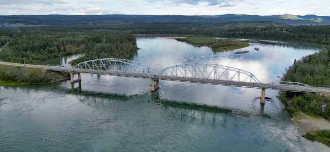
Our next rest stop is at Pelly’s Crossing, where there is a gas station, a general store, and a few houses. Just under two hours later, we arrive in Carmacks, where we check into the local Hotel Carmacks. The hotel looks pretty dodgy, but my room is clean. The Trans-Canada Trail is just a block away, offering a nice walk along the shore of the river on a boardwalk. I fly my drone up the Yukon River, over the bridge and circle back taking 4k video. I have a very nice butter chicken dinner in the hotel restaurant.
Today, our group visit Tuktoyaktuk and the Arctic Ocean, and have a scenic flight over the Mackenzie River delta.
We are split into two groups, with my group leaving in the morning for Tuktoyaktuk on a touring van driven by our guide Olaf. This is the northern section of the Dempster Highway, some 150 kms of gravel from Inuvik. While in Tuk, we have an opportunity to take a dip in the Arctic Ocean and have a cultural visit before flying back to Inuvik over the beautiful Mackenzie River delta.
The other half of our group flies to Tuktoyaktuk later in the afternoon, visits Tuk, and returns by road in the evening.
Drive to Tuktoyaktuk
This most-northerly section of the Dempster Highway is 150 kms long and originally cost $300 million to build on the tundra and muskeg. Maintenance and rebuilding is done each summer, since the roadbed is built on such a soft foundation. At its highest point the highway is 550 metres above sea level. Locals stash snowmobiles and other camp equipment just off the highway and use the snowmobiles in the summer to cross the tundra to seasonal camps. We pass many lakes and bogs along the way, including Jimmy Lake, where a huge reindeer herd lives during the winter. Pingos are visible here and there – hills formed from the melting and freezing cycle, with their cores being permafrost.
Tuktoyaktuk
After making use of the washrooms at the Tuk airport, we drive over to Roger and Winnie’s home for an Inuit cultural experience. Winnie has prepared lunch for us: Cranberry jam on Bannock and Doughnuts to start; Reindeer soup; Whitefish and Arctic Char; and Cloudberry compote on confetti cake for dessert.
Roger shares with us his life in the north. Food comes from hunting, fishing and whaling (Beluga). Living in freezing temperatures most of the year means wearing parkas, mittens and boots. Winnie and Roger first met at a residential school. Roger was a leader for his people’s self-government and land settlement initiatives. Food is stored in permafrost root cellar lockers – a community resource.
Our next activity is to take a dip in the Arctic Ocean – a bucket list item for many in our group. This will likely be the furthest north (69º 27′ North Latitude) any of us will be while on land, so this is the time for selfies beside the shore of the Arctic Ocean, and dipping toes into the water, with a few in swimsuits going full immersion! On our way back to the airport, we stop for photos of two nearby and large Pingos in the Mackenzie River delta.
Sightseeing Flight over the Mackenzie River to Inuvik
Our sightseeing charter flight departs from Tuk airport at 3:30pm on a De Havilland Canada DHC-6-300 Twin Otter
Altitude – 150′ to 1,000′
Fly along the Arctic Ocean coastline, circle some Pingos, and fly low over the intricate channels, pools and islands of the Mackenzie River delta
Arrive in Inuvik at 4:30pm
For me personally, this sightseeing flight is the highlight of the tour, and the weather was perfect!
After our return to Inuvik, some of us have dinner at Alestine’s – a casual restaurant built in the owner’s front yard, with the kitchen inside a converted school bus. I enjoy some excellent fish tacos & Yukon Gold beer on the patio. Cost for me was $45 (tax and tip included, cash only). Very good service and food – highly recommended!
I have a substantial breakfast this morning and grab a muffin for our long road trip to Dawson City on the Klondike Highway 2. We leave at 8:10am without one couple and our tour director. Alastair is staying with the couple until the man who is suffering a medical incident is transported to hospital. He will then fly to Dawson to catch up with the group, so our bus driver Harold will lead the group today. We see new housing developments as we leave Whitehorse: new subdivisions, schools, commercial buildings and roads are being built in Whitehorse.
Points of interest on the road trip
Lake Laberge – I catch a glimpse of this famous lake (The Cremation of Sam McGee – Robert Service) through the bus window
Fox Lake – a long lake parallel to the highway
Braeburn Lodge – our first rest stop, where giant cinnamon buns are sold for $20 each! There is an airstrip on the other side of the highway.
Montague Road House – a rest stop which was part of the overland trail between Whitehorse and Dawson City
Carmacks – a rest stop with a general store, gas station, hotel and restaurant, where the highway crosses the Yukon River
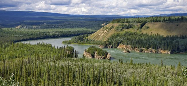
Five Fingers Rapid – some members of the group hike down the steep stairs and trail to the rapids. I stay at the observation platform to fly my drone, capturing some panoramic photos and video of the river, valley and rapids.
Minto Landing RV – we stop for lunch by the river at this new RV park, which is still being developed. Our driver Harold is conscripted to serve the soup!
Pelly River Crossing – a rest stop with a general store and gas station, and 5G mobile reception! The highway is no longer following the Yukon River.
Stewart Crossing – a rest stop where the highway is now following the Stewart River.
Gravel Lake – rest stop where the highway is on the southern side of a broad valley. The Tintina Fault runs through this area of the Yukon from Circle, Alaska to Watson Lake.
The Tintina Fault runs from Circle, Alaska to Watson Lake, Yukon. The SW corner of Yukon landmass shifted 1,000 km 55 million years ago. Yukon government information sign at Gravel Lake.
We are staying at the Triple J Hotel and Cabins in Dawson City. I join some other tour group members for dinner and a beer in the hotel restaurant. Despite being a modest establishment, the food and service are good. After dinner, I go for a walking tour of historic Dawson City, since it is still daylight at 11PM!
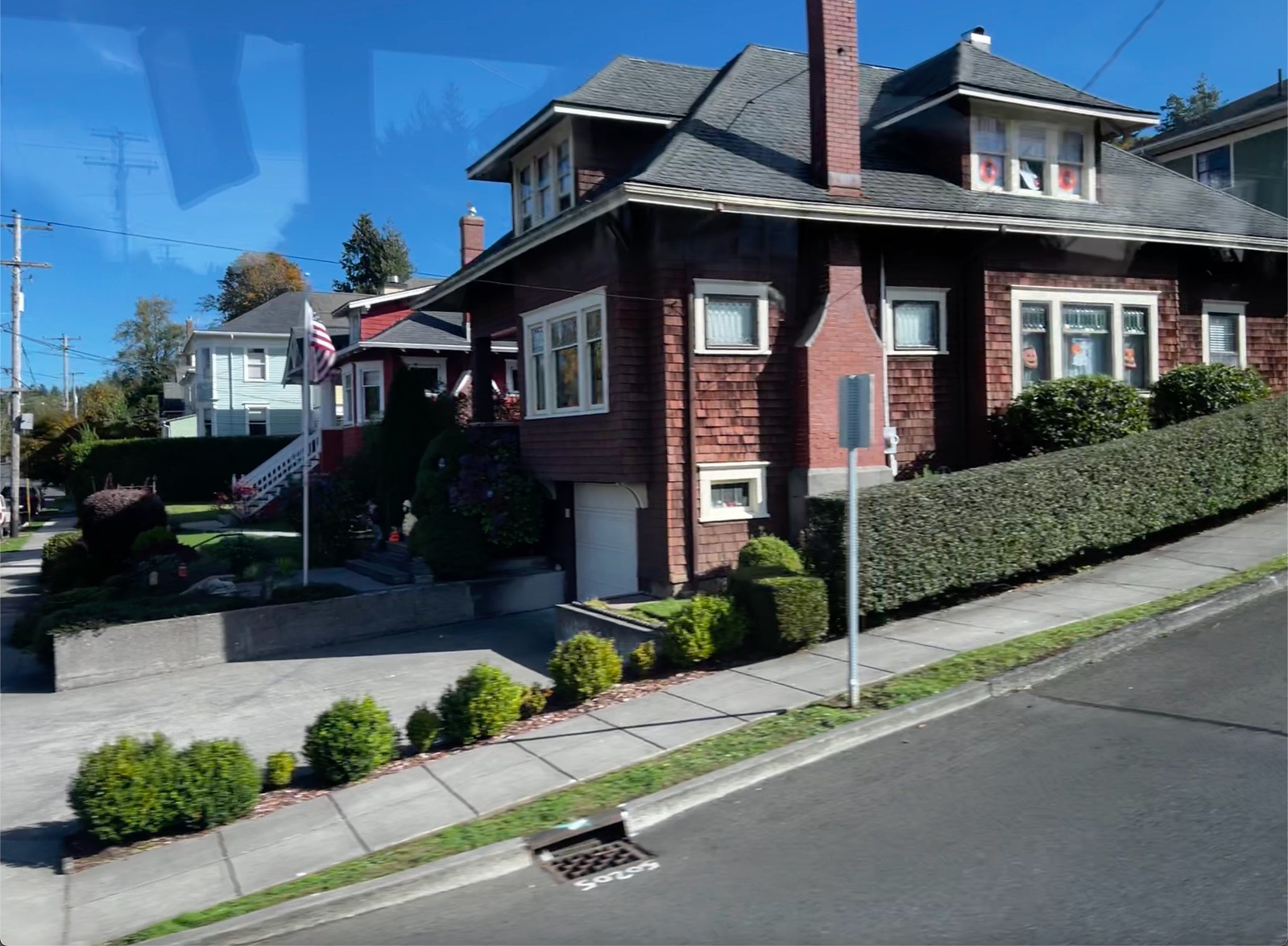
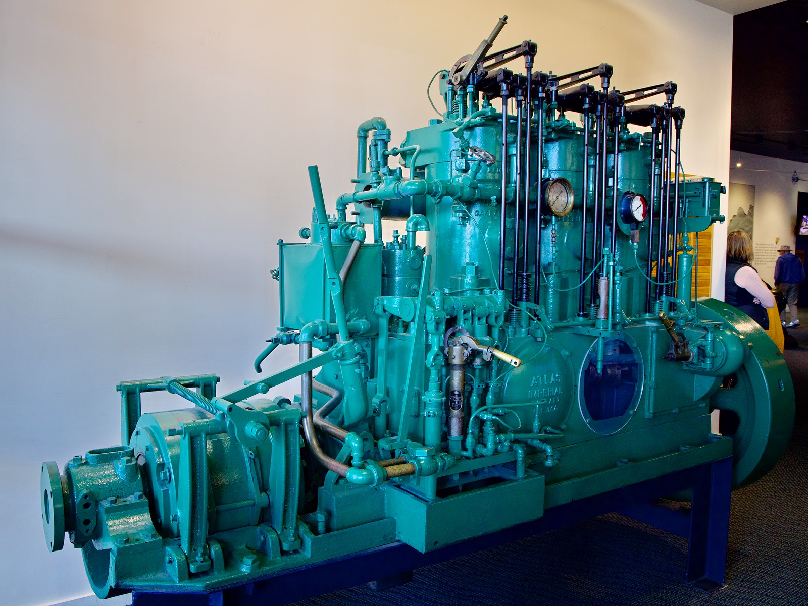
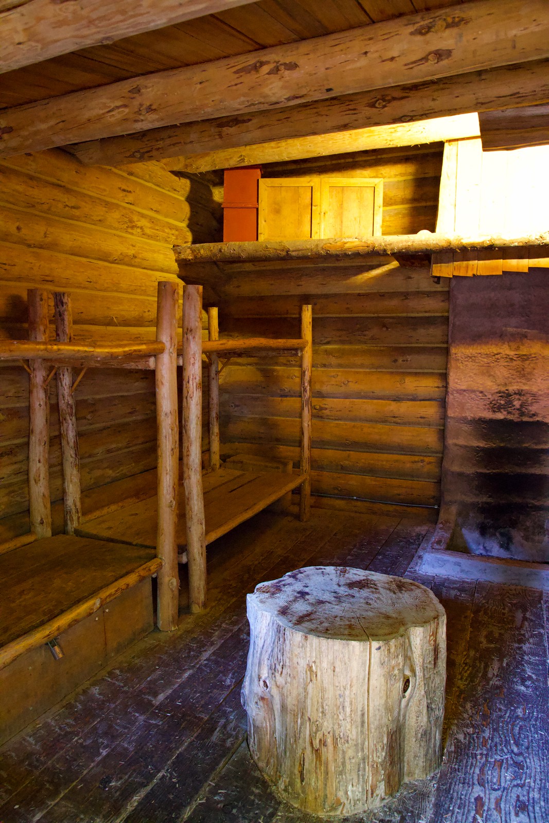
Our group have the included breakfast at the hotel before our tour director walks us over to the MacBride Museum, which is only a short distance away. There are the usual stuffed animals and birds, but I find the transportation history and artifacts of the Yukon fascinating, since it includes early sleds, horse-drawn and rail wagons, snowmobiles and more. I discover an old Peerless Magnarc movie projector, which unfortunately our museum guide doesn’t talk about. There is an authentic Miner’s tent showing all the supplies the miners had to haul with them into the gold mining areas. The Telegraph office is the oldest building still standing in Whitehorse, and includes original telegraph and telephone equipment, as well as a 1970s radio station.
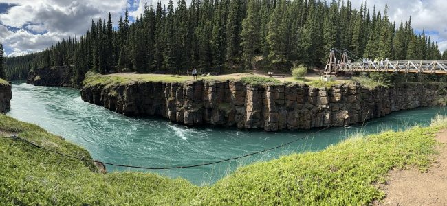
Our bus shows up outside the museum to take us on a locally guided tour of Whitehorse. First stop is the SS Klondike sternwheeler, which is currently being restored by Parks Canada. We learn about the critical role these boats played in moving freight in the summer months between Whitehorse, Dawson City, and other mining towns. We visit a Hydro dam and fish ladder on the Yukon River, and spot a black bear cub as it crosses the road and climbs up the nearby hill. Our final stop before returning to the hotel is Miles Canyon on the Yukon River, where there is a pedestrian bridge to cross the river. It’s hard to believe the sternwheelers made it through this narrow passage lined with basalt columns! (see banner image above)
After we return to Whitehorse, I have a late lunch at the Java Connection (TripAdvisor) since it is near the hotel. The chicken and pesto sourdough panini is very tasty, and I have a cappuccino before returning to the hotel. Late this afternoon, we visit the Beringia Centre, which features skulls and dioramas of Ice Age animals, and stories and artifacts of First peoples in the area. Our guide talks about the Blue Fish Caves (pdf) where many of these artifacts were found, and Dry Tundra grasslands, which were prevalent in the Yukon during the Ice Age, and where many of the animals on display lived.
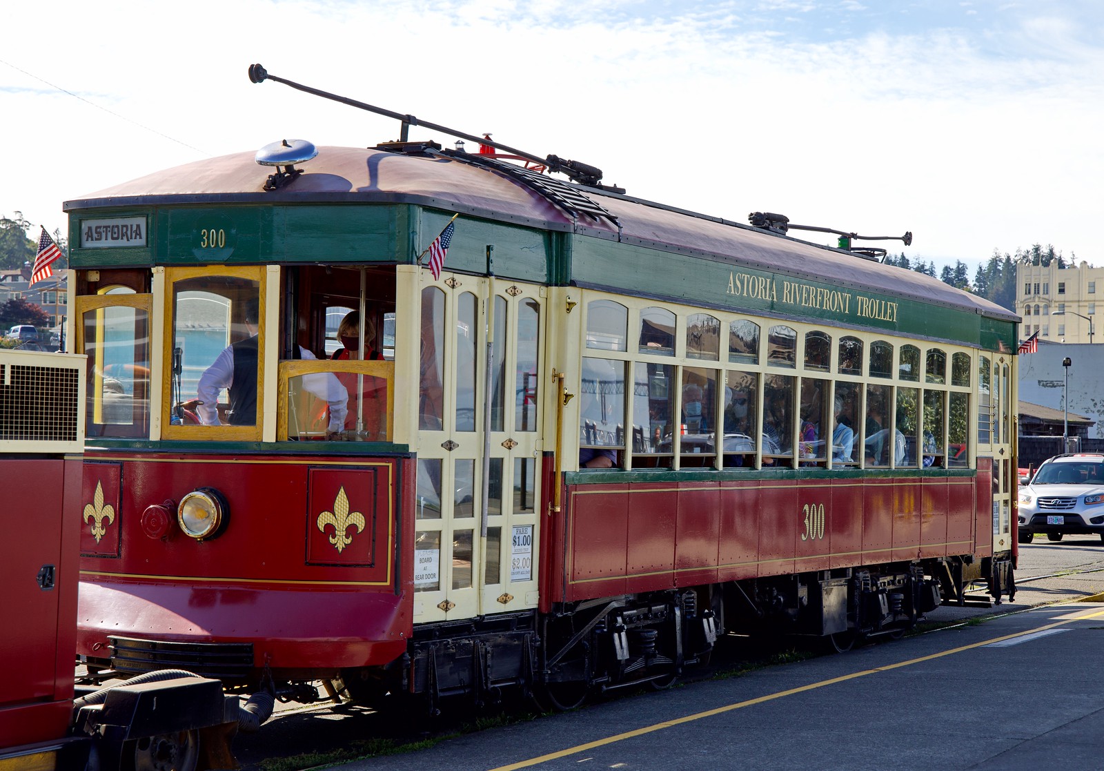
I have a nice halibut and fish dinner at the nearby Klondike Rib & Salmon after we return to the city before walking along the Yukon River waterfront. There is a Trolley rail line operating along a section of the tracks, but the railway shed with the historic engine is closed. Despite it being late evening, there is lots of light since the Sun doesn’t set for several hours yet. When I return to the hotel, I make use of the blackout curtains to ensure I get to sleep.
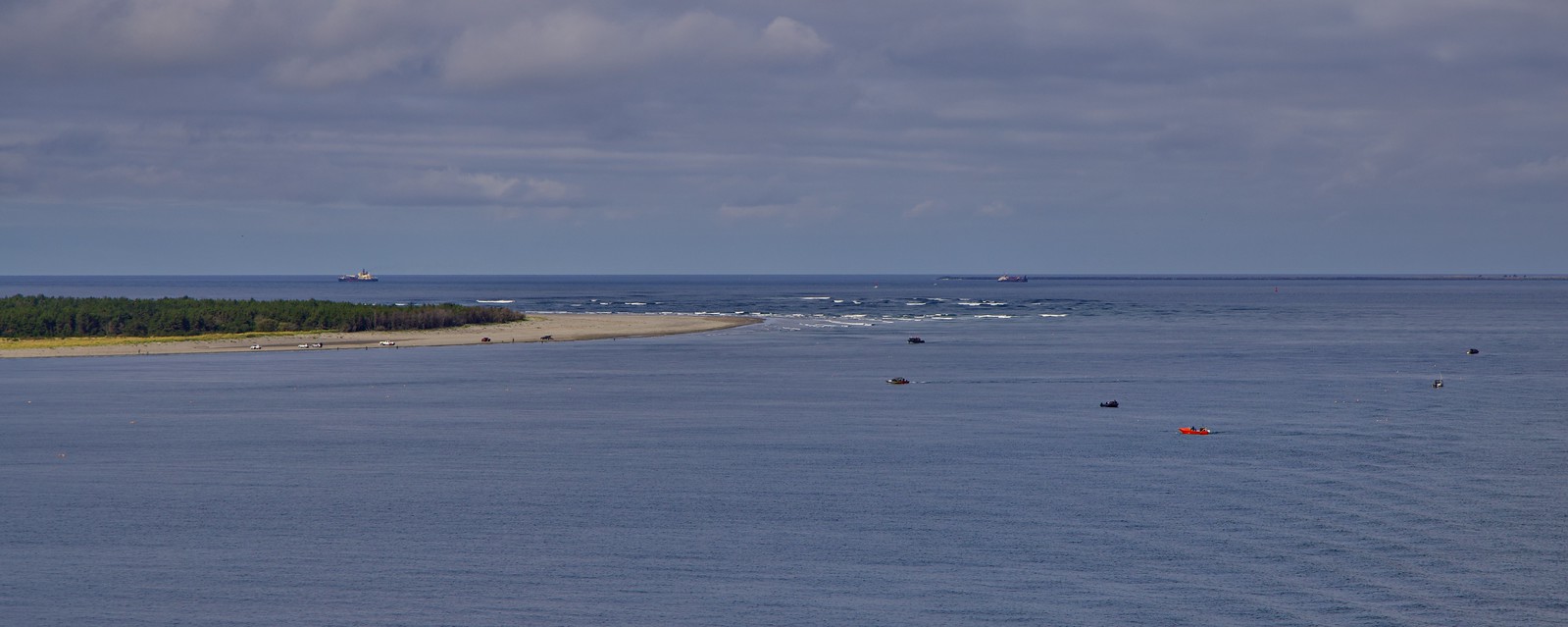
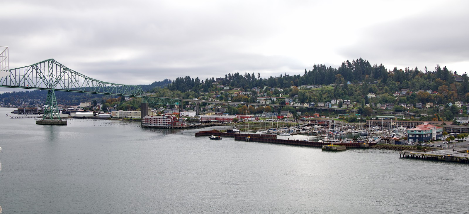
Our approach to the Columbia River mouth was in the morning hours, with the river pilot boarding the ship from a helicopter on the stern – Deck 9 Lido. Passengers were advised to stay clear until the pilot was aboard and the crew had placed all deck furniture back in place. I’m out on deck with my camera as the ship passes Cape Disappointment at about 10:20AM. We pass Fort Stevens as we sail up the Columbia River to dock at Astoria at Noon under clear and sunny skies and lovely 18ºC temperatures.
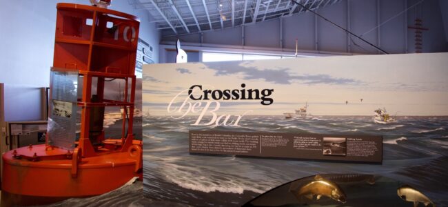
Since Astoria is a hilly city, I had booked the Astoria Scenic Waterfront Biking excursion, but due to the ship arriving late, that excursion is cancelled, so I go to the excursion desk and book the Historic Astoria excursion. After our bus drives under the imposing Astoria-Megler Bridge and through the city, our first stop is the Columbia River Maritime Museum on the river shore. This modest museum offers both inside displays about local maritime history and the Columbia lightship was docked nearby, beside the still active USCGC Steadfast. Driving to the second stop, the Astoria Column, gives us drive-by glimpses of the historic neighbourhoods that would otherwise be difficult to get to in this hilly city. The 360-degree views from the top of the column are worth the claustrophobic climb up the circular staircase!
Westward panoramic view from the top of the Astoria Column
Astoria, OR, USA
2023-10-08, 3:06:59 PM
Final stop is Fort Clatsop at the Lewis & Clark National Historic Park where a park ranger does a good job of setting the historical context for this strategically important outpost for the still-forming country – the United States of America. Fort Clatsop was a winter encampment for the Lewis & Clark Expedition in 1805-06.
After returning to the ship in the late afternoon, I go for an early dinner to the Canaletto Italian premium restaurant while the ship is still docked. I have a table with a nice view across the river as I start with fresh, warm artisan bread with green olives, olive oil and balsamic vinegar, green and red pesto, along with a glass of Pinot Grigio white wine. Next is a delicious Canaletto salad – greens, walnuts, gorgonzola, beets, with balsamic dressing. My main course is an exceptionally good Escalope of Fresh Cod with a small side of fresh-made pasta topped with parmesan. The cod melts in my mouth! The premium charge for Canaletto is US$25 pp, however since I’m a 4-star Mariner I get 50% off, so with the $4.50 service charge, my cost for this very enjoyable meal is US$17.
After having an early breakfast in my hotel room, our tour bus leaves by 8AM. Our all-day tour hosts are both geologists (and RASC members), so they share lots of info about rocks, glaciation, the K/T Boundary, and how the dinosaurs died off so quickly 65 million years ago. We are all given handouts authored by our hosts, with scientific references, diagrams, and notes.
Our first stop is Dry Island Buffalo Jump Park, where we dig around a bit and see the K/T Boundary for ourselves. There are hoodoos, piles of lignite, and a beautiful valley with the Red River below. The park gets its name from a “dry island” formed by the ancient flow of the Red River, and later used by First Nations people as they drove buffalo over the cliff edge to their deaths, ensuring everyone survived the winter. This park is accessible during fair-weather and daytime only, but it is a fascinating area to explore!
Our next stop is the Royal Tyrrell Museum in Drumheller. I have visited this museum before, but it is one of those museums where you can go back again and again to see and learn about new things. Today is the Canada Day civic holiday, so it is crowded, but as a tour group we have priority admission arranged, so walk right in ahead of the lines. There are dinosaurs on display here that defy description, along with all the usual suspects like Tyrannosaurus rex, Triceratops, Brontosaurus, Stegosaurus, fish, turtles, shellfish, worms, you name it! All the fossils are from this area of Alberta, which is rich in fossilized remains from this epoch.
Our last stop is a complete change of pace: the Trekcetera Museum (since closed), also located in Drumheller. Their main claim to fame is the amazing collection of all things to do with Star Trek: phasers, hollow decks, original costumes, and other original memorabilia from the Trek movies and TV series. They also cover Men In Black, Superman, Titanic, Sherlock Holmes, and other entertainment classics. This little museum appealed to those of us who are Trekkies!
After a full day of touring, a few of us walk from the hotel to nearby Gus’s Cafe and Pizzeria for dinner. The food is good, but the service is surly, just like the online reviews indicated!
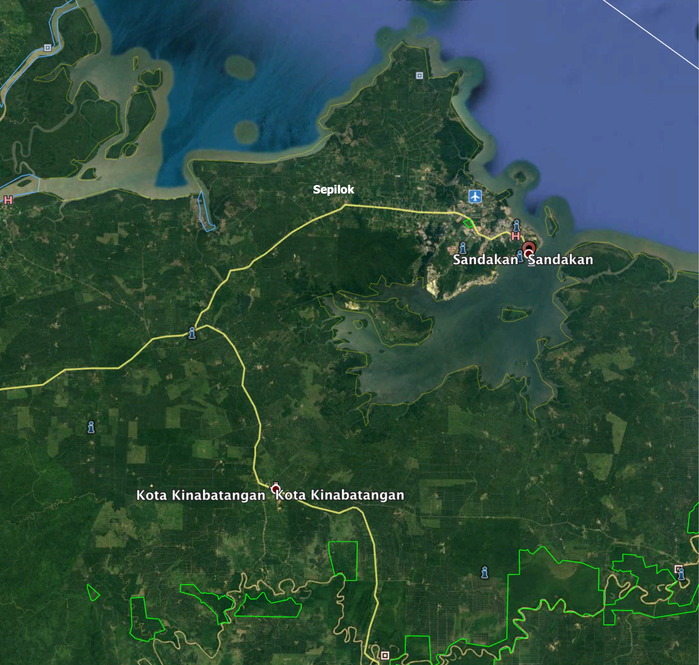
Today we trade our posh Le Meridien hotel in Kota Kinabalu for a wilderness lodge in the Kinabatangan Wildlife Sanctuary. We fly to Sandakan in East Sabah this morning, drive along the Kinabatangan River (Sabah’s longest at over 500 kilometres) to Sukau and the Kinabatangan Riverside Lodge.
Along the way we pass through many kilometres of oil-palm plantations, and arrive in time for lunch (served buffet-style). When one of the staff takes my bag to my cabin, he is attacked by a troupe of Macaque monkeys and is bitten. Not an impressive start to my stay!
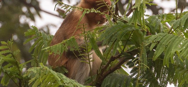
Female Proboscis monkey in a tree
Late this afternoon we take our first river cruise in search of Pygmy Elephants, but our guide Junior only finds fresh elephant dung, since they appear to be on the move. We do see a large group of Proboscis monkeys high in the trees beside the river, Silver Langur monkeys, and the Borneo Civet after dark as we return for a late dinner.
The cabins at the lodge are pretty basic, with no air conditioning, just fans and screens on the windows. There are bugs in the room and especially the bathroom. I started taking my Malarone anti-malarial medicine a couple of days ago in preparation for this segment of our travels, however despite the lodge being located right on the river, I see no mosquitos.
April 11, 2018 Wednesday – Kinabatangan in East Sabah, Malaysia
Black and red Broadbill
We leave the lodge by boat at 6:30AM for a 2.5 hour trip along the Kinabatangan River. We spot a beautiful Stork-billed Kingfisher soon after we leave the dock. Unlike yesterday evening, today I have my full camera kit with me for the boat trip, I take some good photos of a female Proboscis monkey with a baby in a tree, some Hornbills, a Black and Red Broadbill, a male Blue-eared Kingfisher, a Chestnut-breasted Malkoha, an Oriental Darter, some Silver Langur monkeys, a Wrinkled Hornbill, and a small Monitor Lizard. This is my most productive day for wildlife photography!
Our guide Junior gives a presentation on how he started out as a waiter in a resort, becoming a guide 35 years ago, and had the opportunity to work with David Attenborough on The Living Planet series. The biodiversity on Borneo is very concentrated, lending itself to feature films about the rainforest, such as the National Geographic Great Migration series. Junior tells us he is self-taught as a guide, but he is licensed by the government. Same goes for our other guides, which includes his son.
Stork-billed Kingfisher
On the afternoon boat trip, we go up a tributary of the main river, where we spot: a Stork-billed Kingfisher (again), a Roller Broadbill (aka Dollar Bird), and an Oriental Darter bird. We see a couple of wildlife bridges built by the government wildlife service to help the Orangutans cross the river channel (since they don’t swim). Our guide tells us the wildlife bridges are mainly used by the monkeys.
I skip the night cruise, since photography is pretty well out of the question, and I really don’t want to be bitten by bugs, pick up any leeches, or attempt to photograph bugs by flashlight.
April 12, 2018 Thursday – Kinabatangan to Sandakan in East Sabah, Malaysia
On our morning boat trip, we see: Proboscis monkeys feeding (including a male), a Cattle Egret in breeding plumage, a pair of Hornbills, a male Black and Red Broadbill guarding its nest, and a young Crocodile on the muddy shore.
Staff waving goodbye to us from the Kinabatangan Riverside Lodge
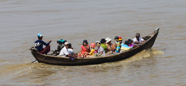
After lunch, it is time to leave the lodge by taking a 2.5 hour boat trip down the river to the jetty at Sandakan. This turns out to be an endurance contest, despite having a rest stop half way at Abai Jungle Restaurant and Lodge, a lodge on the lower river run by the same company (S I Tours) as where we were staying. The boats are going about 40 knots and when we are in exposed sea water in the Sulu Sea, the ride is very rough and noisy. I wear my noise-cancelling earbuds to reduce my stress level.
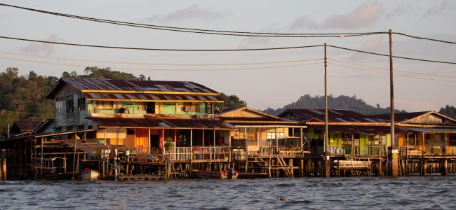
Our luggage being wheeled from the jetty where we landed through the stilt village to our awaiting bus
Once we arrive at the jetty in Sandakan, our bags are taken by hand carts to the bus waiting for us, and we are driven a short distance to the only deluxe hotel to be found in Sandakan, the Four Points by Sheraton. It has an infinity pool, gym, 2-level lobby with a piano, and is over 20 stories high. It’s quite pretentious, however I’m happy to have an American-style room with air conditioning, hot water and comfy bed after the last few nights spent in the river lodge!
Woman’s Entrance, Jame Asr Hassanil Bolkiah new mosque
We start our full day in Brunei visiting the opulent Jame Asr Hassanil Bolkiah new mosque, where we are allowed to visit the inside of the men’s prayer hall after removing our shoes. The women in our group must also cover their heads and legs, and everyone has to check our bags, although we are allowed to carry a camera with us.
There is a very impressive Royal Entrance to the mosque with fountains, gardens and ornate gates, however the best photo-op I found was the Woman’s Entrance, where the symmetry of the golden domes and minarets is stunning.
We then travel back into Bandar Seri Begawan to see Masjid Omar Ali Saifuddien old mosque. I decide to not go inside, since our time here is limited. I walk out to the decorative cement boat that is situated in the middle of the lake beside this mosque, where I take some very nice photos of the mosque despite the midday Sun beating down on us.
We walk along the Jalan McArthur waterfront promenade to the jetties and board boats which take us across the Brunei River to Kampong Ayer, a Malay stilt village. After our return, we have time for a quick lunch at Franini’s Italian restaurant before boarding the bus to head out of the city. We make a quick stop for some retail therapy at a Starbucks in a mall, where I find some unique souvenirs of Brunei to take home with me before we continue on to see the Wawasan Brunei 2035 craft skills display.
Proboscis monkey in a tree on the Brunei River
Boats on the Brunei River take us past Istana Nurui Iman – the Sultan’s palace to see Proboscis monkeys in the mangrove at nearby Pulau Ranggu. We finish the day with another visit to the Jame Asr Hassanil Bolkiah new mosque at night, which is spectacular.
I’m pretty well beat by the end of this marathon day, so after we return to the hotel, I go downstairs to have a quick dinner of Nasi Goreng, and then I unwind in my room before bedtime.
We arrive early this morning in Singapore’s cruise ship terminal. We have a day in port and then overnight aboard the ship this evening. Most of the passengers are disembarking tomorrow morning, but I’m one of the 175 who are staying on board for the next cruise segment.
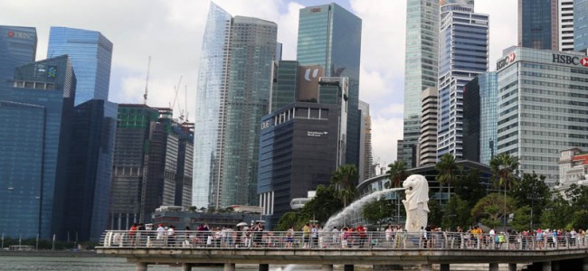
I take the Best of Singapore excursion today. It is an exhausting 8 hour tour, but we cover a great deal of ground, and I take some good photos and video. Our guide takes us to the City Gallery, where there are some wonderful scale models of the city and the whole country of Singapore. It shows just how much of Singapore is dedicated to gardens and other non-developed land, including the reservoir system for their water supply.
Marina Bay Sands hotel
We take an electric-powered riverboat ride down the Kallang River and into Marina Bay, past Merlion Park. The Merlion fountain statue was erected as a symbol of welcome to visitors; the lion statue is emblematic of Singapore itself.
We also see the historic Fullerton Hotel, on our way to the three towers that make up the Marina Bay Sands hotel. Our group have passes to go to the Observation Deck, some 200 metres (650 feet) above sea level, perched on Tower 3 of the hotel. I manage to photograph the amazing infinity pool (reserved for hotel guests) by leaning out from the observing deck to grab a shot. The view of Gardens by the Bay below the towers, as well as the city and harbour are fantastic from this high vantage point. The Marina Bay Sands hotel has one of only two casinos in Singapore, and a huge number of high end shops in a vast mall under the main hotel.
Our bus takes us to the entrance to Gardens by the Bay – a 100 hectare (250 acre) spectacularly designed park, home to an amazing variety of rare plants housed in giant, innovative domed conservatories. There are several different regions and ecosystems to discover, but we only have time to explore two: the Flower Dome and the Cloud Forest.
The Cloud Forest – Gardens by the Bay
The Flower Dome replicates the cool-dry climate of Mediterranean regions, and showcases flora that thrive in these conditions. Oddly enough, cactus and succulents, as well as Baobab trees are included in this ecosystem. True to its name, the Flower Dome showcases massive numbers of flowers from all over the world. As we move into the mist-veiled Cloud Forest, we feel the climate change to warmer and moister conditions. The 35 metre (115 foot) tall mountain showcases the world’s tallest indoor waterfall and presents plant life from tropical ecosystems, and is nothing short of spectacular.
We stop for a family-style Chinese lunch in a restaurant in Chinatown, which offers us a welcome air-conditioned respite from the heat and humidity on Singapore’s streets after seeing the Buddha Tooth Relic Temple. After lunch, we see the gold-domed Masjid Sultan Mosque, the centre of Muslim culture in the city, and nearby Arab Street offers lots of carpet dealers. Shopping in Little India is interesting, and there are bargains to be had here when compared with Singapore’s more upscale (and expensive) shopping areas.
Joe with a Singapore Sling in the Long Bar at Raffles Hotel
We finish our day at the legendary Raffles Hotel. I have a Singapore Sling cocktail while our group relaxes in Raffles’ Long Bar where this cocktail was originally invented. Named after the British designer of modern-day Singapore, Sir Stamford Raffles, this property is one of the world’s finest and most famous hotels. The high ceilings and colonial architecture reflect the era of British rule (1819-1963). There is no public access to the lobby and other guest areas, however the Long Bar and shops are open to the public.
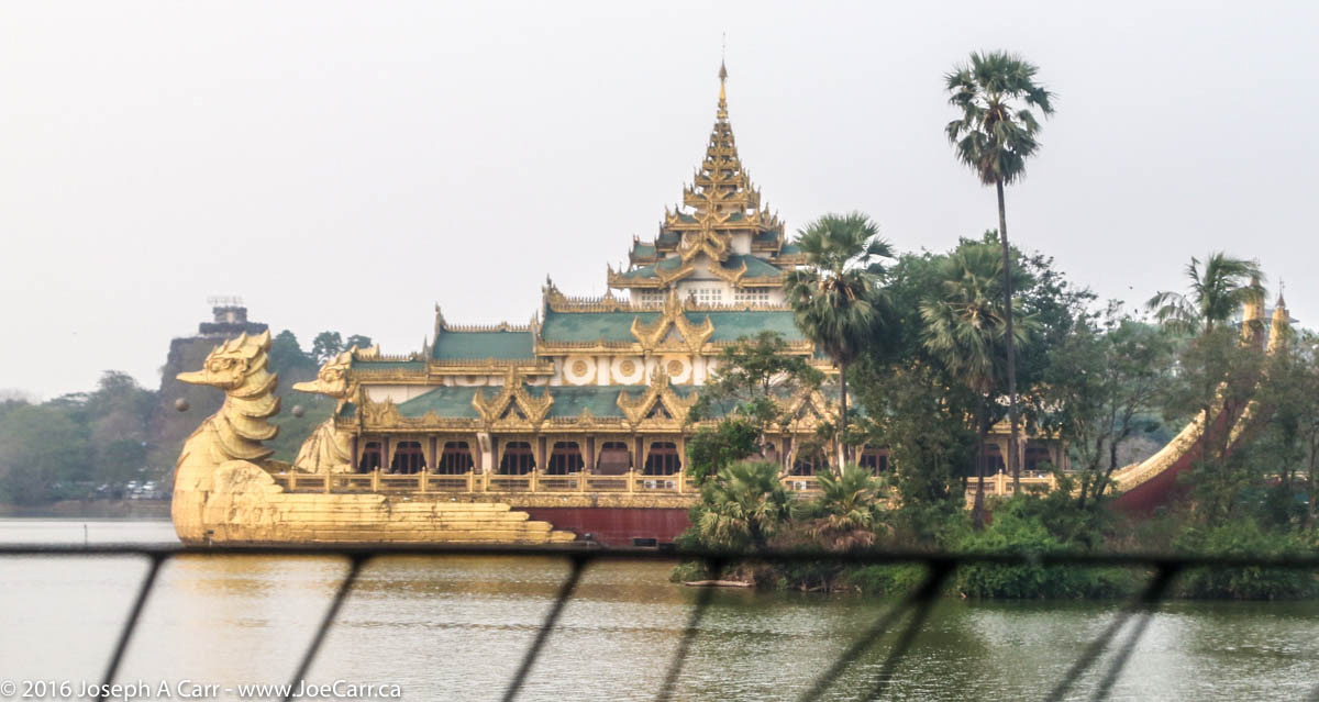
The Volendam is docked about an hour’s drive south of Yangon in the river port city of Thilawa, which is as far up the shallow Rangoon River as deep sea ships can go.
Our police escore in Yangon
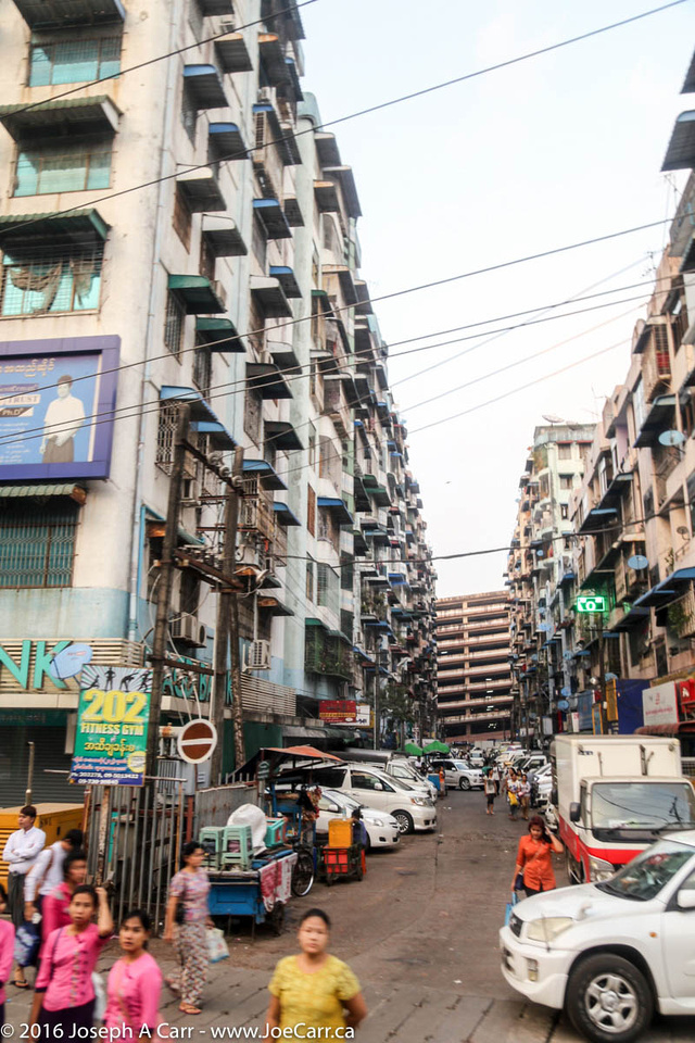
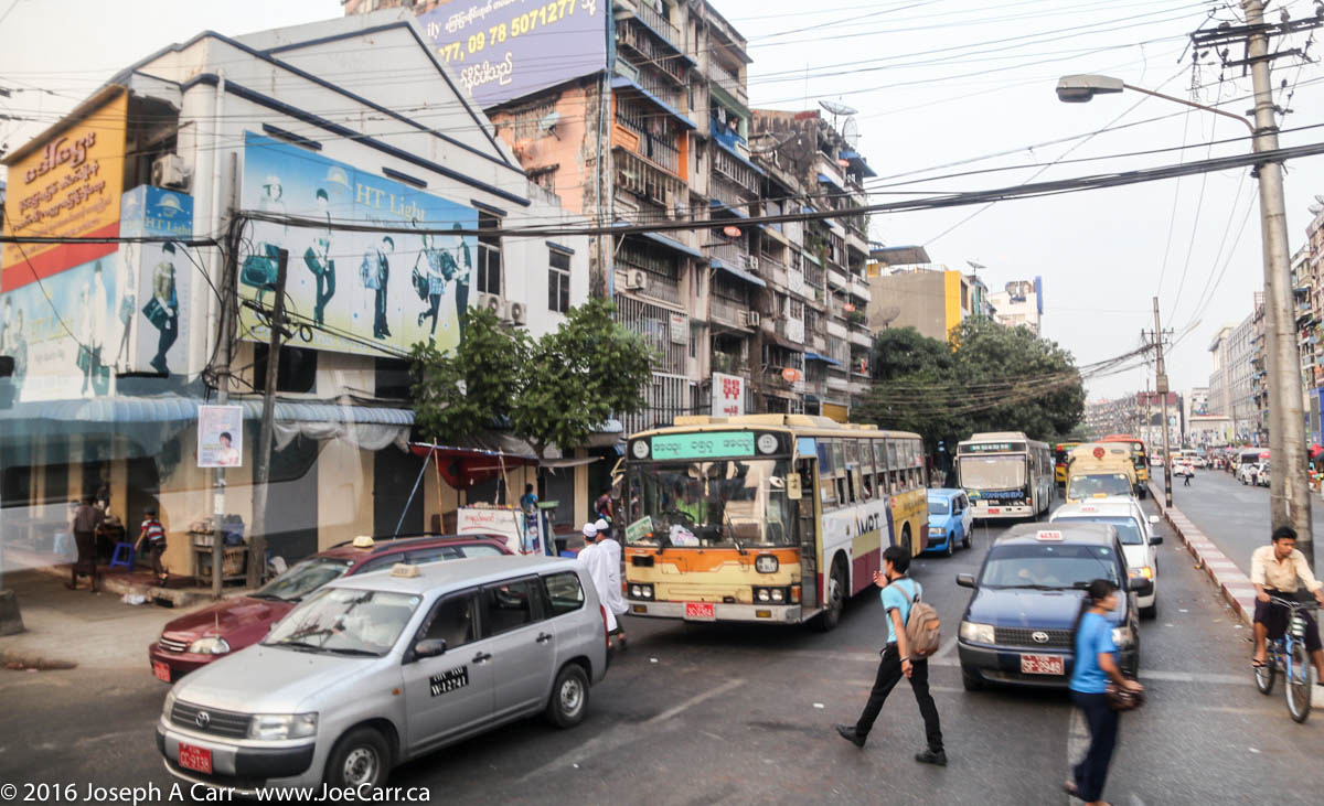
My shore excursion into Yangon takes most of the day. Our bus is a bit dodgy, but our driver and guide are great, and the driver has a helper, so we are well-served, and we are offered lots of bottled water in order to stay hydrated in the heat. The drive from the port to the city takes almost two hours each way through very heavy traffic. As we leave the port through Thilawa, we encounter early preparations for a pagoda festival. There are circus rides, lots of food stands, and people everywhere despite the festival not starting for several hours. We cross the Rangoon/Bago River over the bridge into the city of Yangon, where we pick up a police escort. So for the rest of the day, we arrive at each location like rock stars!
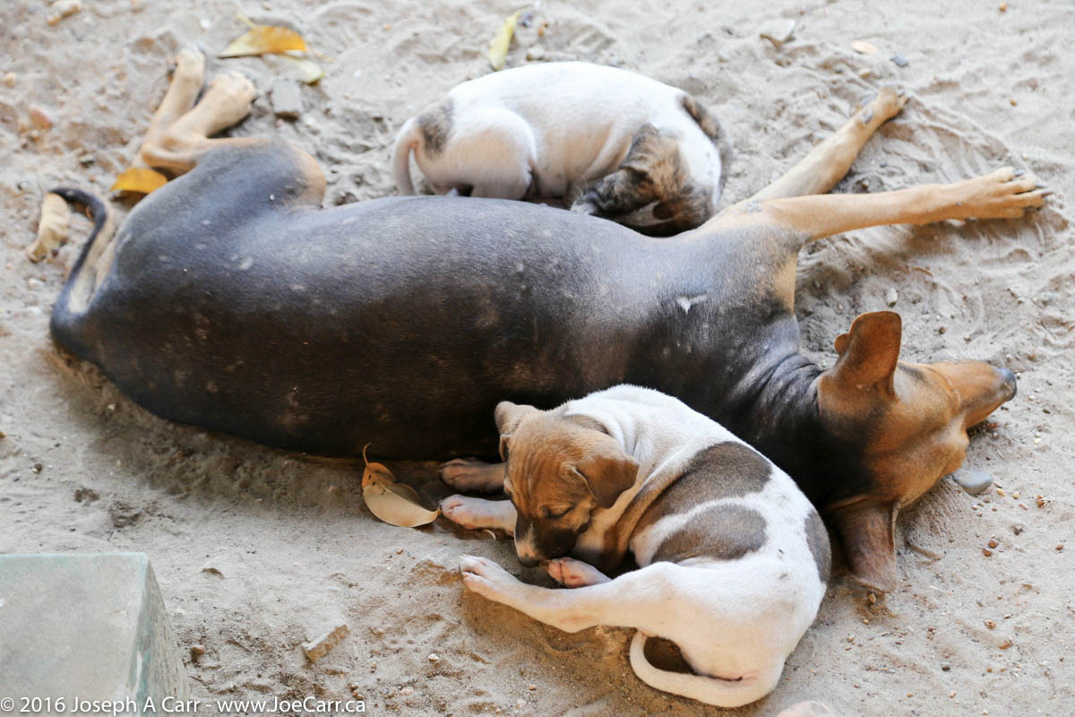
Our guide explains that the change in spelling for the city of Yangon (from Rangoon) and the country of Myanmar (from Burma) was done by the past military government to correct historical misspelling of the two place names into English. She tells us land is very expensive in Yangon, development is sporadic, and is dependant on foreign investment and (in the past) sponsorship by the military regime. There are lots of homeless dogs, who obviously have to scrounge for food, however some are fed and adopted by the Buddhist temples, so they are referred to as “wat dogs”, after the Burmese word for temple.
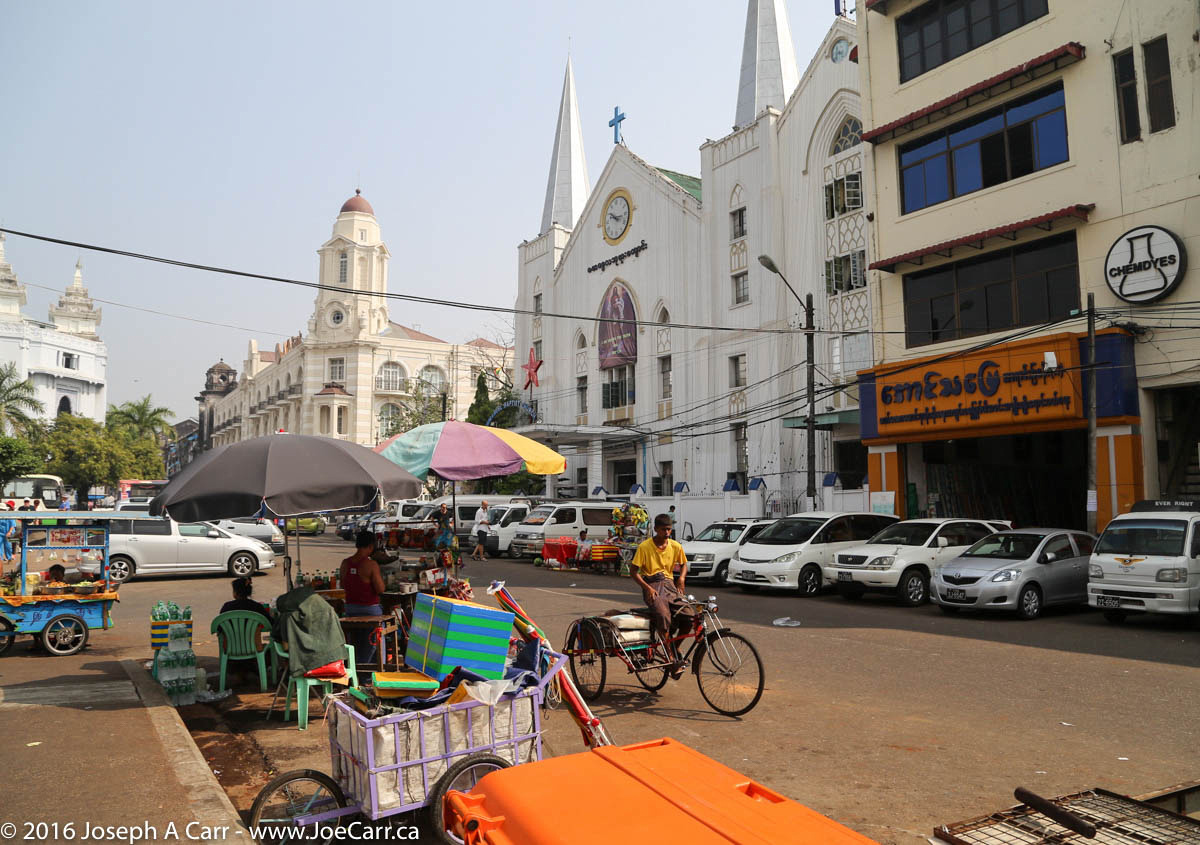
Street vendor beside Mahabandoola Garden in Yangon
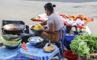
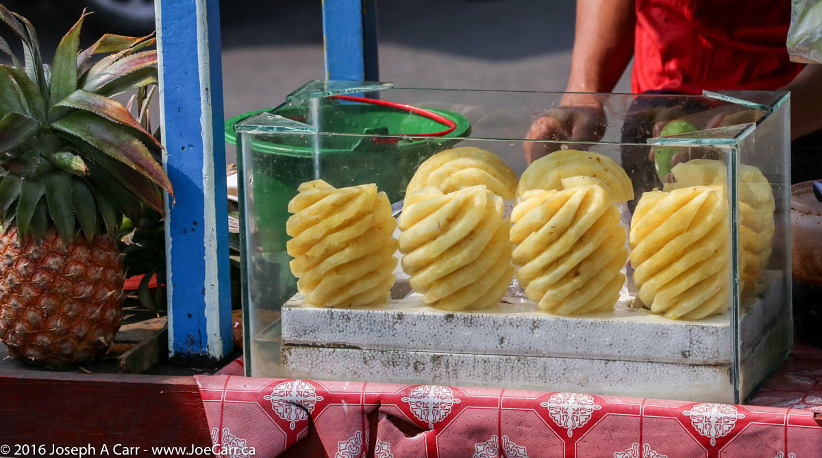
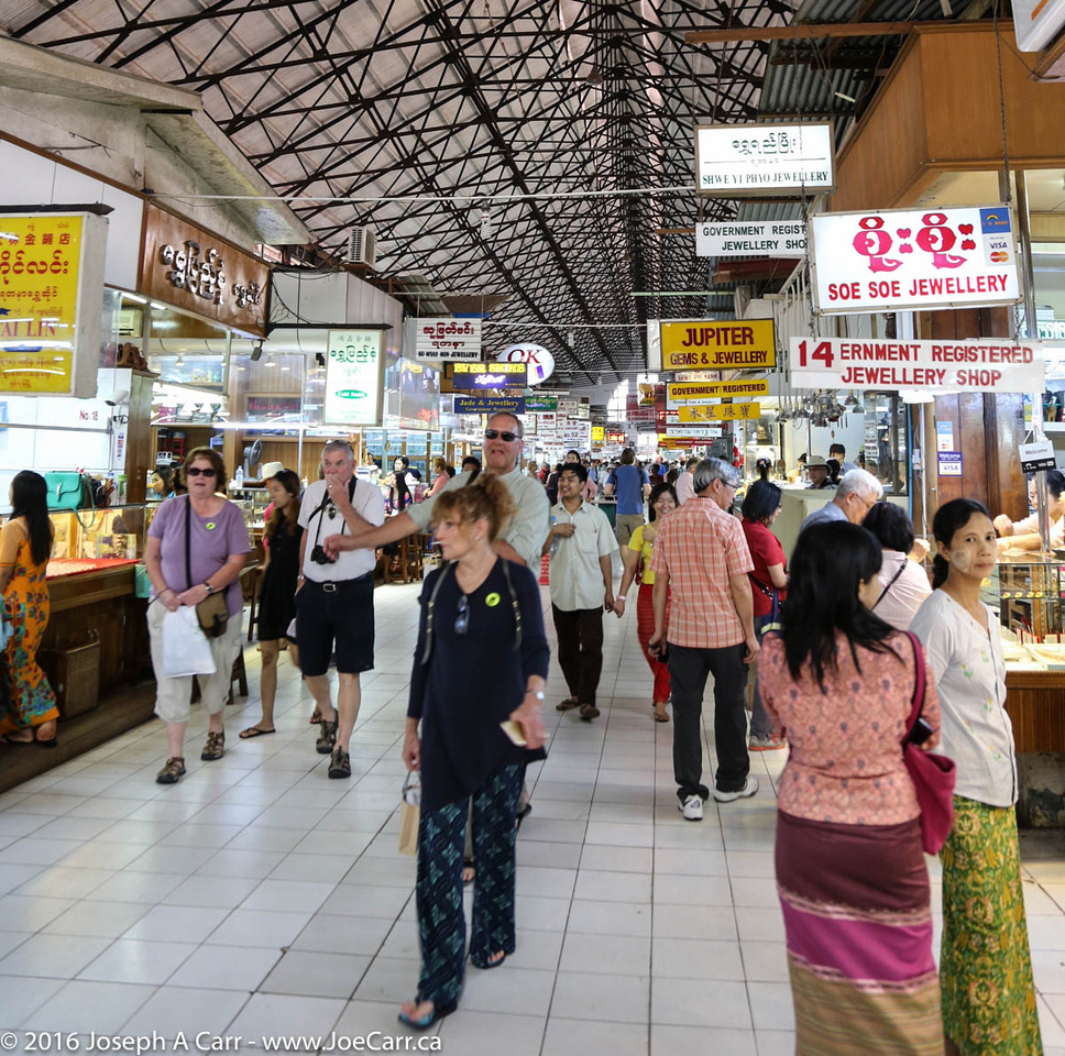
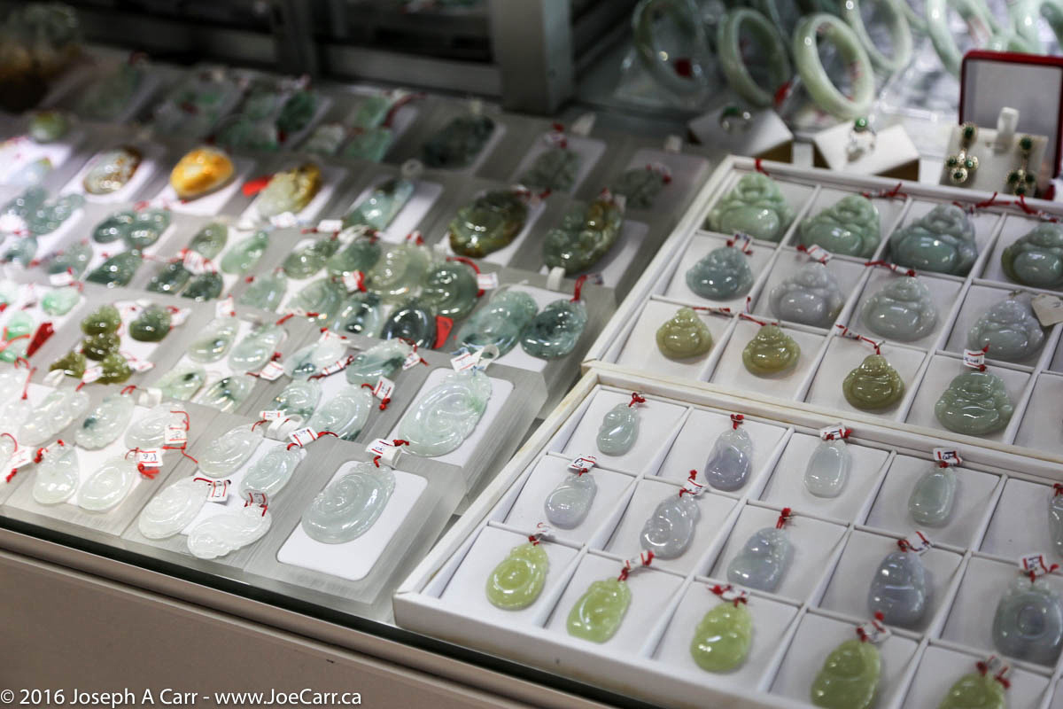
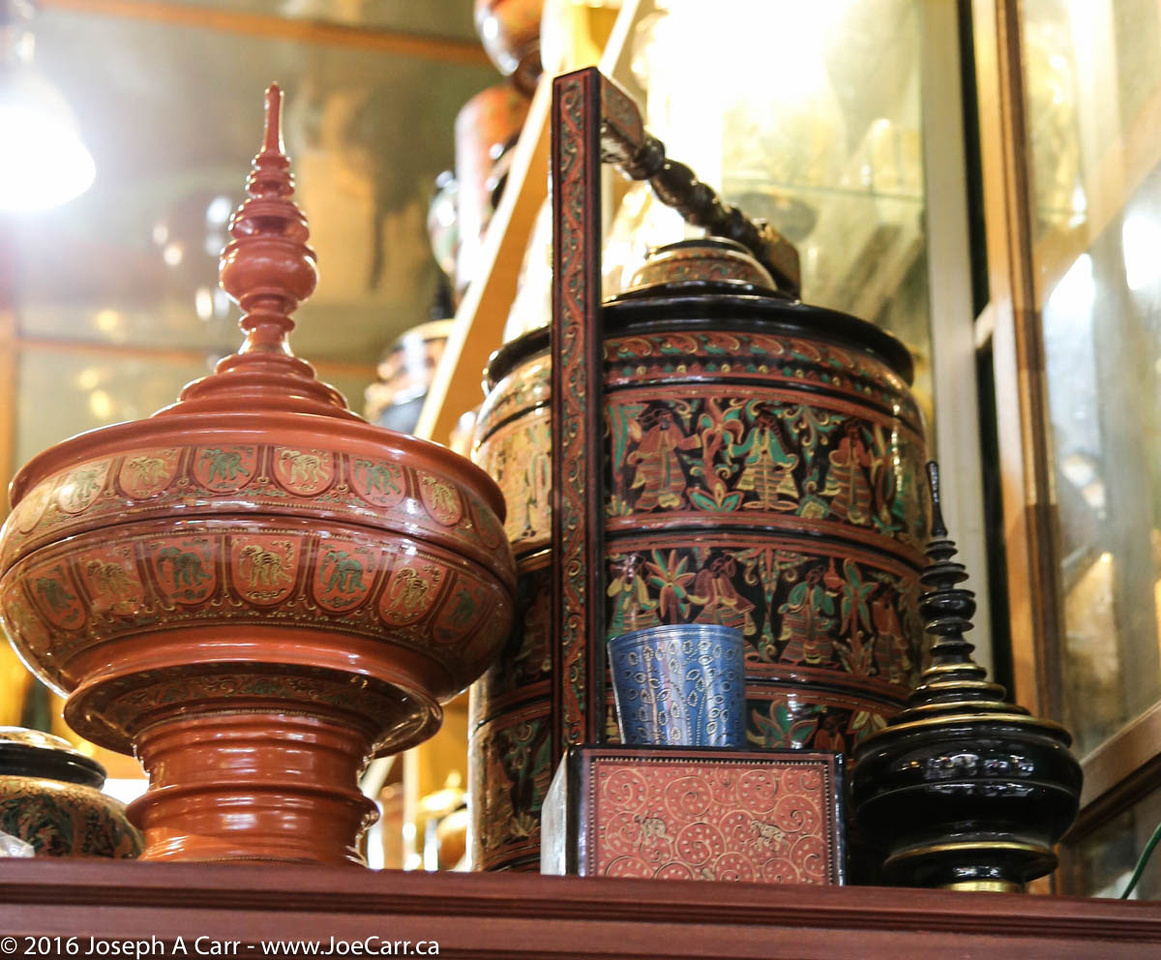
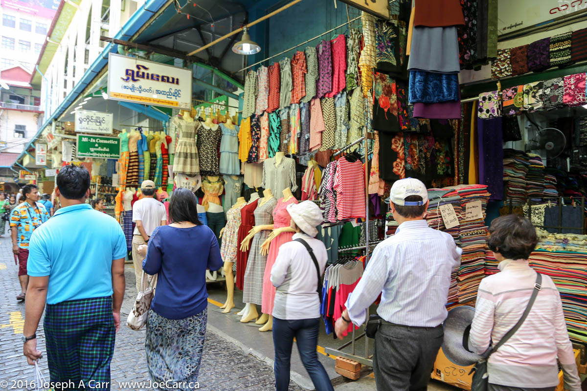
First stop is the Sule Pagoda, which is right in the center of the city. We don’t actually go into the pagoda, but we get to hang around Mahabandoola Garden for a few minutes, where there are lots of street food vendors. Next is the Bogyoke Aung San (Scott) Market, where we have some time to shop or just look around this massive market right in the centre of the city. There are clothes, shoes, precious and semi-precious gems and jewelry, inlaid wood, fabric, cosmetics and all sorts of handicrafts.
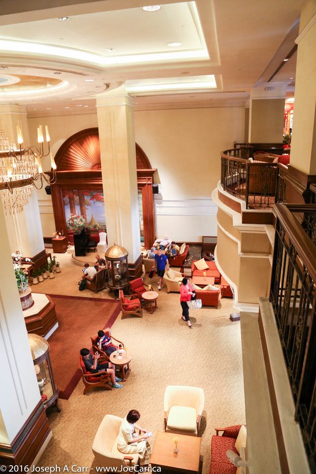
I’m glad to get out of the market, and go for lunch at the very elegant downtown hotel, the Sule Shangri-La. We are served (family style) a lovely Chinese meal with our choice of beverages, including beer or wine. I have a very nice lager-style local beer, and dine with several of my fellow passengers at big round tables. After lunch, our police escort takes us to the National Museum for a quick look at several interesting exhibits, including the 8-metre-tall golden Lion Throne used by the last Burmese King. Unfortunately, no photos are allowed in the museum.
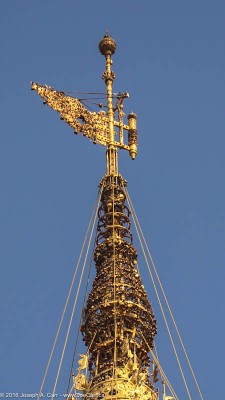
The Vane and Diamond Orb atop Shwedagon Pagoda
Shwedagon Pagoda is the highlight of a very full day. One of the wonders of the religious world, this Buddhist spectacle was built more than 2,500 years ago. The pagoda is located on the top of Singuttara Hill, so it is visible from all over the city, since the golden stupa is 100 metres tall. It is topped with more than 6,500 diamonds, rubies and other precious stones; the largest diamond is 76 carats at the apex! The top three components (the Diamond Orb, The Vane and the Umbrella) consist of some 86,000 jewellery items weighing over 5 tonnes. The decorations on the main stupa were recently redone, with the precious stones coming completely from donations. The pagoda is covered in gold plate (not gold leaf).
Everyone, including tourists have to take shoes and socks off and be modestly dressed before taking the elevator from the entrance to the main plaza that surrounds this huge pagoda. Since it is the middle of the day, the tiles are hot in the midday Sun, however since they are marble, it is tolerable providing you don’t step on the black ones! I work my way around the plaza, which has huge numbers of temples and shrines on both sides of the plaza.
The faithful walk around the pagoda in a clockwise direction (as do we), stopping at shrines and temples along the way. In particular, there are Planetary Posts, or shrines for each day of the week (two for Wednesday), just like there are buddhas for each day of the week. Speaking of Buddhas, there are worship halls and temples for the many different images of Buddhas surrounding the main stupa. Free wifi is available in the southeast area of the plaza, near the south stairway entrance.
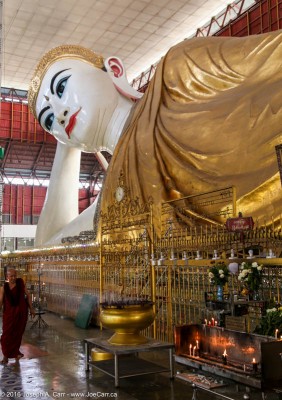
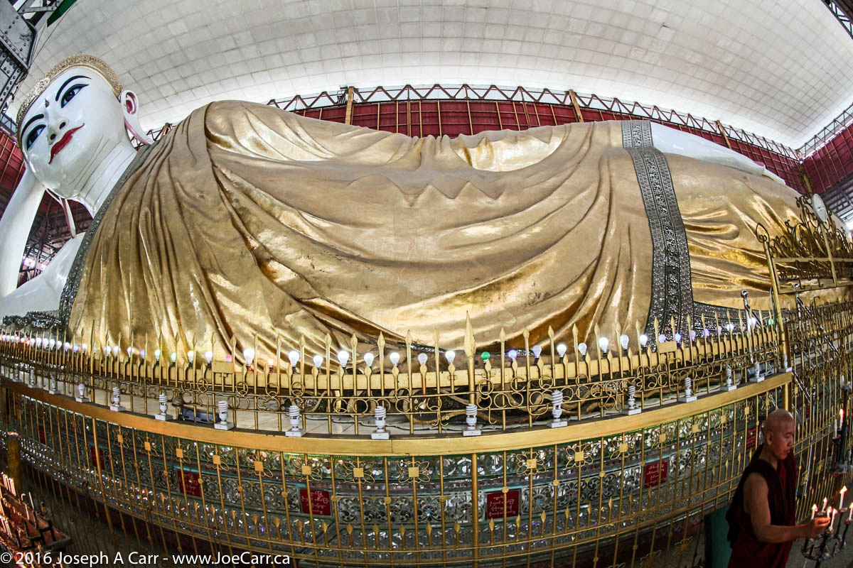
Monk, and offerings, and the Reclining Buddha
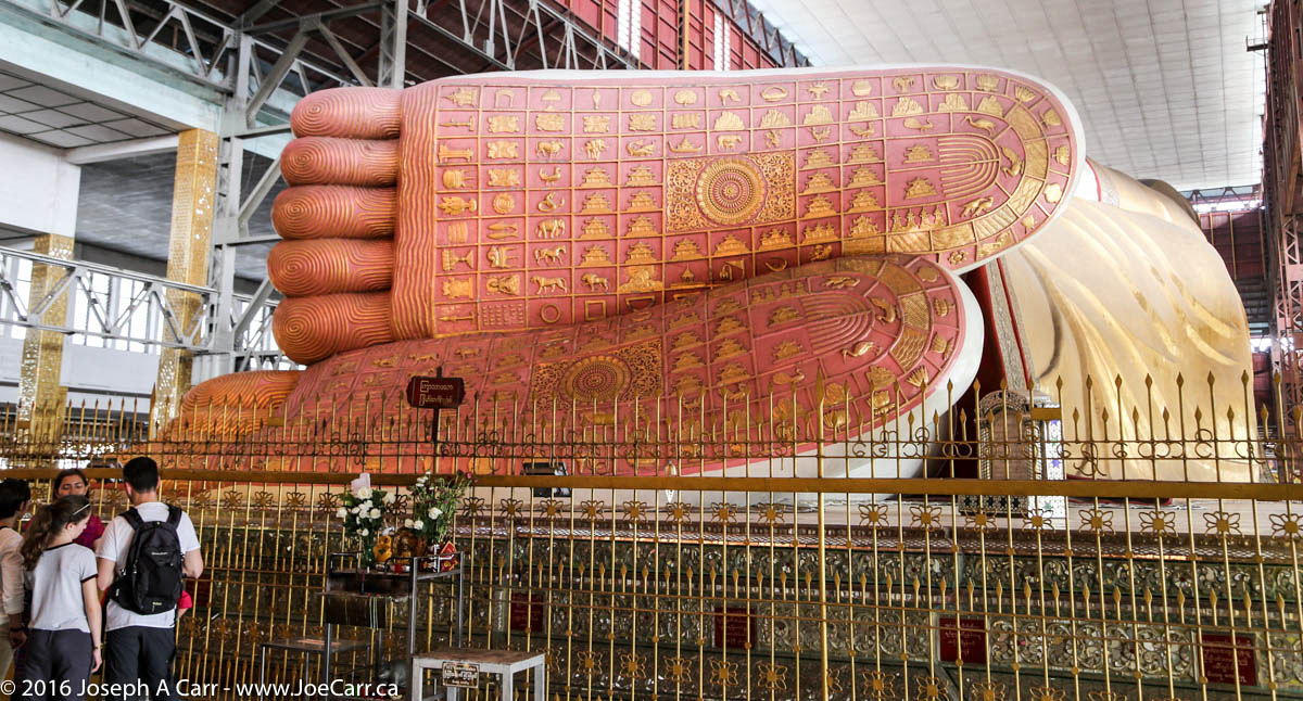
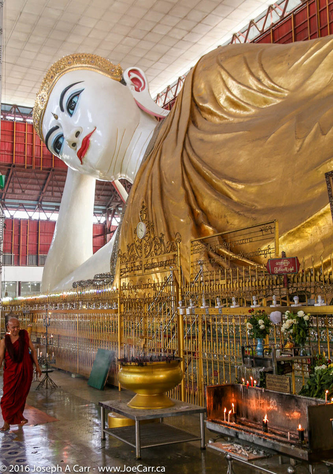
Our last stop of the day is to see the Chauk Htat Gyi Reclining Buddha. Again, we doff our shoes and socks before entering the compound. This statue is 68 metres (223 feet) long. Buddha’s feet are decorated with astrology and other symbols. There are lots of wat dogs and their pups lounging around the compound.
Our trip back to the ship uses back roads after we cross the river, since our guide and driver want to avoid the local pagoda festival being held on the main road in Thilawa. I hear later from other passengers that they were caught for almost an hour in the festival congestion. Although the back road we took was a bit rough, we were back onboard the ship by 5PM.
Feb 22, 2016 – Monday – Yangon, Myanmar
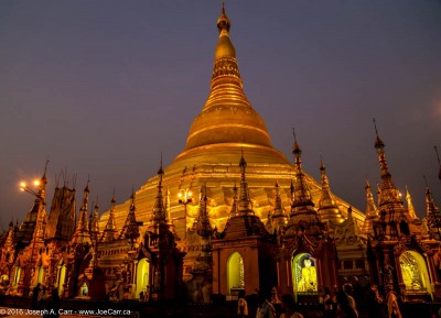
I spend most of the day aboard the ship at the dock before we leave at 4:30PM to see the Shwedagon Pagoda at night. The traffic is very congested south of the main bridge across the river, but we arrive at the pagoda in time for sunset when the lights illuminate all the gold on the structures. One benefit of visiting at night: the marble tiles on the plaza around the pagoda are cool. Yesterday, I was burning my bare feet as I walked around the pagoda in the midday Sun. The Moon is full, making this evening even more picturesque.
The main Shwedagon Pagoda at night
While walking around the pagoda, a young Burmese man strikes up a conversation with me, asking about my country, how long I am staying in the country, how I got here and where I’m going after leaving. He speaks very good English, so we have quite a conversation. Two monks also approach me later on, although they speak poor English. They have similar questions as the young man posed, but they also want me to go with them for some reason that isn’t entirely clear. I decline, since I have no idea what they want, and I have no intention of finding out!
This evening, the Thilawa Music & Dance troupe perform traditional Burmese music, dance and acrobatics onboard the ship. Their music is kind of screechy, but the performances are very interesting and the costumes are ornate and colourful. The last number involves two guys inside a giant elephant costume! I take video of portions of the performance.
Myanmar is going through dramatic economic and political change. As a privileged traveller, I only saw hints of the poverty and bad labour practices as we whizzed by in our bus. Here is an article from a reputable news service that describes the darker side of their economy, struggling to emerge from being one of the poorest countries in the world.
The Dark Side of Liberalization: How Myanmar’s Political and Media Freedoms Are Being Used to Limit Muslim Rights – Taylor & Francis Online