post

Matauri Bay & Whangaroa

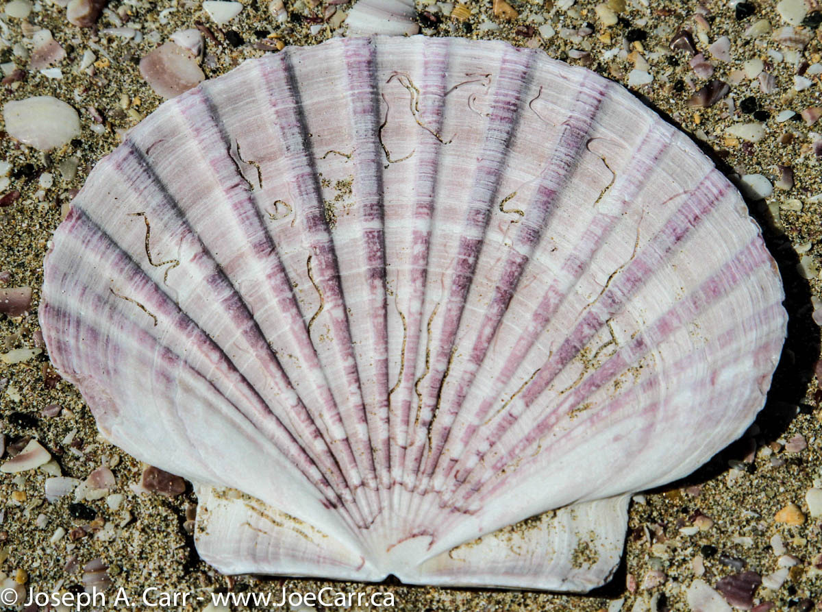
Oct 23, 2010 – Saturday – Kerikeri – Matauri Bay & Whangaroa, New Zealand

I’m up first and have my morning coffee in the kitchen while Keith prepares breakfast, but my friends are soon up, so we move to the dining room for the main event. Keith makes us a wonderful meal to start the day: field mushrooms on toast with ham, fruit, cereal, homemade yogurt, and a vast selection of jams and marmalades, as well as more of his very good Bodum-style press coffee.

Sheep & lambs
Sheep & lambs near Matauri Bay

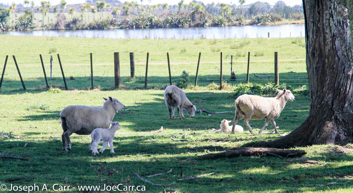
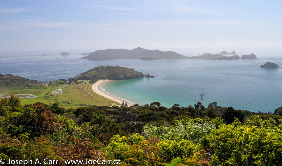
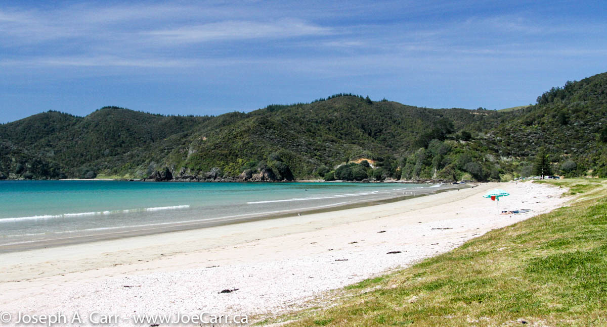
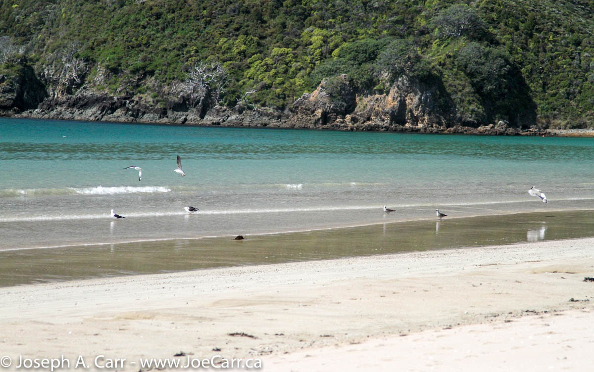
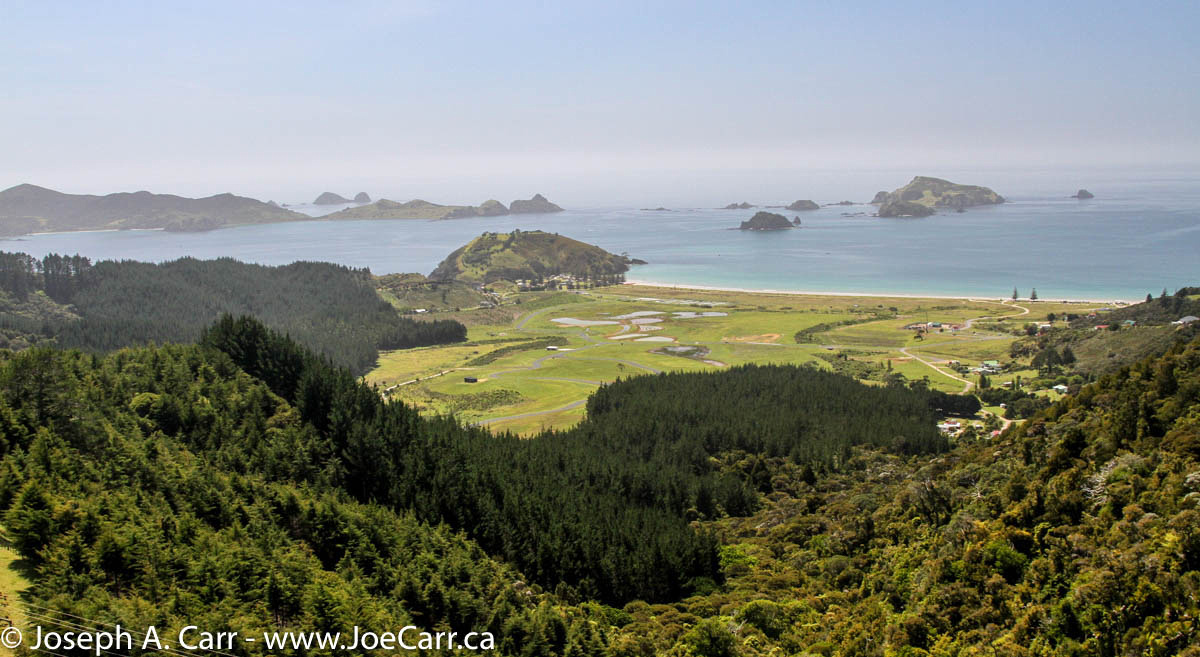
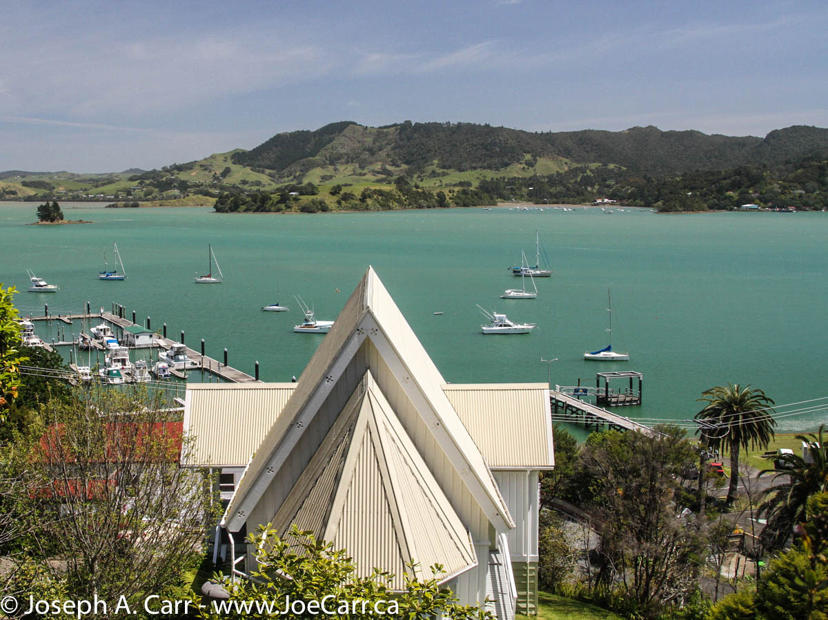
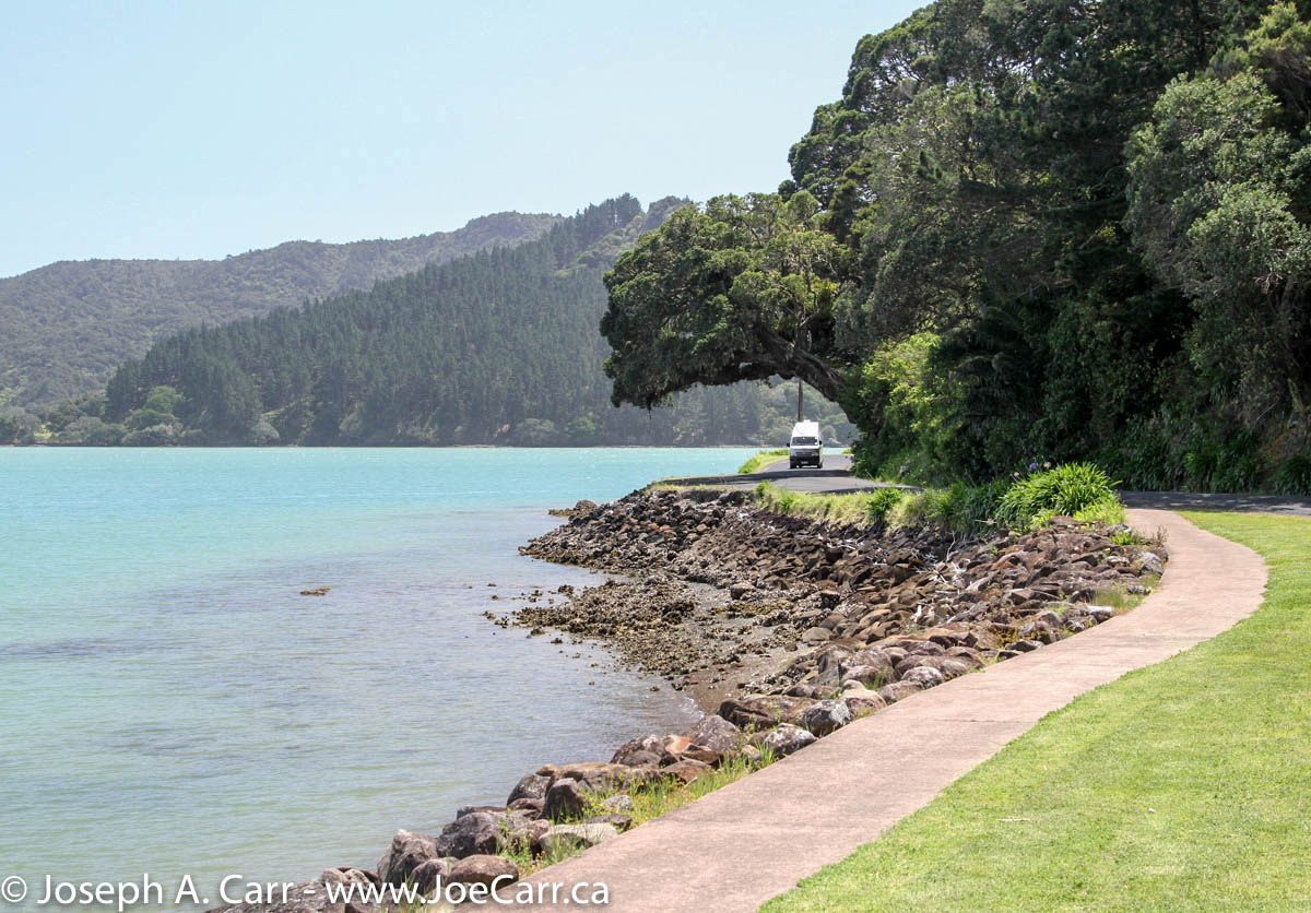
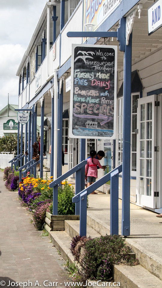
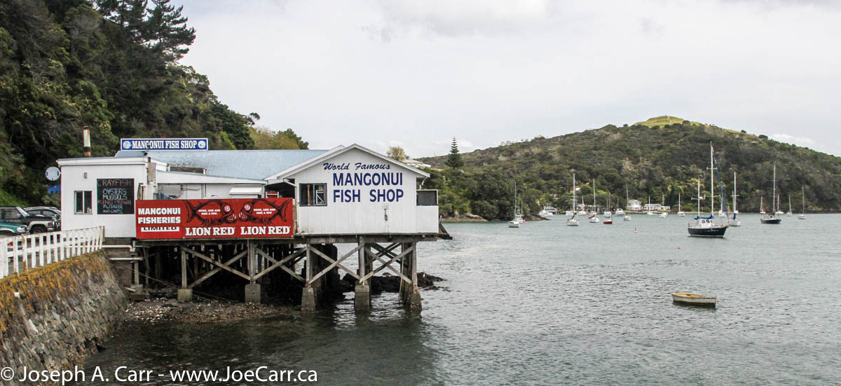
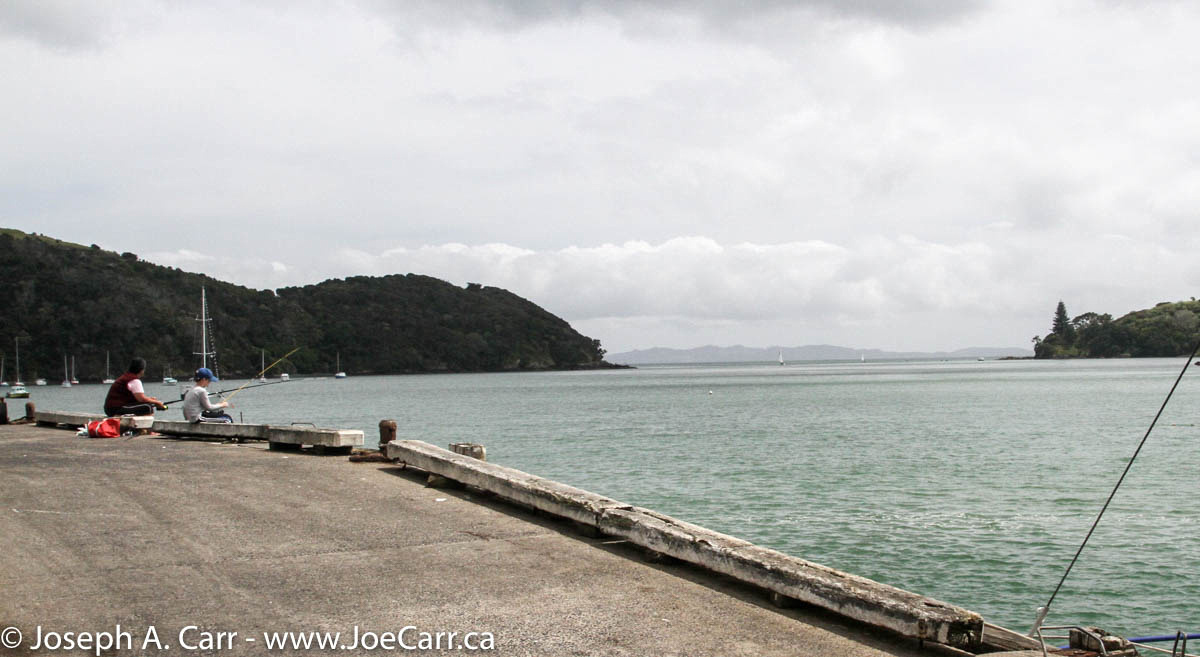
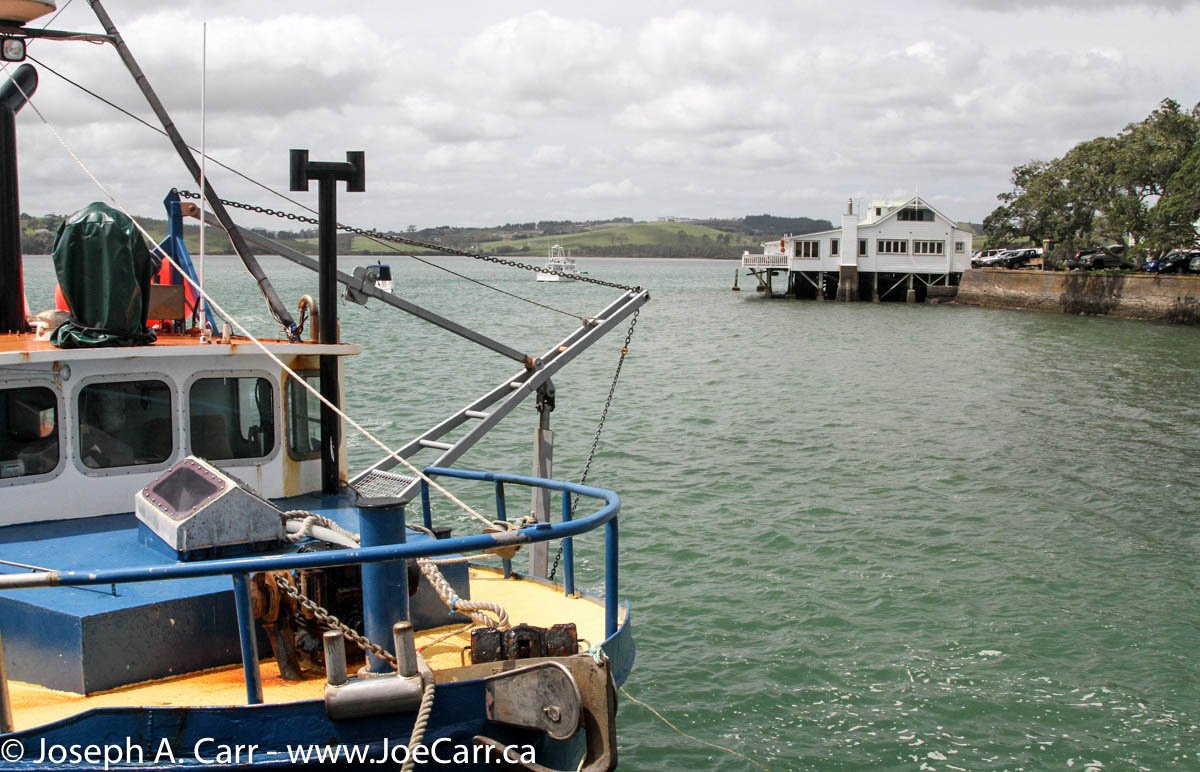
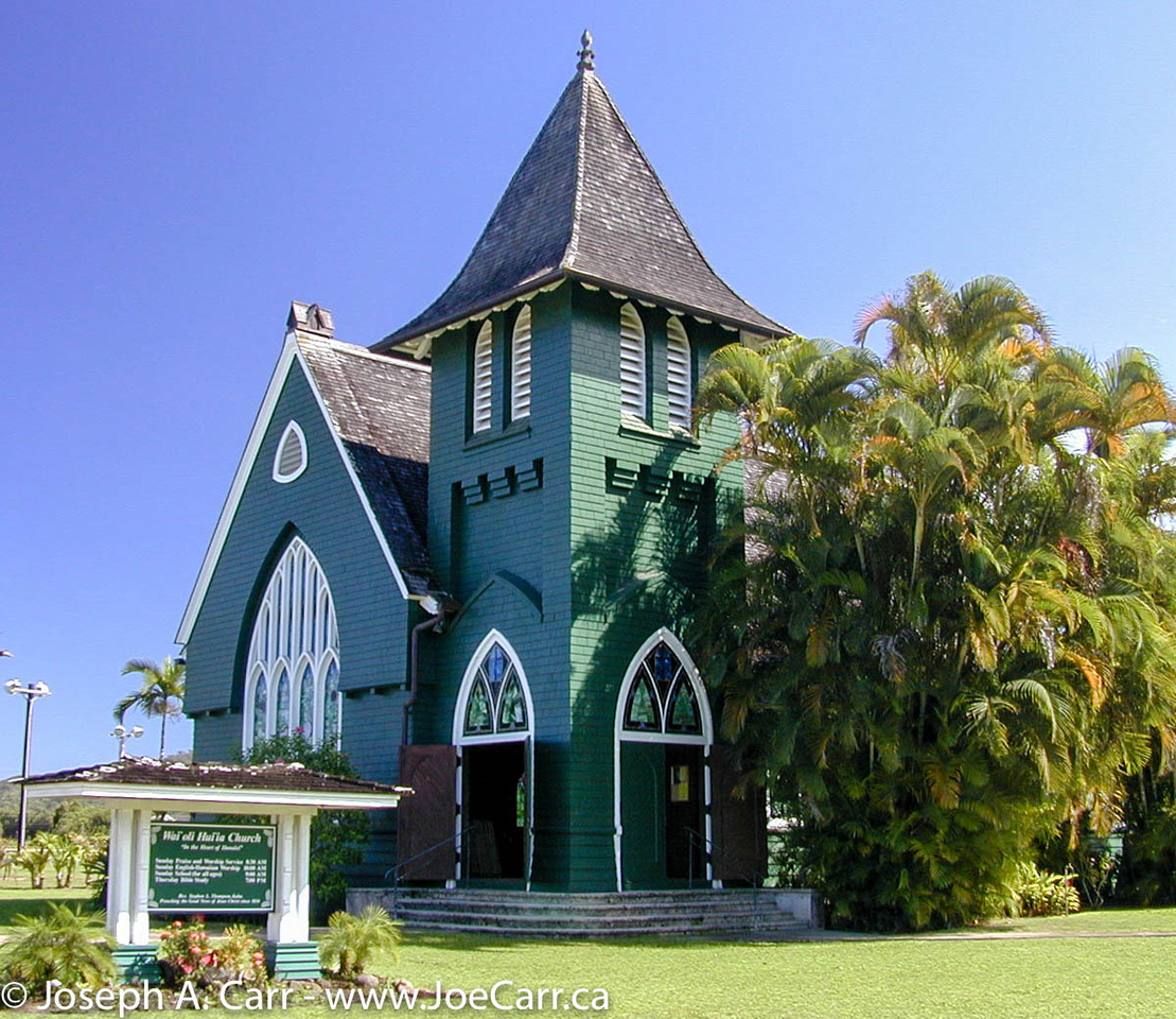
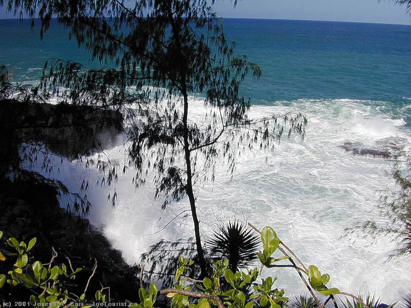
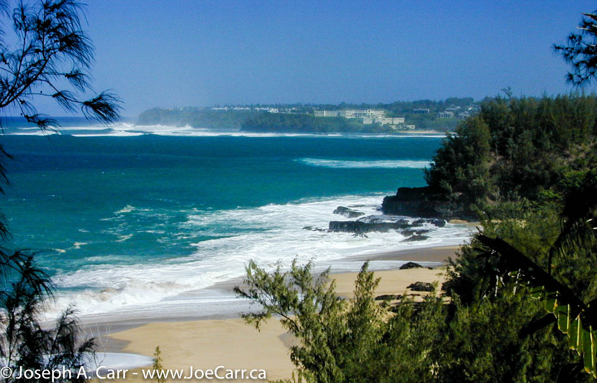
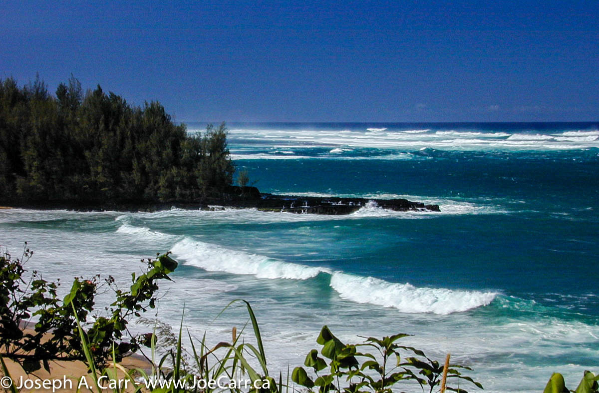
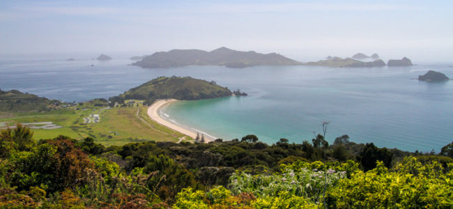
Keith suggests a route for us to drive today, which goes north to Matauri Bay, and then to Whangaroa (pronounced fang-a-roah). Both locations are superb, and we enjoy ourselves. The beach at Matauri Bay is outstanding and not crowded. The Rainbow Warrior was sunk by the French while the ship was in Auckland, and the wreck is now re-sunk just offshore from Matauri Bay, to be used as a diving reef. We stop along the way and take some photos of spring lambs and sheep in a beautiful pasture, and then drive a bit further to the lovely bay at Whangaroa. We climb the hill up to the pretty Anglican Church on the hill behind the village to take some photos. We don’t travel the complete route which Keith suggested, but perhaps tomorrow we will explore further.

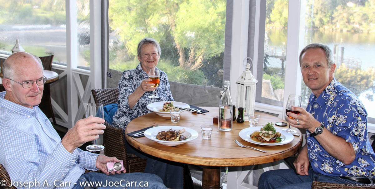
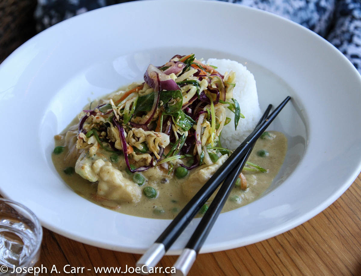
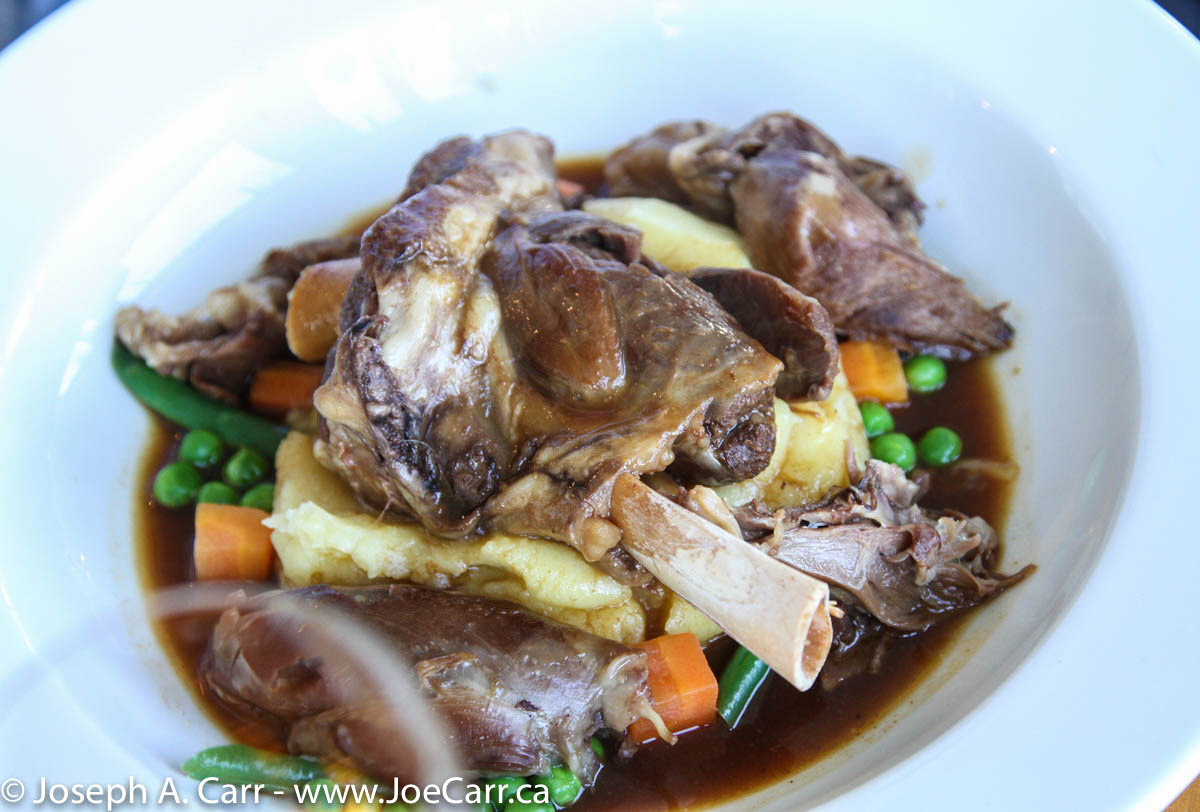
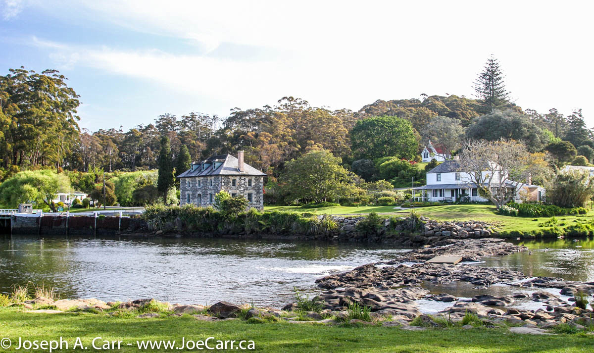
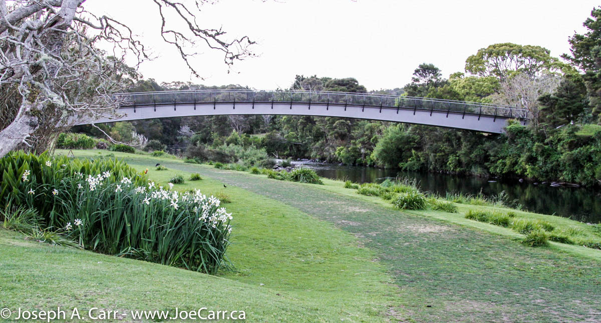
Keith makes a reservation for us at the Pear Tree Restaurant for dinner this evening. We walk down the hill the short distance to the restaurant, which is right across the street from the Stone Store. There is a new pedestrian bridge across the Kerikeri River, which replaces the old single lane vehicle bridge that used to be there, so the road on the other side now dead ends at the Old Stone Store (where we ended up yesterday). Our meals at the restaurant are very nice, but we find the charge of NZ$120 pretty high for three entrees, three beers, and one dessert.

post

Oahu, Hawai’i

Port of call on a 2010 South Pacific Cruise from Vancouver to Auckland aboard the Volendam

Oct 1, 2010 – Friday – Oahu, Hawai’i

Koko Head shoreline, Oahu, Hawaii

I wake up early, and Volendam is already docked in Honolulu harbour at Pier 11, right beside the Aloha Tower. My friends and I thought we could catch a free shuttle to Waikiki, but instead have to take a taxi to pick up our rental car for the day. This is a hassle and delays us a bit, but eventually we are off on our self-guided tour around Oahu.

We head out to Diamond Head, but after paying to get inside the crater, find out it is an hour and a half hike to the top and return. We don’t have time for this, so we don’t stay long. We drive a bit further to see Hanauma Bay – a very pretty coastal location where there is lots of coral growing. It is very popular for swimming and snorkelling and costs $14.50 to go down to the shore and use the beach, but only $1 to park and look around. We do the latter and then move on to Koko Heads – another spectacular sight – a blowhole and beautiful shoreline along the south coast of Oahu.

Yellow Hibiscus in Crouching Lion's garden
Yellow Hibiscus in Crouching Lion’s garden

As we head north to the eastern shore of Oahu, it starts to rain. The vegetation is more tropical of course…the south shore is like a desert in comparison. The coastline around the Kaneohe area is very pretty, and the mountains are deeply grooved similar to the Napali Coast on Kauai. I guess the same processes are at work since they are both north-facing coasts – wind and water erosion. We have lunch at the Crouching Lion Bar & Grill in Kaaawa (now closed), and then head back to Waikiki to return the rental car and get back to the ship.

Volendam departs Honolulu at about 11pm, bound for Kailua-Kona and the Big Island of Hawai’i on a slow overnight cruise. We have another lovely dinner in the Rotterdam Dining Room this evening.

post

Kaua’i, Hawai’i

Port of call on a 2010 South Pacific Cruise from Vancouver to Auckland aboard the Volendam

Sep 29, 2010 – Wednesday – Volendam arrives in Kaua’i

I get up around 8:30am and go for breakfast in the Lido. I have an omelette made to order, and have my breakfast on the outside deck; the first al fresco dining for me on this trip, since it is now 24°C in the morning.

Rotterdam moored in Nawiliwili Harbour

We dock in Nawiliwili this afternoon at 5:20pm, and we don’t leave port until tomorrow afternoon. The Rotterdam is also docked in the harbour as we arrive. She departs about an hour later – a lovely sight. As our gangway is put in place, complete with red carpet, a rain shower starts up – “welcome to Kauai”. We all stay aboard the ship this evening.

Lance Ringnald doing an acrobatic performance using hanging silks

As we dine in the Canaletto, an Italian menu restaurant on the Lido Deck, we are a couple of tables away from the Captain. Afterward, we go to the Frans Hals Lounge, where Lance Ringnald is doing an acrobatic performance. He is a past Olympic gymnast winner for the USA and is now 40 years old, but is still in great shape and puts on a very entertaining show. He uses hanging silks like Cirque de Soleil does, along with some jokes and banter to the audience (he is wearing a microphone). I shoot some video, since he says he has no problem with flash photos or video. Normally neither are allowed during performances in the show lounge.

Sep 30, 2010 – Thursday – Kaua’i

Joe & Wendy wandering a beach

I set my alarm last night to get up at 7:30am, since I want to beat the crowds disembarking today. I am out of my cabin and up to the Lido for breakfast: scrambled eggs, sausage, bacon and toast. My friends and I then catch the Hertz shuttle to the airport, where I have reserved a very nice Nissan Altima. We decide to drive up the eastern and northern coasts of Kauai to a bit past the Hanalei Valley. We stop to see the Kilauea Lighthouse and for a swim near Anini Beach, and we are back into town to return our rental car by 3PM. We are back onboard the ship by 3:30pm…well ahead of the 4:30pm “All Aboard” deadline.

My friends and I have visited Kaua’i before, so this visit brings back good memories for all of us – it was a most enjoyable day!

The Grand Nawiliwili Sail Away party is hosted by Holland America as Volendam sailed out of Nawiliwili Harbour. In order to compensate for the missed stop in Maui there are free drinks and snacks, so I have a couple of gin and tonics. The headlands of Kauai are beautiful as we sail away while the sun sets. I sure didn’t need any wine with dinner when we dined later at the Italian restaurant Canaletto.

post

Cape Peninsula

November 8, 2008 – Saturday – Cape Peninsula Tour, Western Cape, South Africa

Southern Africa 2008

JoeTourist: Cape Peninsula &emdash; Cape Fur Seals on Duiker Island
Cape Fur Seals on Duiker Island

As we leave Cape Town, we drive past millionaire’s paradise: Camps Bay, Clifton Beach, and Llandudno. We stop at Hout Bay and take the boat tour to see the Cape Fur Seals on Duiker Island (60 Rand, US$7 each). There is a five man band serenading us as we disembark. Since Chapman’s Peak Drive is closed due to slides, we drive through Constantia and go past the prison where Nelson Mandela was held while he was treated for TB.

We then loop back to the outer coast and see parasail surfers at Witsand Bay before entering the Cape of Good Hope Preserve. Our driver spots 12 Eland and 6 Bontebok, and some wild Ostrich. The Cape of Good Hope is the most southwesterly point of land in Africa, and certainly qualifies as a landmark. It is madness as tour buses arrive and everyone scrambles to get their photo taken. I manage to get my photo taken before the crowd gets in there!

Cape Peninsula shoreline - Sea Point, Bantry Bay and Camp's Bay
Cape Peninsula shoreline at False Bay – used with permission from Emile Grundlingh

Cape Point is at the end of the peninsula, and has both the original lighthouse (decommissioned after the Portuguese liner Lusitania was lost on the rocks) and the new lighthouse (located lower down so it’s not obscured by fog). I hike up the very steep trail to the top of Cape Point where the old lighthouse is located (see banner image above). There is also a funicular railway running to the top. Our guide called ahead and reserved a table for us in the restaurant at Cape Point – a very busy place!

JoeTourist: Cape Peninsula &emdash; African Penguins at the Boulders Penguin Colony
African Penguins at the Boulders

After lunch, we drive back along False Bay, stopping at a very nice public campground and picnic area. Next stop is the African Penguin colony at The Boulders, where we nearly get blown to bits by flying sand and strong winds. As we drive through Simon’s Town, our guide points out the shark warning system that is in place for this strikingly beautiful beach area.

As we return to Cape Town, our guide talks about the apartheid years and how Cape Town was segregated. He is of Indian descent, and describes how his family was forced to move several times during that dark period of South Africa’s history.

post

The Transkei & Coffee Bay

November 2, 2008 – Sunday – Drakensberg to Coffee Bay, Eastern Cape – the Wild Coast of South Africa

JoeTourist: Eastern Cape Province &emdash; A woman and her cow alongside the highway
A woman and her cow alongside the highway in Transkei Province

Southern Africa 2008

We drive through the Transkei Province on our way to Coffee Bay on the Wild Coast. Transkei is a former homeland area for blacks when apartheid was still in force in South Africa. Many black people continue to live in this region despite there being a chronic lack of water.

We travel through Mthatha aka Umtata, which is the provincial capital and home of South Africa’s most famous citizen, Nelson Mandela. Mr. Mandela no longer lives here, however some of his family continue to live in the region. He comes back to his hometown to celebrate his birthdays. He celebrated his 90th awhile ago, so he is getting to be quite old.

Update: Nelson Mandela died December 5, 2013 after suffering from a long illness, and was buried in his hometown of Qunu.

JoeTourist: Eastern Cape Province &emdash; View of the beach and the Indian Ocean from the hotel
View of the beach and the Indian Ocean from the hotel at Coffee Bay

It takes almost an hour to drive from the main highway just south of Umtata to the Ocean View Hotel at Coffee Bay. It’s like traveling to another country, since the coastline along the Indian Ocean is warm, wet, and tropical. I have a room with a view of the ocean. This is a nice hotel, but well off the beaten track.

I join the wake-boarders, taking my first dip in the Indian Ocean surf before dinner, and body surf for awhile, which is great fun! Coffee Bay is spectacular, with dramatic headlands at either end of a beautiful curved one kilometre long sandy beach. There is also an estuary at one end of the beach where a stream enters the ocean.

After dinner this evening, an African dance troupe comes in and does a similar floor show of Zulu singing and dancing as we saw at the Drakensberg Gardens with one difference – the young women are topless. Some of the men in our group go crazy, taking pictures and generally acting goofy. As I leave the dining room after dinner, the dance troupe are in the lobby counting the money they collected from us after the show. I compliment them on their dancing and singing, but take no photos or video.

November 3, 2008 – Monday – Coffee Bay to East London

We have a late 10:30am departure from Coffee Bay, which gives everyone time to have a leisurely breakfast. There are some surfers and wake boarders out this morning, as well as some porpoises just past the surf line. I have plenty of time to walk the full length of the beach before we depart.

South Coast of Kaua’i, Hawaii

Jan 21, 2001 – South Coast of Kaua’i, Hawaii

It is a short drive from Lihu’e or Kapa’a to the Po’ipu Beach area, which is on the south shore of Kaua’i. Along the way, drive down the mile of Eucalyptus trees, growing tunnel-like on both sides of the road. Old Koloa town makes for an interesting stop, with lots of shops to browse through. It’s just like stepping back 50 years in time to an old sugar mill town. I bought some Kaua’i coffee here, but red dirt t-shirts are also very popular items. Coffee growing on Kaua’i is a relatively new venture, however the quality is starting to rival the more well-known Kona coffee grown on the Big Island. On to Po’ipu Beach, where there are many condos and luxury resorts with spectacular ocean views and golf courses, and then on to the blowhole at Spouting Horn Park.

Abandoned sugar mill and red dirt

Abandoned sugar mill and red dirt

The return trip took us past an abandoned sugar mill, near Koloa. Notice the famous red dirt, which is so fertile for growing sugar cane. The main sugar mill in Lihu’e was closed in 2000, leaving only one sugar mill running on Kaua’i near Port Allen. The sugar industry on Hawai’i is slowly being put out of business. They will have to find another agricultural crop to grow, or find some other use for this very fertile land.

One restaurant on Kaua’i I must mention is Gaylord’s Restaurant, located in the main building of Kilohana Plantation Estates (an old sugar plantation). There are some very nice shops in this same building, and they offer some quality merchandise, should you be so inclined. The restaurant service is impeccable, and the food is superb. Reservations accepted. Highly recommended!

September 29-30, 2010 – Nawiliwili Harbor, Kaua’i, Hawaii aboard the cruise ship Volendam

We dock in Nawiliwili this afternoon at 5:20pm (Sept 29th), and don’t leave port until the following afternoon. The Rotterdam is also docked as we arrive. She departs about an hour later – a lovely sight. As our gangway is put in place, complete with red carpet, a rain shower starts up – “welcome to Kauai”. We all stay aboard the ship this evening.

Headlands of Kaua'i as the Volendam departs

Headlands of Kaua’i as the Volendam departs

The following day, we decide to drive up the eastern and northern coasts of Kauai to a bit past the Hanalei Valley. We stop for a swim near Anini Beach and to see the Kilauea Lighthouse, and are back into town by 3pm and back onboard the ship by 3:30pm…well ahead of the 4:30pm All Aboard deadline. My friends and I have visited Kauai before, so this visit brings back good memories for all of us, and was a most enjoyable day.

The Kauai headlands at sunset are spectacular as the Volendam pulls out of Nawiliwili harbour

Na Pali Coast boat tour

January 20, 2001 – Na Pali Coast boat tour from Waimea area of Kaua’i

A small boat cruise to the Na Pali coast offers an excellent way to get out on the water around Kaua’i, do some snorkelling, see some whales, turtles and spinner dolphins (depending on the season), and get up close to the Na Pali coast without having to hike for days. I chose Liko Kaua’i Cruises, who operate the Na Pali Kai vessel, a fiberglass hulled, custom designed catamaran with twin Cummins diesels capable of moving the boat at a speedy 31 knots. The crew are knowledgeable about the area, they serve good quality food and drinks (no alcohol), and are very safety conscious. Liko’s offices are in the town of Waimea. You will need to check in there before proceeding to the dock in the boat harbor at Kikiaola (5 minutes further by car).

Sunrise from Kikiaola Boat Harbor, Waimea, Kaua'i

Sunrise from Kikiaola Boat Harbor, Waimea, Kaua’i

The cruise I chose departed at 7:30am, so I had to check in to the Liko office by 7am. Since there was road construction along the way, and I was driving from the opposite side of the island, I had to leave very early! Just to prove that I was up at the crack of dawn, have a look at the gorgeous sunrise photo!

The cruise took us past Barking Sands, all along the Na Pali coast almost to Ke’e Beach (where the North shore road stops. Along the way we saw numerous Humpback Whales (one baby a few days old) and Spinner Dolphins. We were within 50′ of the shoreline at times, so we saw the Na Pali coast up close. A very different perspective than from a helicopter.

They served us a very nice deli lunch and soft drinks on the way back. As soon as we rounded Mana Point (Barking Sands), the afternoon swells hit us full tilt, making for a roller coaster ride back to the harbor. However, along the way we were treated to an adolescent Humpback whale doing repeated breaches, flipper flapping, and other acrobatics. Although we didn’t get to snorkel due to the choppy seas, the whale made a memorable ending to a very successful cruise.

Free advice

Taking photos of whales, dolphins, turtles and fish consumes huge amounts of time you could otherwise spend enjoying these creatures. If the opportunity presents itself, by all means take a photo or two…otherwise buy some postcards!

There are many cruises to the Na Pali coast to choose from. I would suggest you select one that either leaves from Hanalei Bay (only two operators do this), or choose an operator who has a very fast boat (such as Liko) if they leave from the Waimea (southwest) coast area. It is over 20 miles by sea from Waimea to the start of the Na Pali coast (Polihale area). It is only 5 miles to the start of the Na Pali coast (Ka’ilio Point) from Hanalei Bay.

Waimea, Kaua’i, Hawaii

January 18, 2001 – Waimea – Waimea town, Hanapepe, Waimea Canyon, Barking Sands

If you are staying on the east coast of Kaua’i, the drive to the west coast make a nice day trip by car. The only working sugar mill is located at Port Allen, and they offer tours. Call ahead, since the tours are limited. Hanapepe and Waimea are agricultural centers for sugar cane, and both towns have boat harbors. Salt Pond Beach Park is just off the highway at Hanapepe – follow the signs. A nice beach for all ages, basic facilities, and limited camping.

The little town of Waimea is the gateway to the Waimea Canyon, which is a “must see” while you are on Kaua’i. There are two roads to Waimea Canyon, but I would recommend the Kokee Road, which is a right turn 3.6 miles past the town of Waimea. The sign is easy to spot from the highway. Just follow this very steep road with lots of curves, and stop at the lookouts along the way. Take your time, and enjoy the views along the way. After you leave the main highway, there are no gas stations or facilities other than a primitive bathroom at the main lookout, so take your own water and food, and fill the car with gas.

This side of Kaua’i is very dry, and if there was no irrigation, no productive crops would be possible. Irrigation ditches were established by the Robinson family when they originally acquired this land from the Hawaiians, and these ditches are still in use today. They can be seen from the air and you can catch glimpses of them from the Waimea Canyon roads.

Barking Sands is a missile testing range, and military airport. Restricted access is usually granted to civilians if you provide identification. Major’s Bay is worth visiting, but is inside Barking Sands, so you will need ID. Further along is the longest sand beach with the fewest people on it you will find anywhere in Hawaii! If you are adventurous, drive to the end of the Kaumuali’i Highway past Barking Sands base, and drive five miles further along the coast to Polihale State Park. This is as far as you can travel by car along the west side of the Na Pali Coast, and your car rental company may forbid you to go here.

North Coast of Kaua’i, Hawaii

January 17, 2001 – North Coast of Kaua’i

Kilauea Point, Kaua'i
Kilauea Point, Kaua’i

Kilauea Point National Wildlife Refuge, is north of Kapa’a on the Kuhio Highway. Watch for the signs and turn right to get to Kilauea Point and the little community. There is no entrance fee, but please drop a donation in the boxes provided. The lighthouse grounds can be home to wildlife. We found an Albatross on a nest, and the nearby cliffs are covered with nesting Shearwaters, Red Boobys, and Laysan Albatrosses. Kilauea Point is the most northerly point on Kaua’i, and Kaua’i is the most northerly of the Hawaiian Islands, so I assume this why the birds find this a good location for nesting. I also spotted a flock of about 6 Nene Geese (native Hawaiian goose).

When the Trade Winds are high, this area around Kilauea Point experiences huge surf, causing some spectacular wave action. Moku ‘Ae’ae Islet and blowhole is a sight to see just off Kilauea Point. There is a small community at the turnoff to Kilauea Point, and I would recommend Kong Lung – a funky store filled with unusual gifts some might be interested in. I also recommend the Lighthouse Bistro for lunch or dinner (located beside Kong Lung). You can’t go wrong ordering their fresh fish of the day. Very good food – highly recommended.

Just past Kilauea Point is Anini Beach County Park. This is a good spot for a picnic lunch, and the fantastic white sand beach is rarely crowded. Anini Beach would make an ideal destination for a whole day’s outing, since it one of the safest for swimming (not too common on Kaua’i due to the offshore reef and strong currents), and it has good picnic facilities. Another good beach just past Kikauea Point is Kalihiwi Bay. As you can see by the photos, the surf was up while I was visiting in January 2001, so no swimming was possible. The surfers were certainly out there riding the waves, although the emergency rescue was called while I was there, so it was even a bit too rough for some of the surfers!

Princeville is the next community along the North Coast. It is one of those planned communities, which are so common in Hawaii. Everything revolves around the superb golf courses, and yet I find all of them so sterile and cold. No doubt the exclusive properties are very expensive to purchase, and yet they hold no appeal to me whatsoever.

Hanalei Valley
Hanalei Valley

Past Princeville is the Hanalei Valley, which is very picturesque. Hanalei is a small community located on a superb little bay with the same name. The valley is rich and fertile, and many crops are grown here, including lots of taro. Needless to say, there is a great deal of rainfall in this area. Hanalei Bay can experience spectacular surf when the winds are high. If you rent a kayak, stick to the inland waterways.

Ha’ena Beach (aka Tunnels Beach) is normally calm and is a good beach for swimming and snorkelling, but as you can see by my photos, the surf can get very high. Ke’e Beach is much smaller than Tunnel Beach, but it is the end of the north shore road. While you are there, have a look at the Waikanaloa Wet Cave.

Near the end of the North Shore road is the Limahuli Gardens, but they deserve their own article!

East Coast of Kaua’i, Hawaii

January 16-21, 2001 – East coast of Kaua’i, Hawaii

As mentioned on the main Kaua’i page, I stayed at Kakalina’s Bed & Breakfast for the week I spent on Kaua’i in 2001. Kathy still runs this B&B, and it continues to get high ratings.

Wailua Falls, Kaua'i

Wailua Falls, Kaua’i

Before leaving Lihue, take the Ma’alo Road (near the old sugar mill) and drive the short distance to see Wailua Falls. Afterward, proceed northward along the east coast of Kaua’i along the Kuhio Highway. First stop is the spectacular Opaeka’a Falls, and the view of the Wailua River across the road from the falls lookout. If you continue driving up the road to the end, you will find the Keahua Arboretum. I would not recommend taking the boat cruises along the Wailua River. The fern grotto and other sights along the way are underwhelming, although Tripadvisor gives these cruises high marks, so some may like it. The best way to see the Wailua River and falls is to drive to the lookouts on the hills surrounding the river valley (easy), and ideally take a helicopter tour of the whole island (expensive).

The Poliahu Heiau is adjacent to Opaeka’a Falls. Heiaus (or temples) are holy places for Hawaiians, and were used extensively by the ancient Hawaiians. Most heiaus consist of rock walls, and platforms made of rock. Spiritual leaders ensured that the mana (spiritual power) was respected by all, and they also enforced the kapu (sacred rules of life). For more info on Hawaiian sacred places, please refer to a more extensive discussion off my Big Island page which highlights Puuhonua o Honaunau.

Next up the highway, is the town of Kapa’a. This is a good place to pick up snack food, fruit and drinks, all at reasonable prices.

  • Pono Market – hot & cold food to go & sushi – inexpensive & good – where the locals shop for takeout! This place continues to be a must-try according to the enthusiastic Yelp reviews.
  • ABC Store – best place to buy cold beverages and snacks, and the best prices on the standard Hawaiian souvenirs.
  • Farmers’ Markets – If you want the freshest food, and delicious local snacks, you need to find a local farmers’ market!

Wandering an east coast beach

Wandering an east coast beach

There are some restaurants scattered along the eastern shoreline of Kaua’i, and they are worth finding and trying out, since many cater more to the locals than tourists. There are resorts along the east coast, but they tend to be more modest than those you will find elsewhere on Kaua’i. There are also many public beaches along the eastern shoreline. They are well worth exploring, since they are less crowded than other areas of the island. In particular, Anini Beach is a great spot to spend the day after picking up your picnic lunch in Kapa’a.