I wake up early, and Volendam is already docked in Honolulu harbour at Pier 11, right beside the Aloha Tower. My friends and I thought we could catch a free shuttle to Waikiki, but instead have to take a taxi to pick up our rental car for the day. This is a hassle and delays us a bit, but eventually we are off on our self-guided tour around Oahu.
We head out to Diamond Head, but after paying to get inside the crater, find out it is an hour and a half hike to the top and return. We don’t have time for this, so we don’t stay long. We drive a bit further to see Hanauma Bay – a very pretty coastal location where there is lots of coral growing. It is very popular for swimming and snorkelling and costs $14.50 to go down to the shore and use the beach, but only $1 to park and look around. We do the latter and then move on to Koko Heads – another spectacular sight – a blowhole and beautiful shoreline along the south coast of Oahu.
Yellow Hibiscus in Crouching Lion’s garden
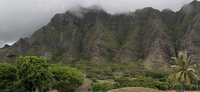
As we head north to the eastern shore of Oahu, it starts to rain. The vegetation is more tropical of course…the south shore is like a desert in comparison. The coastline around the Kaneohe area is very pretty, and the mountains are deeply grooved similar to the Napali Coast on Kauai. I guess the same processes are at work since they are both north-facing coasts – wind and water erosion. We have lunch at the Crouching Lion Bar & Grill in Kaaawa (now closed), and then head back to Waikiki to return the rental car and get back to the ship.
Volendam departs Honolulu at about 11pm, bound for Kailua-Kona and the Big Island of Hawai’i on a slow overnight cruise. We have another lovely dinner in the Rotterdam Dining Room this evening.
November 7, 2008 – Friday – Cape Town, Western Cape, South Africa
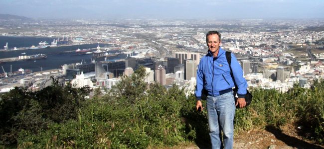
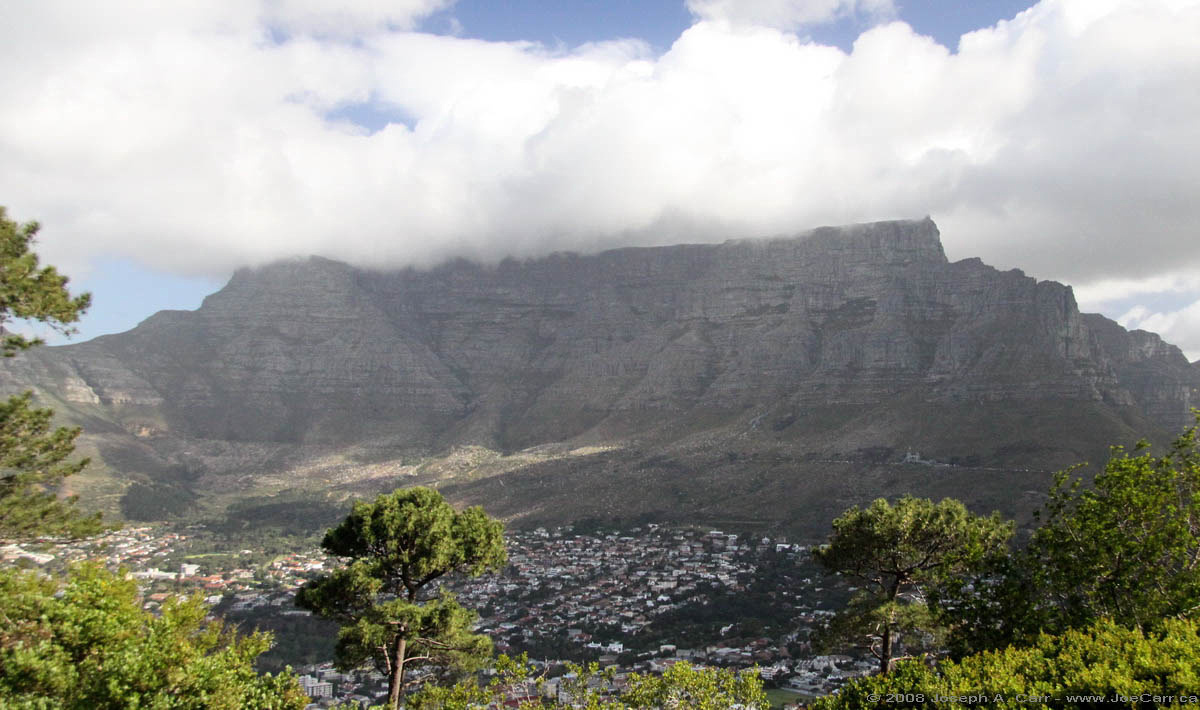
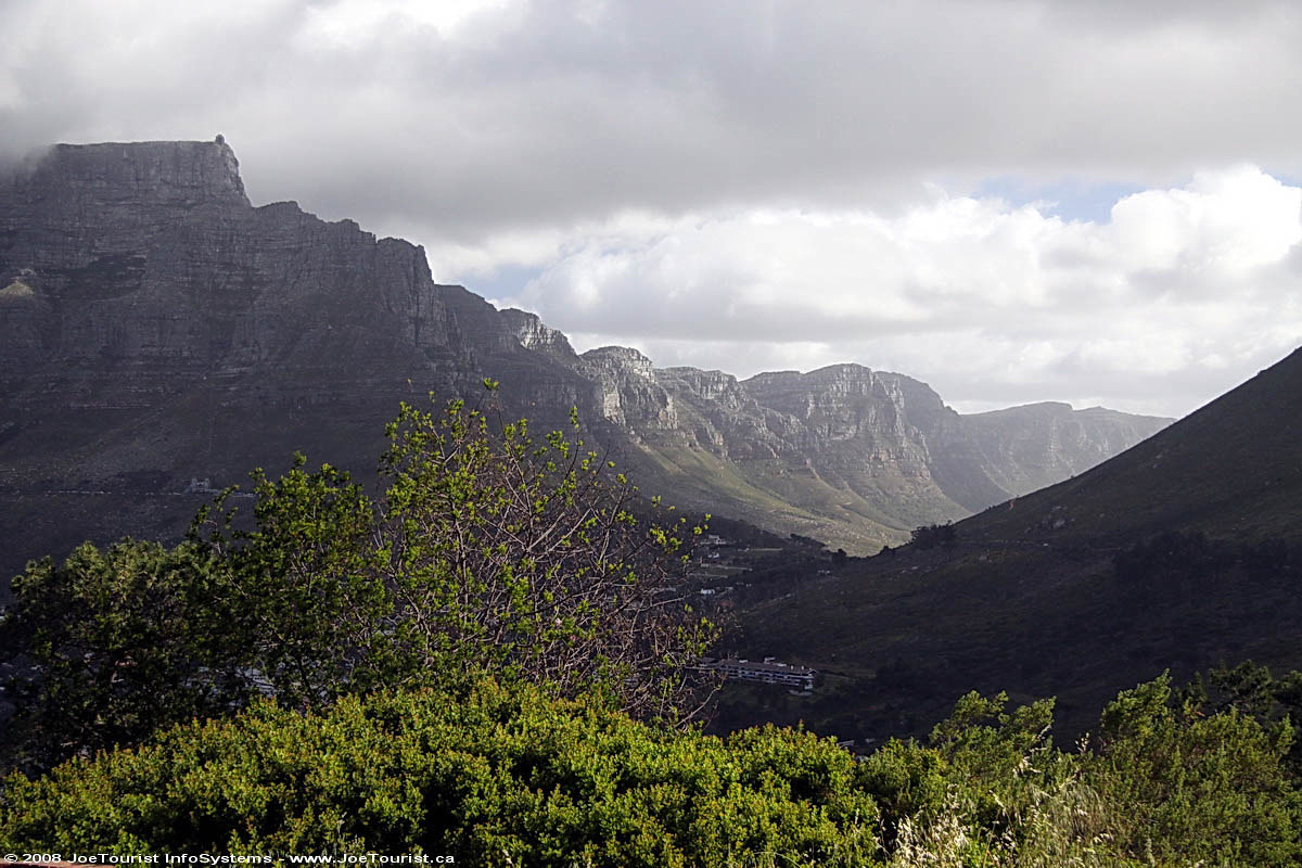
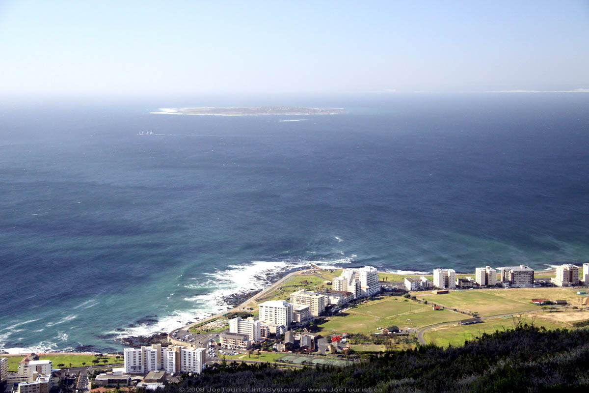
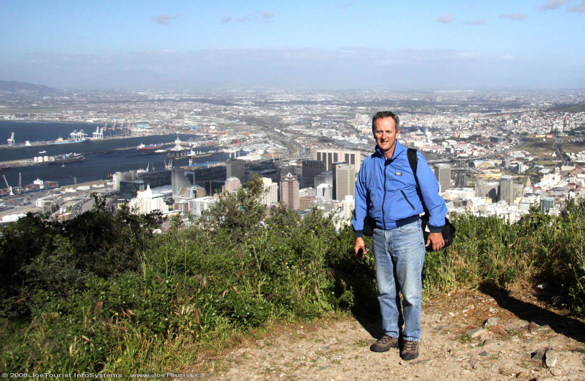
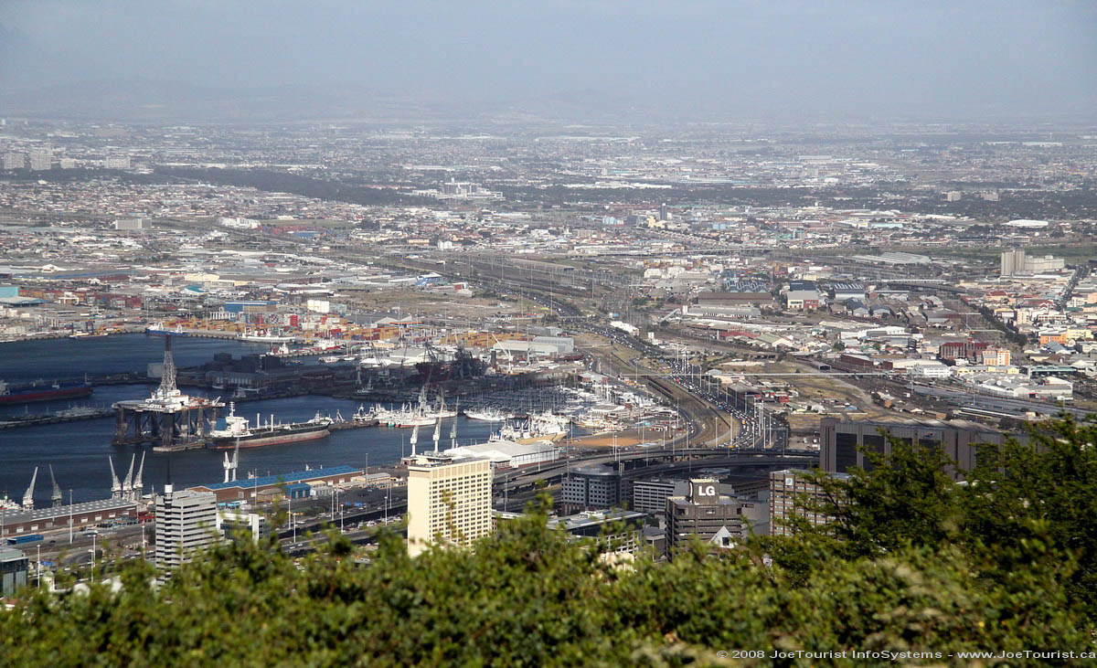
Before checking into our Cape Town hotel, Craig and Phineous take us up to Signal Hill. The views of Cape Town’s shoreline and the mountains (including Table Mountain, the Apostles, and the Lion) are spectacular (see above banner image). We then check into the Hollow on the Square Hotel, and I say goodbyes to our guide Craig and our driver Phineous.
One of my fellow solo travellers on the tour and I take the hotel shuttle (R10 each) to the Victoria and Alfred Waterfront. It is a happening place – the locals are obviously out for dinner on this Friday evening. We manage to get the last unreserved table at the Wang Thai restaurant. It is wonderful Thai food. I have prawns and stir-fried vegetables with steamed rice, a corn meal appetizer and a cappuccino to finish (200 Rand, US$24).
Useful information about Cape Town from our guide
The Red and Blue open-top buses offer good self-guided tours of Cape Town. Tickets cost 100 Rand (US$12) for the whole day. Buses run from 9am to 2pm. Buy tickets from the Clock Tower at Victoria & Albert dock. The Blue bus covers the beachfront area, and the Red bus covers the inland area (city & Table Mountain).
Robben Island boat tour is closed right now, but it is a 4 hour tour when operating.
If restaurants list “SQ” in place of the prices, ask for the price before you order, otherwise you will probably be in for a rude shock when the bill arrives.
The red Excite taxis offer the best rates and service in town. Call them on 021 448 4444.
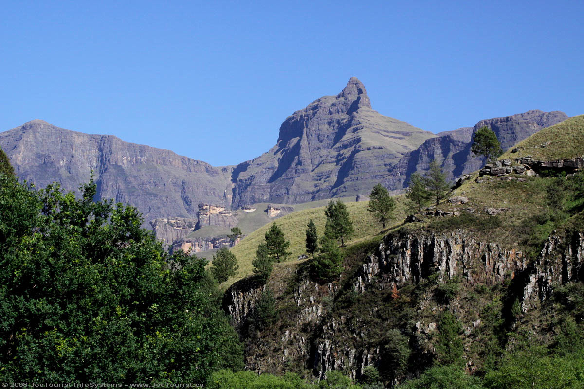
We are up at 5am this morning so we can arrive in Underberg early enough for people to embark on a 4×4 expedition to Lesthoto, a mountainous land-locked nation within South Africa. I opt to skip this excursion, so I stay with the bus, and go for an early check-in at the Drakensberg Gardens Resort. We are warmly greeted at this nicely appointed and vast resort. They have their own 18 hole golf course, multiple dining rooms and bars, hiking trails, a pool, spa, and lots more to do. I have a nice lunch on the patio and then go back to my room and sleep for a couple of hours this afternoon to recover from all the early mornings on this tour. Later, I go for a hike along the river for an hour before dinner. It’s always good to have some down time away from the group when on such a long tour.
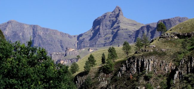
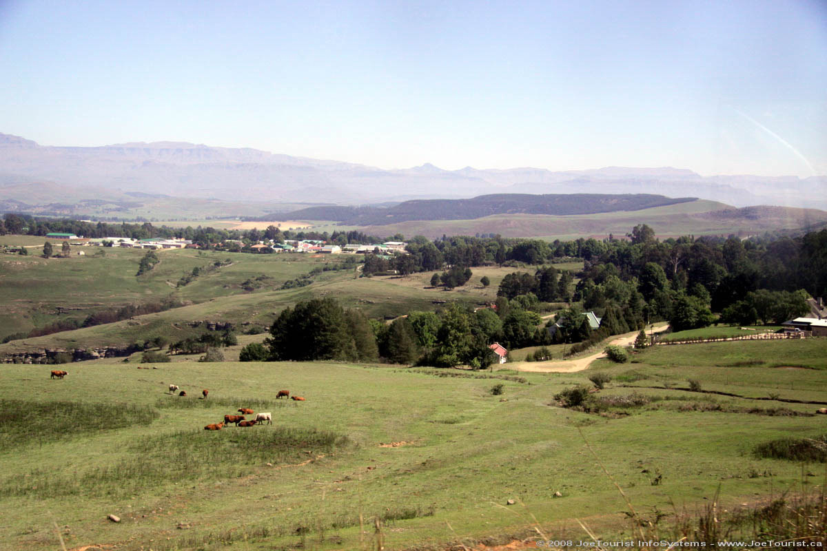
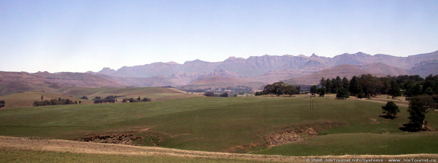
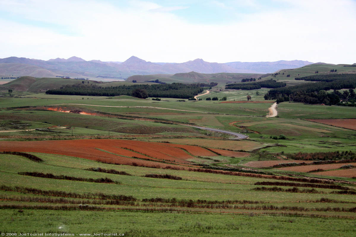
Drakensberg is a strikingly beautiful area of South Africa. The mountains are the main feature, however there are also some vast farms in this area. Most seem to be raising livestock – cattle or sheep.
This evening’s dinner is included in the tour and is served buffet style. I’m seated with the Dutch contingent this evening. Some of them speak good English, and they are always a lot of fun. We get along very well, as they buy me wine and I buy them beer. The staff of the resort performs a floor show of Zulu singing and dancing. They are quite good, so I take some video.
We board our coach after breakfast this morning, and end up waiting for a half hour while a couple pull their bags apart in the parking lot looking for something terribly important. Eventually we leave and learn our “Coach Captain” (driver) is called Phineus. He proves to be a very good driver: good-humored, and always on time. Our bus is quite new, very comfortable, air conditioned, and has a washroom and a fridge.
Freshly ploughed farm fields – red dirt
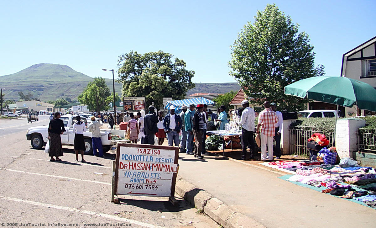
As we roll through Pretoria and onto South Africa’s national road system, we can see this is an excellent transportation system, with toll booths on certain sections. The M4 divided highway takes us past Cullinan (some famous diamonds mined here), Witbank (surface coal mining & refining), Middelburg and Belfast (forestry & farming) before we turn off and end up in Lydenburg. Most of us go to Wimpy’s for lunch – a fast food joint, South African style.
South Africa is home to the largest man-made forest in the world (140 sqkm). We learn that Pine trees are harvested after 10 years, with the trees growing to 12m high. Eucalyptus are also used in some areas, however they require more water, so they are falling out of favor. We see a steel mill just outside of Lydenburg.
Eroded rock formations on the Treur River at Bourke’s Luck Potholes
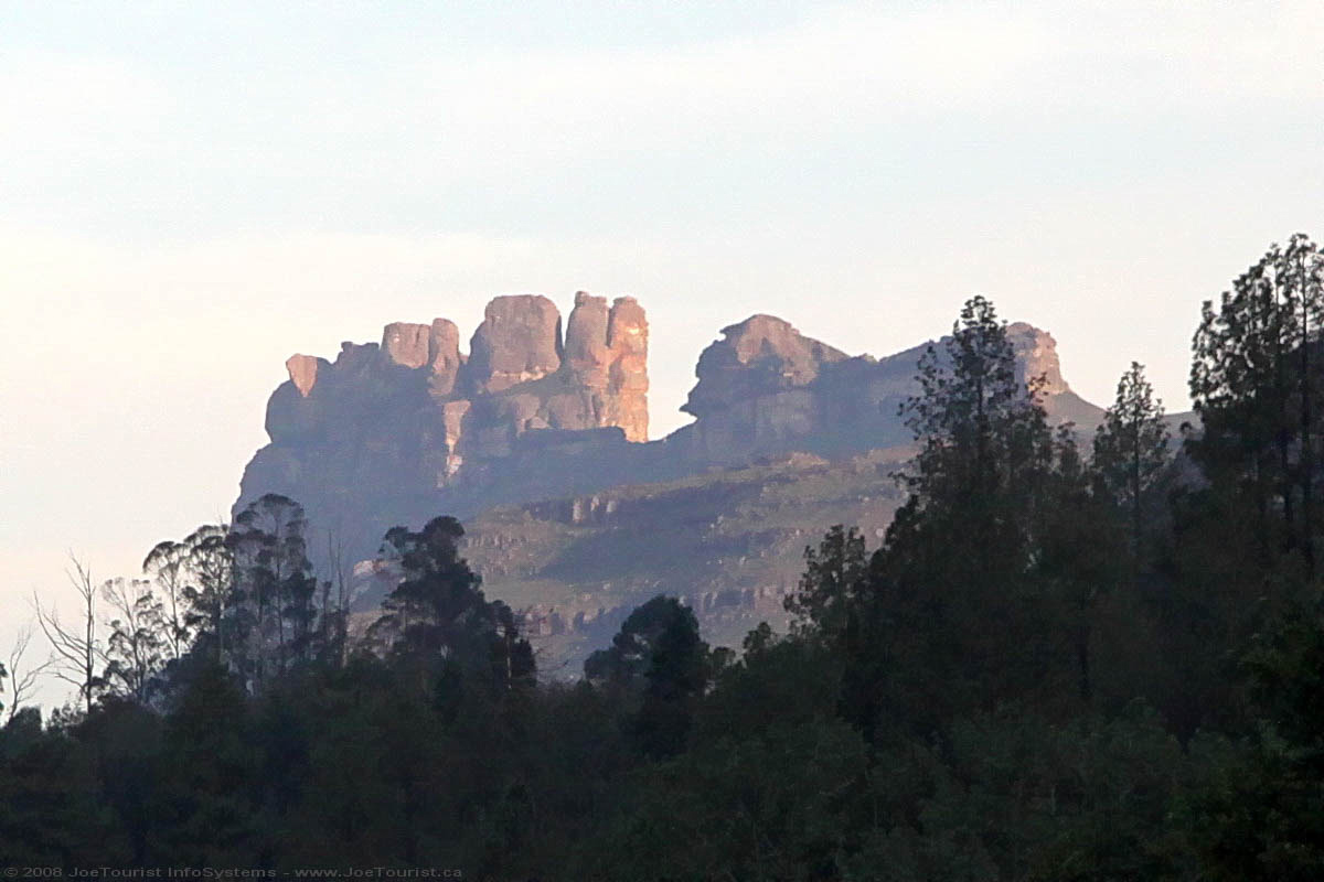
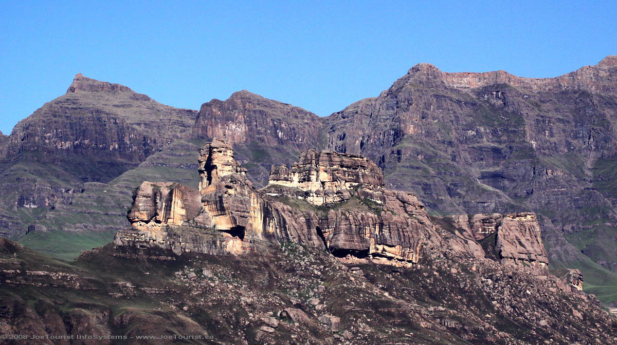
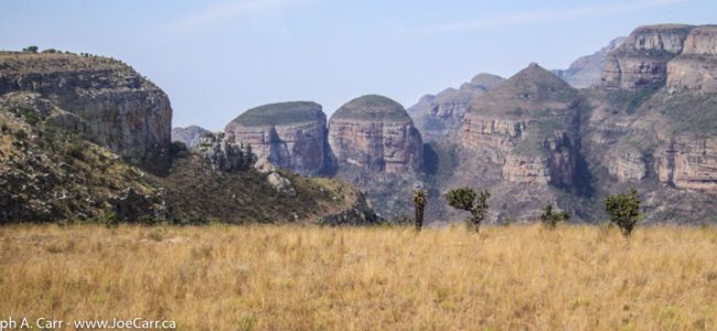
Panorama Route – Our first scenic stop is the viewpoint at the Blyde River Canyon, where we can fully appreciate the 800 metre drop to the canyon floor. Across the canyon are the “Three Rondavels”, huge round rocks that look like African huts. Our next stop is Bourke’s Luck Potholes, where the Treur River has eroded strange cylindrical potholes in the sandstone.
View of the Lowveld and escarpment from God’s Window
Our last stop in this area is God’s Window, a dramatic vantage point to view the Drakensberg Mountain escarpment with beautiful views of the lowveld, and even Kruger National Park is visible on a clear day. This is where the quirky movie The Gods Must Be Crazy (1980) was shot.
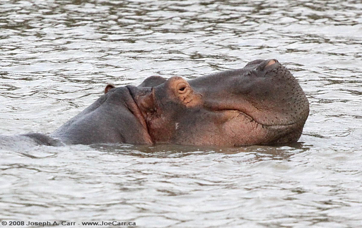
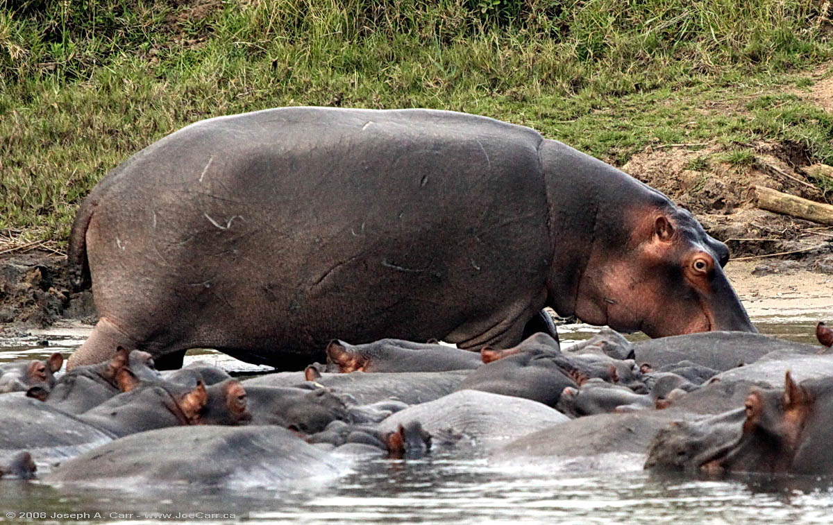
We arrive late in the afternoon in Hazyview after our first full day on the road. Hippo Hollow Country Estate is located on the tranquil Sabie River, where the resort’s namesake hippos regularly graze on the front lawn. My cottage is quite luxurious, having a king sized bed on the main floor and two single beds in a loft. My patio overlooks the Sabie River. There are very few mosquitoes, which seems strange with all the vegetation around and the slow flowing river only a few metres away…but I’m complaining!
The Chief
7pm – Shangaan River Club – This is a cultural experience that is staged right on the grounds of Hippo Hollow, consisting of tribal drumming, singing and dancing, followed by a traditional African feast. The chief of the local village is the master of ceremonies, and he introduces his troupe of orphans who sing and dance. He is very animated, talking to us for well over three quarters of an hour before the performance begins.
The chief explains how he is personally responsible for the care of the orphans, many of which are the result of AIDS killing both of their parents. They support themselves by this arrangement with the Hippo Hollow Country Estate, so I’m pleased that Thompsons has chosen to include this performance in the tour. I shoot some high definition video using “night mode” on my Canon HV-20, which works quite well until I run out of video tape! Despite this glitch, I have enough video to capture the event.
The feast of culture served buffet style after the performance is very good. There are lots of choices from the usual soups and salads, as well as a nice selection of African meat dishes that are served from traditional cast iron pots. Fruit, dessert, and drinks are also included. This is all served under a massive boma, or thatched building right next to the performance area. It wasn’t just our group who were taking in the feast, however the staff coped with the crowds quite efficiently. All of my group seemed to enjoy themselves, and everyone left the tables fully satiated.
I have a nice breakfast of waffles with fruit and chocolate sauce, coffee & fresh fruit juice at 5:30AM. Today is obviously starting off early, since we go on a hike to see a volcanic flow on Arenal Volcano. A woman in our group sits on an unstable rock and rolls to the ground, resulting in some cuts and bruises. Otherwise, everyone coped well with the sometimes rough terrain. There is some rain at the start of our hike, and it is cloudy to clear the rest of our time on the mountain shrouded in cloud, which is not unusual for Arenal. The last time I was here 10 years ago, Arenal was in cloud as well. We watch the volcano spit hot boulders for awhile and then return to the bus.
The Arenal Volcano Observatory is our next stop – a sublime place which has a nice restaurant overlooking the volcano, a resort, Lake Arenal, and the observatory operated by the Smithsonian Institute. We have a leisurely lunch, observe the volcano from the deck, and have fun watching the tropical birds feeding on some fruit left out for them at a feeding station. There is also a Coatimundi foraging in the gardens. From this vantage point I take better photos of the mountain than from our hike earlier in the day. Steven O’Meara shares a bit of history about Arenal, and then we get back on the bus and return to Tabacón.
The rest of the afternoon is free, so I go to the hot springs and spa and soak in the hot pools. Some of them are very hot (41.5°C) and others are as cool as 25°C. I find a hot pool away from the crowds and alternate between hot and cool for about an hour. Our hotel room booking includes admission to the hot springs, so many of my group are also taking advantage of the facility. Normal admission is $60/person for a day pass. There is a free shuttle between the hotel and the hot springs – they are located about a block apart.
We enjoy a sumptuous dinner at Arenal Kioro Hotel, a resort located toward La Fortuna not far from Tabacón. This two year old resort is situated on the mountain and has wonderful views of the area. The whole complex is quite spectacular. After dinner, we drive back to Arenal and park along an access road, trying to spot the hot lava rocks as they tumble down the mountain, but it is so cloudy we only spot a couple before giving up to return to Tabacón.
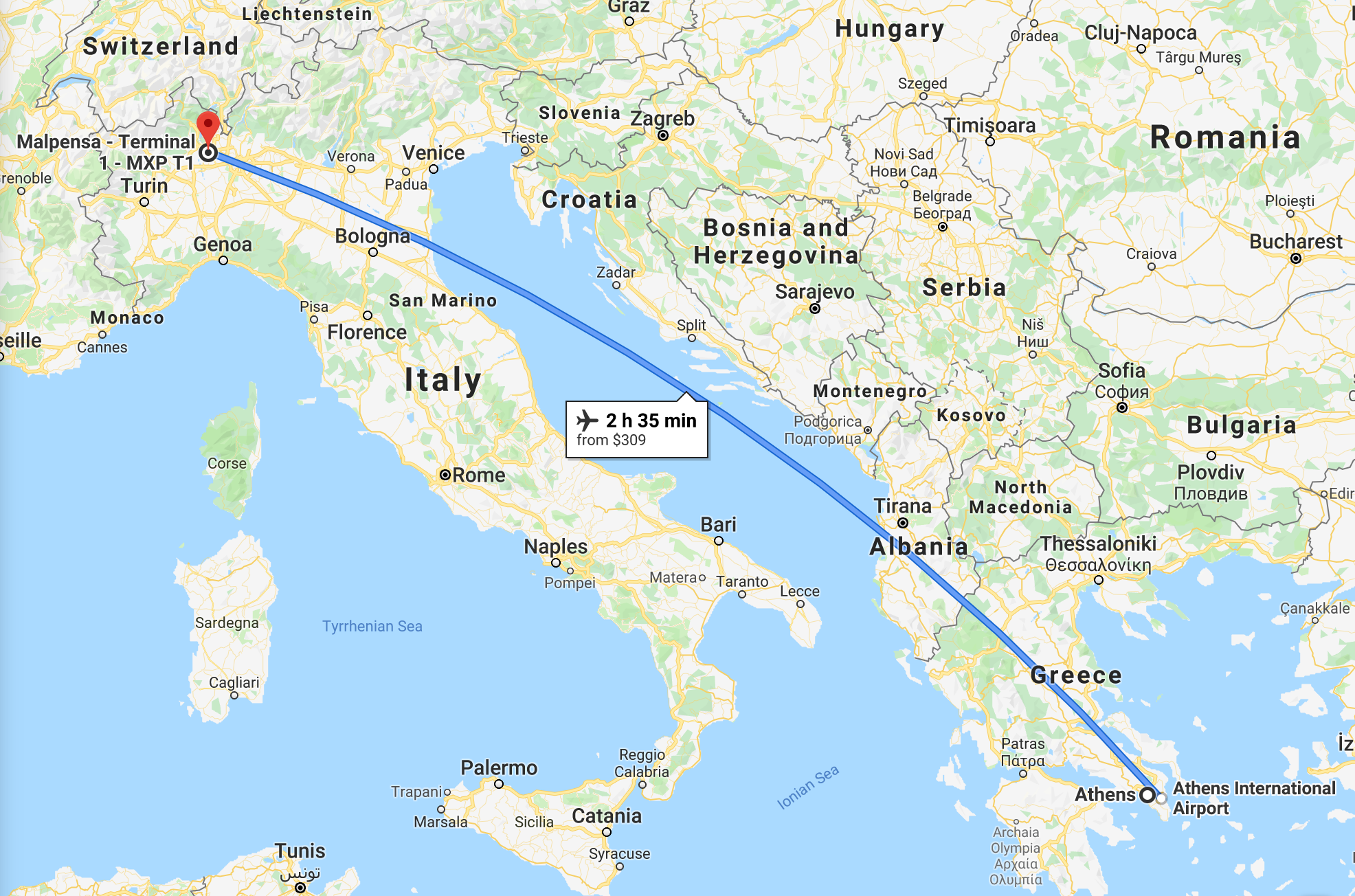
April 14, 2006 – Friday – Flight from Athens, Greece through Milan to Toronto and onward to Victoria, Canada
My alarm goes off at 3am and I am picked up by Jimmy (Paul’s alternate) at 4am. It is a bit confusing picking out Jimmy, since there are so many cabs going by. Exarhia is still going strong at this late hour! Jimmy and I have a nice chat on the way to the airport, and I pay him the €500 I owe Paul for the taxi services over the last week.
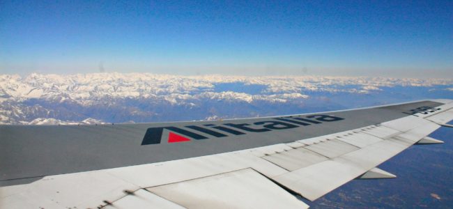
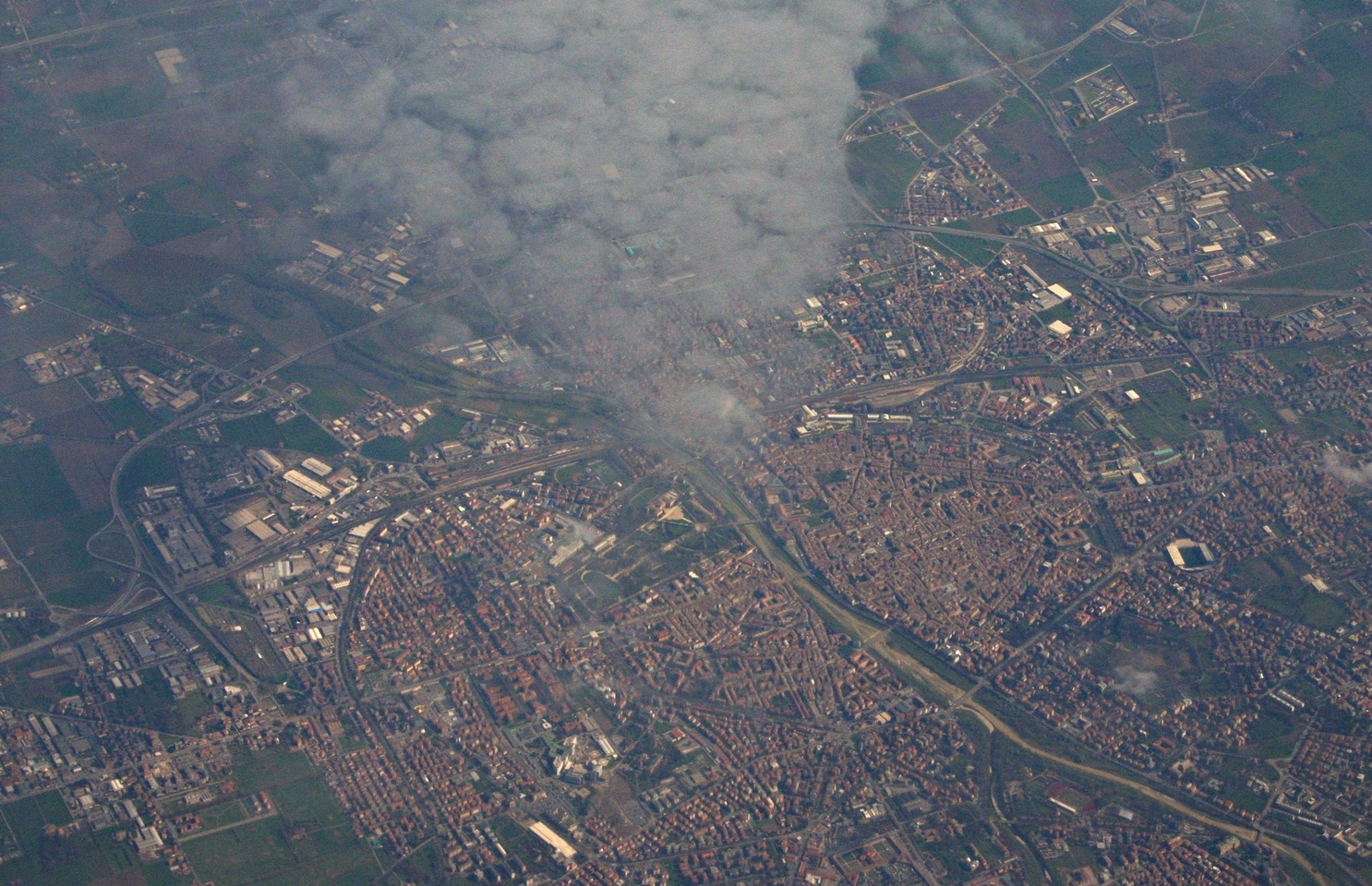
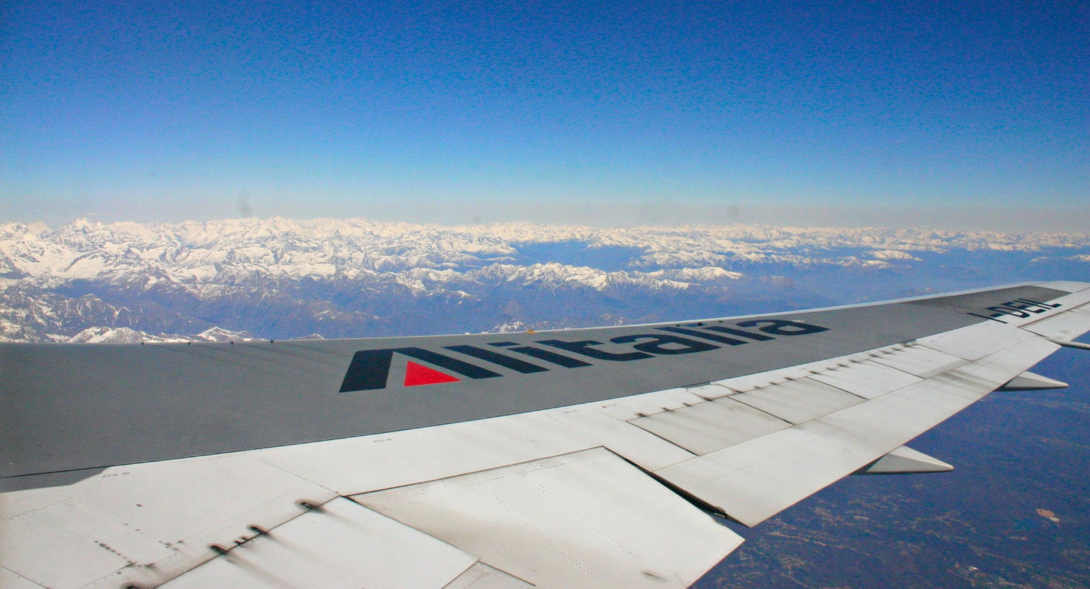
As I board my Alitalia flight to Milan, it is raining lightly at Athens airport. We taxi over the airport’s main access road on an overpass to get to our runway. As we takeoff, the rain is increasing. What luck I’ve had on this trip. At most we had some overcast in Venice, otherwise it has been sunny every day. We fly the length of Italy’s east coast south to north, and land on time in Milan. I end up only two gates away from where my group left Malpenza for Tripoli three weeks ago! This is the old part of the airport, and it is very crowded. Destinations for the four gates include: Prague, Bucharest, Tunisia, Timisora, Cairo, Istanbul, Krakow, Dublin, and (of course) Toronto – my flight.
Flight map – Athens to Milan
The Tunisia flight seems to be popular with the Italians by the look of the passports. Lots of tired, squalling kids all appear to be waiting for the Toronto flight. I observe two types of passengers bound for Toronto: Indians with kids returning home (after already spending many hours in the air), and older Italians obviously going to visit their family in Toronto. We board Alitalia Flight AZ652, a Boeing 767-33A (ER) about 20 minutes late, then once we are aboard, another 30 minute delay is announced due to ATC traffic congestion.
Flight map – Milan to Toronto
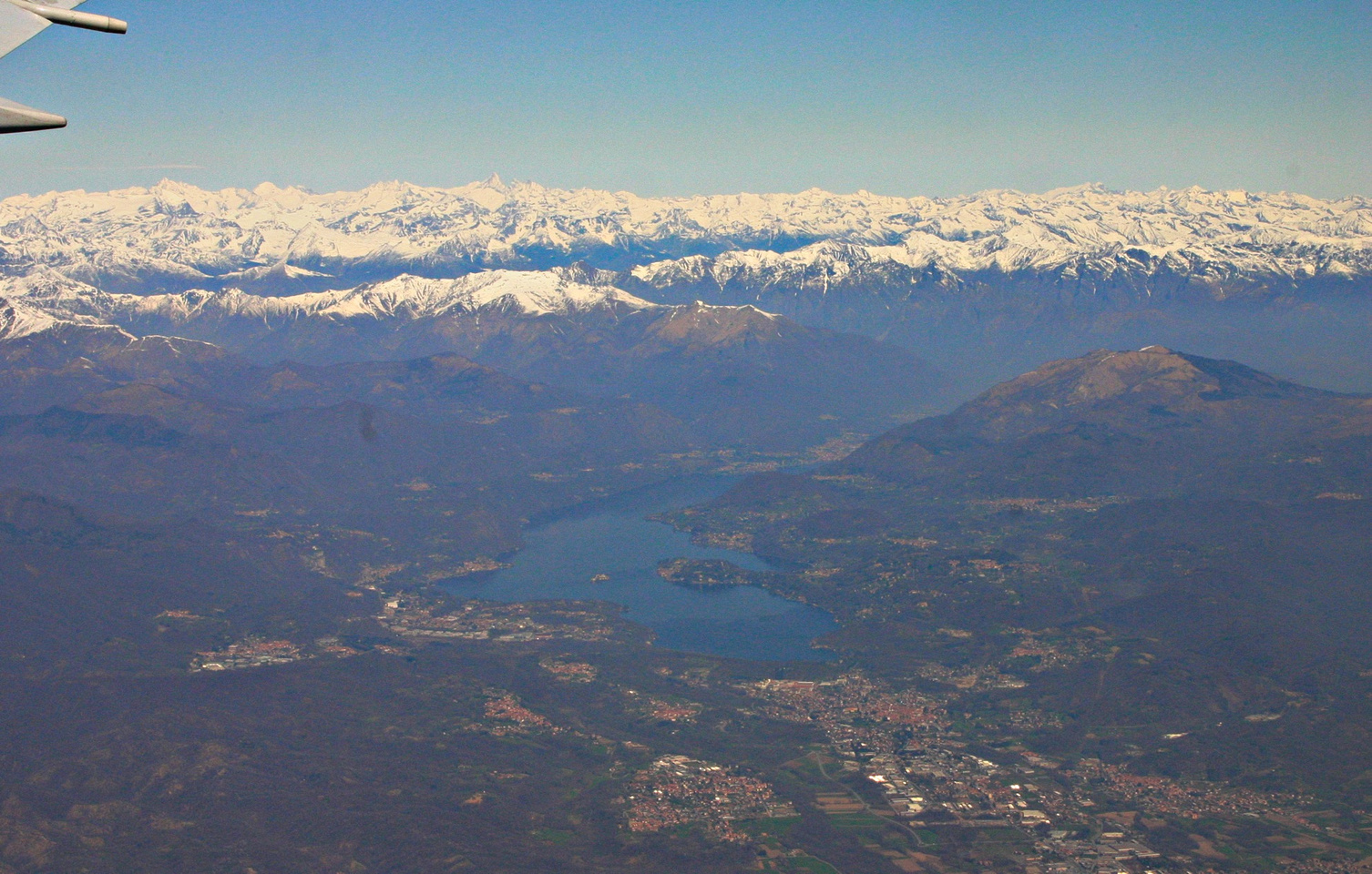
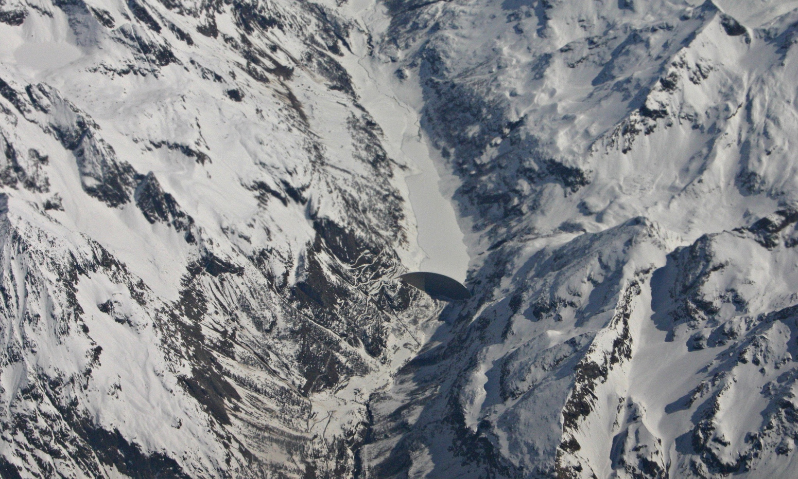
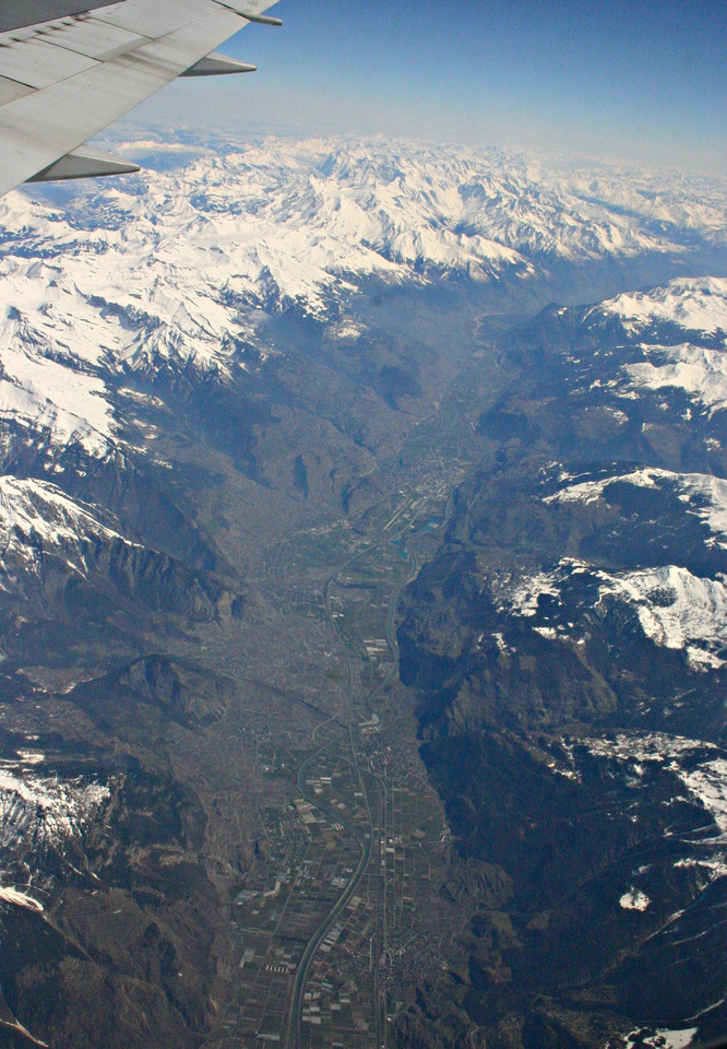
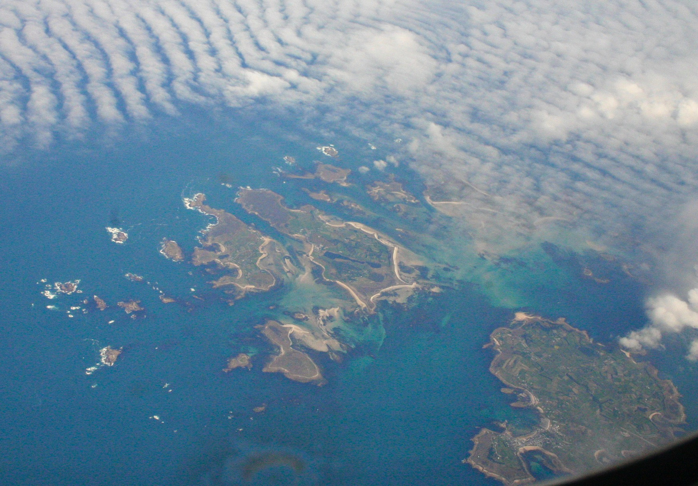
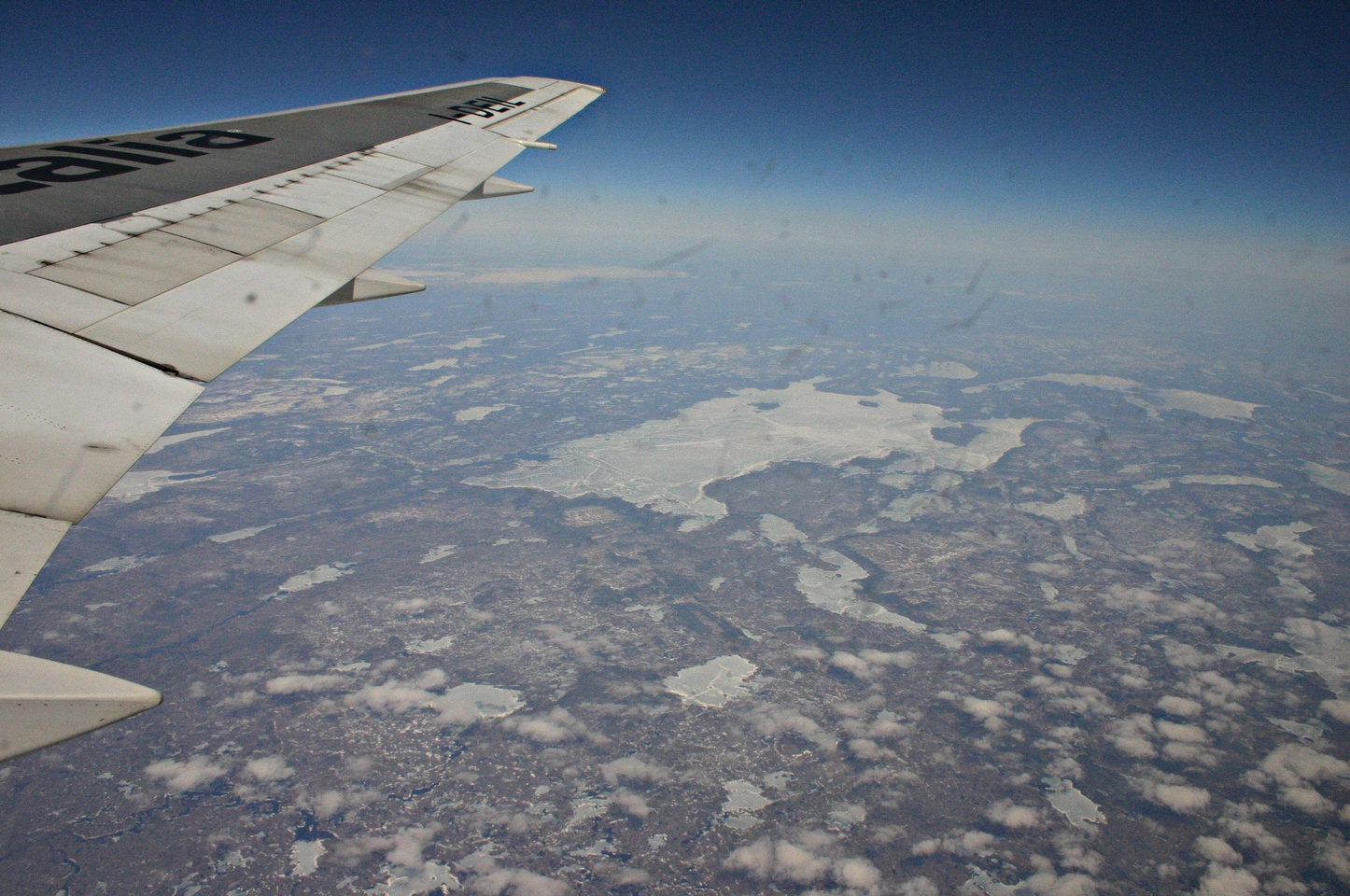
I take some nice photographs of Lago Maggiore, where my eclipse tour group stayed in Beligerate on our last night. The Italian Alps are spectacular, as are the beautiful blue waters surrounding the Isles of Scilly off the south coast of Wales. I spot several large ships in the Atlantic shipping lane off the coast of England as we have dinner. Several hours later we fly over Newfoundland, revealing endless frozen lakes and not a tree in sight. I think the Italian woman sitting beside me is impressed, and perhaps a little worried about finding the same thing in Toronto! Unfortunately she doesn’t speak English, so I can’t reassure her about Toronto’s milder climate.
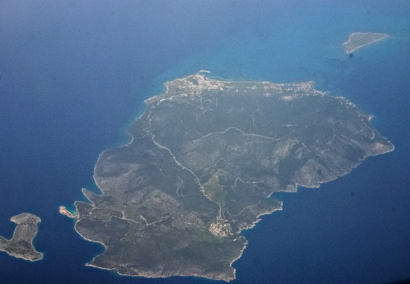
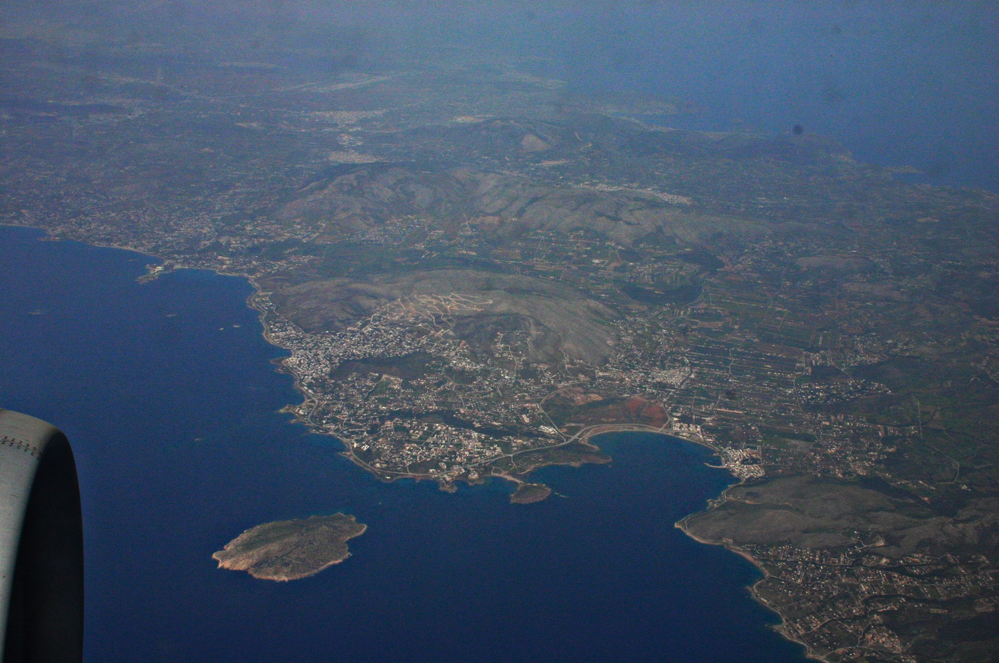
I’ve noticed as we fly over the Atlantic that aircraft in the traffic lanes fly very close to each other – at times I could almost make out the aircraft markings. One of the female Alitalia cabin crew sees my digital SLR, and tells me I can’t use it in flight. This doesn’t make any sense – it’s normal to prohibit use of electronic devices during takeoff and landing, but not during flight. Alitalia’s own announcement states this, but I wasn’t going to argue the point with her so I put my camera away. Despite this warning, I took some great aerial shots all the way from Athens through to the St. Lawrence.
After 9.5 hours in the air, we finally arrive at Pearson Airport in Toronto. Alitalia lands at a skyway equipped gate, but it is off in some remote area of the airport. Everyone has to get on a shuttle bus and go for a 20 minute ride to Terminal One, where we go through Canadian Immigration. There are a dozen officers, however two flights are being processed: ours from Italy, and one from China. The Chinese take a long time to be interviewed, since many don’t speak English, and it appears some haven’t filled in the form. Once I finally speak with an officer, I breeze through in less than a minute. I also am lucky to find the correct luggage carousel and grab my bag right away. Canada Customs decides they don’t want to talk with me, so that was easy!
I now have five hours to kill before my Air Canada direct flight to Victoria departs. I sip a Cappuccino Grande, which is my first cappuccino since we left Italy. While in Athens, I made brewed coffee with my breakfast in the apartment. I really didn’t feel comfortable spending time in the numerous cafés in Athens for some reason – perhaps it was all the smoking that put me off.
Pearson International Airport is quite impressive, now that the expansion is completed. The new Terminal One is grand-looking, with soaring ceilings and glass, new car displays, bars, restaurants, coffee bars, duty free shops, bookstores and all sorts of other shops. Even the cleaning staff are impressive: they wear black and white suit-like uniforms complete with ties, and the airport is absolutely spotless.
While I’m waiting for my flight, I call home and let them know I’m in Toronto and the flight appears to be on-time, so they should plan to pick me up at 10:30pm. After this call, I watch a young Chinese guy try to use one of the pay telephones without success. He then asks me for help, and I see that the number he is calling is Ottawa (long distance). I coach him through the process of using a credit card, but the telephone rejects his Chinese card. I then offer to let him use my cellular telephone, which works fine. He is very grateful, shakes my hand, and runs off to the gate to board his flight.
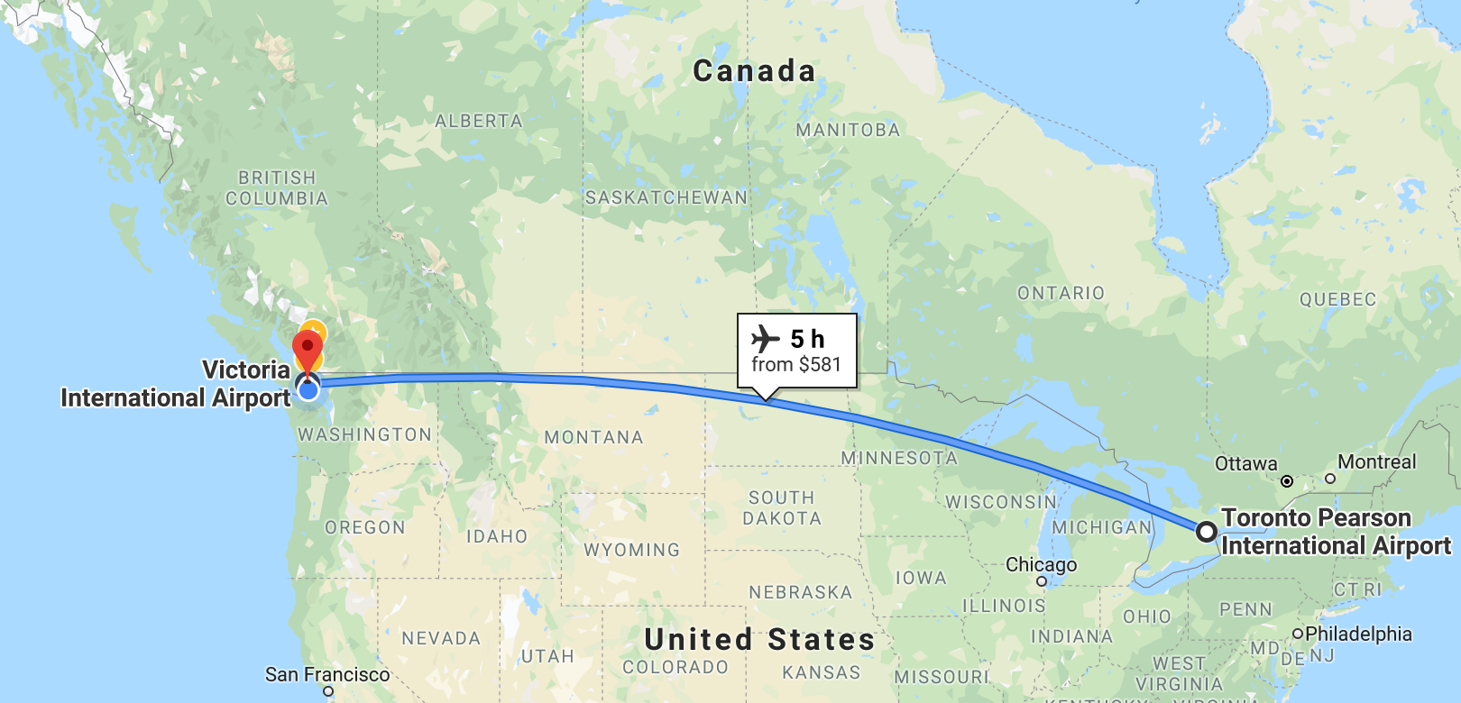
Flight map – Toronto to Victoria
I am extremely tired when I finally arrive at Victoria Airport. It takes me about five days to fully recover from the jet lag. The westward journey was certainly the killer. I wouldn’t let a travel agent talk me into a 30 hour elapsed time flight again. I should have stayed overnight in Toronto on the way back, as happened for the start of my trip.
January 20, 2001 – Na Pali Coast boat tour from Waimea area of Kaua’i
A small boat cruise to the Na Pali coast offers an excellent way to get out on the water around Kaua’i, do some snorkelling, see some whales, turtles and spinner dolphins (depending on the season), and get up close to the Na Pali coast without having to hike for days. I chose Liko Kaua’i Cruises, who operate the Na Pali Kai vessel, a fiberglass hulled, custom designed catamaran with twin Cummins diesels capable of moving the boat at a speedy 31 knots. The crew are knowledgeable about the area, they serve good quality food and drinks (no alcohol), and are very safety conscious. Liko’s offices are in the town of Waimea. You will need to check in there before proceeding to the dock in the boat harbor at Kikiaola (5 minutes further by car).
Sunrise from Kikiaola Boat Harbor, Waimea, Kaua’i
The cruise I chose departed at 7:30am, so I had to check in to the Liko office by 7am. Since there was road construction along the way, and I was driving from the opposite side of the island, I had to leave very early! Just to prove that I was up at the crack of dawn, have a look at the gorgeous sunrise photo!
The cruise took us past Barking Sands, all along the Na Pali coast almost to Ke’e Beach (where the North shore road stops. Along the way we saw numerous Humpback Whales (one baby a few days old) and Spinner Dolphins. We were within 50′ of the shoreline at times, so we saw the Na Pali coast up close. A very different perspective than from a helicopter.
They served us a very nice deli lunch and soft drinks on the way back. As soon as we rounded Mana Point (Barking Sands), the afternoon swells hit us full tilt, making for a roller coaster ride back to the harbor. However, along the way we were treated to an adolescent Humpback whale doing repeated breaches, flipper flapping, and other acrobatics. Although we didn’t get to snorkel due to the choppy seas, the whale made a memorable ending to a very successful cruise.
Free advice
Taking photos of whales, dolphins, turtles and fish consumes huge amounts of time you could otherwise spend enjoying these creatures. If the opportunity presents itself, by all means take a photo or two…otherwise buy some postcards!
There are many cruises to the Na Pali coast to choose from. I would suggest you select one that either leaves from Hanalei Bay (only two operators do this), or choose an operator who has a very fast boat (such as Liko) if they leave from the Waimea (southwest) coast area. It is over 20 miles by sea from Waimea to the start of the Na Pali coast (Polihale area). It is only 5 miles to the start of the Na Pali coast (Ka’ilio Point) from Hanalei Bay.
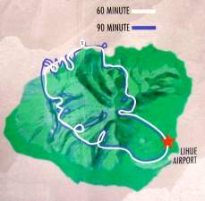
January 19, 2001 Helicopter Tour – Lihu’e, Waimea Canyon, Na Pali Coast, Hanalei, Kawaihau
Jack Harter Helicopter Tours
Jack Harter Helicopters started the helicopter tour business in Kaua’i, and they came recommended by the B&B I was staying with. They use six passenger Eurocopter AStars custom-equipped with the largest windows and a unique cabin layout, giving passengers the best views possible. They also offer doors-off flights with their Hughes four passenger helicopters for those who want an extra thrill, or for dedicated photographers who want to avoid window reflections in their photos. I learned from my trip to the Grand Canyon that helicopters are an excellent way to see the country, so I decided to spend the money on this tour.
Jack Harter Helicopter tour map
The tours start at the Lihue heliport, which is adjacent to the main airport, but you need to check in at the Jack Harter Helicopter office, which is located very close to the airport. You will be briefed on safety procedures and then driven to the heliport. Takeoff was smooth – an indication of the rest of the flight. We flew around Kaua’i in a clockwise direction.
South Coast
Looking over Ha’upu (Hoary Head) Ridge from the air offers a gorgeous view towards Kipu Kai, Kawai Point, and the Menehune Fishpond. The spectacular Mana Waipuna Falls is next on the itinerary, and as we proceed toward Waimea Canyon, we fly over Olokele Canyon and can see the irrigation ditch which supplies the fields in this normally arid area with water for the sugar cane crops.
Waimea Canyon
Driving to Waimea Canyon by car presents some spectacular vistas, but seeing this canyon from a helicopter is a whole new experience. As we approach the canyon from the south, we catch glimpses of the colors and water courses that make this canyon so interesting. The red rock and soil that makes up so much of Kaua’i is laid bare in this area of high erosion. The vistas from the head of the canyon looking back south show the way the layers of mountain ranges fades into the sea, and we get an excellent view of Barking Sands from high atop the ridge just before we dip over the top and catch our first glimpse of the Na Pali Coast.
Na Pali Coast
Our first glimpse of the Na Pali coast as we clear the ridge line wows us with the view of the Kalepa Ridge cones on the Na Pali coast. Streaming sunlight over the mountains is simply magical; the high surf makes the Na Pali coastline stand out. This is simply awe-inspiring. There is no substitute for seeing the Na Pali coast from a helicopter.
Hanalei & Central Mountains
Maniholo Bay & Ha’ena Pt looking toward Hanalei
As we leave the Na Pali coast and head past Ha’ena Point, the beautiful Hanalei Bay comes into view. Maniholo Bay & Ha’ena Point frame pretty Hanalei Bay, with Princeville further down the coast. We fly close to falls in the mountains behind the valley, which are the source of the Hanalei River. In quick succession as we cruise down the coast towards Lihue: the Makaleha Mountains, fantastic Keana’awi Falls shrouded in cloud , beautiful Kohalalele Falls, showing us the wettest place on earth are the central peaks of Kaua’i – Wai’ale’ale and Kawaikini.
East Coast & Lihue
As we approach Lihue and the end of our tour, we see Wailua Falls and look north along the east coastline over Hanama’ulu Bay, productive farmlands, the upper Wailua River, and glimpse the Sleeping Giant. We float down on the helicopter pad and reluctantly return to our land-based existence.
What was the highlight of the helicopter tour? The Na Pali Coast was a clear winner, although seeing the Waimea Canyon from the air was interesting after having driven there the day before. The Hanalei Valley is even more beautiful from the air. Incidentally, the narration from the helicopter pilot was amazing. He had facts, figures, answered our questions, and had some very interesting stories to tell the whole time we were airborne. He even knew when to be quiet, and let us enjoy the amazing views!
I enjoyed this helicopter tour immensely – this is a vacation highlight you should not miss!
If you are staying on the east coast of Kaua’i, the drive to the west coast make a nice day trip by car. The only working sugar mill is located at Port Allen, and they offer tours. Call ahead, since the tours are limited. Hanapepe and Waimea are agricultural centers for sugar cane, and both towns have boat harbors. Salt Pond Beach Park is just off the highway at Hanapepe – follow the signs. A nice beach for all ages, basic facilities, and limited camping.
The little town of Waimea is the gateway to the Waimea Canyon, which is a “must see” while you are on Kaua’i. There are two roads to Waimea Canyon, but I would recommend the Kokee Road, which is a right turn 3.6 miles past the town of Waimea. The sign is easy to spot from the highway. Just follow this very steep road with lots of curves, and stop at the lookouts along the way. Take your time, and enjoy the views along the way. After you leave the main highway, there are no gas stations or facilities other than a primitive bathroom at the main lookout, so take your own water and food, and fill the car with gas.
This side of Kaua’i is very dry, and if there was no irrigation, no productive crops would be possible. Irrigation ditches were established by the Robinson family when they originally acquired this land from the Hawaiians, and these ditches are still in use today. They can be seen from the air and you can catch glimpses of them from the Waimea Canyon roads.
Barking Sands is a missile testing range, and military airport. Restricted access is usually granted to civilians if you provide identification. Major’s Bay is worth visiting, but is inside Barking Sands, so you will need ID. Further along is the longest sand beach with the fewest people on it you will find anywhere in Hawaii! If you are adventurous, drive to the end of the Kaumuali’i Highway past Barking Sands base, and drive five miles further along the coast to Polihale State Park. This is as far as you can travel by car along the west side of the Na Pali Coast, and your car rental company may forbid you to go here.
The drive from our condo in Kihei to the top of Haleakela and back – an easy half day trip. Haleakala volcano is 3,058 metres (10,033 feet high). Driving to the summit will take about two hours from Kahului, assuming you take your time to see the sights along the way. Give yourself an extra 20 minutes if you are traveling from Kihei or Wailea, or give yourself an extra 45 minutes if you are driving from Lahaina/Kaanapali. The road is paved the whole way, although the upper half of the route has many hairpin turns and is quite narrow. Haleakela National Park charges a modest per car fee, which is collected at a toll booth on the way up the mountain.
Make sure your car has a full tank of gas and check all fluid levels before you leave. There are no service stations once you pass Pukalani on Highway 37, so it is up to you to ensure your vehicle is in good condition. Speaking of being prepared – you should take some snacks and drinks with you. Although there is a restaurant and lodge in Kula on Highway 377, most visitors get hungry or thirsty while up on the summit, so bring food and drinks with you. Leave yourself at least a half hour to experience the strange sights from the summit.
The weather on the summit is not easily predictable. It can be sunny or rainy – or both! Keep in mind, you are at 3,000 metres elevation, so the air temperature will be quite cool. Take a jacket. Likewise, it is impossible to predict whether you will be able to view the scenery of Maui from the summit or not. Obscuring clouds come and go…just because you see clouds while driving up the mountain, doesn’t mean they won’t clear by the time you reach the summit.
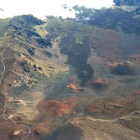
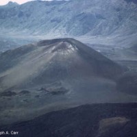
There are many unusual and contrasting colours at this elevation, so take lots of pictures. Compare my photos of the crater taken in 1983 with the ones taken of the same area in 1995. There are some interesting cinder cones inside the crater.
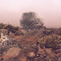
Silver Sword plants on the slopes of Haleakela
Aerial photo of Heleakela caldera
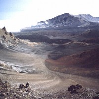
Haleakela cinder cone – 1983
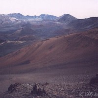
Haleakela caldera in 1995
Haleakela caldera in 1983
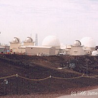
Observatories on top of Haleakela – 1995
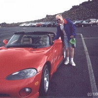
Jim beside a Dodge Viper
Although there are observatories and repeater stations on the summit, there is no access permitted to this area. There are some spectacular silver sword plants to see, depending on the season. Please remember – don’t touch. The ecology in Haleakala National Park is very fragile. Please observe signs which restrict access to certain areas used by the nene, or native Hawaiian goose.
On the way up, observe the transitions through several ecosystems – from the tropical valley floor, through the temperate forests on the lower slopes, to grasslands on the middle slopes. The higher elevations have very little vegetation, except the hardiest of plant varieties.
You never know what you will encounter on these trips. Who would have thought that a Viper sports car would be parked at the top?
One last warning – traveling from sea level to 3,000 metres (10,000 feet) so rapidly is hard on the human respiratory system. If you have a heart condition, or have respiratory ailments, think twice before making this trip. Hardly a day goes by without an ambulance having to take someone down from Haleakala. Even healthy individuals will find that the rapid climb to the summit can cause “fuzzy” sensations, feelings of slight nausea or loss of balance. While on the summit, take it easy. Walk slowly (even if you feel OK), and sit down for short rests on the benches provided. Haleakala is well worth seeing, so make sure you are one of the 99% of visitors who enjoy this unique experience.
For the more adventuresome, there are many activities available within the Haleakala crater: hiking trips (3 cabins are available, reservations required), ranger-guided walks and hikes, concessionaire-guided trips through the crater, short, self-guided walks, and camping at Hosmer Grove Campground.
Although I have concentrated on the Haleakala Crater portion of Haleakala National Park, there is a second section to the park – the Kipahulu area. This coastal area can be reached by driving the road to Hana (Highway 360), and going past Hana on Highway 31 to the Oheo Gulch (Seven Pools) area. Hiking, swimming, camping, and picnicking is available in this area. Facilities at Kipahulu are primitive. Neither drinking water nor modern restrooms are available. If you are considering going to this area, check with the park administration first. Car rental agencies may prohibit the use of their vehicles on Highway 31, so check before you go.