post

Costa Rica to Canada

2008 Costa Rica Southern Skies Fiesta, Volcanos & Rainforest

Feb 15, 2008 – Friday – San Jose, Costa Rica to Seattle, WA, USA

Flight map - San Jose - Houston - Seattle
Flight map – San Jose – Houston – Seattle

I’m up at 4am after about 4 hours sleep. I’m going to be beat flying to Seatac, so it’s probably a good thing that I overnight in Seattle to allow me to get some sleep before returning home. Diego and Walter are there at quarter to five to pick me up, along with another couple leaving on the same flight. I guess Diego and Walter will be going back and forth to the airport all morning as flights depart.

I pay my US$26 Departure Fee, clear security and wait for my Continental flight to Houston. There are only folding chairs in the departure area – I hesitate to call it a “lounge”, since there is no counter, and the gate itself is well-hidden. I start the waiting process by sorting through my photos after find a carpeted bench area to sit on so I can plug my notebook adapter into a nearby outlet. My friends soon show up, and we trade stories about the last week, since they went off on their own instead of booking the Volcanoes and Rainforest tour. My group certainly accomplished more, but my friends wanted some down time to just relax, which I can relate to.

Flying over the Gulf of Mexico shoreline

Since I only slept four hours last night, I try to get some rest on this leg of the journey once we’re airborne. The breakfast bun Continental serves is dreadful, but I eat the egg and ham and drink the lukewarm coffee. Once we land in Houston at the George Bush airport, my friends and I take one of the golf cart shuttles since our gate for the flight to Seatac is a long way across the terminal.

Our flight to Seatac is full except for one empty seat which my friends happened to get in their row – a good thing. I’m seated in the third-to-last row, which is fine except for the deodorant smell emanating from the nearby washrooms. As on the previous flight, I zone out by listening to music through my noise-cancelling Shure earphones. That way I isolate myself somewhat from the stress of a full aircraft cabin, as well as from the noise of the jet engines. When I arrive at Seatac, I experience no ringing in my ears. Previously, I would normally have ringing in my ears for a couple of days, and have trouble hearing.

I like George Bush airport in Houston, since despite it is huge, it is well laid out and I find it easy to navigate. There is a good choice of services near each group of gates, and the airport staff are helpful and friendly. I find that Seatac airport is also improving as far as customer service is concerned, however the poor layout and those infernal trains between various terminals present challenges to passengers who have to find their gates.

Flying over the Rocky Mountains

When I arrive at Seatac I clear customs and immigration, retrieve my checked bag, and then proceed to the ticketing and check-in area at the front of the main terminal. I find the Horizon Air counter and ask if there is a seat available on the flight leaving this evening. They confirm the flight is fully-booked, so I then find the Continental counter and tell them I will need a hotel voucher, as instructed by my travel agency. After a short delay, the woman gives me the voucher for a stay at the nearby Clarion. I proceed to the hotel shuttle pickup area, call the Clarion, and shortly after the shuttle picks me up. This hotel at Seatac is not exactly a first rate hotel, but the room is clean and the bed feels good.

Feb 16, 2008 – Saturday – Seattle, WA, USA to Victoria, BC, Canada

I am up at 5am in order to be at the gate at Seatac for my 7:30am flight to Victoria. I am out the door at 5:45am and join several other folks in the shuttle to the airport. I check in at the Horizon Air kiosks that are located in the walkway between the drop-off point and the main terminal. I print my boarding pass and go to the baggage check-in area for Horizon/Alaska airlines. It is very crowded, but I get through after waiting only about 10 minutes and check my bag – no overweight charges this time thank goodness! The line to clear security is very long, but it moves quickly.

I find my gate with almost an hour to spare, get myself some coffee and sit down to work on my notebook computer for awhile. It is great to have my notebook with me, since it gives me something productive to do during the inevitable waiting time while travelling. By the time I get home I’ll have all my photos organized and captioned, which will be a big help to process them more quickly than my last trip, which took me many months.

The Horizon flight to Victoria departs on time, and the flight to Victoria is uneventful. Although there are lots of clouds, there are enough clear spots to give me opportunities to photograph the Olympic Mountains from my left side window seat. My checked bag appears on the baggage belt at Victoria airport, and I clear Canadian Customs in short order. The officer asks me about my farm stay, but wasn’t concerned since I say it was a week ago, and my shoes had been washed since that time. I find my vehicle parked in the long term parking, pay the fee and drove home.

post

Victoria to San Jose

Feb 3, 2008 – Sunday – Flying from Victoria, Canada to San Jose, Costa Rica

2008 Costa Rica Southern Skies Fiesta, Volcanos & Rainforest

Today I travel to Costa Rica. I’m up at 5:15am, do some last minute packing, say goodbye to my family, and I’m out the door at 6:20am. I drive to the Victoria airport, park in the long term parking, and check in at the Horizon counter. My checked bag is overweight by 5lbs, which costs me $25 extra – not a problem, since I can’t lug anymore carry-on luggage. The security guy asks me about the Astrotrac tracking mount for my camera, and we then get into the inevitable discussion about astronomy.

I find a power plug for my notebook in the gate area and sit down to write in my journal to kill a bit of time. My friends (who are also going to Costa Rica) arrive a few minutes after me. Our flight to SeaTac is delayed by about a half hour, but once airborne we are treated to a flight path that loops over Mill Bay, the Malahat and Victoria as we head southeast to Seattle, Washington. Despite the delayed departure, we arrive in plenty of time to find our bags, clear customs, and find the gate for our Continental flight to George Bush airport in Houston.
Portage Inlet, Gorge Waterway, Equimalt Harbour

Our flight to Houston is also a bit late taking off, however we have a smooth flight – seeing Mount Rainier (see banner image above) along the way is a treat before the clouds close in for the last part of the flight. We have less than a half hour between flights in Houston, so Continental has a motorized cart waiting for us at the gate to ensure we connect with our flight to San Jose. The gate for the connecting flight is way across the terminal, however the nice lady driving the cart gets us there with time to spare. As we find our seats, the overhead bins are full, so I keep two carry-on bags on the floor under my feet for this flight.

I’m seated beside a huge guy from Baton Rouge, Louisiana, who overflows the seat with his enormous tattooed arms and shoulders. I manage to survive by ignoring him as best I can, plugging into my music with some Shure in-ear earphones I bought awhile ago to use on this trip. They are fantastic at effectively shutting out the aircraft engine noise in particular, so when we arrive in San Jose my ears are not ringing as they normally do. The airport is controlled chaos, but we clear Costa Rican customs in short order, find our transportation, and are transferred to our hotel after only about a 20 minute wait.

The Courtyard Marriott hotel is pretty deluxe with North American style rooms with Internet connections, telephones, TV, wet bar, coffee maker and hair dryer. I take advantage of the free Internet connection to contact a few folks back home to let them know we arrived safely and will be on our way to the lodge tomorrow. Speaking about La Ensenada “Star” Lodge,I understand that it is more primitive, so it doesn’t have Internet, and even the telephone is not always working. I’m assuming my cellphone won’t work there, unlike here in San Jose where it roamed on the local provider right away.

My friends and I have some beer from the wet bar, and chat about a few things. We are excited about the astrophotography possibilities at the Lodge we are going to stay at starting tomorrow. I go to bed around 1:30am local time (11:30pm Pacific time).

Kealakekua Bay

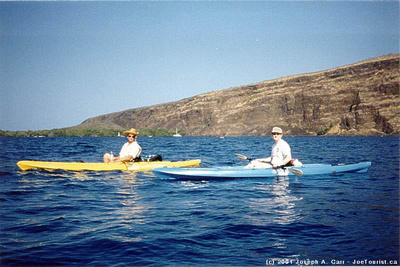
January 21, 2001 – A Snorkel and Kayak Trip to Kealakekua Bay, The Big Island of Hawai’i

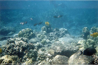
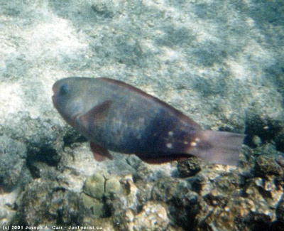
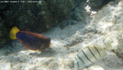
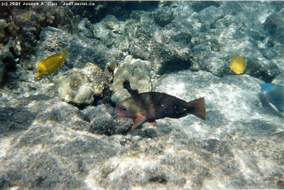
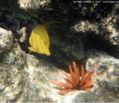
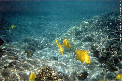
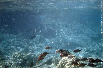
I am staying at A Place of Refuge B&B  (no longer in business) when our host Roger volunteers to take his guests on a kayak and snorkel trip to Kealakekua Bay and the Captain Cook Monument. This is my first time in a kayak. I find them to be very stable and easy to paddle (in calm waters, anyway). I use my Minolta underwater APS film camera for the first time while snorkelling the reef in front of the Captain Cook monument. This location is on the inaccessible side of Kealakekua Bay, so if you wish to explore this bay, you will need to either sign up for a snorkel cruise leaving from Kailua-Kona, or rent a kayak locally and launch it from Napo’opo’o. On our way across the bay, we see a Humpback whale, and we have a school of Spinner dolphins swim alongside us on the way back – both very special treats!

Roger is an experienced diver who visits this area regularly, so he goes exploring some underwater caves outside the reef. He reports that one cave has two sharks staying in it.

South Coast of Kaua’i, Hawaii

Jan 21, 2001 – South Coast of Kaua’i, Hawaii

It is a short drive from Lihu’e or Kapa’a to the Po’ipu Beach area, which is on the south shore of Kaua’i. Along the way, drive down the mile of Eucalyptus trees, growing tunnel-like on both sides of the road. Old Koloa town makes for an interesting stop, with lots of shops to browse through. It’s just like stepping back 50 years in time to an old sugar mill town. I bought some Kaua’i coffee here, but red dirt t-shirts are also very popular items. Coffee growing on Kaua’i is a relatively new venture, however the quality is starting to rival the more well-known Kona coffee grown on the Big Island. On to Po’ipu Beach, where there are many condos and luxury resorts with spectacular ocean views and golf courses, and then on to the blowhole at Spouting Horn Park.

Abandoned sugar mill and red dirt

Abandoned sugar mill and red dirt

The return trip took us past an abandoned sugar mill, near Koloa. Notice the famous red dirt, which is so fertile for growing sugar cane. The main sugar mill in Lihu’e was closed in 2000, leaving only one sugar mill running on Kaua’i near Port Allen. The sugar industry on Hawai’i is slowly being put out of business. They will have to find another agricultural crop to grow, or find some other use for this very fertile land.

One restaurant on Kaua’i I must mention is Gaylord’s Restaurant, located in the main building of Kilohana Plantation Estates (an old sugar plantation). There are some very nice shops in this same building, and they offer some quality merchandise, should you be so inclined. The restaurant service is impeccable, and the food is superb. Reservations accepted. Highly recommended!

September 29-30, 2010 – Nawiliwili Harbor, Kaua’i, Hawaii aboard the cruise ship Volendam

We dock in Nawiliwili this afternoon at 5:20pm (Sept 29th), and don’t leave port until the following afternoon. The Rotterdam is also docked as we arrive. She departs about an hour later – a lovely sight. As our gangway is put in place, complete with red carpet, a rain shower starts up – “welcome to Kauai”. We all stay aboard the ship this evening.

Headlands of Kaua'i as the Volendam departs

Headlands of Kaua’i as the Volendam departs

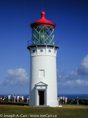
The following day, we decide to drive up the eastern and northern coasts of Kauai to a bit past the Hanalei Valley. We stop for a swim near Anini Beach and to see the Kilauea Lighthouse, and are back into town by 3pm and back onboard the ship by 3:30pm…well ahead of the 4:30pm All Aboard deadline. My friends and I have visited Kauai before, so this visit brings back good memories for all of us, and was a most enjoyable day.

The Kauai headlands at sunset are spectacular as the Volendam pulls out of Nawiliwili harbour

Na Pali Coast boat tour

January 20, 2001 – Na Pali Coast boat tour from Waimea area of Kaua’i

A small boat cruise to the Na Pali coast offers an excellent way to get out on the water around Kaua’i, do some snorkelling, see some whales, turtles and spinner dolphins (depending on the season), and get up close to the Na Pali coast without having to hike for days. I chose Liko Kaua’i Cruises, who operate the Na Pali Kai vessel, a fiberglass hulled, custom designed catamaran with twin Cummins diesels capable of moving the boat at a speedy 31 knots. The crew are knowledgeable about the area, they serve good quality food and drinks (no alcohol), and are very safety conscious. Liko’s offices are in the town of Waimea. You will need to check in there before proceeding to the dock in the boat harbor at Kikiaola (5 minutes further by car).

Sunrise from Kikiaola Boat Harbor, Waimea, Kaua'i

Sunrise from Kikiaola Boat Harbor, Waimea, Kaua’i

The cruise I chose departed at 7:30am, so I had to check in to the Liko office by 7am. Since there was road construction along the way, and I was driving from the opposite side of the island, I had to leave very early! Just to prove that I was up at the crack of dawn, have a look at the gorgeous sunrise photo!

The cruise took us past Barking Sands, all along the Na Pali coast almost to Ke’e Beach (where the North shore road stops. Along the way we saw numerous Humpback Whales (one baby a few days old) and Spinner Dolphins. We were within 50′ of the shoreline at times, so we saw the Na Pali coast up close. A very different perspective than from a helicopter.

They served us a very nice deli lunch and soft drinks on the way back. As soon as we rounded Mana Point (Barking Sands), the afternoon swells hit us full tilt, making for a roller coaster ride back to the harbor. However, along the way we were treated to an adolescent Humpback whale doing repeated breaches, flipper flapping, and other acrobatics. Although we didn’t get to snorkel due to the choppy seas, the whale made a memorable ending to a very successful cruise.

Free advice

Taking photos of whales, dolphins, turtles and fish consumes huge amounts of time you could otherwise spend enjoying these creatures. If the opportunity presents itself, by all means take a photo or two…otherwise buy some postcards!

There are many cruises to the Na Pali coast to choose from. I would suggest you select one that either leaves from Hanalei Bay (only two operators do this), or choose an operator who has a very fast boat (such as Liko) if they leave from the Waimea (southwest) coast area. It is over 20 miles by sea from Waimea to the start of the Na Pali coast (Polihale area). It is only 5 miles to the start of the Na Pali coast (Ka’ilio Point) from Hanalei Bay.

Helicopter tour of Kaua’i, Hawaii

January 19, 2001 Helicopter Tour – Lihu’e, Waimea Canyon, Na Pali Coast, Hanalei, Kawaihau

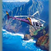
Jack Harter Helicopter Tours

Jack Harter Helicopter Tours

Jack Harter Helicopters started the helicopter tour business in Kaua’i, and they came recommended by the B&B I was staying with. They use six passenger Eurocopter AStars custom-equipped with the largest windows and a unique cabin layout, giving passengers the best views possible. They also offer doors-off flights with their Hughes four passenger helicopters for those who want an extra thrill, or for dedicated photographers who want to avoid window reflections in their photos. I learned from my trip to the Grand Canyon that helicopters are an excellent way to see the country, so I decided to spend the money on this tour.

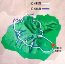
Jack Harter Helicopter tour map

Jack Harter Helicopter tour map

The tours start at the Lihue heliport, which is adjacent to the main airport, but you need to check in at the Jack Harter Helicopter office, which is located very close to the airport. You will be briefed on safety procedures and then driven to the heliport. Takeoff was smooth – an indication of the rest of the flight. We flew around Kaua’i in a clockwise direction.

South Coast

Looking over Ha’upu (Hoary Head) Ridge from the air offers a gorgeous view towards Kipu Kai, Kawai Point, and the Menehune Fishpond. The spectacular Mana Waipuna Falls is next on the itinerary, and as we proceed toward Waimea Canyon, we fly over Olokele Canyon and can see the irrigation ditch which supplies the fields in this normally arid area with water for the sugar cane crops.

Waimea Canyon

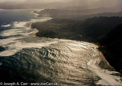
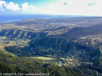
Driving to Waimea Canyon by car presents some spectacular vistas, but seeing this canyon from a helicopter is a whole new experience. As we approach the canyon from the south, we catch glimpses of the colors and water courses that make this canyon so interesting. The red rock and soil that makes up so much of Kaua’i is laid bare in this area of high erosion. The vistas from the head of the canyon looking back south show the way the layers of mountain ranges fades into the sea, and we get an excellent view of Barking Sands from high atop the ridge just before we dip over the top and catch our first glimpse of the Na Pali Coast.

Na Pali Coast

Our first glimpse of the Na Pali coast as we clear the ridge line wows us with the view of the Kalepa Ridge cones on the  Na Pali coast. Streaming sunlight over the mountains is simply magical; the high surf makes the Na Pali coastline stand out. This is simply awe-inspiring. There is no substitute for seeing the Na Pali coast from a helicopter.

Hanalei & Central Mountains

Maniholo Bay & Ha'ena Pt looking toward Hanalei

Maniholo Bay & Ha’ena Pt looking toward Hanalei

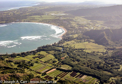
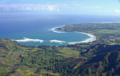
As we leave the Na Pali coast and head past Ha’ena Point, the beautiful Hanalei Bay comes into view. Maniholo Bay & Ha’ena Point frame pretty Hanalei Bay, with Princeville further down the coast. We fly close to falls in the mountains behind the valley, which are the source of the Hanalei River. In quick succession as we cruise down the coast towards Lihue: the Makaleha Mountains, fantastic Keana’awi Falls shrouded in cloud , beautiful Kohalalele Falls, showing us the wettest place on earth are the central peaks of Kaua’i – Wai’ale’ale and Kawaikini.

East Coast & Lihue

As we approach Lihue and the end of our tour, we see Wailua Falls and look north along the east coastline over Hanama’ulu Bay, productive farmlands, the upper Wailua River, and glimpse the Sleeping Giant. We float down on the helicopter pad and reluctantly return to our land-based existence.

What was the highlight of the helicopter tour? The Na Pali Coast was a clear winner, although seeing the Waimea Canyon from the air was interesting after having driven there the day before. The Hanalei Valley is even more beautiful from the air. Incidentally, the narration from the helicopter pilot was amazing. He had facts, figures, answered our questions, and had some very interesting stories to tell the whole time we were airborne. He even knew when to be quiet, and let us enjoy the amazing views!

I enjoyed this helicopter tour immensely – this is a vacation highlight you should not miss!

Waimea, Kaua’i, Hawaii

January 18, 2001 – Waimea – Waimea town, Hanapepe, Waimea Canyon, Barking Sands

If you are staying on the east coast of Kaua’i, the drive to the west coast make a nice day trip by car. The only working sugar mill is located at Port Allen, and they offer tours. Call ahead, since the tours are limited. Hanapepe and Waimea are agricultural centers for sugar cane, and both towns have boat harbors. Salt Pond Beach Park is just off the highway at Hanapepe – follow the signs. A nice beach for all ages, basic facilities, and limited camping.

The little town of Waimea is the gateway to the Waimea Canyon, which is a “must see” while you are on Kaua’i. There are two roads to Waimea Canyon, but I would recommend the Kokee Road, which is a right turn 3.6 miles past the town of Waimea. The sign is easy to spot from the highway. Just follow this very steep road with lots of curves, and stop at the lookouts along the way. Take your time, and enjoy the views along the way. After you leave the main highway, there are no gas stations or facilities other than a primitive bathroom at the main lookout, so take your own water and food, and fill the car with gas.

This side of Kaua’i is very dry, and if there was no irrigation, no productive crops would be possible. Irrigation ditches were established by the Robinson family when they originally acquired this land from the Hawaiians, and these ditches are still in use today. They can be seen from the air and you can catch glimpses of them from the Waimea Canyon roads.

Barking Sands is a missile testing range, and military airport. Restricted access is usually granted to civilians if you provide identification. Major’s Bay is worth visiting, but is inside Barking Sands, so you will need ID. Further along is the longest sand beach with the fewest people on it you will find anywhere in Hawaii! If you are adventurous, drive to the end of the Kaumuali’i Highway past Barking Sands base, and drive five miles further along the coast to Polihale State Park. This is as far as you can travel by car along the west side of the Na Pali Coast, and your car rental company may forbid you to go here.

Limahuli Gardens, Kaua’i, Hawaii

January 17, 2001 – Limahuli Gardens, Kaua’i, Hawaii

This botanical garden is located in Ha’ena, near the end of the north shore road. Be sure to allow yourself over an hour (two hours is better) to explore these botanical gardens. You don’t have to be interested in plants to appreciate the rare window to ancient Hawai’i which Limahuli Gardens offers its visitors.

Only basic facilities are available: composting toilets are located at the visitors’ center, drinking water is supplied along the way, and a guide book is part of the modest admission fee. Mosquitoes can be a problem in this wet area (Skin-So-Soft is provided), and rain showers are frequent but usually brief (ponchos and umbrellas are provided). Please stay on the well-marked pathway provided, and be sure to stay hydrated by sipping water from each station where it is provided for your use. Parts of the path are steep, and may not be suitable for those with mobility issues or certain medical conditions. Access beyond the parking lot for those who have limited mobility can be a problem, so check with the facility for current info.

Makana Mountain towers above Lumahuli, and was given the name Bali Hai by the producers of the movie South Pacific. In Hawaiian “Makana” means “gift”, giving us a clue to the importance of this mountain in ancient Hawaiian life. Makana was used for the ‘oahi fire-throwing ceremony, where light, dry logs were set aflame and flung off the mountaintop. The strong winds would carry the firebrands as far as a mile out to sea. This ceremony was reserved for very special occasions.

Pohaku-o-Kane means Stone of Kane. Ancient Hawaiian legend tells us this rock is very significant. Kane (the rock) and his brother and sister were rolling around on the ocean floor long before humans inhabited Hawaii. They all liked Kaua’i and decided to stay here. His brother and sister fell asleep on the shore nearby, but this rock was determined to climb to the top of the ridge. He tried and tried, but each time he fell back until Kane (a Hawaiian god) helped him to the top of the mountain ridge. In return, the rock promised to remain awake and watchful, and report everything he saw to Kane. Personally, I believe the legend – what other explanation can there be for such a large rock to be perched so precariously atop a high ridge, and remain there for so long?

Lumahuli is a special place which gives me good feelings. Take the opportunity to rest for awhile at the Lookout. Gaze around to fully appreciate the natural beauty, and soak up some of your own good feelings from this place to carry with you in your travels through these special islands.

North Coast of Kaua’i, Hawaii

January 17, 2001 – North Coast of Kaua’i

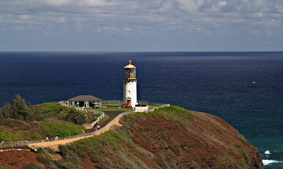
Kilauea Point, Kaua'i
Kilauea Point, Kaua’i

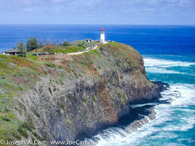
Kilauea Point National Wildlife Refuge, is north of Kapa’a on the Kuhio Highway. Watch for the signs and turn right to get to Kilauea Point and the little community. There is no entrance fee, but please drop a donation in the boxes provided. The lighthouse grounds can be home to wildlife. We found an Albatross on a nest, and the nearby cliffs are covered with nesting Shearwaters, Red Boobys, and Laysan Albatrosses. Kilauea Point is the most northerly point on Kaua’i, and Kaua’i is the most northerly of the Hawaiian Islands, so I assume this why the birds find this a good location for nesting. I also spotted a flock of about 6 Nene Geese (native Hawaiian goose).

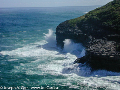
When the Trade Winds are high, this area around Kilauea Point experiences huge surf, causing some spectacular wave action. Moku ‘Ae’ae Islet and blowhole is a sight to see just off Kilauea Point. There is a small community at the turnoff to Kilauea Point, and I would recommend Kong Lung – a funky store filled with unusual gifts some might be interested in. I also recommend the Lighthouse Bistro for lunch or dinner (located beside Kong Lung). You can’t go wrong ordering their fresh fish of the day. Very good food – highly recommended.

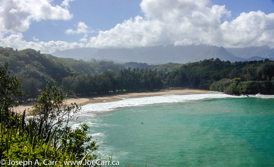
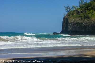
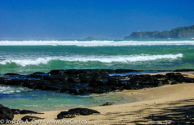
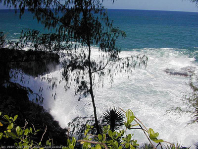
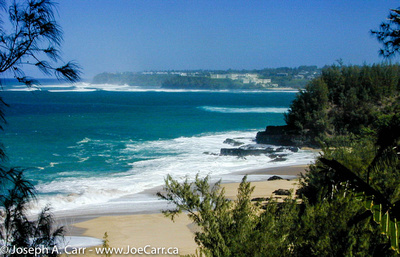
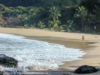
Just past Kilauea Point is Anini Beach County Park. This is a good spot for a picnic lunch, and the fantastic white sand beach is rarely crowded. Anini Beach would make an ideal destination for a whole day’s outing, since it one of the safest for swimming (not too common on Kaua’i due to the offshore reef and strong currents), and it has good picnic facilities. Another good beach just past Kikauea Point is Kalihiwi Bay. As you can see by the photos, the surf was up while I was visiting in January 2001, so no swimming was possible. The surfers were certainly out there riding the waves, although the emergency rescue was called while I was there, so it was even a bit too rough for some of the surfers!

Princeville is the next community along the North Coast. It is one of those planned communities, which are so common in Hawaii. Everything revolves around the superb golf courses, and yet I find all of them so sterile and cold. No doubt the exclusive properties are very expensive to purchase, and yet they hold no appeal to me whatsoever.

Hanalei Valley
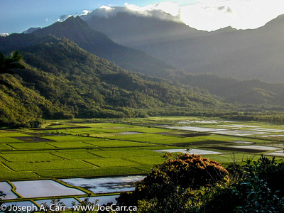
Hanalei Valley

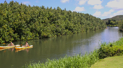
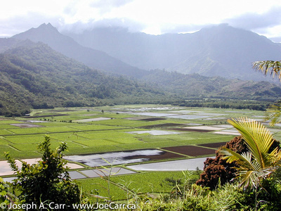
Past Princeville is the Hanalei Valley, which is very picturesque. Hanalei is a small community located on a superb little bay with the same name. The valley is rich and fertile, and many crops are grown here, including lots of taro. Needless to say, there is a great deal of rainfall in this area. Hanalei Bay can experience spectacular surf when the winds are high. If you rent a kayak, stick to the inland waterways.

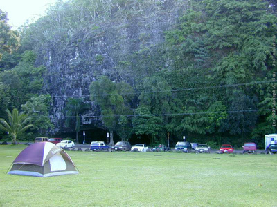
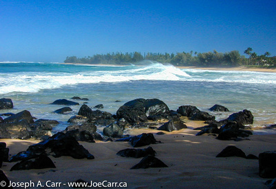
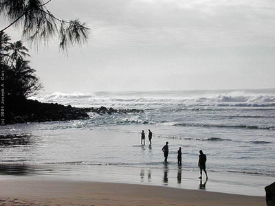
Ha’ena Beach (aka Tunnels Beach) is normally calm and is a good beach for swimming and snorkelling, but as you can see by my photos, the surf can get very high. Ke’e Beach is much smaller than Tunnel Beach, but it is the end of the north shore road. While you are there, have a look at the Waikanaloa Wet Cave.

Near the end of the North Shore road is the Limahuli Gardens, but they deserve their own article!

East Coast of Kaua’i, Hawaii

January 16-21, 2001 – East coast of Kaua’i, Hawaii

As mentioned on the main Kaua’i page, I stayed at Kakalina’s Bed & Breakfast for the week I spent on Kaua’i in 2001. Kathy still runs this B&B, and it continues to get high ratings.

Wailua Falls, Kaua'i

Wailua Falls, Kaua’i

Before leaving Lihue, take the Ma’alo Road (near the old sugar mill) and drive the short distance to see Wailua Falls. Afterward, proceed northward along the east coast of Kaua’i along the Kuhio Highway. First stop is the spectacular Opaeka’a Falls, and the view of the Wailua River across the road from the falls lookout. If you continue driving up the road to the end, you will find the Keahua Arboretum. I would not recommend taking the boat cruises along the Wailua River. The fern grotto and other sights along the way are underwhelming, although Tripadvisor gives these cruises high marks, so some may like it. The best way to see the Wailua River and falls is to drive to the lookouts on the hills surrounding the river valley (easy), and ideally take a helicopter tour of the whole island (expensive).

The Poliahu Heiau is adjacent to Opaeka’a Falls. Heiaus (or temples) are holy places for Hawaiians, and were used extensively by the ancient Hawaiians. Most heiaus consist of rock walls, and platforms made of rock. Spiritual leaders ensured that the mana (spiritual power) was respected by all, and they also enforced the kapu (sacred rules of life). For more info on Hawaiian sacred places, please refer to a more extensive discussion off my Big Island page which highlights Puuhonua o Honaunau.

Next up the highway, is the town of Kapa’a. This is a good place to pick up snack food, fruit and drinks, all at reasonable prices.

  • Pono Market – hot & cold food to go & sushi – inexpensive & good – where the locals shop for takeout! This place continues to be a must-try according to the enthusiastic Yelp reviews.
  • ABC Store – best place to buy cold beverages and snacks, and the best prices on the standard Hawaiian souvenirs.
  • Farmers’ Markets – If you want the freshest food, and delicious local snacks, you need to find a local farmers’ market!

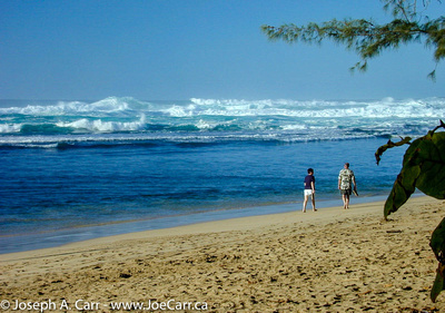
Wandering an east coast beach

Wandering an east coast beach

There are some restaurants scattered along the eastern shoreline of Kaua’i, and they are worth finding and trying out, since many cater more to the locals than tourists. There are resorts along the east coast, but they tend to be more modest than those you will find elsewhere on Kaua’i. There are also many public beaches along the eastern shoreline. They are well worth exploring, since they are less crowded than other areas of the island. In particular, Anini Beach is a great spot to spend the day after picking up your picnic lunch in Kapa’a.