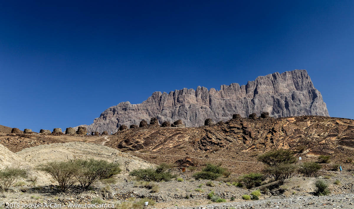
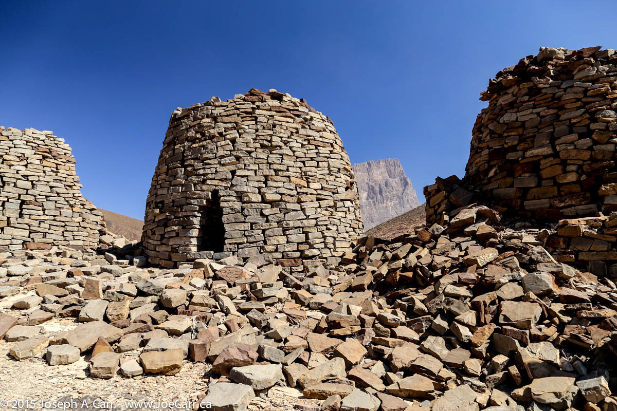
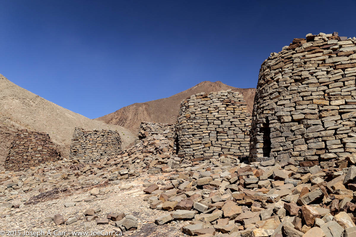
After driving down the steep roads from Jebel Shams, we visit the beehive tombs at Al Ayn.These tombs are about 5,000 years old, although not much is known about them. This means the necropolises were built in the same era as the Egyptian pyramids. The tombs are fascinating and quite photogenic, however as we descend from the ridge to return to our 4x4s, the wind picks up and a sand storm blasts everyone as we hurry to get back inside our vehicles.
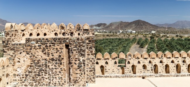
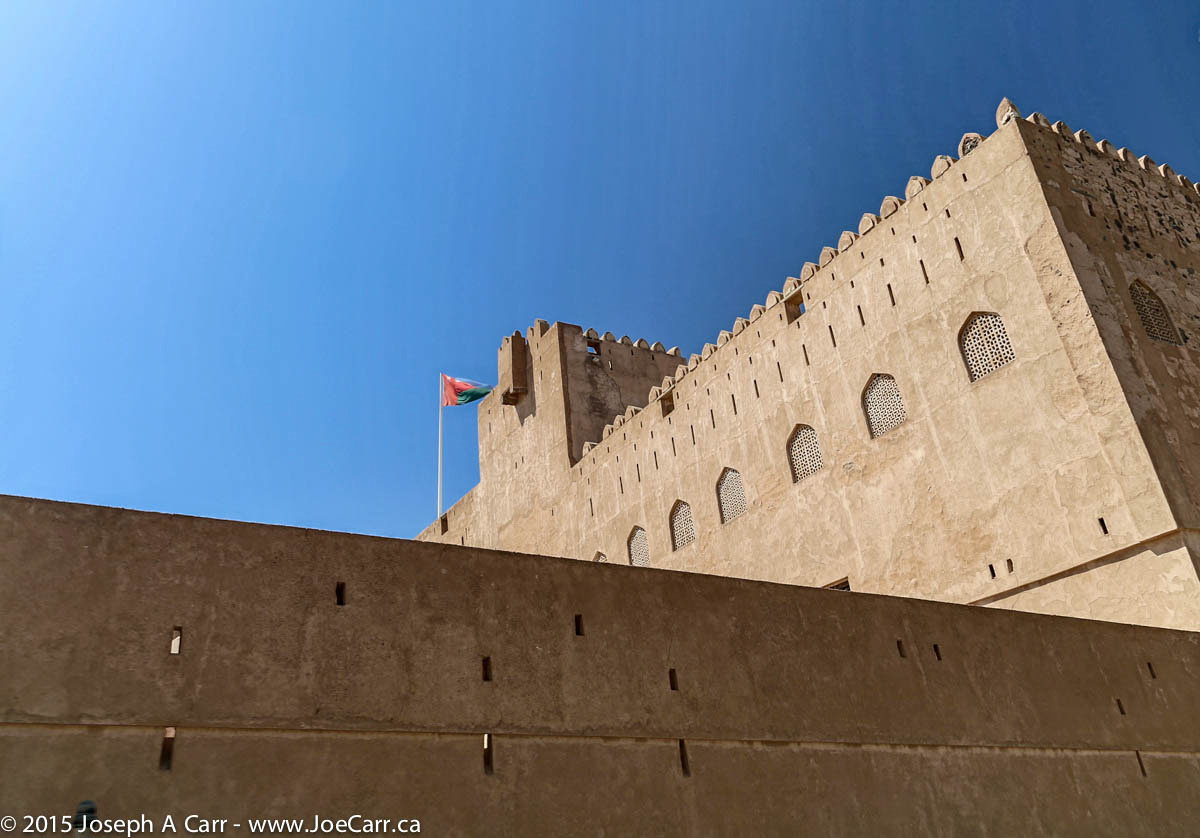
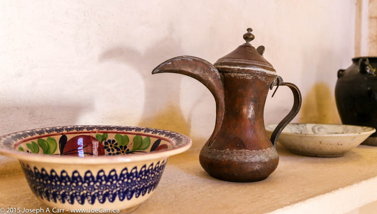
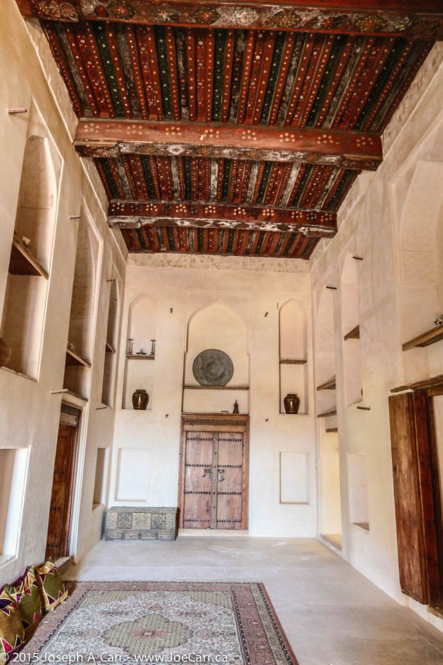
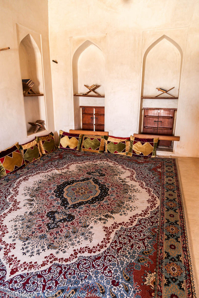
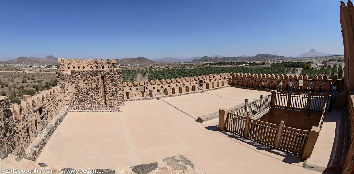
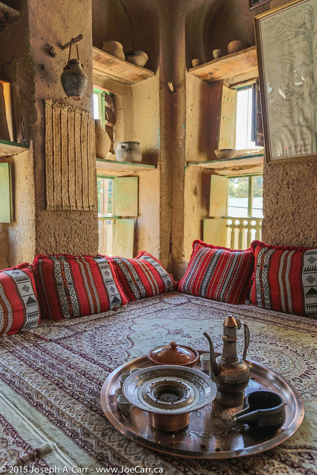
Next stop is Jabrin Castle, which was built by the Yaruba dynasty Imam Bil’arab bin Sultan, who ruled from 1679 to 1692. This is without a doubt the most impressive castle or fortification we have visited in Oman. It is a UNESCO World Heritage Site, is beautifully restored, and is surrounded by groves of palm trees in a lush valley. The castle has impressive wooden painted ceilings in some rooms.
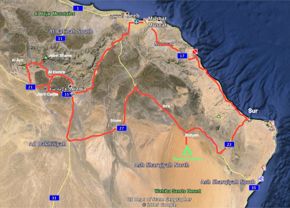
After driving back along the highway to Muscat, we say goodbye to our driver Ali, who drops us off at the City Seasons Hotel. He has been an excellent driver; taking us over sand dunes at Sharqiya Sands, along back roads to Bedouin camps, and zooming up and down both expressways and mountain roads. It has been a wonderful driving adventure in our 4x4s over the last five days. Tomorrow, we return to Dubai by bus for our final day in Arabia before returning home.
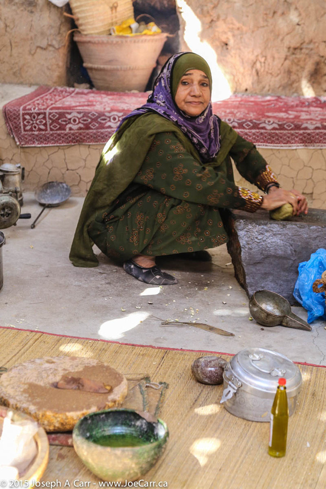
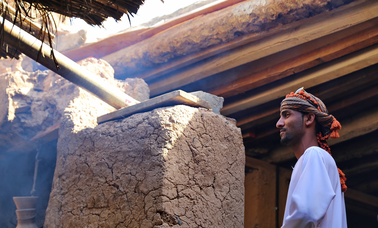
Omani man eating some dates – lunch stop, Al Hamra oasis
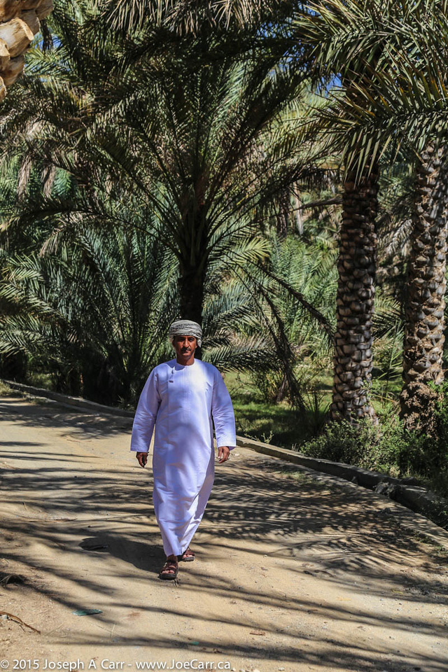
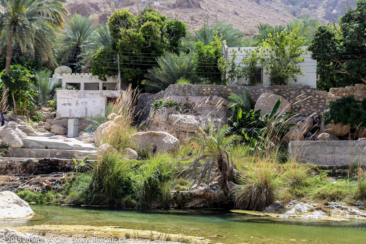
After leaving our palatial hotel in Nizwa, we stop for lunch in the Al Hamra oasis, and make a brief stop to see the abandoned Persian village of Ghul before climbing 2,000 metres up into the mountains. Our destination is Jebel Shams (Mountain of the Sun), Oman’s highest mountain at 3,028 metres (just over 10,000 feet). We stay at the Jebel Shams Resort, which is at the end of a long, winding and steep road. The resort is situated a few hundred metres from Wadi Ghul, the Grand Canyon of Arabia.
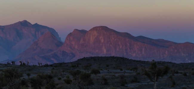
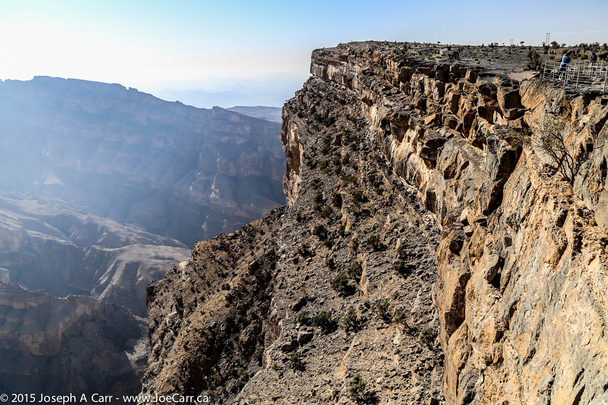
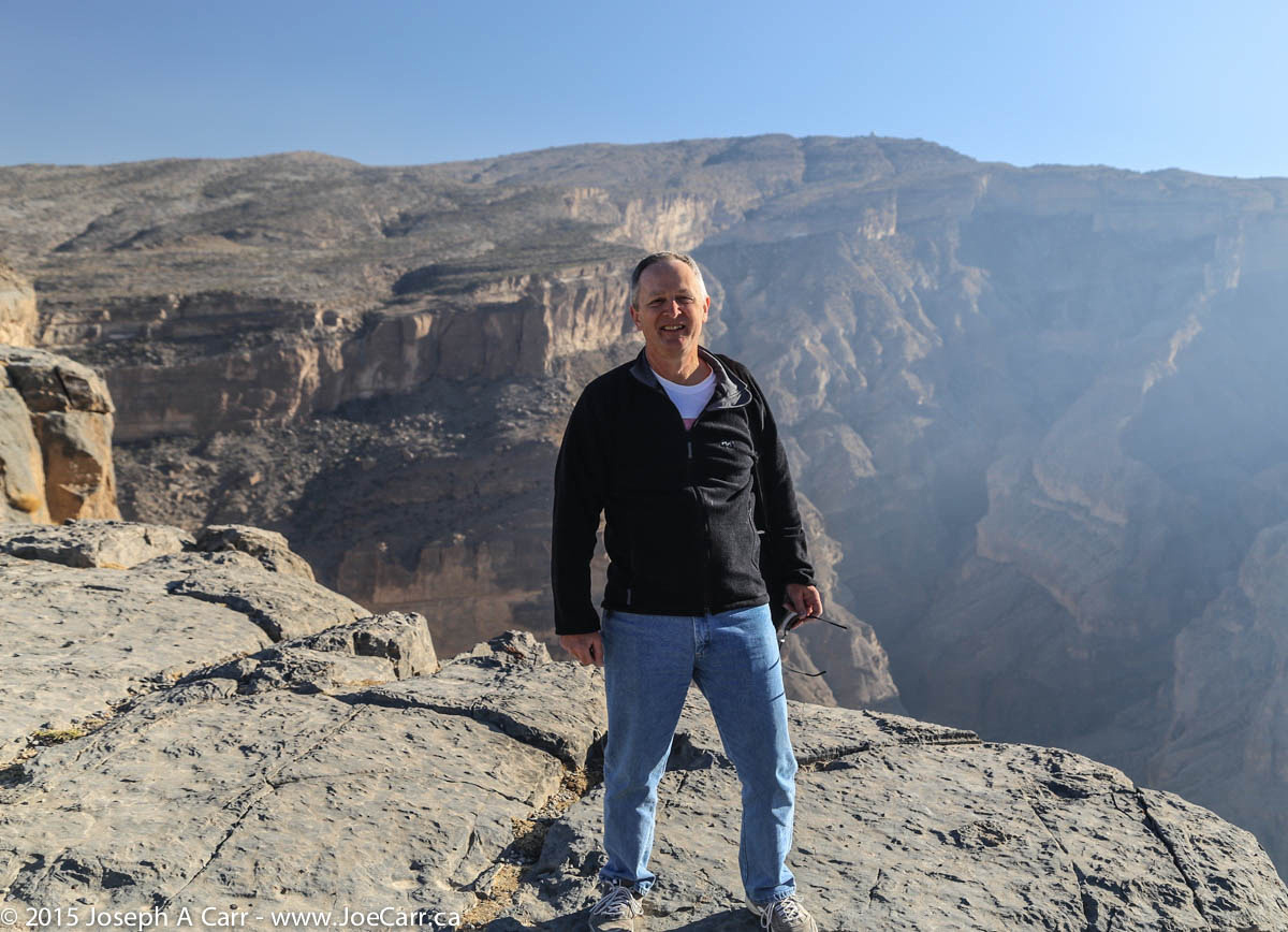
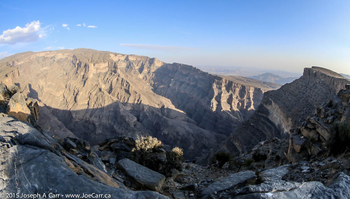
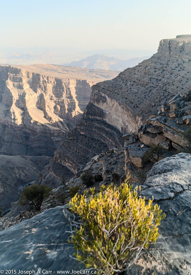
I walk over from the resort to the rim of the canyon before dinner, and find a spectacular sight that is much deeper than the Grand Canyon in Arizona. I peer over the edge of Wadi Ghul to a small abandoned village barely visible almost 1,000 metres below! The wind is terribly strong, but at least it is blowing up the canyon and over the rim, so it isn’t a safety hazard. I find taking photos of the canyon in the late afternoon very challenging, and resort to bracketed photos and HDR settings.
Jebel Shams Resort has pretty basic accommodation compared to the luxury we have had so far on the tour. I keep the electric heater going in my room, since at this elevation, it gets very cold at night. The Internet connection is down, so I use my time this evening to catch up on my journal and tag my photos with locations and titles.
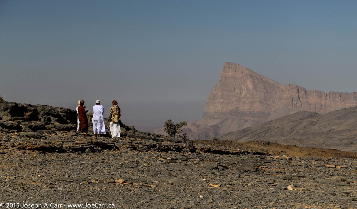
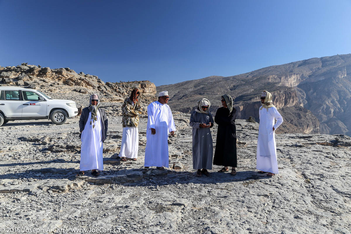
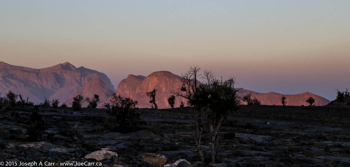
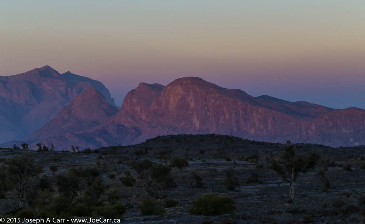
I get up before dawn this morning and take some photos of the mountains bathed in the pre-dawn light. The pre-dawn view of the mountains, the Earth’s shadow and the Belt of Venus is spectacular! After an early breakfast, we drive (as a group) the short distance from the resort to see and photograph Wadi Ghul after sunrise, and then drive down the mountain and onto the wadi and other sights before returning to Muscat and civilization.
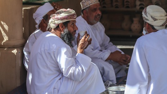
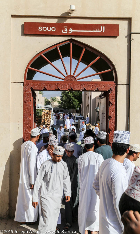
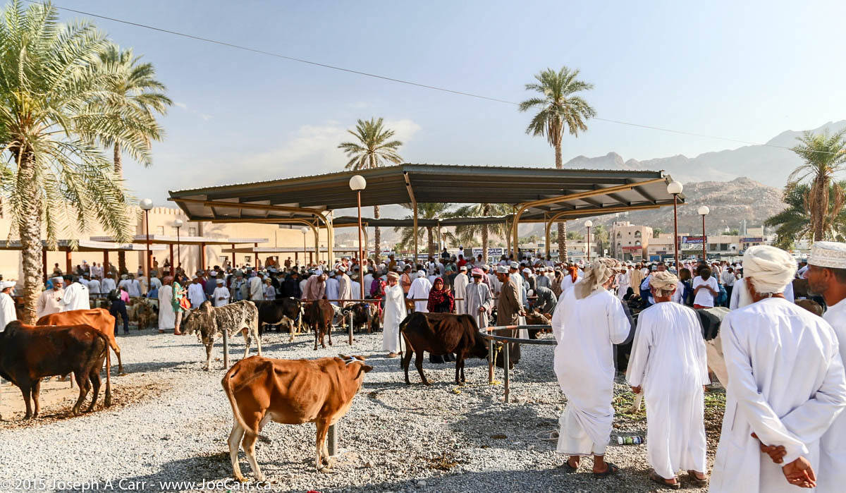
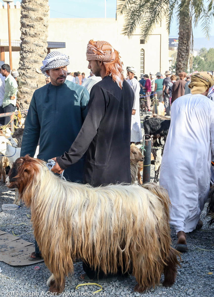
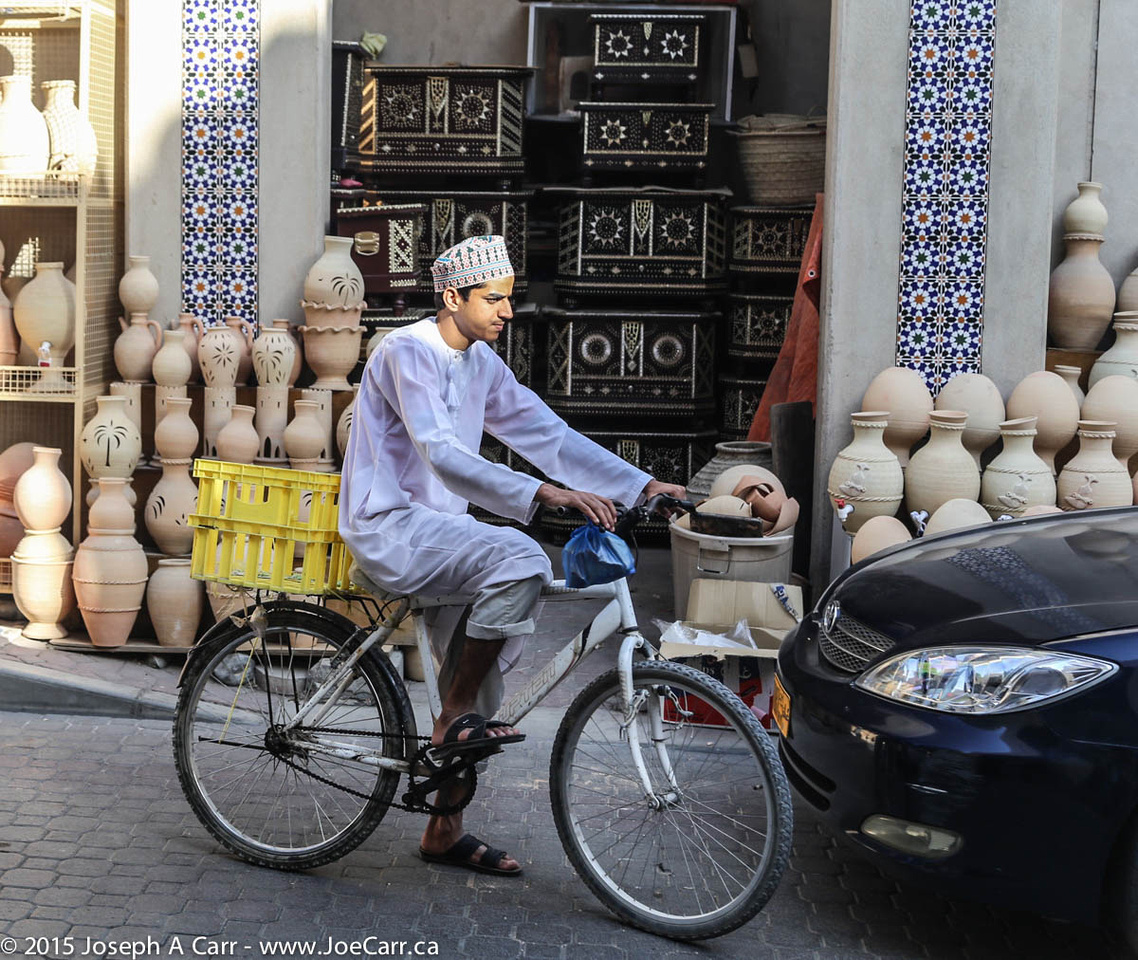
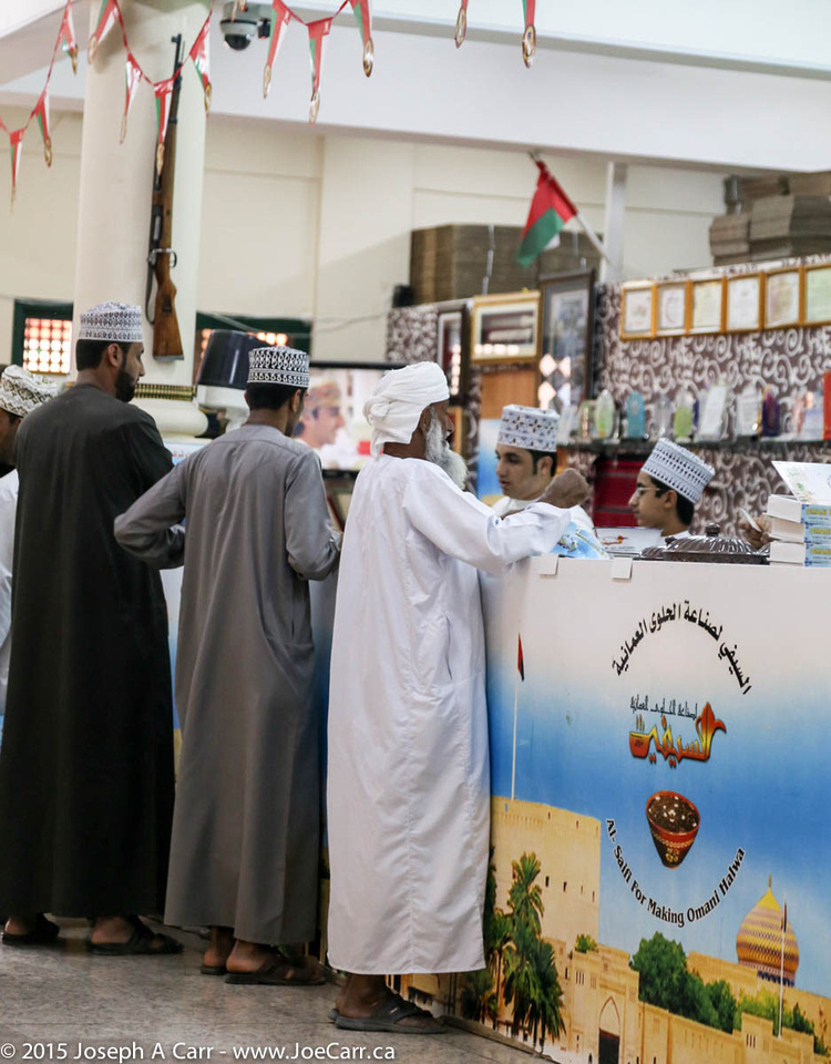
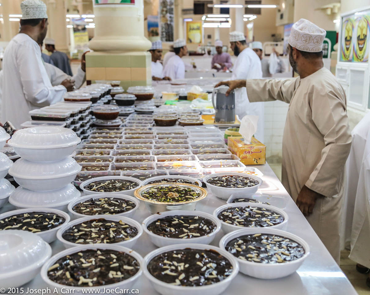
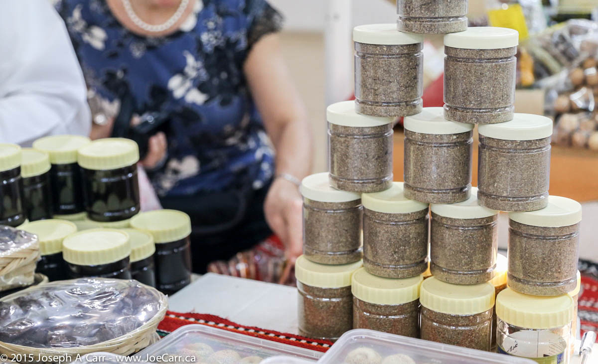
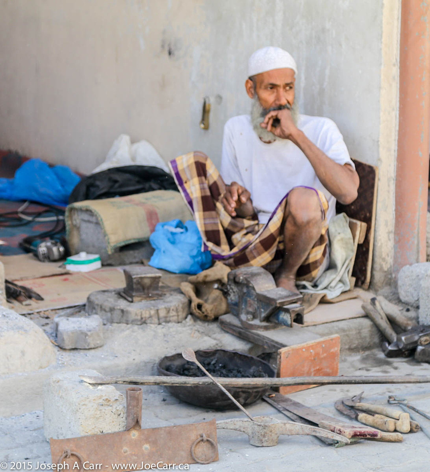
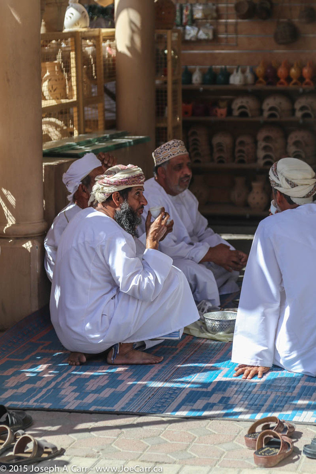
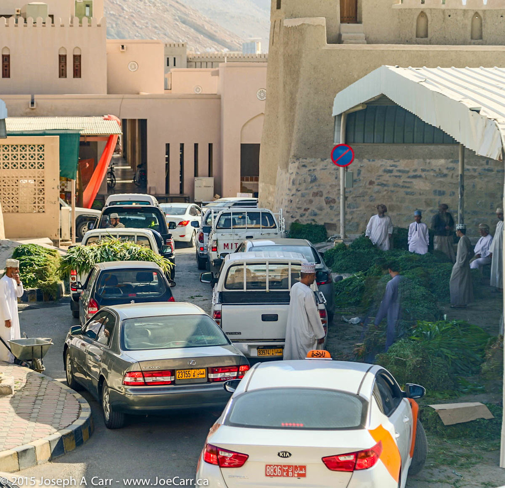
It is another full day today, beginning with a visit to yet another souq: the Nizwa Souq. This souq is perhaps the most interesting of them all, since it is huge, and offers an amazing variety: cattle and goat market, butchered meat, fruit and vegetables, silver jewelry (especially silver khanjars – traditional daggers of Oman) and crafts. The Halwa shop (Omani sweets) is undoubtedly the busiest place in the whole souq. However, there are no camels at this livestock sale. In addition to the large number of locals, there are lots of tourists at the souq…and everyone arrives early!
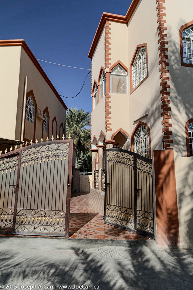
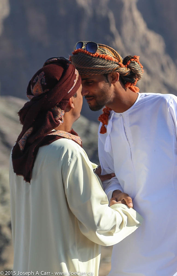
I have lots of time to people watch, and yet I see only one woman the whole time I’m there. Omani men (and their sons) are doing the shopping, at least at the souq. Nizwa’s fort is on the edge of the souq. It was built in the 17th century, and dominates the city with a 40 metre (125 foot) high huge round tower. I walk the back streets to see where the residents live. It is considerably quieter away from the souq, and the city appears to be very well developed, and offers its residents a good quality of life.
The oasis at Al Hamra
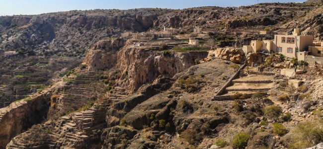
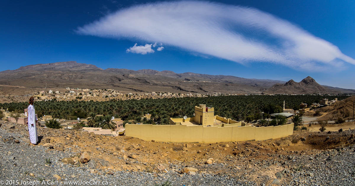
After leaving the souq, we visit the oasis village of Al Hamra, at the foot of the Hajar Mountains. This village is one of the oldest in Oman, and has a well-preserved row of two- and three-story mud-brick houses built in the old Yemeni style. We visit a traditional Omani house (Beit al-Safa) and have lunch in the oasis.
After leaving the oasis, we climb 2,000 metres up the tallest mountain in Oman, Jebel Shams. We are staying at Jebel Shams Resort, situated across the road from Wadi Ghul, the Grand Canyon of Arabia.
A camel in the back of a pickup truck & a goat being led away at the Sinaw Thursday Souq
We depart our desert camp early this morning for Sinaw, whose Thursday souq attracts many Bedu from Sharqiya Sands. Omani women who are Bedouin have more visible social roles than other Omani women. They wear brightly coloured costumes with peaked masks and an abeyya of gauze. I find some shade while we are at the souq in Sinaw and spend my time taking people photos using my long telephoto zoom, since the people here are camera-shy.
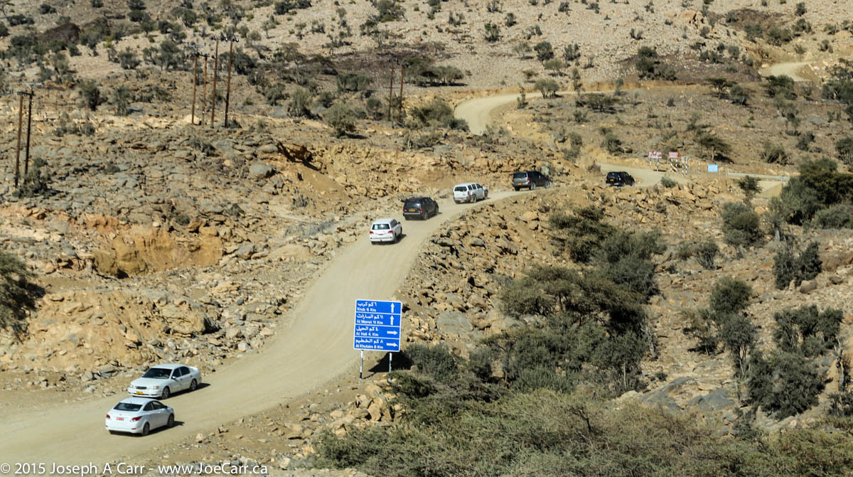
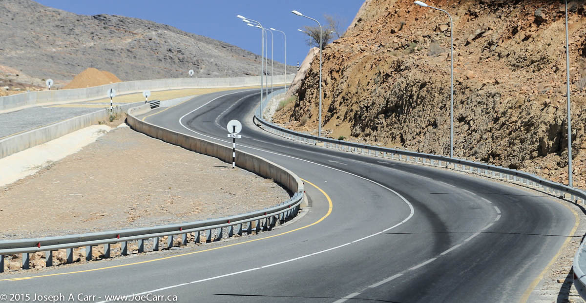
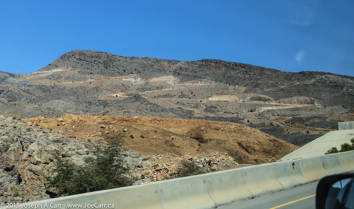
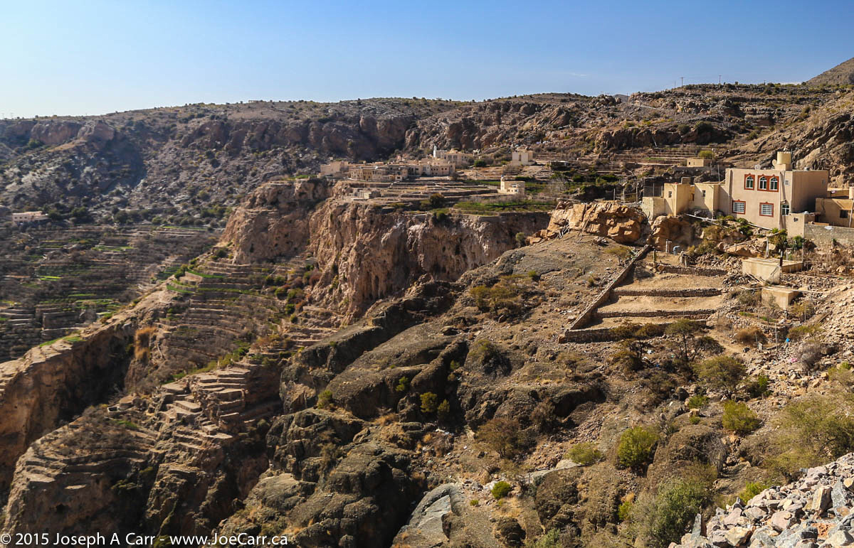
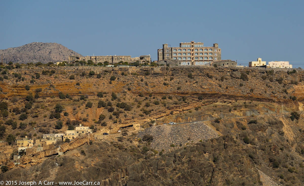
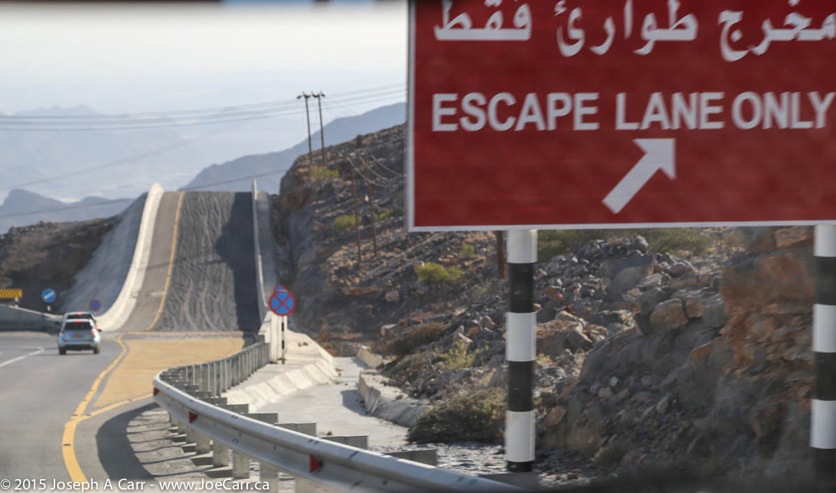
After leaving the souq, we climb some roads near Birkat Al Mouz which are controlled by the army for some reason. The road is extremely steep and also has sharp curves, so our 4x4s get a good workout today on Oman’s spectacular mountain highways! Two of our 4×4 vehicles have broken down so far, but the local tour company is replacing them with no delays. We drive through the lower plateau of Jebel Akhdar, where most of the market-gardening happens in terraced plots in small villages clinging to the steep hillsides. We have a wonderful buffet lunch at the very remote Jabal Akdhar Hotel., which is 2,000 metres above sea level.
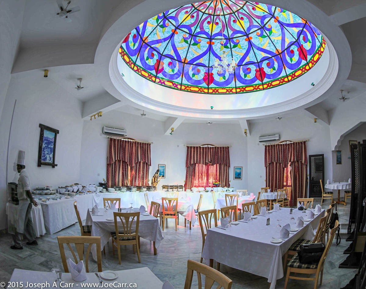
Our final destination today is Nizwa, a large city which lies on a plain surrounded by a palm oasis and some of Oman’s highest mountains. Our Golden Tulip Nizwa Hotel is quite palatial!
We drive out of the desert camp and take the highway to Ibra, where we wander around the Wednesday Woman’s Souq. On the way back, we see the 400 year old town and fortifications of al-Mudayrib, where the buildings are made out of mud.
Old wooden doors, Al Mudhaireb
A Bedouin man in his living room – Sharqiya Sands
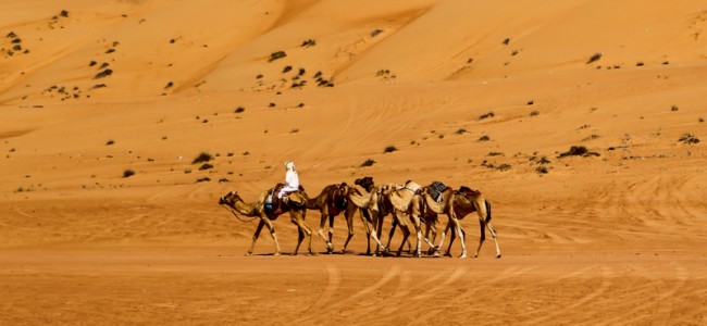
We travel across the dunes once again to a Bedouin camp, where we see some of their handicrafts (some people buy), and have a traditional lunch under the shade inside their reed houses. A couple of our group have a ride on a camel.
It’s very hot by this time, so we are all glad to climb back into our air-conditioned vehicles for the ride back to our air conditioned rooms and nice showers at our luxurious desert camp!
Oman & UAE group photo at Sharqiya Sands
Our tour leader Michele organizes a group photo in front of the sand dunes late this afternoon. We manage to find a camel to stand behind, and it behaves itself very nicely while we pose in the afternoon heat. I opt out of this evening’s 4×4 drive to the sand dunes at sunset, since I need some down time.
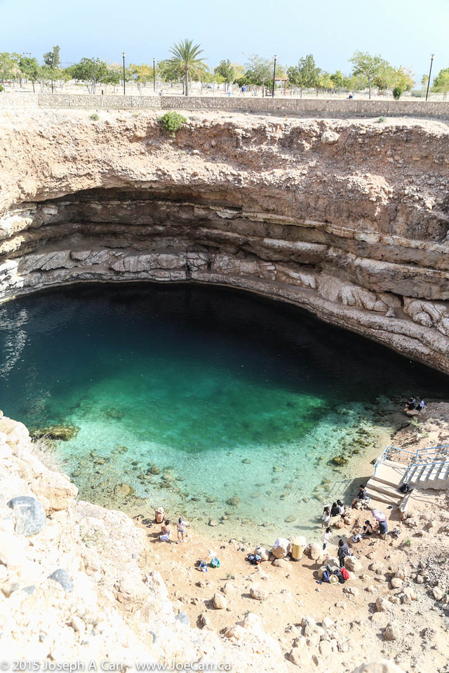
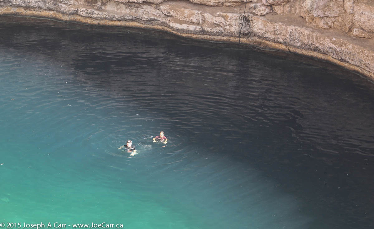
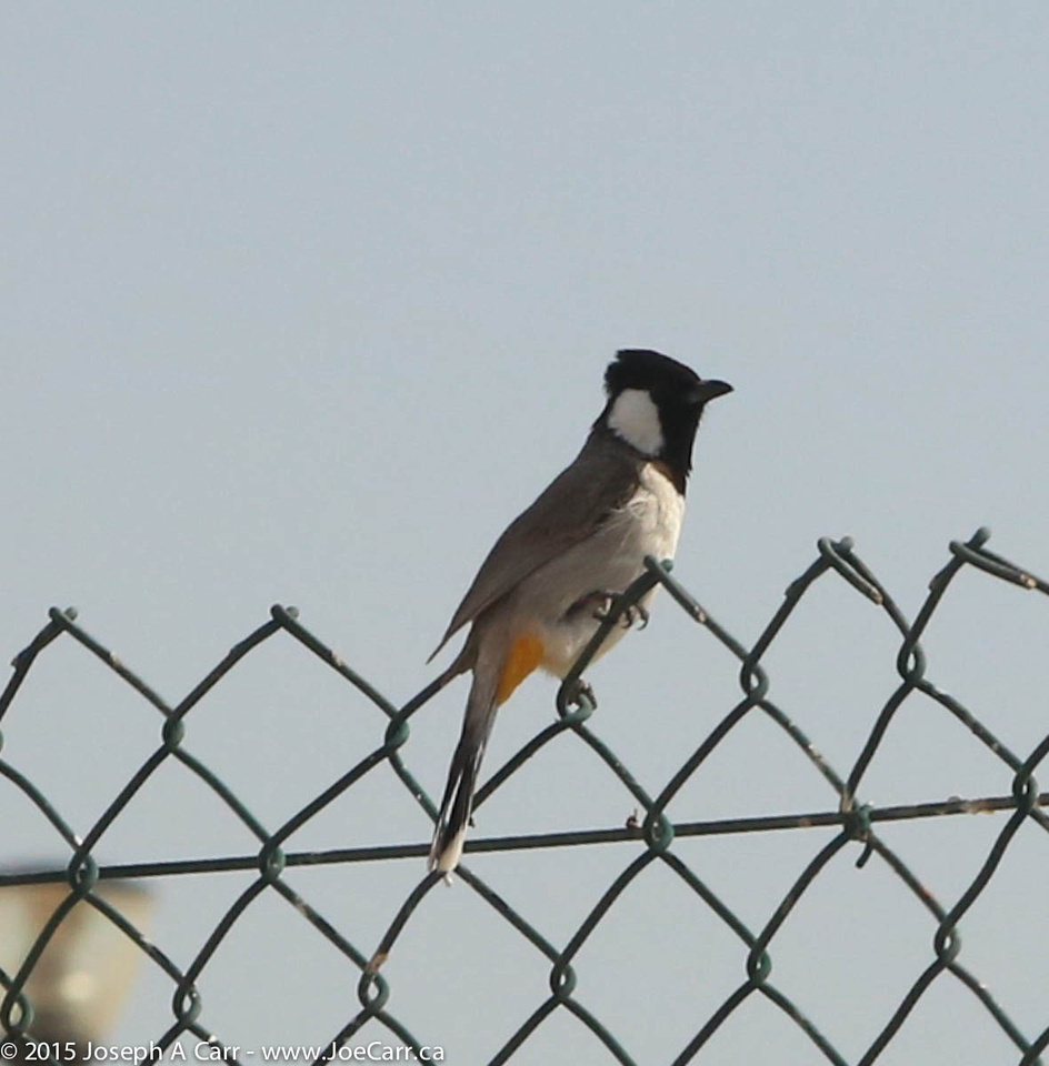
We drive from Muscat along a new inland road to our first stop to see a large sink hole, where some people are swimming – Bimmah Sinkhole is in Muntazah Hawit Najam Park. This otherwise sun parched area obviously has water below ground, since there is vegetation here and I even spot some birds.
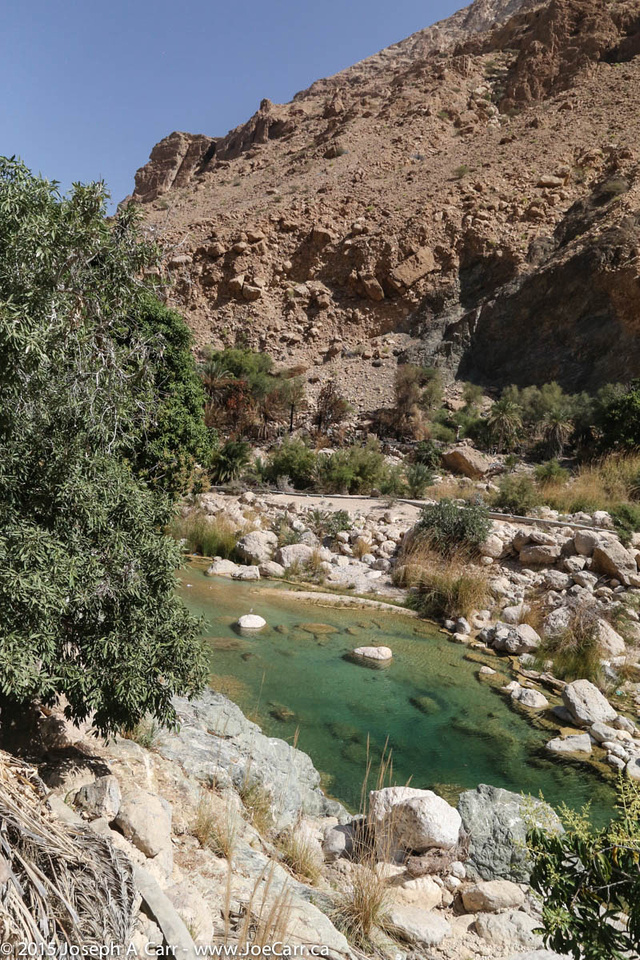
Our next stop is Wadi Tiwi, which is a lush river valley just a short distance from the coastline. The plantations and a string of emerald-coloured pools in the narrow valley are especially beautiful as we walk along the narrow road, which winds up the valley from village to village.
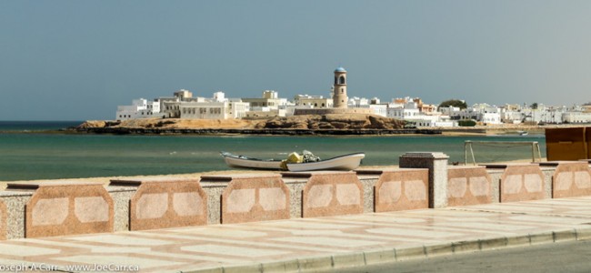
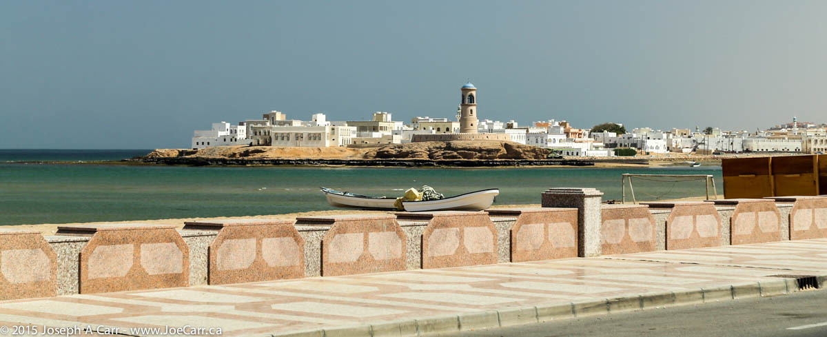
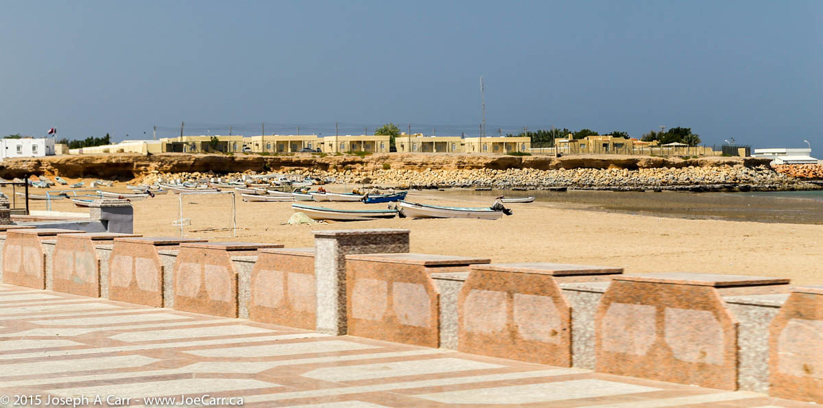
We stop for lunch in the sleepy little seaside town of Sur. There is a wonderful view across Sur’s corniche, beach and fisherman’s boats to the nearby village of Ayjah, with its whitewashed houses and dhow-building yard (see banner image above).
A couple of hours later we approach the small town of Bidiyah, where we turn off the main road to drive across a sand road for about 11km to Desert Nights Camp, where we stay for two nights.
It is pretty luxurious considering it is setup in the desert along with another more modest camp about a kilometre away. Sharqiya Sands (aka Wahiba Sands) is a large area of rosy-hued dunes, some of which are over 100 metres high. We quickly get settled and then go out on a dune ride to see the sun set over the sand dunes.
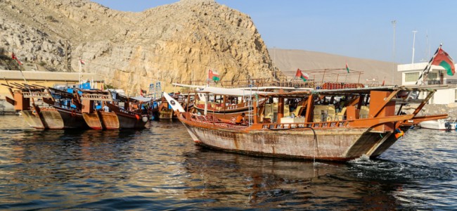
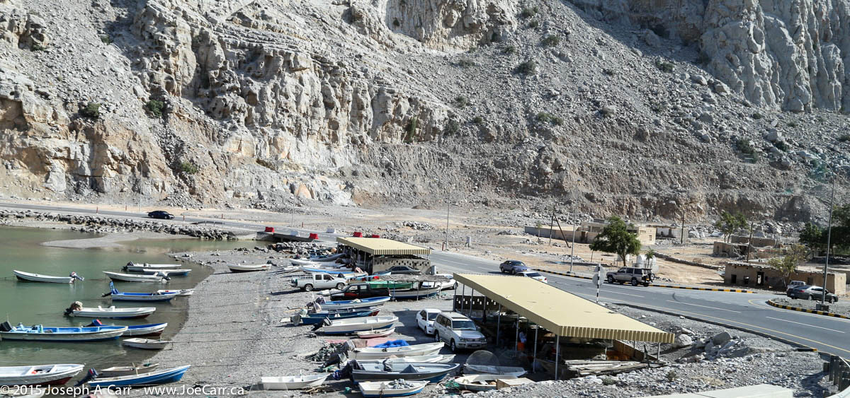
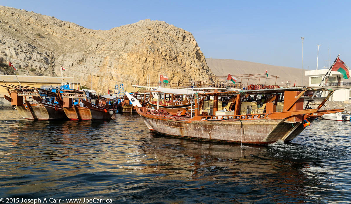
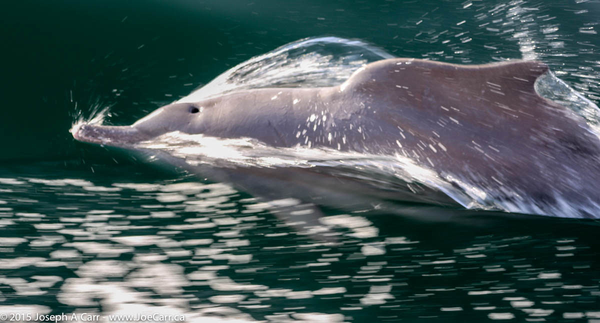
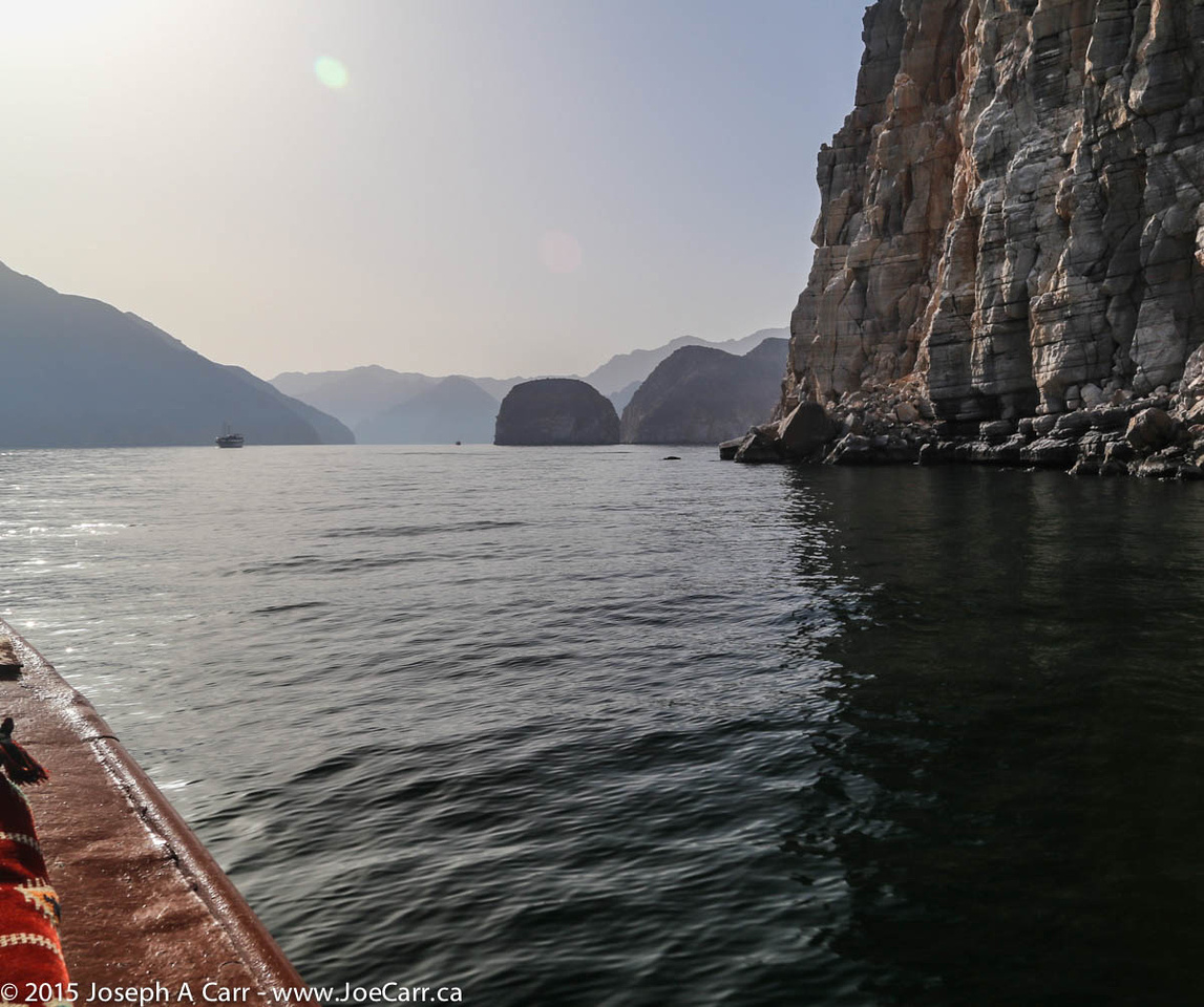
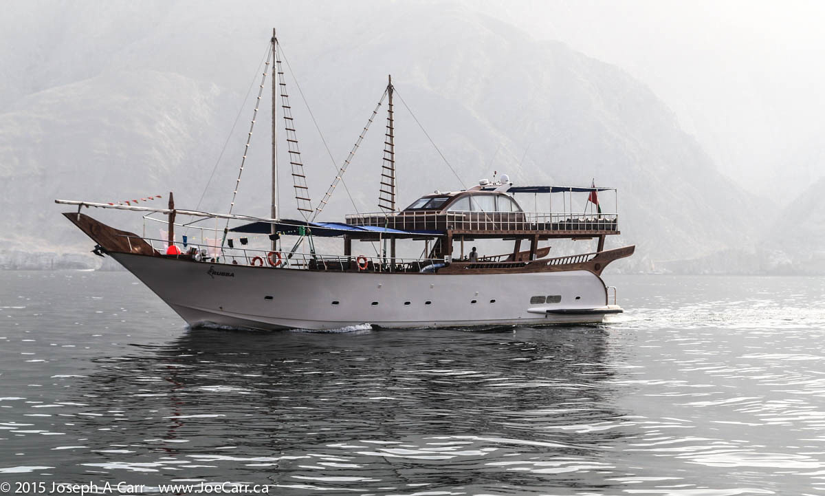
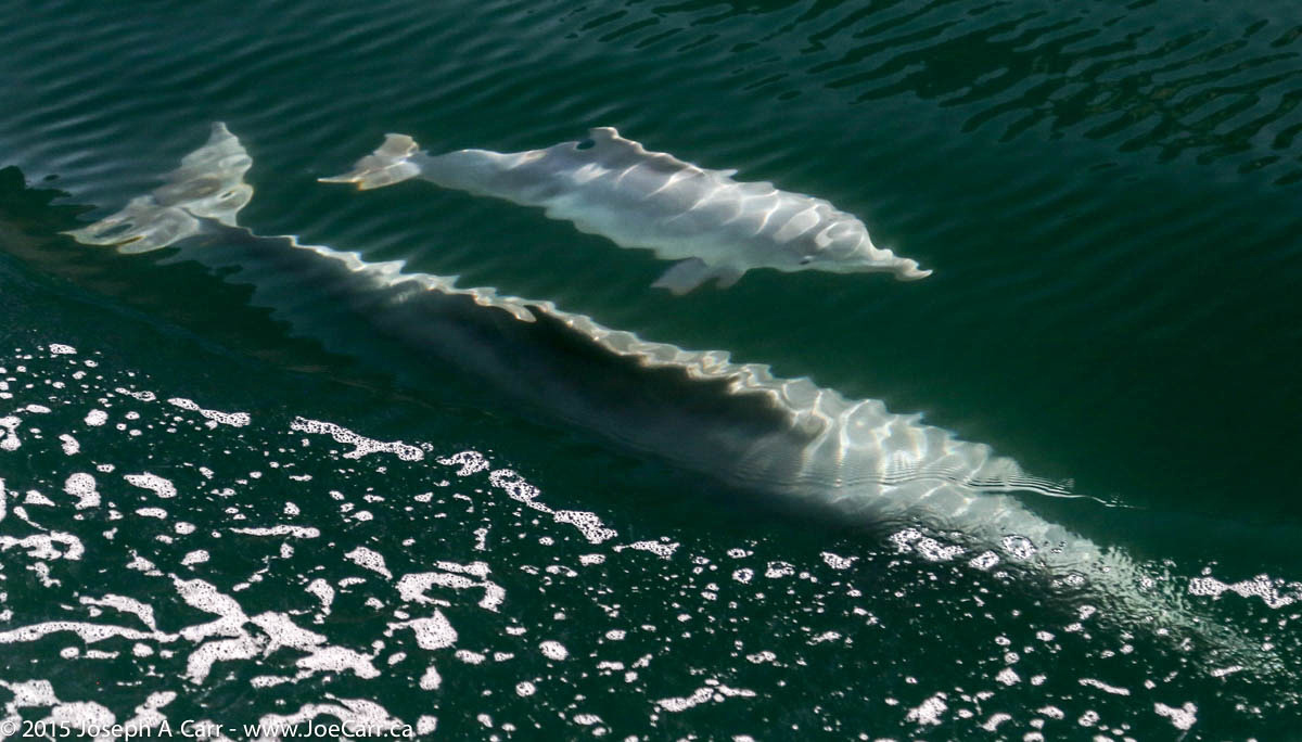
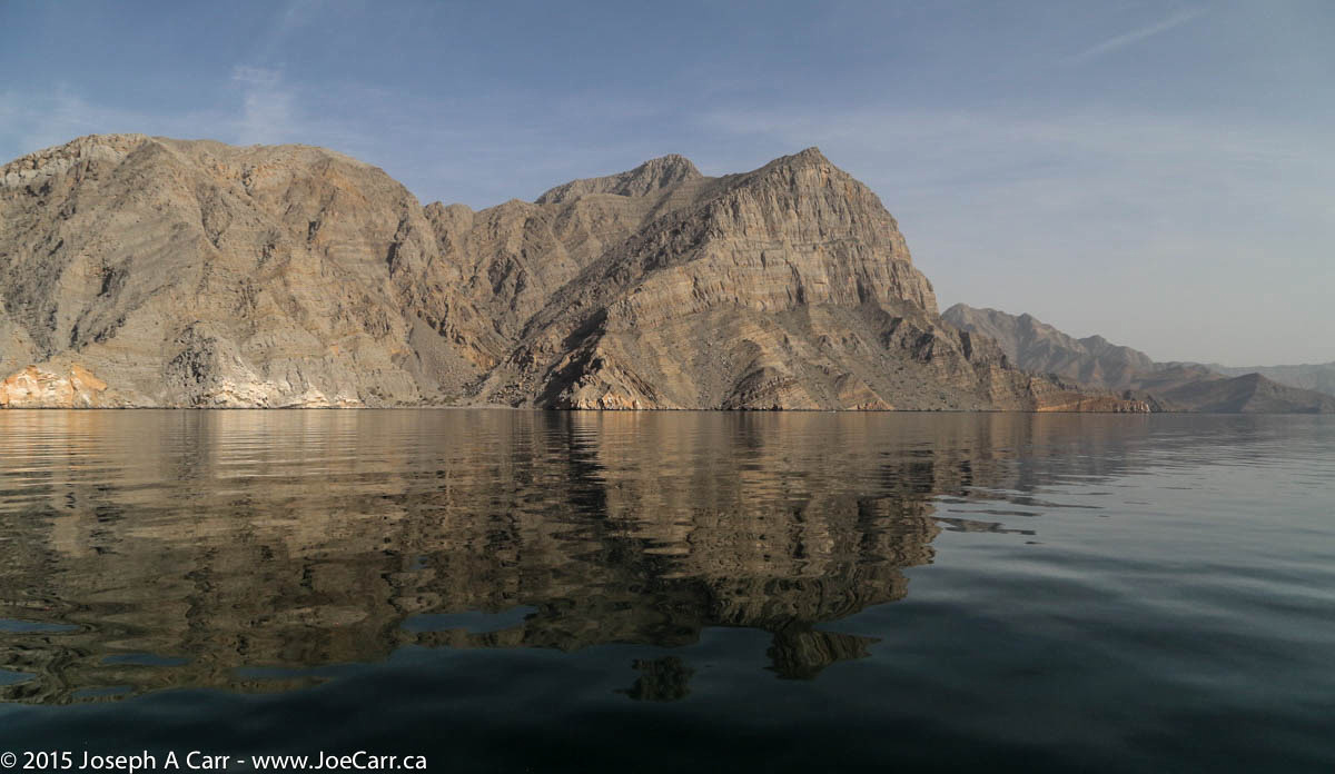
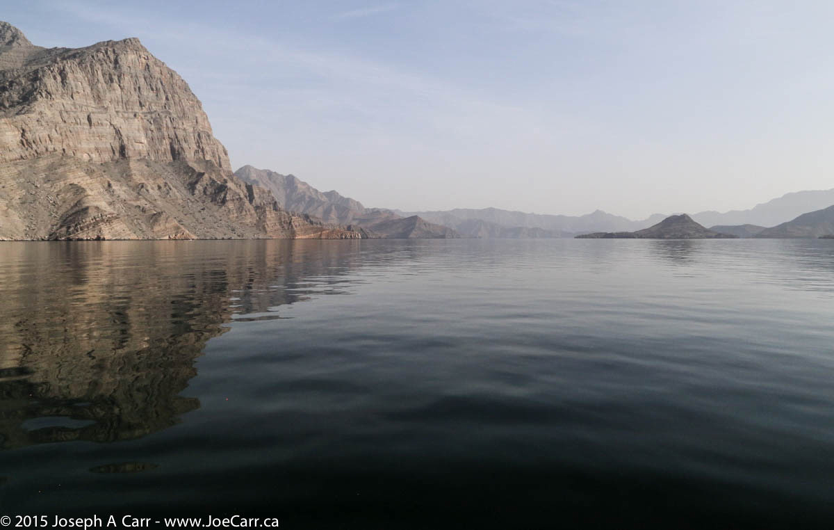
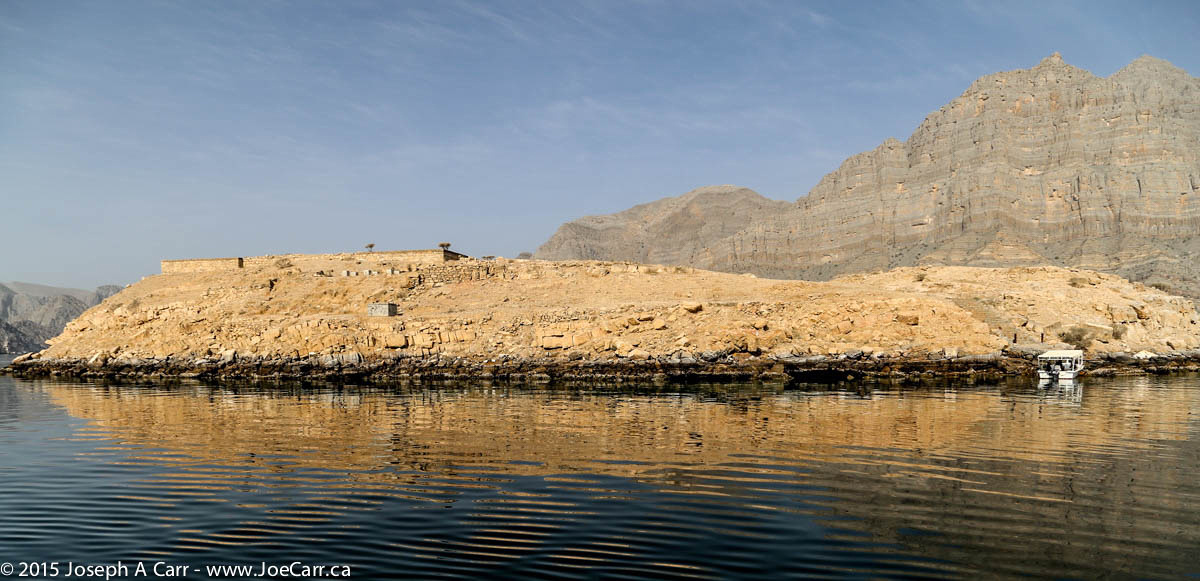
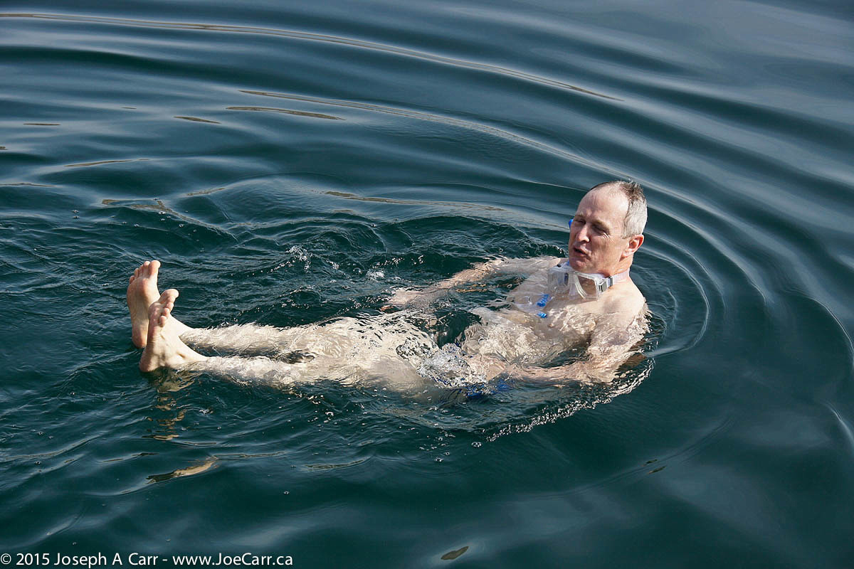
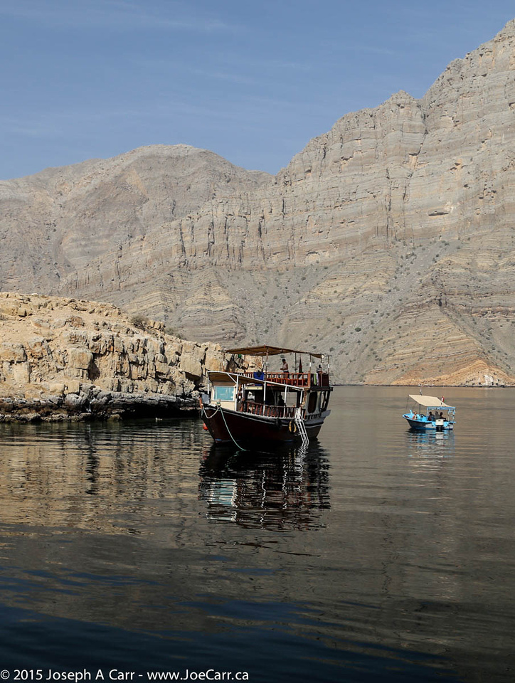
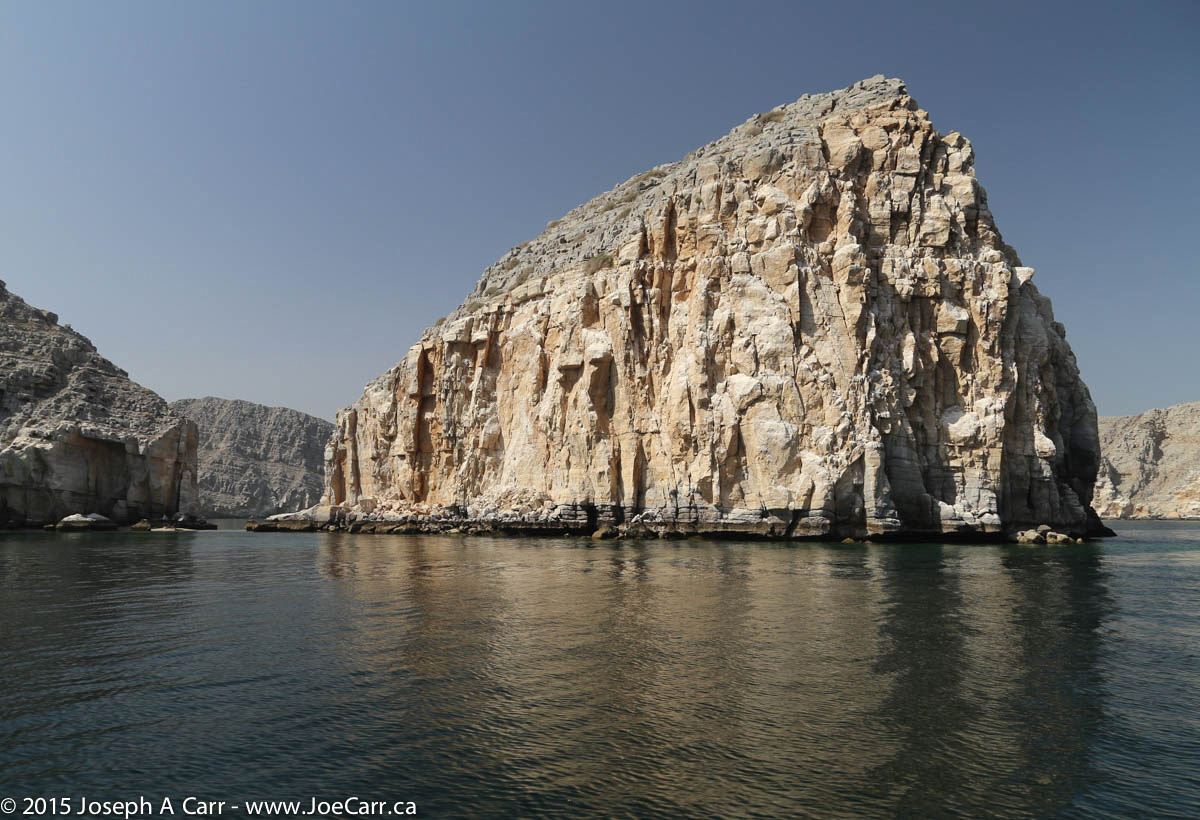
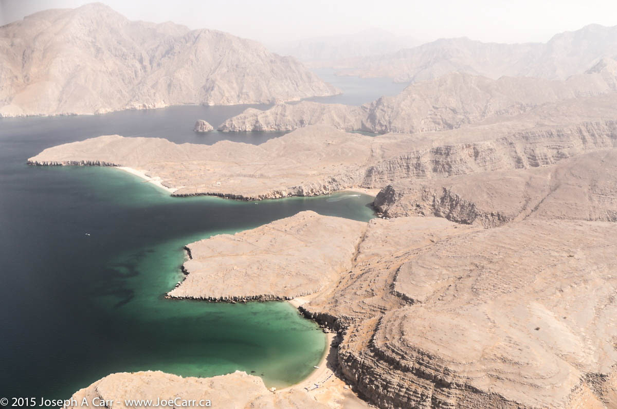
This morning we board a traditional Omani dhow for a half-day cruise into the Musandam Peninsula’s nearby fiords, or khawrs. Dolphins play in the wake of the boat as we travel along the tranquil waters. We arrive at Telegraph Island, which was a repeater station built in 1864 by the British to connect Bombay with Britain via an underwater and overland telegraph cable. Once the boat is anchored, I am the first one in to have a swim. The water is a bit cloudy, but it feels great, and floating is no problem in the very salty water.
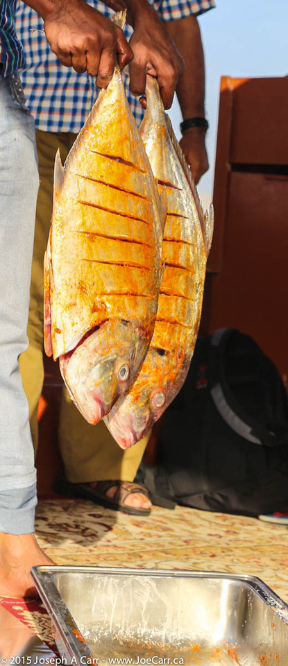
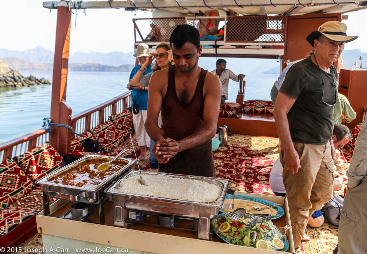
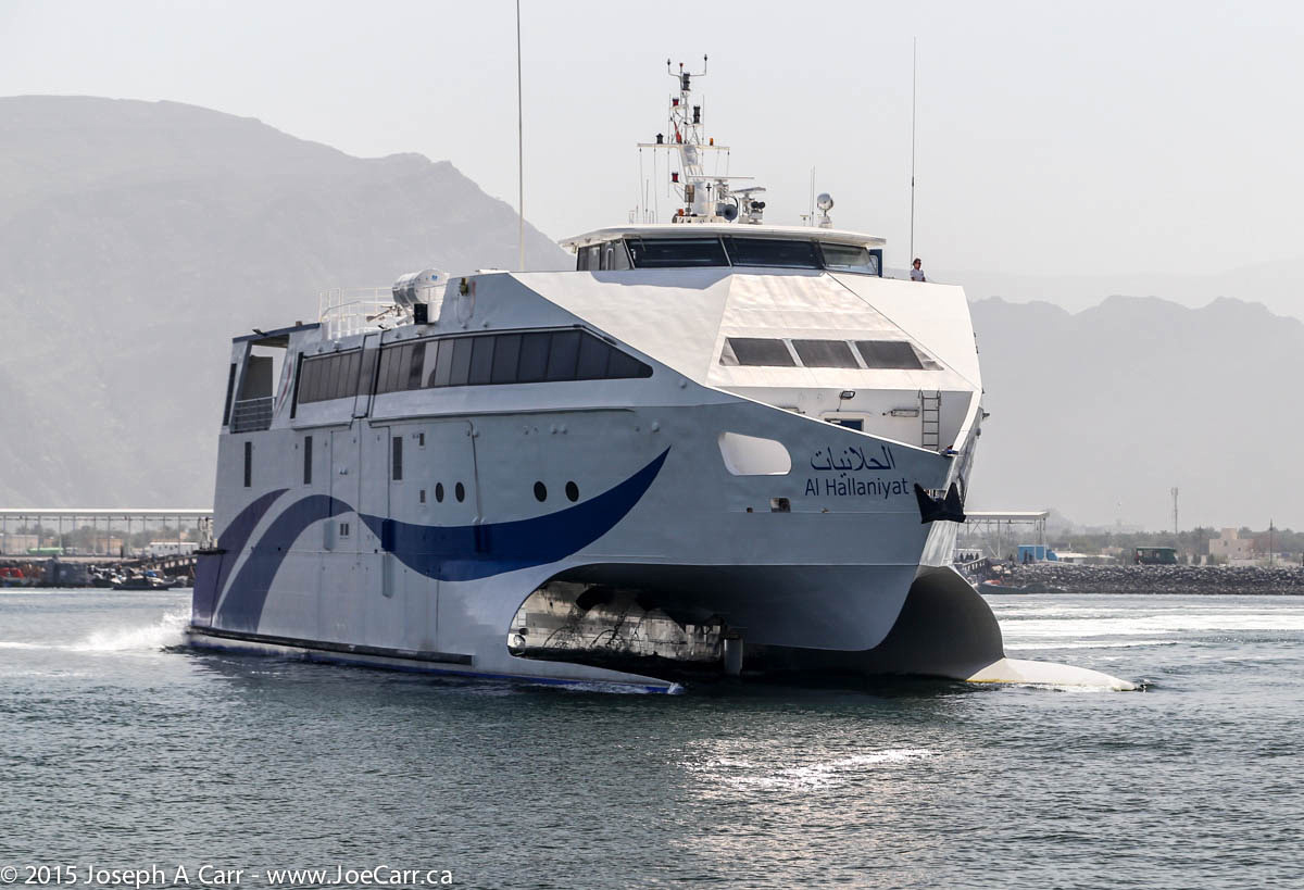
We see the famous Sherry fish marinated and grilled for our hot buffet lunch, which is served aboard the dhow, and then we return the same way back to Khasab harbour. There are numerous fishing villages along the shoreline. Some have power, water and communications, while others don’t. As we return to Khasab harbour, we see Shinas, the fastest catamaran ferry in the world docked. It travels between Khasab and Muscat down the coast in about five hours.
This dhow cruise is one of the highlights of the tour for me!
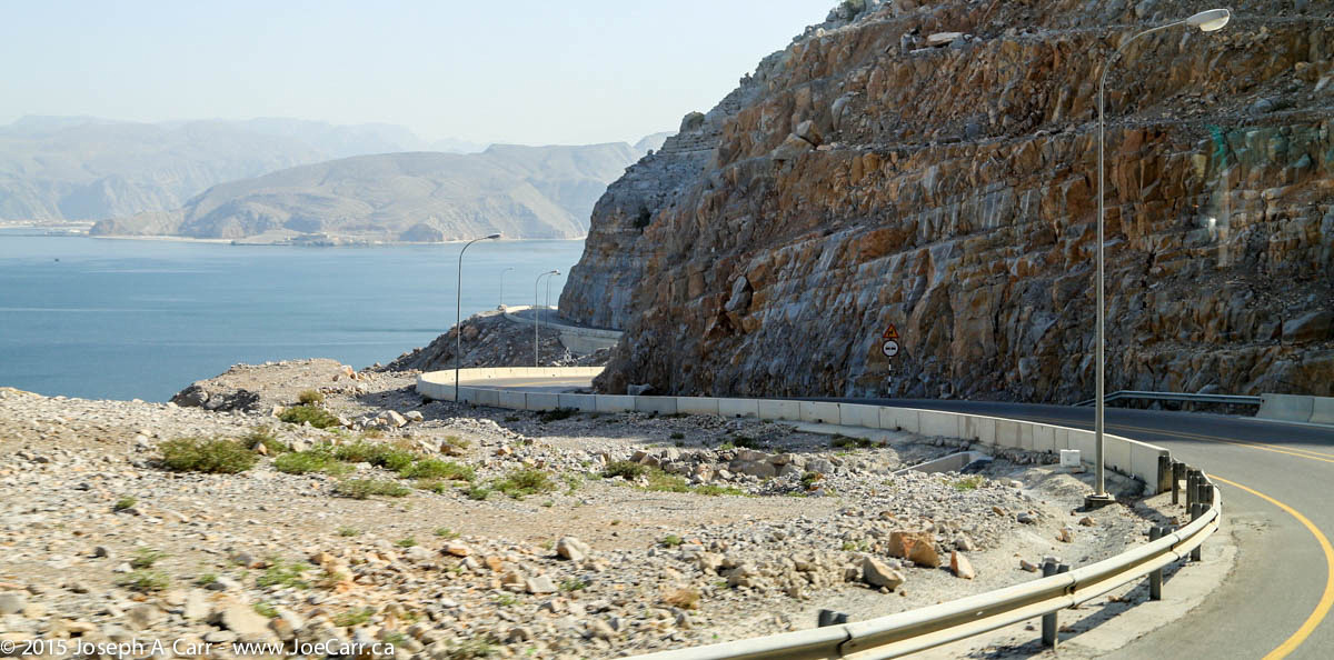
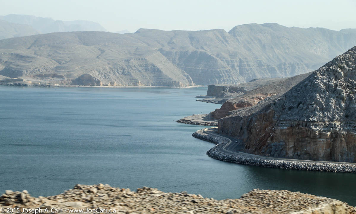
In the afternoon, we take a 4×4 drive, climbing up into the mountains along steep gravel roads to Jebel Harim (1,800 metres or 5,900′ elevation), where we see a beautiful oasis and some petroglyphs. There are century-old villages built into the rocks on the sides of the wadis, including Bait ai-Qufl with its old stone houses, and the lush nature of Al Khalidiyyah Park with its many acacia trees, and interesting clam and oyster fossils.
The gravel roads throughout this mountainous region are very impressive, since they are very well engineered and maintained.
Upon our arrival in Rome, our driver Sylvain has to maneuver through some pretty challenging turns and narrow streets to get us to the drop off point in the city at Repubblica Square. Driving a vehicle that large in Rome is a real challenge! Once we are parked, we schlepp our bags the few blocks to Hotel Nardizzi Americana in sprinkling rain. A bunch of us have lunch on our own at a nearby salad bar deli. I have a delicious prosciutto panino (we say Panini in North America, which is actually the plural form of panino in Italian).
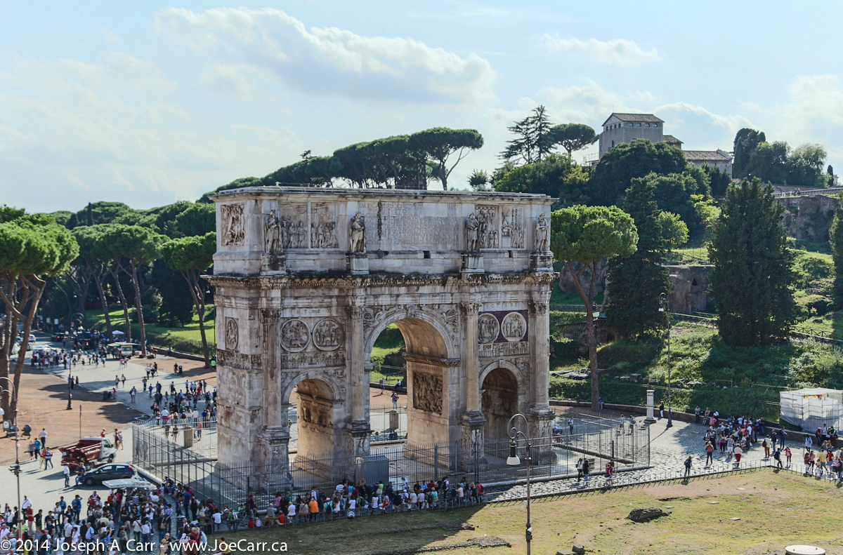
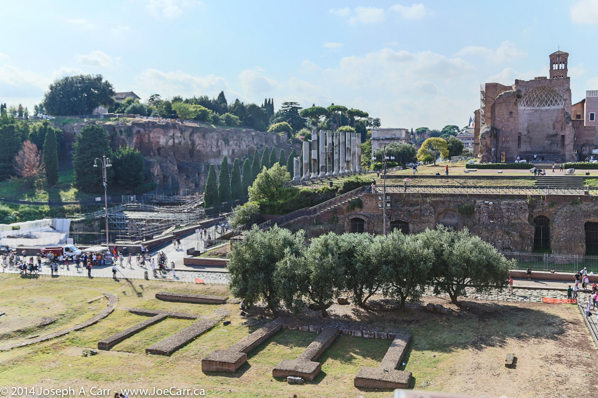
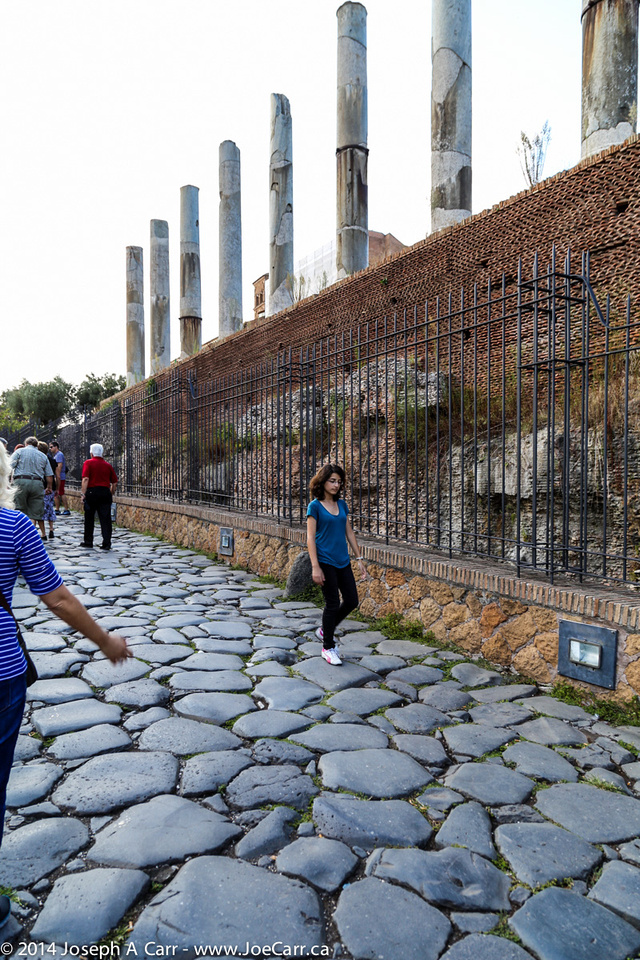
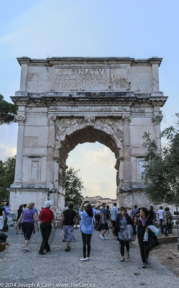
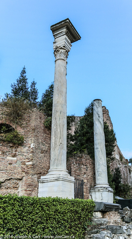
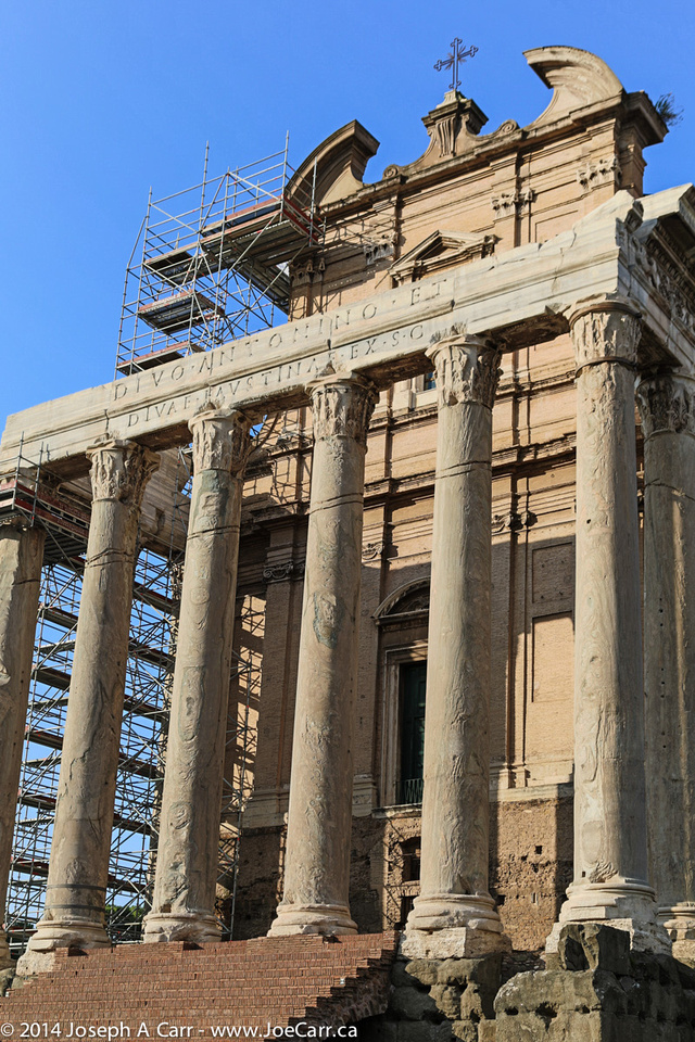
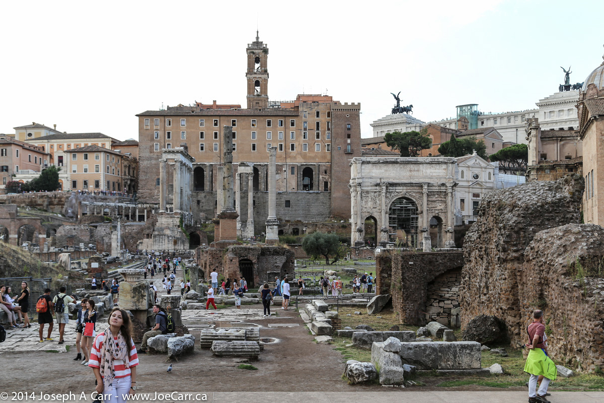
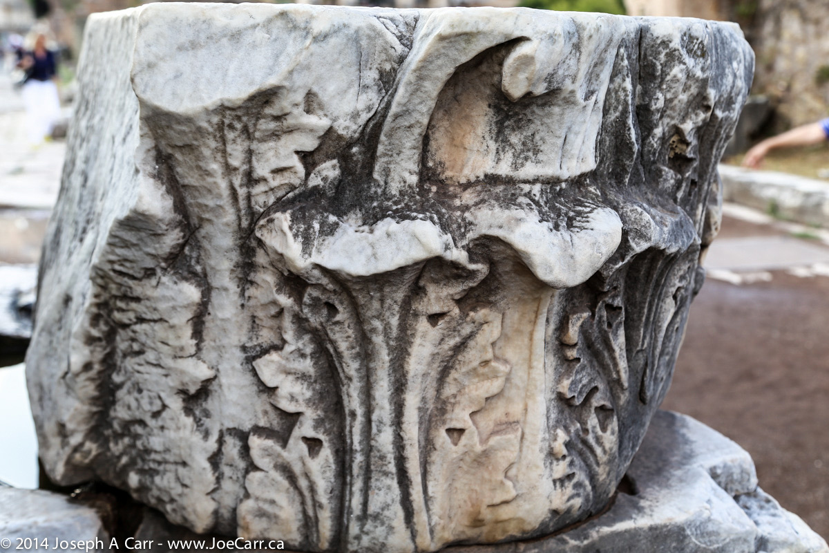
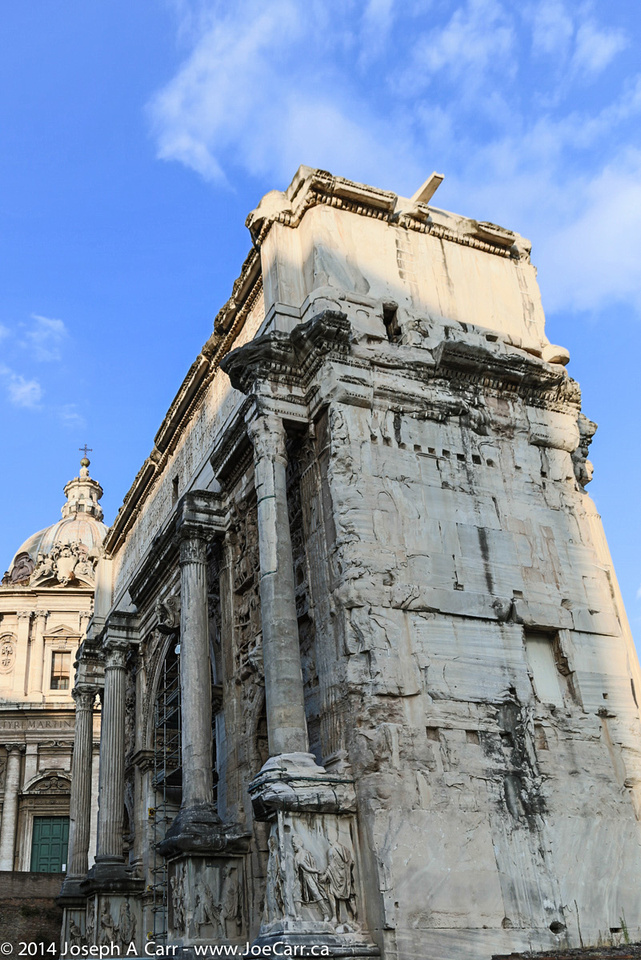
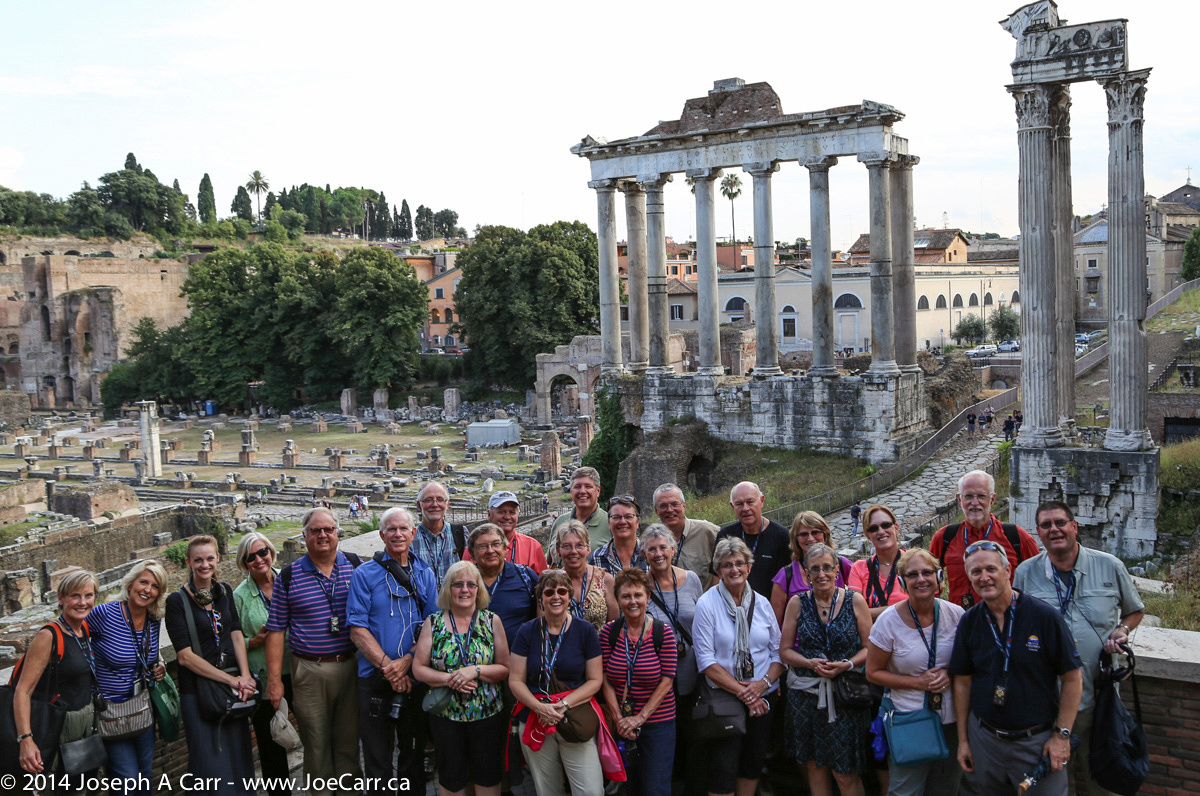
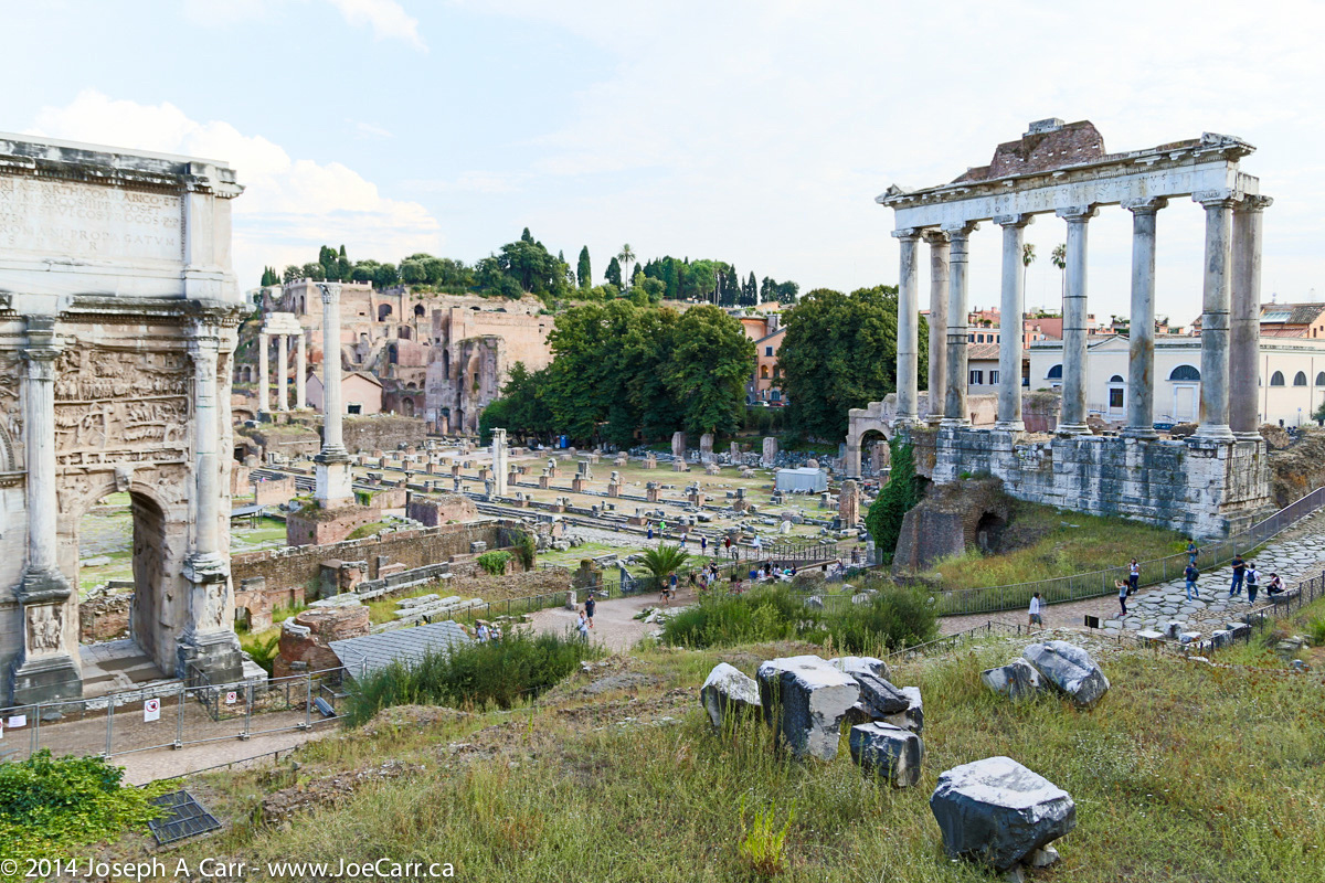
Group photo in front of the Roman Forum
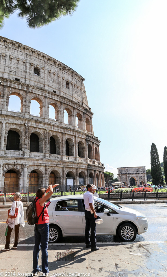
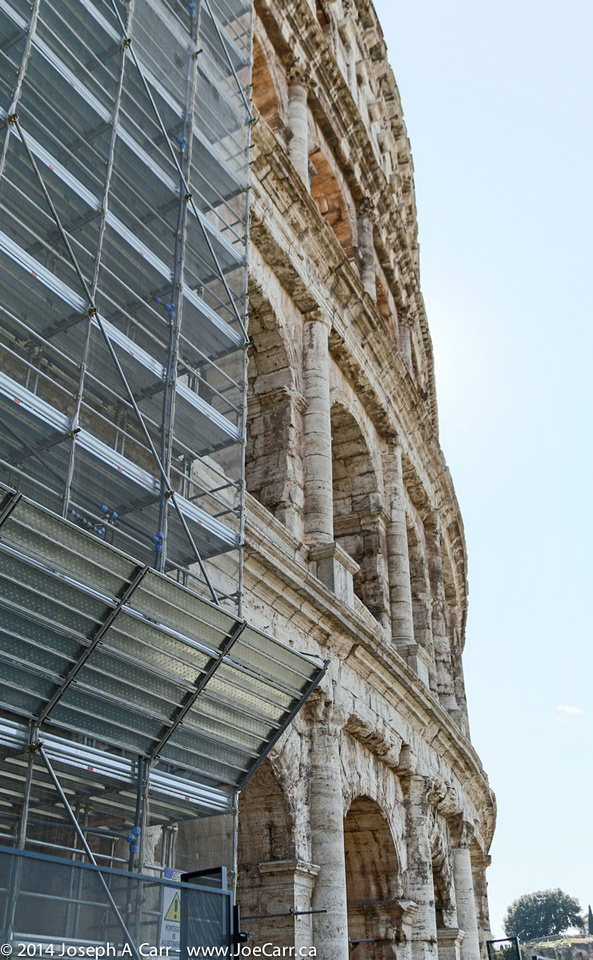
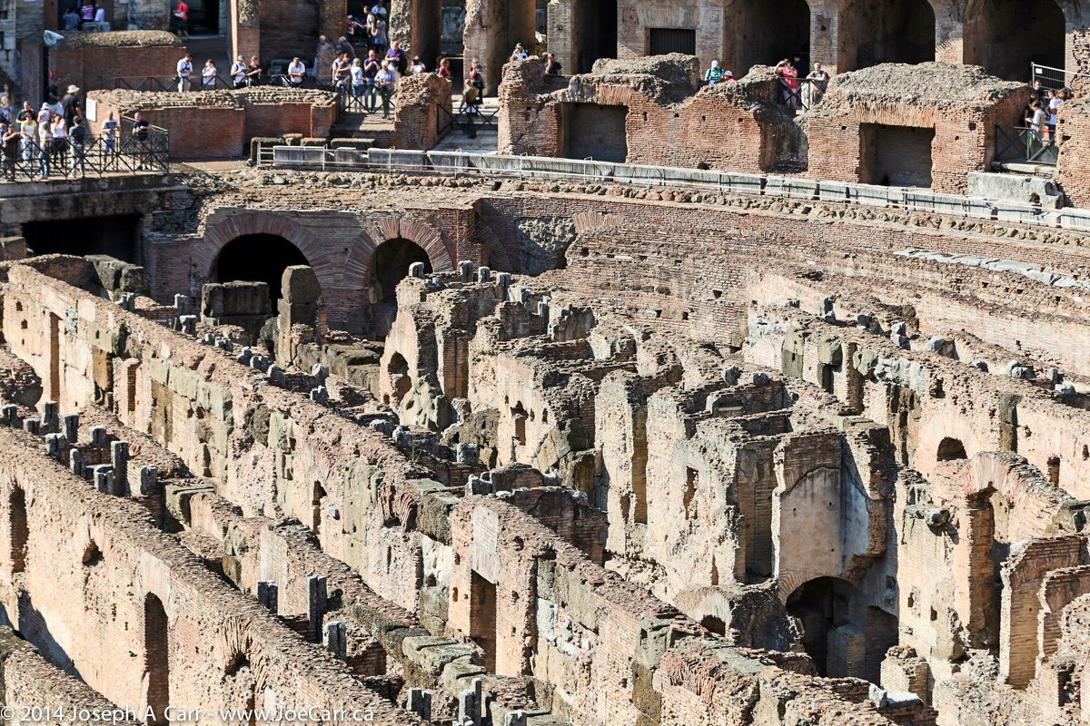
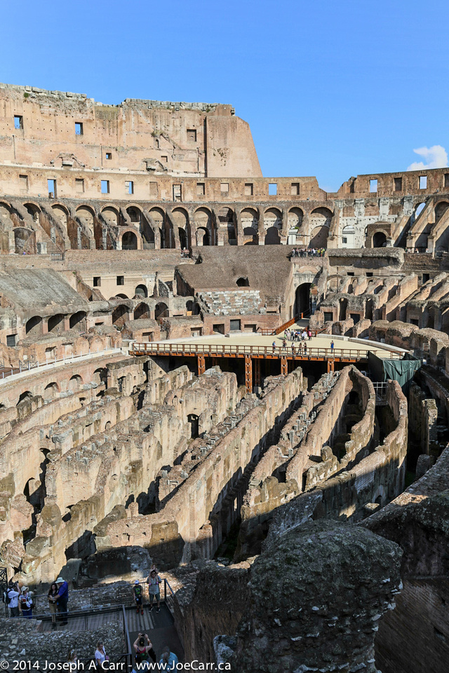
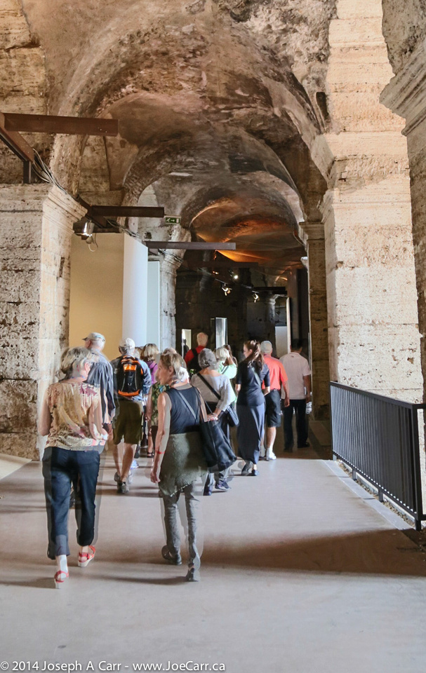
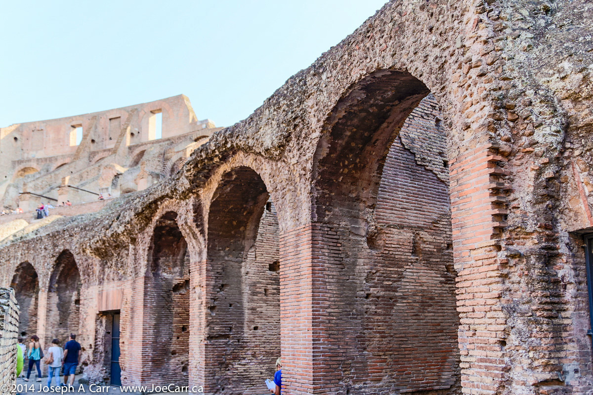
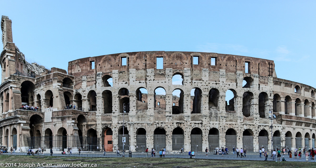
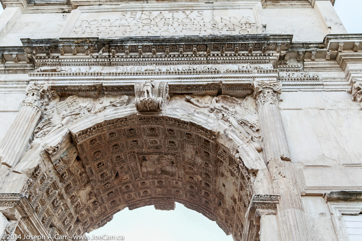
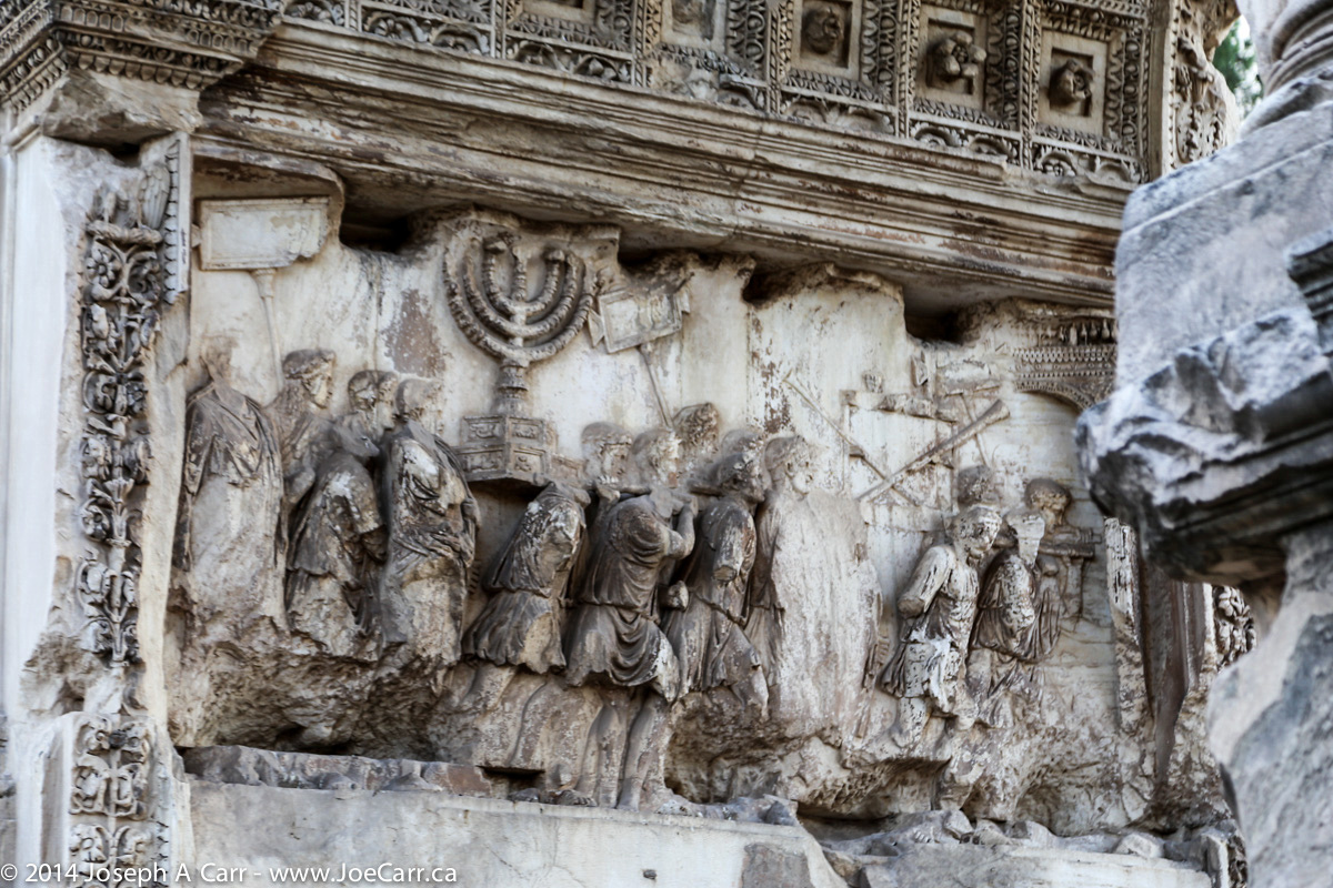
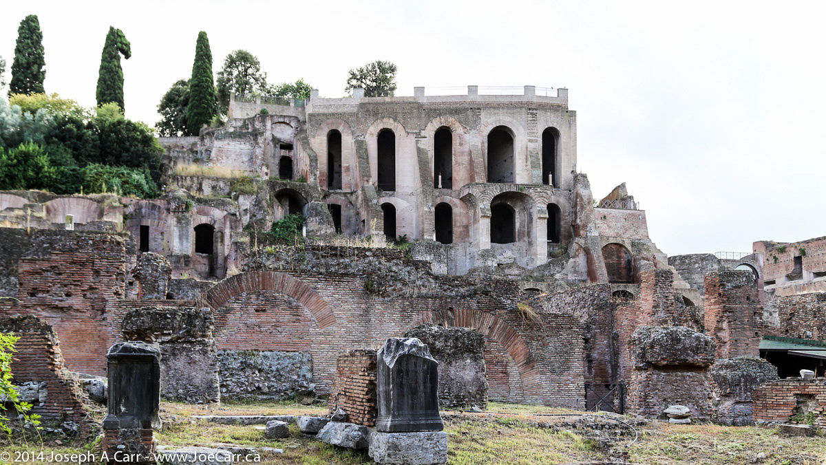
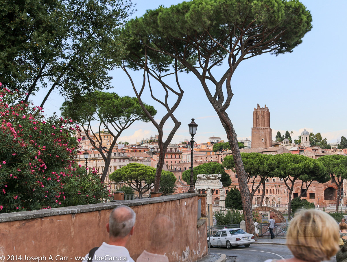
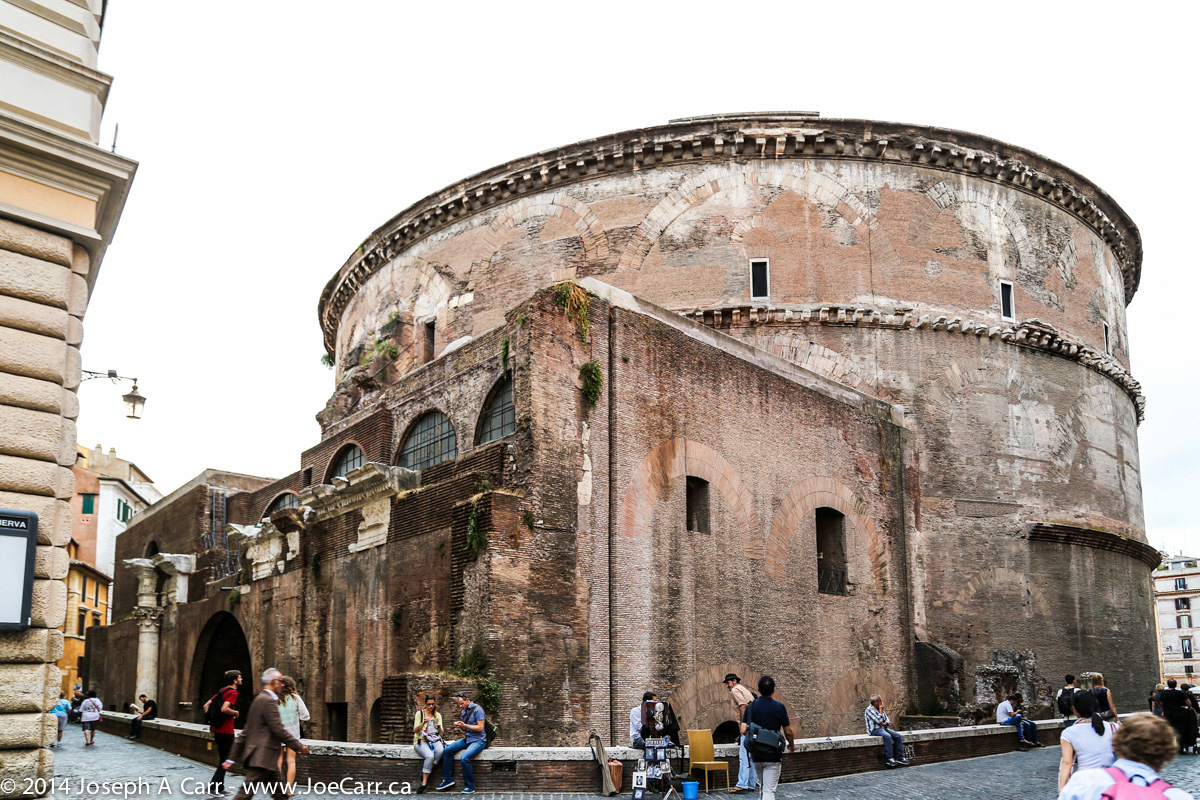
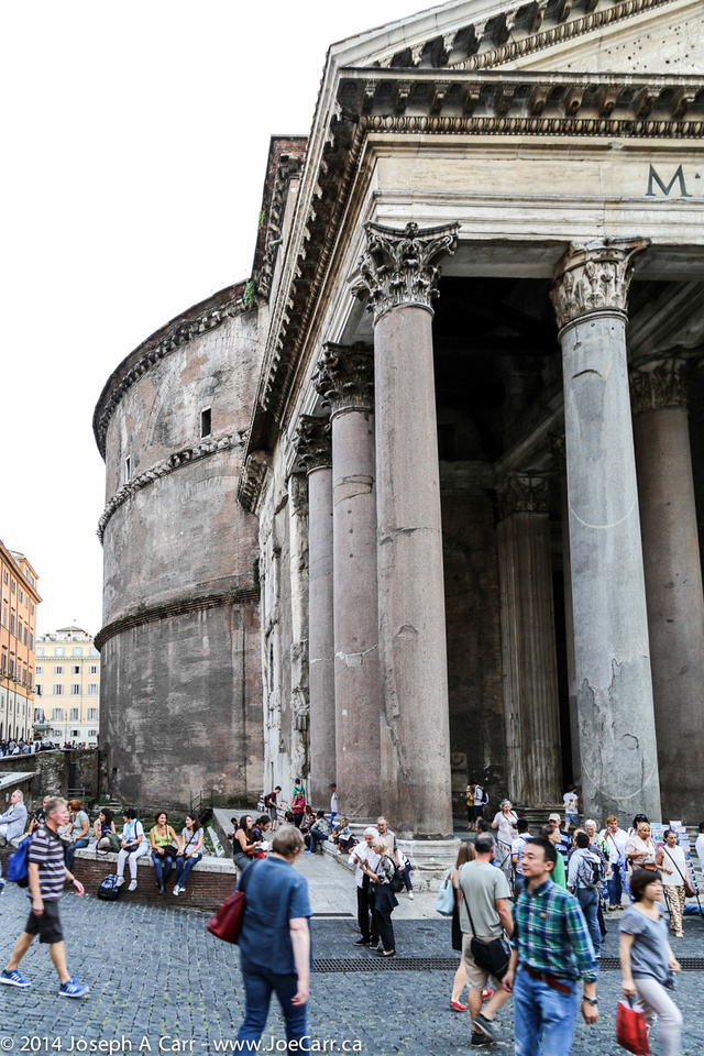
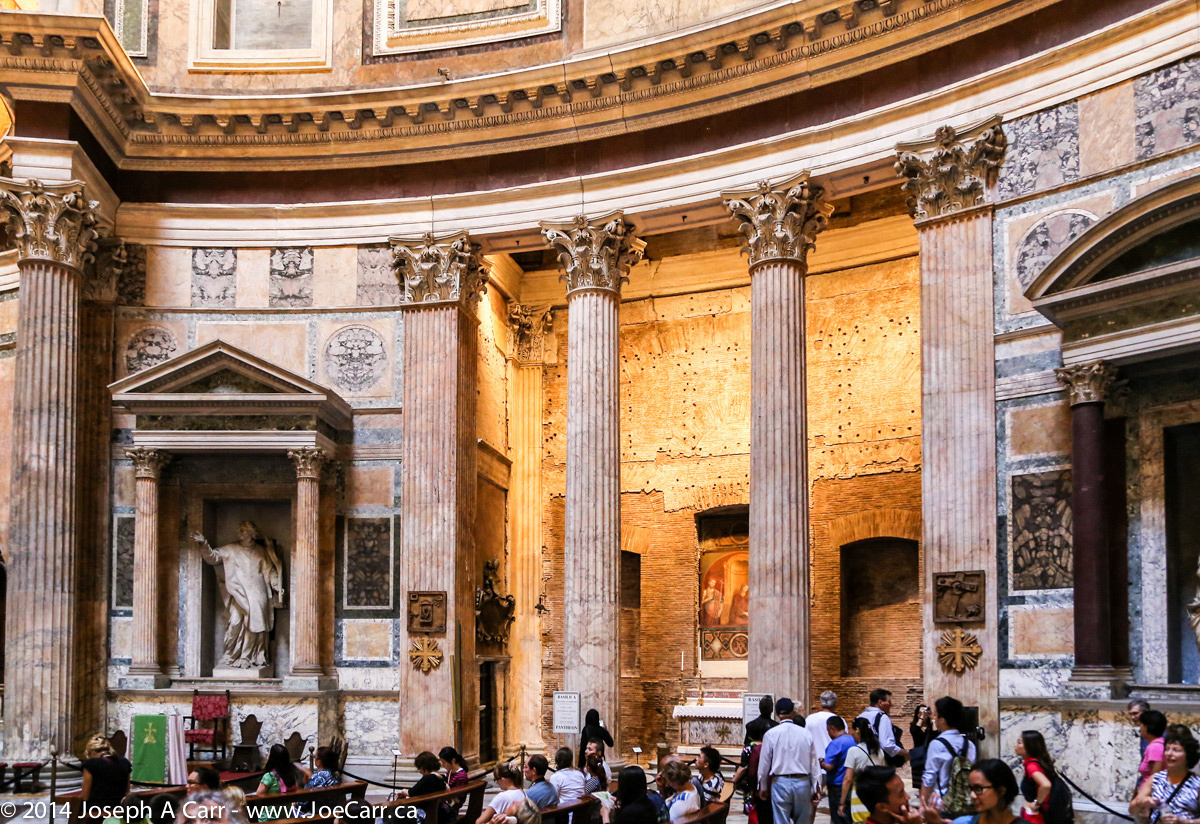
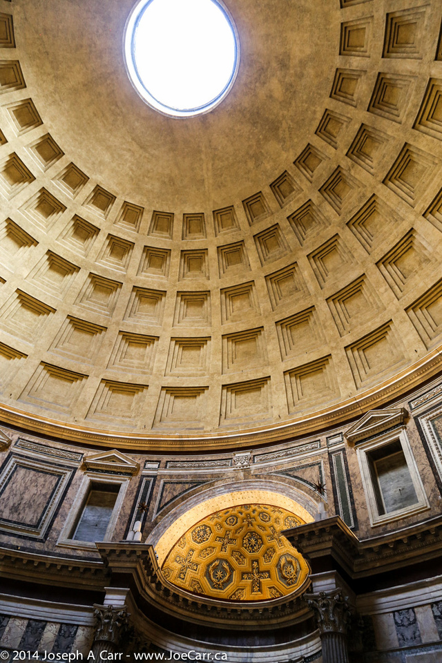
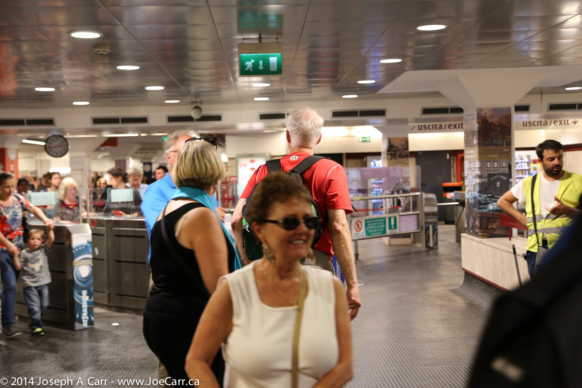
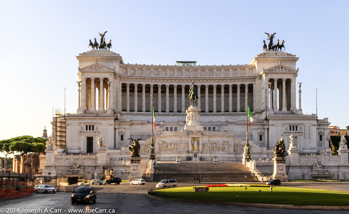
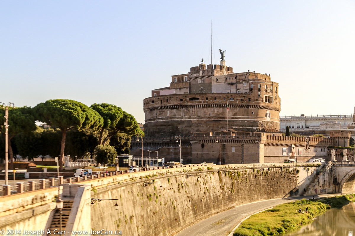
We go on an extensive walking tour of Rome this afternoon with a local guide who succeeds in bringing the Coliseum, the Roman Forum, and the Pantheon alive for us all. Several of us are tired after all the walking this afternoon, so we return to the hotel on our own using the Rome subway. Jennifer taught us well earlier in the day when we started our tour by taking the subway, so we have no problem reversing the route.
Three of us have dinner at Ristorante Esperia, which is a trattoria only a couple of blocks away from our hotel. I have Spaghetti Carbonara, which is very rich and tasty. We all enjoy our meals, although the wine is a bit expensive.
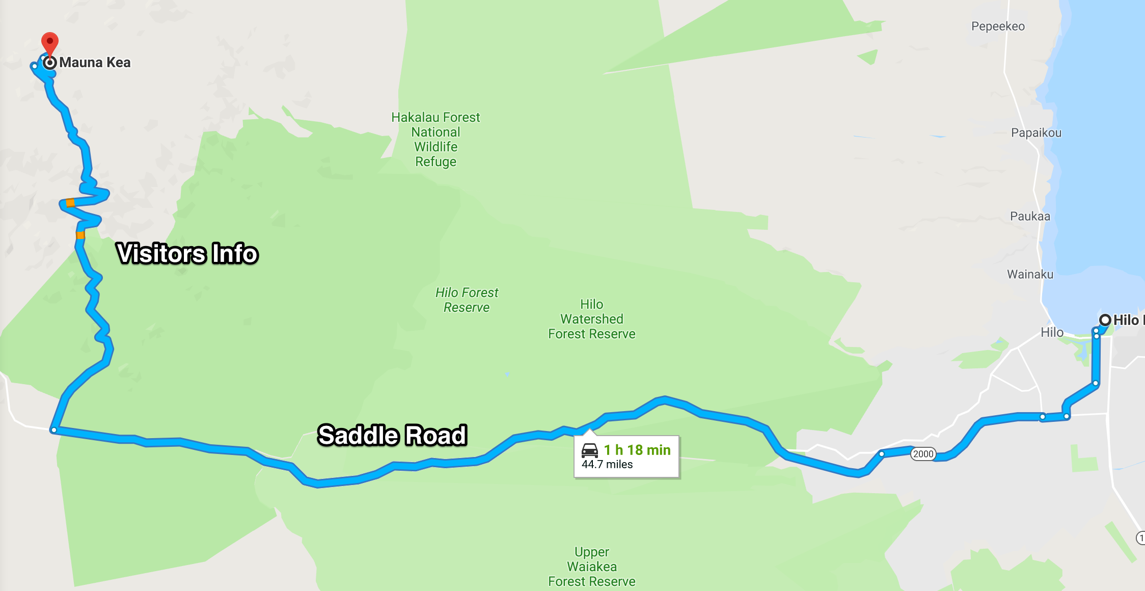
The ms Statendam arrives early in Hilo, and docks at the pier in the harbour. I have some breakfast and gather up my cold weather gear for my big trip up to the summit of Mauna Kea. I disembark, find the shuttle to Harper’s Car & Truck Rental (no longer in business). and rent a 4×4 Ford Ranger truck, which Harper’s allow on the Mauna Kea access roads.
Hilo-Mauna Kea map
Once I’m off in my little truck, I work my way out of Hilo and drive up the Puainko Street Extension, which becomes the H200/H2000 Saddle Road. I stop to pick up some refreshments from a corner store, since I will skip lunch. I’m glad I brought along my vehicle GPS from home, which guides me through several complicated twists and turns until I get out of the city. The first half of the 45-mile drive to the summit takes me along the Saddle Road Highway (2000), a paved 3-lane road all the way to the Mauna Kea Access Road turn-off, and then up to the Visitors Information Station (VIS) on a good (but steep) 2-lane paved road all the way through ranch country.
Gravel access road to Mauna Kea above the VIS
I stay at the VIS for 45 minutes in order to acclimatize myself to the elevation change (sea level to 9,000′), and then put the vehicle into 4-wheel drive and start up the gravel road to the summit. The road surface is washboard, so having 4WD is great to keep traction and stability. A few miles before the summit, the road returns to a paved surface, since dust control is a big factor with these expensive observatories.
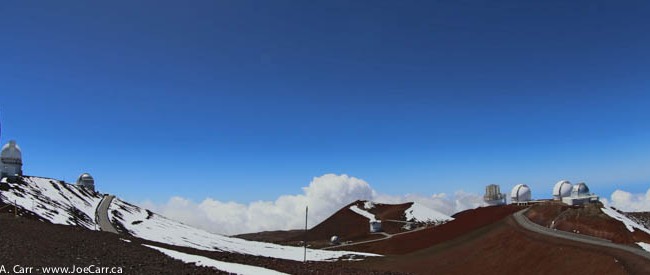
Canada-France-Hawaii & Gemini North observatories
There is snow on top, and the air is clear and cold. I pull on my winter coat, which I have been dragging around with me on this trip just for today’s adventure. It is wonderful to finally see all these observatories in person, especially the ones Canada is involved with. The Canada-France-Hawaii (CFHT) observatory has a prime location on the end of the north ridge, and is a beautiful, brilliant white structure. The Gemini North observatory is next to CFHT, and is a silver structure with bulging air vents all around the lower part of the dome…again, a very beautiful design.
I drive around to see all the observatories up close, but unfortunately I can’t stay for the VIS’ tours inside some of the facilities. The sky is a deep blue and crystal clear, and the observatories are stark white or silver, so I use the High Dynamic Range feature of my Canon 6D dSLR. This allows me to capture the scenes much more successfully. I shoot lots of photos, since I probably won’t return to Mauna Kea again. I can see the summit of the mountain and the trail leading to it from Gemini North, but I have to be careful to not exert myself too much while at 4,205 metres (13,792′) elevation, since the amount of oxygen available up here is less than half than at sea level.
Looking back from CFHT at all the observatories
Reluctantly, I have to return to my cruise ship, so I start the drive down the mountain, with my vehicle in low range 4WD and in 2nd gear as well. I barely touch the brakes for the whole way down the mountain until I shift out of 4WD at the VIS before returning to paved roads. The return trip to Hilo and sea level goes without a hitch. I return the vehicle to the rental company, and I’m back on board the ship a couple of hours before departure time.